
 English
 Español
 中文
中文 हिन्दी
 Français
Climate
Tropical, arid, temperate, continental, polar — the patterns of weather that shape life on every continent.
Climate is the long-term pattern of weather that characterizes a place — the rhythms of temperature, precipitation, humidity, wind, and sunshine that, averaged across decades, shape ecosystems, agriculture, architecture, and daily life. From the steaming rainforests of the equator to the polar deserts of Antarctica, Earth's climates form a mosaic that ranges across more than a hundred degrees of temperature and from hyperarid to hyperwet extremes.
Overview
Weather and climate are related but distinct. Weather describes the state of the atmosphere at a particular moment in time, including the temperature, humidity, wind, cloud cover, and precipitation observed over hours or days. Climate, by contrast, describes the statistical pattern of weather at a given location, typically averaged over a reference period of about thirty years. The World Meteorological Organization designates standard climatological normals using such thirty-year baselines, allowing scientists to distinguish the ordinary variability of weather from meaningful shifts in the underlying climate itself.
Earth's climate system is driven by the uneven distribution of solar energy across the planet's surface. Because the Earth is roughly spherical and tilted on its axis, the equator receives more direct and intense solar radiation than the poles, producing a thermal gradient that powers atmospheric circulation, ocean currents, and the hydrological cycle. Climate at any given place is shaped by several interacting factors, chief among them latitude, elevation, proximity to large bodies of water, prevailing wind direction, adjacent ocean currents, and local topography such as mountain ranges and valleys.
The most widely used framework for describing Earth's climates is the Koppen-Geiger classification, first developed by the German climatologist Wladimir Koppen in the late nineteenth century and subsequently refined by Rudolf Geiger in the twentieth. Koppen-Geiger organizes world climate into five principal groups, conventionally labeled A through E, with a sixth group, H, sometimes added for highland climates. These groups are subdivided according to seasonal temperature and precipitation behavior, producing the familiar global map of climate zones taught in schools and used in scientific literature.
Understanding climate is foundational to understanding a country. The crops a nation grows, the cities it has built, the houses people live in, the illnesses they face, the water they drink, and the energy they consume are all mediated, in one way or another, by the climate of the place.
Key Facts
- Average global surface temperature
- Approximately 14 °C
- Hottest recorded temperature
- Approximately 56.7 °C at Furnace Creek, Death Valley, California, on July 10, 1913 — a figure that remains disputed; some meteorologists consider recent Furnace Creek readings of about 54.4 °C in 2020 and 2021 more reliable.
- Coldest recorded temperature
- Approximately −89.2 °C at Vostok Station, Antarctica, on July 21, 1983
- Wettest place on Earth
- Mawsynram and Cherrapunji in the state of Meghalaya, India, with average annual rainfall exceeding 11,000 millimeters
- Driest place on Earth
- The Atacama Desert in northern Chile; some weather stations have recorded essentially no measurable rainfall over multi-decade intervals.
- Highest rainfall in 24 hours
- Approximately 1,825 millimeters at Foc-Foc, Reunion, on January 7 and 8, 1966, during Tropical Cyclone Denise
- Koppen primary groups
- A (tropical), B (arid), C (temperate), D (continental), E (polar); H (highland) is sometimes added as a separate category.
- Principal climate authority
- The World Meteorological Organization, the United Nations specialized agency for weather, climate, and hydrology
The Koppen-Geiger Classification
The Koppen-Geiger system is the most widely used empirical climate classification in the world. Wladimir Koppen, a Russian-born German climatologist, first published the scheme in 1884 and subsequently refined it in a series of papers through the 1930s. His collaborator Rudolf Geiger extended and revised the system after Koppen's death in 1940. The classification assigns each region of the world a short alphabetic code based on monthly averages of temperature and precipitation. A first letter identifies the principal group (A for tropical, B for arid, C for temperate, D for continental, E for polar). Subsequent letters describe the seasonal distribution of rainfall and the severity of summer or winter temperature. The system is valued for its simplicity, its close correspondence to the distribution of natural vegetation, and its accessibility to students and generalists.
Koppen-Geiger is not the only scheme. The Thornthwaite classification, developed by the American geographer Charles Warren Thornthwaite in 1948, uses potential evapotranspiration rather than raw precipitation and is favored in agricultural and hydrological contexts. The Trewartha modification, developed by the American geographer Glenn Trewartha in 1966, refines Koppen's temperate category to better match the climates of eastern Asia and parts of North America. For most everyday and teaching purposes, however, the Koppen-Geiger map remains the shared reference. The sections that follow describe each of its principal groups in turn, using the letters A through E with a sixth section on highland climates.
Tropical Climates (A)
Tropical climates, the A group in the Koppen-Geiger system, occur in a broad belt roughly between 23.5 degrees north and 23.5 degrees south latitude, bounded by the Tropic of Cancer and the Tropic of Capricorn. Every month in a tropical climate has an average temperature of at least 18 degrees Celsius, and there is no meaningful cold season. The three principal subtypes are the tropical rainforest climate (Af), the tropical monsoon climate (Am), and the tropical savanna climate (Aw or As, depending on whether the dry season falls in winter or summer). Each is defined by the total quantity and seasonal distribution of rainfall.
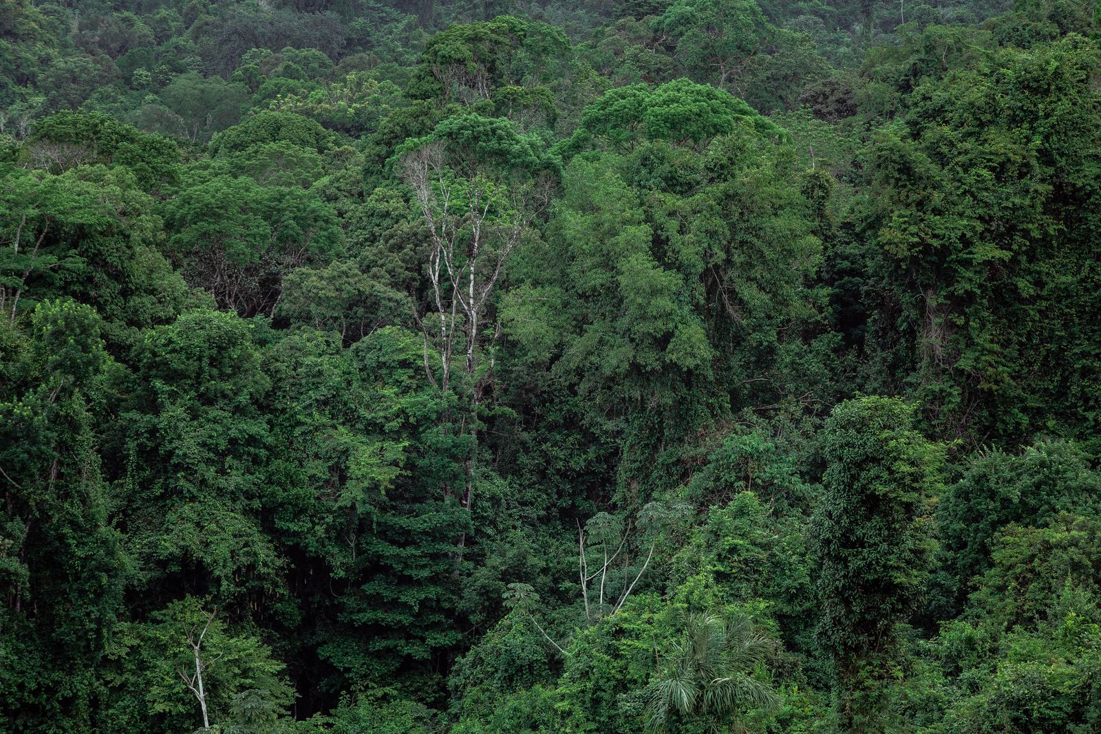
Tropical rainforest climates receive abundant precipitation in every month of the year and support the planet's most biologically diverse ecosystems: the Amazon basin in South America, the Congo basin in central Africa, and the rainforests of insular Southeast Asia. Tropical monsoon climates experience a short dry season followed by an intense wet season driven by seasonal wind reversals, a pattern especially pronounced across the Indian subcontinent and mainland Southeast Asia. Tropical savanna climates feature a more pronounced dry season and support grassland ecosystems with scattered trees, such as the Serengeti of East Africa, the Cerrado of Brazil, and the llanos of Venezuela and Colombia.
Nations with significant tropical climate territory include Brazil, Indonesia, and Kenya, each of which exemplifies a different facet of the tropical world. Tropical environments support more than half of Earth's terrestrial biodiversity, though they cover only about a quarter of the land surface.
Arid and Semi-Arid Climates (B)
Arid and semi-arid climates, the B group in the Koppen-Geiger system, are defined not by temperature but by the relationship between precipitation and potential evaporation. A climate is classified as arid when potential evaporation exceeds precipitation by a large margin, producing a persistent moisture deficit. Koppen-Geiger distinguishes true desert climates (BW) from steppe or semi-arid climates (BS), and further separates hot variants (BWh and BSh) from cold variants (BWk and BSk) depending on mean annual temperature. Together the arid climates cover roughly a third of Earth's land surface, more than any other primary group.
Hot deserts occur in broad subtropical belts centered around latitudes 20 to 30 degrees, where descending air from the Hadley cells suppresses cloud formation. The Sahara of North Africa, the Arabian Desert of southwest Asia, the Kalahari of southern Africa, and the Sonoran Desert of North America all fall within this pattern. Cold deserts, such as the Gobi of Mongolia and the Patagonian Desert of southern Argentina, lie in continental interiors or in rain shadows behind major mountain ranges, where cold winter temperatures coexist with year-round aridity. Semi-arid steppes, by contrast, receive enough seasonal rainfall to support extensive natural grasslands, as seen in the Great Plains of the United States and Canada, the steppes of Central Asia, and the African Sahel along the southern edge of the Sahara.
Water scarcity has been one of the decisive forces shaping human settlement in arid zones. Ancient civilizations arose along the great rivers that cross otherwise dry landscapes — the Nile in Egypt, the Tigris and Euphrates in Mesopotamia, the Indus in Pakistan. Modern nations such as Saudi Arabia and Australia rely on aquifer extraction, long-distance water transfer, and desalination to sustain agriculture and growing urban populations in regions where rainfall alone cannot.

Temperate Climates (C)
Temperate climates, the C group in the Koppen-Geiger system, occupy much of the middle latitudes and include several of the world's most densely populated and agriculturally productive regions. A climate is classified as temperate when the coldest month averages between −3 and 18 degrees Celsius and the warmest month averages above 10 degrees Celsius. The main subtypes are the Mediterranean climate (Cs), the humid subtropical climate (Cfa), and the marine west coast climate, also called oceanic (Cfb and Cfc). Each has a distinctive seasonal signature shaped by the interplay of continental landmass, ocean, and prevailing westerly winds.
Mediterranean climates are defined by hot, dry summers and mild, wet winters. They occur on the western sides of continents between about 30 and 45 degrees latitude: the Mediterranean basin itself, central and coastal California, central Chile, the Cape region of South Africa, and the southwest of Australia. Humid subtropical climates, with hot humid summers and cool-to-mild winters, dominate the southeastern United States, eastern China, southern Japan, southeastern South America, and parts of the Indian subcontinent. Marine west coast climates, featuring mild temperatures and abundant precipitation year-round, occur in western Europe from Ireland through northern France and into western Scandinavia, in the Pacific Northwest of North America, along coastal southern Chile, and in New Zealand.
Temperate climates underpin much of the world's grain, fruit, wine, and livestock production. Northern Italy, the Paris basin in France, the American Midwest, and the eastern plains of China and Japan all sit within C or adjacent climates and have historically supported large, settled populations. The general mildness of the temperate belt has also made it a focus of human civilization for millennia, though its seeming benignity masks real variability, including severe storms, droughts, and heat waves.

Continental Climates (D)
Continental climates, the D group in the Koppen-Geiger system, occupy the large interiors of the Northern Hemisphere landmasses and are defined by a wide annual temperature range with warm or hot summers and cold, often snowy, winters. By Koppen's definition, a continental climate has at least one month averaging above 10 degrees Celsius and at least one month averaging below −3 degrees Celsius (or below 0 degrees Celsius in some modifications of the scheme). The principal subtypes are humid continental with hot summers (Dfa), humid continental with warm summers (Dfb), and the subarctic or boreal climate (Dfc and Dfd), which occupies the colder northern fringe of the group.
The D climates have no meaningful equivalent in the Southern Hemisphere, because at the latitudes where continental conditions would otherwise occur there is mostly ocean rather than land. In the Northern Hemisphere, however, D climates dominate an enormous territory. The Midwest and northeastern United States, the southern half of Canada, nearly all of European Russia and Siberia, northeastern China, the Korean Peninsula, and northern Japan all fall within this group. Canada and Russia together contain most of the world's D-climate land area.
The natural vegetation of the continental belt ranges from mixed deciduous forest in the milder southern sections to the vast coniferous taiga, or boreal forest, that girds the Northern Hemisphere just below the tundra. The taiga is among the largest intact biomes on Earth, a critical carbon sink and home to distinctive wildlife communities. Human populations in continental climates have historically adapted through well-insulated housing, seasonal clothing, long food-storage traditions, and centralized heating infrastructure in modern cities.

Polar Climates (E)
Polar climates, the E group in the Koppen-Geiger system, occur where the warmest month averages below 10 degrees Celsius. The two main subtypes are the tundra climate (ET), in which the warmest month lies between 0 and 10 degrees Celsius, and the ice cap climate (EF), where every month averages below freezing. Polar climates occupy the high-latitude fringes of the Arctic Ocean, most of Greenland, the Antarctic continent, and the highest peaks of many mountain ranges. They are distinguished not only by severe cold but by extreme seasonality: extended polar day in summer, when the sun does not set, and polar night in winter, when it does not rise.
Tundra environments stretch across the northern margins of Siberia, Alaska, northern Canada, coastal Greenland, the Svalbard archipelago, and the peninsular fringes of Antarctica. Much of the tundra lies atop permafrost, ground that remains frozen throughout the year and that locks in vast stores of organic carbon. Vegetation is restricted to lichens, mosses, grasses, sedges, and low-growing shrubs. Ice cap climates, by contrast, are found almost nowhere outside the interiors of Greenland and Antarctica, where the great continental ice sheets hold roughly two-thirds of Earth's fresh water and govern planetary sea level.
Human presence in polar climates is sparse but long-standing. Indigenous peoples, including the Inuit, Saami, Yupik, Nenets, and Chukchi, have inhabited Arctic lands for thousands of years and adapted to the extreme seasonality through hunting, herding, and close understanding of ice and weather. Modern nations with polar territory include Iceland along its glacier-bound interior and Greenland, an autonomous territory of the Kingdom of Denmark, whose ice sheet alone covers roughly 1.7 million square kilometers. Life in these regions is organized around the extreme rhythm of polar day and polar night, the limits of sea ice, and the short window of the summer melt.

Highland Climates (H)
Highland climates, sometimes designated H in modified Koppen-Geiger maps, occur in mountainous regions where temperature and precipitation change sharply with elevation rather than with latitude. A single mountain slope in the tropics can pass through the climatic equivalent of a journey from the equator to the poles over the span of a few kilometers of vertical relief. Temperature generally falls about 6.5 degrees Celsius for every 1,000 meters of elevation gain, a gradient known as the environmental lapse rate, though local conditions and humidity introduce considerable variation. Precipitation often increases with elevation on the windward side of a range and decreases on the leeward side.
The principal highland regions include the Andes of western South America, the Himalayas and Tibetan Plateau of South and Central Asia, the Rocky Mountains of North America, the Alps of Europe, the Ethiopian Highlands of northeastern Africa, and the mountains of the East African Rift. In each, characteristic altitudinal life zones succeed one another from base to summit: tropical or warm temperate forest at the foot of the range, a cooler montane forest belt, a subalpine zone of dwarf trees and shrubs, an alpine grassland or paramo, and a nival zone of bare rock, snow, and ice near the summit. Countries such as Nepal, Peru, and Ethiopia contain an especially pronounced stacking of these zones within their national territory, and highland agriculture, pastoralism, and settlement patterns have evolved to match.

Ocean Currents and Winds
No climate zone can be fully understood without reference to the oceans and the winds that move over them. Major surface currents transport enormous quantities of heat around the planet, warming some coasts and cooling others. The Gulf Stream, flowing northward along the eastern seaboard of North America and continuing across the North Atlantic as the North Atlantic Drift, carries tropical warmth toward western Europe and moderates winters from Ireland to Norway. The Kuroshio Current performs a similar role for Japan and the western Pacific. The cold Humboldt Current off the Pacific coast of South America, by contrast, chills the adjacent land and contributes to the extreme aridity of the Atacama Desert. The Benguela Current produces analogous effects along the southwestern African coast.
Above the oceans, Earth's prevailing winds are organized into three great circulation cells in each hemisphere. Warm air rising near the equator flows poleward aloft, descends in the subtropical belts, and returns toward the equator as the trade winds — the engine of the Hadley cells and a key driver of tropical weather. In the middle latitudes, the Ferrel cells drive the prevailing westerlies that sweep storms across Europe, North America, and the Southern Ocean. At the poles, the polar cells produce easterly winds at the surface. These planetary patterns interact with ocean temperatures to spawn phenomena such as the El Nino-Southern Oscillation, which reshapes rainfall across the tropics on a three to seven year rhythm.
Mountains reshape all of these patterns at the regional scale. When moist air is forced to rise over a mountain range, it cools, condenses, and releases its moisture on the windward slope. As that air descends the leeward side, it warms and dries, producing a rain shadow. Rain shadows are responsible for the extreme dryness of the Atacama (leeward of the Andes), Death Valley (leeward of the Sierra Nevada), and the Great Basin (leeward of multiple ranges). Orographic uplift, the windward counterpart, is responsible for some of the wettest places on Earth, including the windward slopes of Mawsynram in northeastern India and the Hawaiian island of Kauai.
Climate and Human Life
Climate is woven into every layer of human society. Agriculture depends on the match between crop requirements and the local growing season, rainfall total, and temperature range; the olive groves of the Mediterranean, the wet-rice paddies of monsoonal Asia, the wheat fields of the Great Plains, and the short-season barley of subarctic Scandinavia each reflect a climate-specific agricultural adaptation. Traditional architecture, too, is an index of climate: thick adobe walls in hot deserts, steep thatched roofs in the wet tropics, elevated wooden houses along flood-prone rivers, tightly insulated log homes in boreal Russia and Canada, and the snow-block construction of the Inuit igloo all represent local engineering responses to the prevailing weather.
Climate also shapes patterns of settlement, public health, and economic development. Populations cluster in temperate and subtropical belts where growing seasons are long and winters survivable, while harsher climates support sparser, more specialized populations. Heat exposure is a leading weather-related cause of mortality in hot-climate countries, and the geographic range of vector-borne diseases such as malaria, dengue, and Lyme disease is closely tied to temperature and humidity. Local climate also dictates the feasibility of particular industries, from viticulture in Mediterranean climates to reindeer herding in the subarctic, and it conditions the kinds of energy a nation consumes — cooling in hot regions, heating in cold ones, and water-intensive infrastructure in arid ones.
Forecasting and Observation
Modern climate and weather science rests on a dense global observation network. Surface weather stations, numbering in the tens of thousands, report temperature, pressure, humidity, wind, and precipitation at regular intervals. Radiosondes, released twice daily from hundreds of stations worldwide, profile the atmosphere from the surface to the stratosphere. Aircraft contribute observations in flight, moored and drifting buoys gather data from the oceans, and a fleet of polar-orbiting and geostationary satellites — including the United States GOES and JPSS series, the European Space Agency MetOp and Sentinel missions, and counterparts operated by Japan, China, India, and Russia — provides continuous global coverage from space. Citizen-science networks such as the Community Collaborative Rain, Hail and Snow Network, known as CoCoRaHS, supplement professional stations with thousands of volunteer observers.
These observations feed numerical weather prediction and climate models run on some of the largest supercomputers in the world. Major operational centers include the European Centre for Medium-Range Weather Forecasts, the National Oceanic and Atmospheric Administration National Centers for Environmental Prediction in the United States, the United Kingdom Met Office Hadley Centre, Meteo-France, Japan Meteorological Agency, and the Chinese Meteorological Administration. Short-range models forecast weather out to a week or two; seasonal-to-decadal models project conditions months to years ahead; and long-range climate models, coordinated internationally through projects such as the Coupled Model Intercomparison Project, simulate the climate system over decades to centuries. Together these tools underpin every severe-weather warning, agricultural forecast, aviation routing, and long-range climate projection in use today.
Sources
Detailed citations, data references, and institutional sources for all CountryReports content are listed on the Sources page. The following government agencies, intergovernmental bodies, and academic research centers are the primary authorities we rely on for world climate content. Each link points to the institution's homepage.
Government and Intergovernmental Agencies
- NOAA Climate.gov — Climate data, explainers, and communications products from the United States National Oceanic and Atmospheric Administration.
- NASA Earth Observatory — Satellite imagery, feature articles, and data products on weather, climate, land, ocean, and atmosphere.
- World Meteorological Organization (WMO) — United Nations specialized agency for weather, climate, and water; publisher of the official global climate normals and State of the Global Climate reports.
- United States Geological Survey (USGS) — Land-based climate and water-cycle monitoring, glacier records, and permafrost studies.
- United Kingdom Met Office Hadley Centre — Climate research, HadCRUT global temperature record, and operational climate services.
- European Centre for Medium-Range Weather Forecasts (ECMWF) — Global numerical weather prediction and the ERA reanalysis series used throughout climate research.
Academic and Research Institutions
- National Center for Atmospheric Research (NCAR) — Federally funded research and development center for atmospheric and related Earth system science.
- University Corporation for Atmospheric Research (UCAR) — Consortium of more than a hundred universities advancing research and education in the atmospheric and related sciences.
- Woodwell Climate Research Center — Independent scientific institute focused on climate science, including Arctic carbon and permafrost research (formerly Woods Hole Research Center).
- MIT Center for Global Change Science — Massachusetts Institute of Technology research program on atmospheric, oceanic, and climate science.
If you notice an error or would like to suggest a correction, please use our contact page to get in touch.