
 English
 Español
 中文
中文 हिन्दी
 Français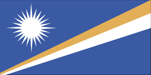
Marshall Islands
Declare Your Relationship to Marshall Islands
CountryReports Community
- Studying1
- From Marshall Islands0
- Marshall Islands heritage0
- Visited0
- Want to visit0
Customs and Culture
Customs and Culture
About the People
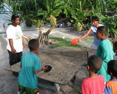
The people of the Marshall Islands are Micronesians, a dark-skinned people with wavy or woolly hair. They are noted for their handicrafts. During the 1940's the United States took possession of the islands and used some of the islands for nuclear weapons testing. As a result of the tests the people of the Marshall Islands have the highest rates in the world for some types of cancer.
Cultural Attributes
The people of the Marshall Islands are Micronesians, a dark-skinned people with wavy or woolly hair. They are noted for their handicrafts. During the 1940's the United States took possession of the islands and used some of the islands for nuclear weapons testing. As a result of the tests the people of the Marshall Islands have the highest rates in the world for some types of cancer.

Islands of Resilience, Hearts of the Pacific

Holidays
Constitution Day
5/1Independence
Dates of Interest
- May 1st
What should travelers know before visiting the Marshall Islands?
The people of the Marshall Islands are Micronesians, a dark-skinned people with wavy or woolly hair, noted for their handicrafts.
Good to know
- The United States took possession of the islands in the 1940s and used some islands for nuclear weapons testing
- As a result of the tests, the people of the Marshall Islands have the highest rates in the world for some types of cancer
- Marshallese are known for their handicrafts
Last updated: 2026-07-12 · Sources: CountryReports
Photos of Marshall Islands
Photos of Marshall Islands


Travel and Tourism
Travel and Tourism
- Travel Alert Status
- Level 3: Reconsider Travel
- Currency
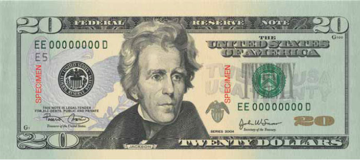
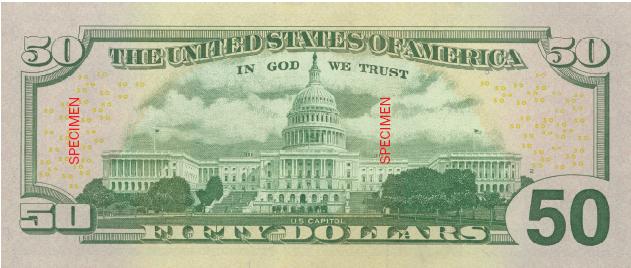
- US dollar (USD)
- Time Difference
- UTC+12 (17 hours ahead of Washington, DC, during Standard Time)
- Climate
- The climate of the Marshall Islands is tropical, with high humidity, and an average year”‘round temperature of 81°F. Trade winds pick up in October or November and blow strongly from January through April, with winds varying from 12 to 22 knots. The trades, often bringing overcast skies, have a cooling effect, although the lagoon can become rough, compared to the placid days of glassy water, so frequent in summer. Typhoon (tropical hurricane) season is from December through March. Tropical depressions form in the Marshall Islands and increase to typhoon strength as they move further west with the prevailing trade winds, making the Marshall Islands less susceptible to a full strength typhoon than most islands in the Pacific. In Majuro, January, February, and March are traditionally the driest months, with rainfall averaging 6-8 inches a month. September through December are the wettest months, with 12-14 inches of average monthly rainfall. The temperature remains stable year-round, averaging 84°F in the day and 76°F at night. The Marshall Islands enjoy clean air, clear ocean water, sunshine, and adequate amounts of rainfall, with the exception of the heavily populated areas of Majuro and Ebeye, where city living has taken its toll on the environment. Water shortages occur at any time when rainfall has been below normal, but in Majuro, shortages will occur most toward the end of the dry season in March. The use of water catchment devices is being promoted throughout the Marshall Islands. The outer islands rely more on a subsistence economy, occasionally experiencing food shortages due to seasonal variation.
- Airports
- 15
Read the full travel guide — health, safety, vaccinations, disease risk, sanitation, and transit details.
View full travel guideRecipes
Recipes
History
History
Historical Eras
Micronesian Settlement
1000 BCE – 1529
Successive waves of Austronesian migrants from Southeast Asia settled the low-lying atolls of the Marshall Islands roughly 3,000 years ago, establishing a society governed by Iroij (high chiefs) within a sophisticated clan-based hierarchy. These navigators developed advanced canoe-building and open-ocean wayfinding techniques suited to the vast distances between atolls. Spanish explorer Álvaro de Saavedra made the first recorded European contact in 1529.
Early European Contact
1529 – 1885
European engagement remained sporadic for centuries after Saavedra's arrival; English captain John Marshall lent the islands their modern name following his visit in 1788. American and European Protestant missionaries arrived by the 1850s, profoundly reshaping Marshallese society and language. Spain asserted a formal claim over the islands in 1874, though it lacked the presence to enforce colonial authority.
German Protectorate
1885 – 1914
Germany established a formal protectorate in 1885, centering its administration at Jaluit Atoll and exploiting the lucrative copra trade through commercial stations on Jaluit and Ebon. The colonial administration ruled indirectly, permitting Marshallese Iroij to retain customary authority over their communities. A trading company, Jaluit Gesellschaft, dominated the economic life of the islands throughout this period.
Japanese Mandate
1914 – 1944
Japan seized the Marshall Islands at the outset of World War I and received a League of Nations mandate over Micronesia in 1920. Japanese settlers arrived in significant numbers, and the islands were heavily fortified in the 1930s as Japan militarized the Pacific. Intense U.S. amphibious assaults on Kwajalein and Enewetak atolls in early 1944 ended Japanese control at considerable cost to both sides and to Marshallese civilians.
US Trust Territory
1944 – 1986
The United States administered the Marshall Islands as part of the UN Trust Territory of the Pacific Islands from 1947, using the strategic location for military purposes including extensive nuclear weapons testing at Bikini and Enewetak atolls between 1946 and 1962. Residents of Bikini and Rongelap were displaced by fallout from the 1954 Castle Bravo hydrogen bomb test, generating lasting health and compensation disputes. A locally drafted constitution was recognized by the United States on May 1, 1979, paving the way for self-governance.
Independence & Modern Era
1986 – present
The Republic of the Marshall Islands entered into a Compact of Free Association with the United States in 1986, achieving full sovereignty while retaining close defense and economic ties with Washington. The nation faces persistent challenges including ongoing nuclear compensation claims, economic dependence on U.S. assistance, and existential threats from rising sea levels that imperil the low-lying atolls. Kwajalein Atoll continues to host a major U.S. Army installation central to missile defense testing.
Overview
Germany established a protectorate in 1885 and set up trading stations on the islands of Jaluit and Ebon to carry out the flourishing copra (dried coconut meat) trade. Marshallese Iroij (high chiefs) continued to rule under indirect colonial German administration.
At the beginning of World War I, Japan assumed control of the Marshall Islands. Their headquarters remained at the German center of administration, Jaluit. U.S. Marines and Army troops took control from the Japanese in early 1944, following intense fighting on Kwajalein and Enewetak atolls. In 1947, the United States, as the occupying power, entered into an agreement with the UN Security Council to administer Micronesia, including the Marshall Islands, as the Trust Territory of the Pacific Islands.
On May 1, 1979, in recognition of the evolving political status of the Marshall Islands, the United States recognized the constitution of the Marshall Islands and the establishment of the Government of the Republic of the Marshall Islands. The constitution incorporates both American and British constitutional concepts.
Timeline of Key Events
500
http://www.rmiembassyus.org/History.htm
500 BC - 2000 BC (approx.) - The first Micronesian navigators arrive in the Marshalls, calling the atolls Aelon Kein Ad (Our Islands). Dates and origins of the settlers are still uncertain. While controversial, archeological finds on Bikini Atoll in the late 1980s were carbon dated to 2000 years BC, suggesting that people may have settled the Marshalls as long as 4,000 years ago.
1494
http://www.rmiembassyus.org/History.htm
The Treaty of Tordesillas cedes ownership of all of Micronesia to Spain
1529
http://www.rmiembassyus.org/History.htm
Seeking a western route to the “Spice Islands,” Spaniard Alvaro Saavedra becomes the first European to “discover” the Marshalls.
1788
http://www.rmiembassyus.org/History.htm
The area now known as the RMI was given its name by British Naval Captain William Marshall, who sailed through the area on the Scarborough while transporting convicts for New South Wales between Botany Bay and Cathay.
1857
http://www.rmiembassyus.org/History.htm
Rev. Hiram Bingham, Jr. of the American Board of Commissioners for Foreign Missions (ABCFM) creates missionary outpost on Ebon
1860
http://www.rmiembassyus.org/History.htm
Adolph Capelle builds first large-scale trading company in the Marshalls. Several German trading firms begin operations in the Marshalls soon thereafter.
1878
http://www.rmiembassyus.org/History.htm
Captain von Werner of the German Navy enters into a treaty with inhabitants of the Ralik chain, granting special trade privileges.
Read the full history profile — narrative overview, defining eras, and the complete timeline in one place.
View expanded historyInteresting Facts
Interesting Facts
For almost 40 years the islands were under U.S. administration as the easternmost part of the United Nation's Trust Territory of the Pacific Islands.
See every fact — trivia, oddities, and curious tidbits gathered from across the country.
View all interesting factsGeography and Environment
Geography and Environment
- Terrain
- low coral limestone and sand islands
- Climate
- The climate of the Marshall Islands is tropical, with high humidity, and an average year‑round temperature of 81°F. Trade winds pick up in October or November and blow strongly from January through April, with winds varying from 12 to 22 knots. The trades, often bringing overcast skies, have a cooling effect, although the lagoon can become rough, compared to the placid days of glassy water, so frequent in summer. Typhoon (tropical hurricane) season is from December through March. Tropical depressions form in the Marshall Islands and increase to typhoon strength as they move further west with the prevailing trade winds, making the Marshall Islands less susceptible to a full strength typhoon than most islands in the Pacific. In Majuro, January, February, and March are traditionally the driest months, with rainfall averaging 6–8 inches a month. September through December are the wettest months, with 12‑14 inches of average monthly rainfall. The temperature remains stable year‑round, averaging 84°F in the day and 76°F at night. The Marshall Islands enjoy clean air, clear ocean water, sunshine, and adequate amounts of rainfall, with the exception of the heavily populated areas of Majuro and Ebeye, where city living has taken its toll on the environment. Water shortages occur at any time when rainfall has been below normal, but in Majuro, shortages will occur most toward the end of the dry season in March. The use of water catchment devices is being promoted throughout the Marshall Islands. The outer islands rely more on a subsistence economy, occasionally experiencing food shortages due to seasonal variation
- Natural Hazards
- infrequent typhoons
- Current Environmental Issues
- inadequate supplies of potable water; pollution of Majuro lagoon from household waste and discharges from fishing vessels
Read the full geography and environment profile — terrain, climate, natural resources, hazards, land use, and international agreements.
View full geographyPeople & Demographics
People & Demographics
Languages Spoken
English (widely spoken as a second language, both English and Marshallese are official languages), two major Marshallese dialects from the Malayo-Polynesian family, Japanese
- English
- Japanese
- Marshallese
Population
- Population
- 65,859
- Population in Major Urban Areas
- MAJURO (capital) 31,000
- Nationality Noun
- Marshallese (singular and plural)
- Ethnic Groups
- Micronesian
Education
- Literacy Definition
- age 15 and over can read and write
Read the full people and society profile — demographics, health, education, religion, languages, and notable people.
View full people and societyGovernment & Politics
Government & Politics
Country Identity
- Country Name
- MarshallIslands
- Full Country Name
- Republic of the Marshall Islands
- Former Name
- Marshall Islands District (Trust Territory of the Pacific Islands)
Government Structure
- Government Type
- constitutional government in free association with the US; the Compact of Free Association entered into force 21 October 1986
- Legal System
- based on adapted Trust Territory laws, acts of the legislature, municipal, common, and customary laws
- Executive Branch
- chief of state: President Hilda C. Heine (since 3 January 2024); note - the president is both the chief of state and head of government head of government: President Hilda C. Heine (since 3 January 2024); note - the president is both the chief of state and head of government cabinet: Cabinet selected by the president from among the members of Parliament elections: president elected by Parliament from among its own members for a four-year term; election last held 3 January 2024 (next to be held in 2028) election results: Hilda C. Heine elected president by Parliament, defeating incumbent David Kabua; Heine previously served as president from 2016 to 2020, making her the first female head of state in the Pacific Islands region
- Legislative Branch
- unicameral Parliament or Nitijela (33 seats; members elected by popular vote to serve four-year terms) elections: last held 17 November 2003 (next to be held by November 2007) election results: percent of vote by party - NA%; seats by party - NA note: the Council of Chiefs is a 12-member body that advises on matters affecting customary law and practice
- Judicial Branch
- Supreme Court; High Court
- Suffrage
- 18 years of age; universal
- Constitution
- 1-May-79
- Independence
- 21 October 1986 (from the US-administered UN trusteeship)
- National Holiday
- Constitution Day, 1 May (1979)
Capital City
- Capital Name
- Majuro; note - the capital is an atoll of 64 islands; governmental buildings are housed on three fused islands on the eastern side of the atoll: Djarrit, Uliga, and Delap
- Capital - geographic coordinate
- 7 06 N, 171 23 E
- Capital Time Difference
- UTC+12 (17 hours ahead of Washington, DC, during Standard Time)
Majuro means "two openings" or "two eyes" and refers to the two major northern passages through the atoll into the Majuro lagoon
Military
Branches: no regular military forces; Marshall Islands Police
Embassy / Diplomatic Mission
The U.S. Embassy in Majuro
(no street address)
Located on the ocean-side of the island's major road, approximately two miles east of the airport.
P.O. Box 1379
Majuro, MH 96960-1379
Telephone: (692) 247-4011
Facsimile: (692) 247-4012
Email: MAJConsular@state.gov
Read the full government profile — flag symbolism, national anthem, and other national symbols.
View full government detailsEconomy
Economy
US government assistance remains the mainstay of this small island economy. Agricultural production is primarily subsistence-based and concentrated on small farms, with coconuts, breadfruit, and copra serving as the most important commercial crops. Small-scale industry is limited to handicrafts, tuna processing, and copra production. Tourism is a modest source of foreign exchange, employing a small share of the labor force and continuing to offer potential for future growth, though the sector was significantly disrupted by the COVID-19 pandemic and has been slow to recover. The islands have few natural resources, and imports vastly exceed exports.
Under the Compact of Free Association, originally signed in 1986 and renewed in 2004, the United States has provided several billion dollars in economic assistance, defense guarantees, and access to various federal programs. In 2024, the US Congress approved a new 20-year Compact agreement providing approximately $2.3 billion in additional funding through 2043, securing the Marshall Islands' fiscal outlook for the coming decades.
Key economic challenges include vulnerability to climate change and sea-level rise, heavy dependence on imports, limited private sector development, outmigration of skilled workers, and reliance on revenue from fishing license fees, ship registry services, and US transfers. GDP growth has been modest and uneven, averaging roughly 2–3% annually in recent years, with the economy gradually recovering from pandemic-related contractions. The government has also pursued initiatives in digital currency and maritime services to diversify revenue, though these remain limited in scale.
Snapshot
- Currency Name and Code
- US Dollar (USD)
- GDP Real Growth Rate
- 1%
Banknotes
Budget & Public Finance
- Fiscal Year
- 1 October - 30 September
- Annual Budget
- $40,000,000 (USD)
- External Debt
- $86,500,000 (USD)
- Economic Aid
- $1,000,000,000 (USD)
Labor, Industry & Trade
- Labor Force by Occupation
- agriculture 21.4%; industry 20.9%; services 57.7%
- Industries
- copra, fish, tourism, craft items from shell, wood, and pearls
- Agriculture Products
- coconuts, tomatoes, melons, taro, breadfruit, fruits; pigs, chickens
- Export Commodities
- copra cake, coconut oil, handicrafts, fish
- Export Partners
- US, Japan, Australia, China
- Import Commodities
- foodstuffs, machinery and equipment, fuels, beverages and tobacco
- Import Partners
- US, Japan, Australia, NZ, Singapore, Fiji, China, Philippines
Energy
- Oil Production
- 0 bbl/day
- Oil Consumption
- 0 bbl/day
- Oil Reserves
- 0 bbl/day
- Natural Gas Production
- 0 cu m
- Natural Gas Consumption
- 0 cu m
- Natural Gas Imports
- 0 cu m
- Natural Gas Exports
- 0 cu m
- Natural Gas Reserves
- 0 cu m
Communications
- Telephone System
- general assessment: digital switching equipment; modern services include telex, cellular, Internet, international calling, caller ID, and leased data circuits domestic: Majuro Atoll and Ebeye and Kwajalein islands have regular, seven-digit, direct-dial telephones; other islands interconnected by high frequency radiotelephone (used mostly for government purposes) and mini-satellite telephones international: country code - 692; satellite earth stations - 2 Intelsat (Pacific Ocean); US Government satellite communications system on Kwajalein
- Internet Country Code
- .mh
News & Weather
News & Weather
Current Weather
Latest News
Marshall Islands Population 2026 - World Population Review
World Population Review · 4d ago
Russia strikes Marshall Islands-flagged vessel in Odesa Oblast port again, injuring four - Українська правда
Українська правда · 3d ago
Tre Kramer-Taylor Follows Football Journey From Marshall Islands To Portland State - Portland State University Athletics
Portland State University Athletics · 63d ago
BitGo to custody Marshall Islands sovereign bond token - Investing.com
Investing.com · 3d ago
Mission To Boost NASA’s Swift Launches From Marshall Islands - NASA Science (.gov)
NASA Science (.gov) · 18d ago
Russian Strike on Civilian Marshall Islands-Flagged Cargo Ship Kills Two in Odesa Region - UNITED24 Media
UNITED24 Media · 6d ago
Marshall Islands launches world’s first sovereign tokenised bond - TheBanker.com
TheBanker.com · 34d ago
President Lai meets Marshall Islands Minister of Foreign Affairs and Trade Kalani R. Kaneko - Office of the President Republic of China(Taiwan)
Office of the President Republic of China(Taiwan) · 19d ago
News via Google News
Climate Overview
The climate of the Marshall Islands is tropical, with high humidity, and an average year”‘round temperature of 81°F. Trade winds pick up in October or November and blow strongly from January through April, with winds varying from 12 to 22 knots. The trades, often bringing overcast skies, have a cooling effect, although the lagoon can become rough, compared to the placid days of glassy water, so frequent in summer.
Typhoon (tropical hurricane) season is from December through March. Tropical depressions form in the Marshall Islands and increase to typhoon strength as they move further west with the prevailing trade winds, making the Marshall Islands less susceptible to a full strength typhoon than most islands in the Pacific.
In Majuro, January, February, and March are traditionally the driest months, with rainfall averaging 6-8 inches a month. September through December are the wettest months, with 12-14 inches of average monthly rainfall. The temperature remains stable year-round, averaging 84°F in the day and 76°F at night.
The Marshall Islands enjoy clean air, clear ocean water, sunshine, and adequate amounts of rainfall, with the exception of the heavily populated areas of Majuro and Ebeye, where city living has taken its toll on the environment. Water shortages occur at any time when rainfall has been below normal, but in Majuro, shortages will occur most toward the end of the dry season in March. The use of water catchment devices is being promoted throughout the Marshall Islands. The outer islands rely more on a subsistence economy, occasionally experiencing food shortages due to seasonal variation.
Frequently Asked Questions
Frequently Asked Questions
What is the population of Marshall Islands?
What should travelers know before visiting the Marshall Islands?
What is the capital of the Marshall Islands?
Where is the Marshall Islands located?
What ocean surrounds the Marshall Islands?
What currency is used in the Marshall Islands?
What languages are spoken in the Marshall Islands?
What is the geography of the Marshall Islands like?
What is the Marshall Islands known for?
What is the political relationship between the Marshall Islands and the United States?
Last reviewed 2026