
 English
 Español
 中文
中文 हिन्दी
 Français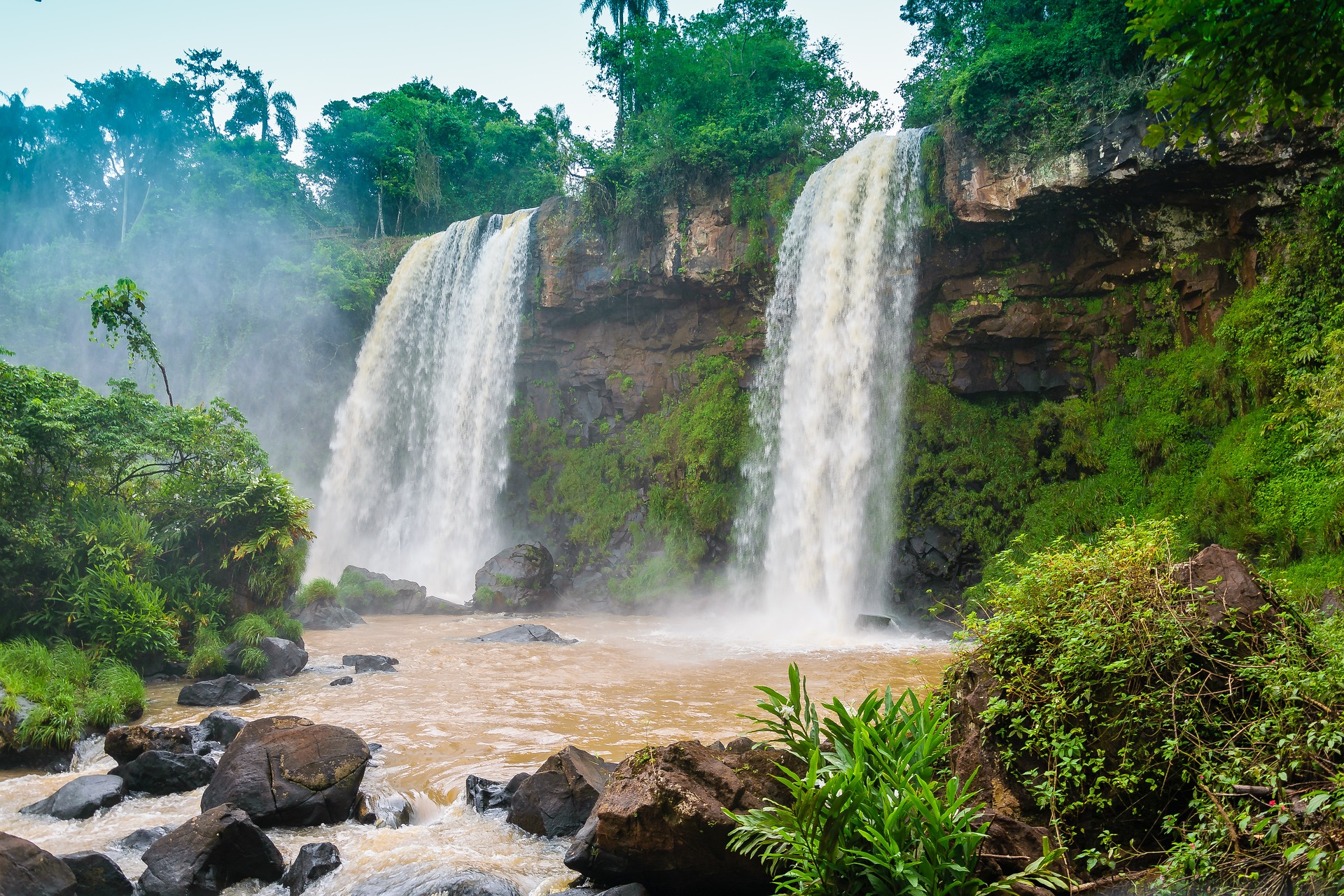
Waterfalls of the World
complete guide to the most spectacular waterfalls of the world from Angel Falls to Niagara
Introduction
Few phenomena in the natural world command the same visceral awe as a great waterfall. The sight of enormous volumes of water hurling themselves over a precipice and plummeting into a churning pool far below engages every human sense simultaneously. The roar fills the ears long before the cataract itself comes into view. The mist, laden with the cool breath of moving water, refreshes the skin. The spray catches sunlight and breaks it into arching rainbows. The very ground trembles faintly underfoot as countless tons of water strike the basin below. In that moment of encounter, human visitors almost universally feel something that transcends mere admiration for scenery. They feel the presence of raw planetary power.
Waterfalls have shaped human civilizations in ways both practical and spiritual. They powered the mills that ground grain and the looms that wove cloth during the Industrial Revolution. They inspired painters, poets, and composers across every culture and century. They drew explorers deep into unmapped continents and guided settlers toward the swift rivers that would sustain frontier communities. They became the subjects of legends and sacred stories on every inhabited continent. Today, they generate electricity for hundreds of millions of people while simultaneously drawing tourists who collectively number in the hundreds of millions each year.
The waterfalls of the world encompass an extraordinary range of scale and character. Some, like Angel Falls in Venezuela, achieve their grandeur through sheer vertical drop, plunging nearly a kilometer through mountain air before reaching the valley floor. Others, like Victoria Falls on the border of Zambia and Zimbabwe, derive their power from the mind-bending volume of water that passes through them, creating a perpetual cloud of mist visible from more than thirty kilometers away. Still others, like Iguazu Falls on the border of Argentina and Brazil, overwhelm visitors with the breadth of their spectacle, spreading across nearly three kilometers of wild riverfront and comprising hundreds of individual cascades.
This comprehensive guide to waterfalls of the world explores the greatest, most celebrated, and most scientifically fascinating waterfalls on every continent. It examines the geological processes that create waterfalls, traces the human histories intertwined with the most famous examples, and considers the ongoing challenges of preserving these irreplaceable natural wonders in an era of climate change, tourism pressure, and competing demands for water resources. Whether the reader is planning a journey to one of the classic waterfall destinations or simply wishes to understand these remarkable features of the natural world more deeply, this guide offers the detail, context, and perspective that such magnificent subjects deserve.
From the mist-shrouded rainforests of South America to the volcanic plateaus of Iceland, from the ancient escarpments of southern Africa to the granite walls of Yosemite, waterfalls represent some of the most dynamic and emotionally resonant landscapes on Earth. The best guide to the world's most breathtaking natural water features reveals not only facts and figures but the living stories of how water, rock, and time collaborate to produce wonders that no photograph can fully capture and no written description can entirely convey.
Understanding waterfalls requires an appreciation of the slow, inexorable forces of erosion and tectonic movement that have shaped the continents over millions of years. It requires attention to hydrology, the study of water movement across landscapes. It requires engagement with ecology, because the spray zones and plunge pools around waterfalls support some of the most biologically diverse and unusual plant and animal communities anywhere on Earth. And it requires a measure of historical and cultural literacy, because the greatest waterfalls have been embedded in human imagination and economy for as long as people have lived near them.
The following sections move through all of these dimensions systematically, beginning with the science of waterfall formation and then devoting extended attention to each of the world's most significant cataracts in turn. The guide then broadens its focus to examine waterfalls as cultural phenomena, as energy sources, and as conservation challenges. It concludes with a survey of famous waterfalls through recorded history, reminding readers that these features of the landscape have always occupied a central place in human experience. For anyone seeking the most complete waterfall travel guide covering the tallest, widest, and most powerful waterfalls across all seven continents, this article provides the authoritative foundation.
How Waterfalls Form
The formation of a waterfall is ultimately a story about the differential resistance of rocks. Rivers flow downhill, carrying energy derived from the sun through the mechanism of the water cycle. As a river moves, it erodes the rock and sediment over which it passes. Most of the time this erosion is gradual and more or less uniform, producing the gentle grades and meandering channels that characterize rivers across most of their length. But sometimes a river encounters a dramatic change in rock type or structure. When a band of hard, resistant rock gives way downstream to softer, more easily eroded material, the softer rock wears away faster, creating a step in the riverbed. The harder rock upstream forms a lip over which the river spills. A waterfall is born.
This fundamental mechanism operates through several more specific geological configurations. In the first and most common, known as a lithological waterfall, the river crosses a contact zone between different rock types. The classic example is a river flowing from granite or basalt onto softer limestone, sandstone, or shale. The hard rock forms the cap or lip of the falls, while the soft rock below is undercut by the falling water and the turbulence of the plunge pool, which gradually eats back into the cliff face, causing the waterfall to migrate upstream over geological time. Niagara Falls provides perhaps the most studied example of this process, having migrated approximately eleven kilometers upstream from its original position since the end of the last ice age, some twelve thousand years ago.
A second mechanism involves tectonic activity. Where fault lines bring rock masses of different resistance into contact, the resulting escarpments can produce dramatic waterfalls. The Drakensberg escarpment in southern Africa, which gives rise to Tugela Falls, was formed by geological processes that uplifted a massive block of basalt-capped rock. Similarly, many of the great waterfalls of East Africa occur where rivers encounter the faulted edges of the Great Rift Valley.
Glaciation has created some of the world's most spectacular waterfalls through yet another mechanism. During the ice ages, valley glaciers carved their host valleys far deeper than the tributary valleys that joined them. When the ice retreated, these tributary valleys were left hanging high above the main valley floor. The streams flowing through them now plunge over the edges as hanging valley waterfalls. Yosemite Valley in California is famously rich in such waterfalls because the main valley glacier was so much more powerful than its tributaries, creating a spectacular array of hanging valleys around the valley walls. The same process has produced the numerous impressive waterfalls that line the walls of Norwegian fjords.
Volcanic activity creates waterfalls both directly and indirectly. Lava flows harden into basalt, one of the most erosion-resistant common rocks, and rivers crossing basalt plateaus often plunge dramatically where the basalt edge has been exposed. Iceland, sitting atop a mid-ocean ridge and intensely volcanic, has produced some of the world's most magnificent waterfalls on exactly this geological foundation. The lava flows that created the Icelandic plateau left behind a landscape of perfectly horizontal basalt columns, and rivers crossing these formations drop in dramatic curtains of white water.
The role of the plunge pool in waterfall development deserves special emphasis because it is so central to the self-perpetuating nature of waterfalls. Where a river drops over a lip of hard rock, the falling water and the trapped air bubbles it carries strike the floor of the pool below with enormous hydraulic force. This force is concentrated on the softer rock beneath the cap, eroding it more rapidly than the cap itself. Over time, the hard cap is undercut, weakens, and eventually breaks away in chunks. The falls retreats, and the process begins again. This is why many waterfalls have an overhanging lip and why they tend to occupy gorges rather than open valleys. The gorge itself is the archaeological record of the waterfall's migration upstream.
Seasonal variation in water volume profoundly affects the character and appearance of waterfalls. Many of the world's most visited waterfalls vary dramatically between wet and dry seasons, sometimes reducing to thin threads of water during droughts and swelling to wall-to-wall curtains of white foam during peak flow periods. Yosemite Falls in California can completely dry up during drought years. The waterfalls of Iceland reach their maximum drama during the spring and early summer when snowmelt adds to heavy rainfall. Victoria Falls reaches its peak between February and May following the rainy season in the Zambezi watershed, while during the dry season its spray is dramatically reduced.
Waterfall classification systems attempt to impose order on an enormous diversity of forms. Scientists and enthusiasts categorize waterfalls by their shape into types including plunge falls, where the water falls freely away from the rock face; horsetail falls, where water maintains contact with the rock as it descends; fan falls, where the water spreads horizontally as it descends; block falls, where the water descends from a wide river in a single broad sheet; and tiered falls, where the descent occurs in a series of distinct steps. Most famous waterfalls combine elements of multiple types, and the classification that applies changes with water volume. What appears as a plunge waterfall at low volume may become a block waterfall when the river is in full flood.
The measurement of waterfall height presents surprisingly complex challenges for scientists and engineers. The total height of a waterfall may include multiple distinct drops, cascades, and steep rapids. Some authorities count only the height of the highest uninterrupted free-fall, while others measure the total vertical descent from the brink of the uppermost fall to the base of the lowest drop. This disagreement in measurement methodology is partly responsible for the ongoing scientific debate about whether Angel Falls or Tugela Falls holds the title of world's tallest waterfall. Each can claim primacy under a different measurement convention, which speaks to the difficulty of imposing simple rankings on phenomena as complex and varied as waterfalls.
The ecology of waterfall environments is among the most distinctive on Earth. The constant spray maintains a zone of perpetual humidity around the falls that supports mosses, ferns, and other moisture-loving plants that cannot survive in the drier surrounding landscape. These spray zones are often rich in species found nowhere else nearby, creating microhabitats of unusual biological diversity. The plunge pools below falls are important fish refuges, and the waterfalls themselves serve as barriers to fish migration that have over evolutionary time caused the development of distinct fish populations above and below major falls. The constant roar of a waterfall creates a zone of acoustic isolation that many birds and insects have adapted to exploit, developing unusually loud calls or specialized frequency communication to function in the permanent noise.
Angel Falls, Venezuela
Rising from the vast grassland wilderness of southeastern Venezuela, the tepuis are among the most extraordinary geological formations on the planet. These massive flat-topped sandstone mountains, remnants of an ancient plateau that once stretched across the entire Guiana Highlands, tower above the surrounding savanna on sheer vertical walls of red and orange rock. They are ancient beyond imagination, their sandstone having been deposited more than a billion years ago, and their isolation has made them evolutionary islands where plant and animal species found nowhere else on Earth have developed over millions of years. Among these remarkable mountains, one name stands above all others in the records of the natural world: Auyantepui, meaning Devil's Mountain in the language of the indigenous Pemon people. From its summit, the world's tallest waterfall makes its extraordinary plunge to the jungle far below.
Angel Falls, known in Venezuela as Salto Angel, has a total height of 979 meters (3,212 feet), with a single uninterrupted free-fall of 807 meters (2,648 feet) that represents the longest continuous drop of any waterfall on Earth. To appreciate these numbers in concrete terms, consider that the Eiffel Tower is 330 meters tall, meaning the main drop of Angel Falls equals approximately two and a half Eiffel Towers stacked on top of each other. Niagara Falls, one of the most famous cataracts in the world, drops approximately 57 meters over its main Horseshoe Falls, making Angel Falls roughly fourteen times taller. The water takes approximately fourteen seconds to fall the full height of the main drop, and by the time it reaches the base it has been transformed into a mist of fine spray rather than coherent water, dispersed by the friction of the air through which it passes.
The Pemon people who have inhabited the region of the Guiana Highlands for centuries were of course well acquainted with the waterfall long before any outsider encountered it. They call it Kerepakupai Meru, meaning waterfall of the deepest place, a name that was formally recognized by the Venezuelan government in 2009 as an alternative official name for the falls. For the Pemon, the tepuis and their waterfalls were sacred features of a living landscape, not merely scenery. The particular power and height of what the outside world would come to call Angel Falls gave it a special place in the spiritual geography of the region.
The first sighting by an outsider is attributed to the American aviator Jimmie Angel, who spotted the waterfall on November 16, 1933, while flying over the region as a pilot for a mining prospecting expedition. Angel was already a colorful and widely traveled adventurer, but his claim to have seen a waterfall of extraordinary height was initially met with skepticism. The falls were too remote, too inaccessible, and too improbable for many to take seriously. Angel himself returned to the region repeatedly, and on October 9, 1937, he landed his monoplane on the top of Auyantepui in an attempt to reach the falls by land. The plane sank into the boggy summit and could not be moved. Angel and his three companions spent eleven days hiking down the mountain through dense jungle before reaching safety. His plane, Río Caroní, remained on the summit for thirty-three years before being airlifted off in 1970. A replica now stands at the airport in Ciudad Bolívar.
The official survey and measurement of Angel Falls was conducted in 1949 by a National Geographic-funded expedition led by Ruth Robertson, with surveyor Perry Lowrey establishing the accepted measurements. The falls were named for Jimmie Angel on official Venezuelan maps in 1939, cementing his place in the history of geographic exploration even though he never lived to see the falls achieve world fame. Angel died in Panama in 1956 from injuries sustained in a plane crash. His ashes were scattered over the falls he had introduced to the world.
Reaching Angel Falls remains an adventure today, which is much of its appeal. The falls lie within Canaima National Park, a UNESCO World Heritage Site covering 30,000 square kilometers of the Guiana Highlands. There are no roads to the falls. Visitors fly to the village of Canaima and then travel by motorized dugout canoe up the Carrao and Churun rivers, a journey of several hours through jungle river scenery of surpassing beauty. From the landing point, a further hike of approximately one hour through dense tropical rainforest leads to the viewpoint at the base of the falls. The experience is one of the great wilderness journeys available anywhere on Earth, combining genuinely remote and challenging travel with one of the most breathtaking natural spectacles imaginable.
The environment around Angel Falls is as extraordinary as the waterfall itself. Canaima National Park encompasses one of the world's last truly wild tropical wilderness areas, with vast undisturbed ecosystems ranging from rainforest to savanna to the unique tepui summit environments. The park supports species that exist nowhere else, including the giant anteater, the giant river otter, and numerous endemic plants that have evolved in isolation on the tepui summits. The waterfalls that pour from the tepuis, of which Angel Falls is only the most famous, feed rivers that drain eventually into the Orinoco River system, one of the great river networks of South America.
The best time to visit Angel Falls is during the wet season, from June through November, when the Churun River is high enough for canoe travel and the falls are at their full flow. During the dry season, the falls can diminish significantly, and river levels may make canoe travel impractical. Cloud and mist can obscure the falls at any time of year, and many visitors make multiple viewings from different angles and at different times of day to maximize their chances of seeing the full spectacle.
The relationship between Angel Falls and the surrounding indigenous Pemon communities is a complex and important one. The Pemon have lived in the region for centuries and have their own deep cultural connection to the tepuis and their waterfalls. Modern tourism to the falls provides economic benefit to Pemon communities through guiding, accommodation, and transport services, but it also creates pressures on traditional ways of life and on the natural environment. The Venezuelan government and various conservation organizations have worked to develop tourism models that respect Pemon cultural rights and minimize environmental impacts, though tensions between development, conservation, and indigenous rights continue to require careful management.
Angel Falls appears on Venezuela's 1,000 bolivar note and in countless promotional materials as perhaps the single most recognizable symbol of the country's extraordinary natural heritage. For those interested in waterfalls and scenic wonders of the world with plunge pools and remote rainforest settings, few destinations anywhere on Earth can match the combination of natural drama, wilderness, and cultural richness that surrounds Kerepakupai Meru.
Niagara Falls
No waterfall in the world has been more thoroughly documented, more intensively developed, more commercially exploited, or more profoundly embedded in the popular culture of North America than Niagara Falls. Straddling the international border between the Canadian province of Ontario and the American state of New York, Niagara consists of three distinct cataracts: the Canadian Horseshoe Falls, the American Falls, and the small Bridal Veil Falls. Together they carry an average of approximately 2,832 cubic meters of water per second during the daytime tourist season, a figure mandated by international treaty between Canada and the United States. This volume, combined with the moderate height of the main falls, gives Niagara its distinctive character as the most powerful waterfall in North America by sheer hydraulic force.
The Horseshoe Falls, which account for approximately ninety percent of the total flow, drop 57 meters (188 feet) in a great curving sweep of white water 792 meters wide. The American Falls, separated from the Canadian side by Goat Island, drop between 21 and 34 meters depending on the point measured, with their face partially obscured by a talus slope of fallen rock at the base. The Bridal Veil Falls, the smallest of the three, are separated from the American Falls by Luna Island.
The geological age of Niagara Falls is relatively young by geological standards but ancient in human terms. The falls formed approximately 12,000 to 12,500 years ago when the retreat of the Laurentide Ice Sheet allowed the Niagara River to begin flowing between Lake Erie and Lake Ontario. At their origin near the present communities of Queenston, Ontario, and Lewiston, New York, the falls encountered the resistant Lockport Dolostone cap rock that forms the lip of the Niagara Escarpment. Below this hard cap lies the softer Rochester Shale, which is continuously undermined by the hydraulic force of the falling water. The result has been a steady upstream migration of the falls at a historical rate of about one meter per year, though the modern rate is much slower due to the diversion of roughly fifty percent of the river's flow for hydroelectric generation. Over the 12,000 years since formation, the falls have migrated approximately eleven kilometers upstream from their original position, carving the spectacular Niagara Gorge in their wake.
The human history of Niagara Falls is rich with figures whose stories illuminate broader American and Canadian history. The Haudenosaunee (Iroquois Confederacy) peoples had known and revered the falls for many centuries before European contact. Jesuit missionary Father Louis Hennepin was the first European to publish a description and illustration of Niagara Falls, doing so in 1683 following his journey through the region in 1678. His description was somewhat exaggerated, placing the falls at a height of over 183 meters, but it was enough to fire the European imagination. Within decades, Niagara Falls had become one of the most celebrated natural phenomena known to the Western world.
The nineteenth century transformed Niagara Falls from a remote natural wonder into one of the first modern tourist destinations. Hotels, taverns, and observation platforms multiplied on both sides of the border. The arrival of the railroad in the 1830s and 1840s made the falls accessible to large numbers of middle-class tourists for the first time. The fashionable honeymoon tradition at Niagara, which became so firmly established that the falls were commonly called the Honeymoon Capital of the World, began in the early nineteenth century and persists to this day.
The history of daredevil stunts at Niagara Falls forms a colorful and sometimes tragic thread in the story of the falls. Charles Blondin, the French acrobat born Charles Emile Gravelet, made the first of his many tightrope crossings above the gorge on June 30, 1859, drawing enormous crowds. He subsequently repeated the feat blindfolded, on stilts, pushing a wheelbarrow, and carrying a man on his back. In 1901, Annie Edson Taylor became the first person to survive a plunge over the falls in a barrel, emerging bruised but alive. The stunt is remarkable not only for its audacity but for the fact that Taylor was at the time sixty-three years old. The tradition of daredevil stunts at Niagara has continued into the modern era, though they are now officially illegal.
The industrial exploitation of Niagara Falls began in earnest in the latter half of the nineteenth century. Early industries including flour mills, paper mills, and chemical plants drew power from the swift current of the Niagara River above the falls. The transition to hydroelectric generation began in the 1880s with the construction of the first generating station. By the early twentieth century, the falls had been partially tamed by massive engineering works designed to channel water through turbines. The 1950 Niagara River Water Diversion Treaty between the United States and Canada formalized the division of the river's flow between power generation and the maintenance of scenic flow over the falls, striking a balance that has remained broadly in effect ever since.
The environmental history of the Niagara region is also one of industrial pollution and subsequent recovery. The Love Canal disaster, centered just a few kilometers from the falls, brought the problem of toxic chemical waste disposal to national attention in the late 1970s and became a landmark in the development of American environmental law. The cleanup of the Niagara River, once heavily polluted by industrial discharges, has been a major conservation success story since the 1970s, with significant improvements in water quality and the return of several fish species to stretches of the river that had been biologically dead.
Today, more than twelve million people visit Niagara Falls annually, making it one of the most visited natural wonders on Earth. The experience of standing at the railing above the Horseshoe Falls, feeling the mist on one's face and hearing the thunder of the water, remains one of the most powerful sensory experiences that nature offers in North America. For those researching iconic North American waterfall destinations with both natural and cultural heritage, Niagara offers an unparalleled combination of geological drama and human history.
Victoria Falls, Africa
David Livingstone, the Scottish missionary and explorer, first laid European eyes on the great falls of the Zambezi River on November 17, 1855. He had been guided to the site by the Kololo people, who called the falls Mosi-oa-Tunya, meaning The Smoke That Thunders, a name so apt that it has remained in common use alongside the colonial name that Livingstone gave the falls in honor of Queen Victoria. His recorded reaction to the sight has become one of the most quoted passages in the literature of African exploration. He wrote that he had never seen anything that made him so forgetful of time and so utterly absorbed in contemplation. The falls, he said, were so beautiful that angels in their flight must have gazed down upon them with equal admiration.
Victoria Falls straddles the border between Zambia to the north and Zimbabwe to the south, where the Zambezi River crosses an ancient basalt plateau and plunges into a narrow chasm. The dimensions of the falls are extraordinary. The cataract spans the full width of the Zambezi River at this point, extending 1,708 meters (5,604 feet) from bank to bank, making it the widest curtain of falling water on Earth. The falls drop 108 meters (354 feet) into the Batoka Gorge below. The combination of width and height gives Victoria Falls the greatest sheet area of any waterfall in the world, leading many authorities to describe it as the largest waterfall on Earth, though that designation depends on how one defines largest. In terms of combined width and height, the claim is essentially unassailable.
During the peak flow season, which typically occurs between February and May following the rainy season in the Zambezi headwaters, the volume of water passing over Victoria Falls reaches approximately 500 million liters per minute, creating a column of spray and mist that can be seen from a distance of more than thirty kilometers. The sound carries nearly as far. The spray sustains a zone of permanent rainforest along the rim of the gorge, creating a lush ribbon of dense vegetation in the midst of the surrounding drier woodland. This rainforest spray zone, visible from satellite imagery, is one of the most distinctive ecological features of Victoria Falls.
The geological history of Victoria Falls involves the progressive erosion of a series of gorges through the basalt plateau. The Zambezi has carved eight successive gorges at different points along the plateau, each representing a former position of the waterfall. The current falls stand at the head of the most recently formed gorge, and in the fullness of geological time the river will continue to erode its way upstream, cutting a new gorge and leaving the present one as another exhibit in the geological record of the river's migration. Geologists estimate that the process of cutting the current series of gorges has taken several hundred thousand years.
The spray and mist of Victoria Falls sustain one of the most unusual ecological communities in Africa. The rainforest of the spray zone is classified as a unique vegetation community, distinct from both the dry woodland that surrounds it and the lowland tropical forests found elsewhere in Africa. It contains species that are entirely absent from the surrounding landscape, including ferns, mosses, and flowering plants that depend on the constant moisture provided by the falls. The gorge below the falls supports crocodiles, hippos, and a remarkable diversity of fish, some of which are found nowhere else in the world having evolved in isolation above or below the falls.
Bungee jumping from the bridge that spans the gorge just below the falls has made Victoria Falls one of the world's most famous adventure tourism destinations. The Victoria Falls Bridge, completed in 1905 on the orders of Cecil Rhodes as part of his ambitious project to build a railway from Cape Town to Cairo, spans the second gorge at a height of 128 meters above the Zambezi. The bungee jump from the centre of this bridge, dropping to a height of just above the water surface, is rated among the most dramatic in the world and draws visitors from every continent.
Both the Zambia and Zimbabwe national parks that encompass Victoria Falls were jointly inscribed as a UNESCO World Heritage Site in 1989, recognizing the outstanding universal value of the falls and their associated ecosystems. The site covers approximately 86,000 hectares and includes the gorges, the spray zone forest, and areas of riverine habitat above and below the falls. The twin designation has complicated governance of the site because it requires coordination between two sovereign nations with different conservation priorities, economic pressures, and administrative systems, but it has also created a framework for collaborative management that has produced genuine conservation achievements.
The Tonga and Lozi peoples have lived along the Zambezi River near the falls for many centuries. Their oral traditions, agricultural practices, and fishing techniques were profoundly shaped by the seasonal flooding of the Zambezi and by the geography of the gorge. Both the Zambian and Zimbabwean sides of the falls have significant tourist infrastructure, and competition between the two countries for tourist revenue has occasionally created political tensions, though both sides acknowledge that cooperation is ultimately in their shared interest.
For travelers seeking premier African waterfall experiences with wildlife viewing and adventure activities, Victoria Falls remains the continent's premier destination. The nearby national parks of Chobe in Botswana and Hwange in Zimbabwe bring large populations of elephants and lions within easy reach, and the Zambezi itself offers world-class white-water rafting through the gorges below the falls.
Iguazu Falls
If Victoria Falls inspires awe through the sheer force of its curtain of water, and Angel Falls through the dizzying height of its plunge, Iguazu Falls overwhelms through the extravagance of its number and variety. Situated on the border of the Argentine province of Misiones and the Brazilian state of Paraná, Iguazu Falls comprises 275 individual falls spread across a front approximately 2.7 kilometers wide, making it nearly three times wider than Niagara Falls. The individual falls range in height from 60 to 82 meters (197 to 269 feet), and the entire system is set within one of the most biologically rich subtropical forests remaining anywhere on Earth.
The Spanish word iguazú and the Portuguese iguaçu both derive from the Guaraní word meaning great water, and indeed the name could hardly be more fitting. The Iguazu River, a major tributary of the Paraná River, flows generally westward from the Brazilian highlands before reaching the great basalt shelf over which it plunges. The river had been flowing over increasingly soft rock eroded from below the basalt, and eventually the underlying material gave way, creating the network of islands and promontories that now divides the single river into hundreds of distinct cascades. The largest and most dramatic of these is the Garganta del Diablo, or Devil's Throat, a U-shaped chasm nearly 150 meters wide and 700 meters long into which roughly half of the river's total flow plunges from all sides, creating a thunderous vortex of mist and sound from which clouds of spray rise continuously.
The Devil's Throat can be reached via walkways that extend out over the river on the Argentine side, placing visitors directly above the lip of the falls and looking down into an abyss of churning white water. On cloudy days the depth of the gorge is completely hidden by spray. On clear days the rainbows that form in the rising mist are so numerous that they overlap and intersect in kaleidoscopic patterns. The experience of standing at the walkway railing above the Devil's Throat, with the river flowing past on all sides and the void immediately below, is one of the most intense encounters with natural power available anywhere on Earth.
The two national parks that protect Iguazu Falls, the Argentine Iguazú National Park and the Brazilian Iguaçu National Park, were both designated UNESCO World Heritage Sites in the 1980s. Argentine Iguazú National Park received the designation in 1984 and the Brazilian park in 1986. Together they protect one of the largest fragments of the Atlantic Forest, a coastal tropical forest that was once one of the most extensive forest ecosystems in South America but has been reduced to approximately twelve percent of its original extent by agriculture and development. The Iguazu falls system and the national parks that surround it thus represent not only one of the world's great natural spectacles but also a critical conservation area for one of the world's most threatened forest ecosystems.
The biodiversity of the Iguazu region is staggering. More than 2,000 plant species, 400 bird species, and 80 mammal species have been recorded within the national parks. Notable inhabitants include the jaguar, the giant anteater, the tapir, and the capybara. The forest is particularly rich in bird life, and the parks are considered among the finest birdwatching destinations in South America. The great dusky swift, a bird that builds its nests behind the falls and flies through the cascading water to reach them, has become one of the iconic wildlife spectacles of Iguazu.
The Guaraní people have lived in the region surrounding Iguazu for thousands of years. Their creation mythology gives the falls a central place, attributing the cataract to the action of a serpent deity who split the river in anger. When a village chief sought to escape with his beloved in a canoe, the deity shook the earth and caused the river to rupture, plunging the lovers into the abyss. The resulting falls are said to bear the spiritual imprint of that ancient drama, explaining both their beauty and their power. Modern Guaraní communities continue to live in the vicinity of the falls, maintaining their language and cultural practices while adapting to the pressures of the modern world.
Both the Argentine and Brazilian sides offer extensive visitor infrastructure, including walkways at multiple levels that bring visitors into close contact with different sections of the falls. The Argentine side generally allows more intimate contact with the falls, with lower walkways that put visitors almost within touching distance of the smaller cascades. The Brazilian side, particularly the panoramic walkway at Foz do Iguaçu, provides the sweeping overview that best conveys the full scale of the system. For the complete experience, most travel writers and tourists agree that at least two days are needed, one on each side of the border.
The Iguazu river system and its extraordinary falls complex represent one of the finest examples of geomorphological processes shaping a landscape in ways that create habitats for extraordinary biodiversity. For travelers planning comprehensive South American waterfall itineraries that include both Iguazu and Angel Falls, the two sites together represent perhaps the most spectacular pairing of waterfall experiences available anywhere in the world.
Yosemite Falls
The Sierra Nevada mountains of California are composed almost entirely of granite, one of the hardest and most resistant rocks on Earth. But granite, though it resists chemical weathering, is not immune to the mechanical force of glacial erosion. During the Pleistocene ice ages, massive glaciers occupied the valleys of the Sierra Nevada, grinding the granite into the smooth, polished, magnificently curved walls that today make Yosemite Valley one of the most celebrated landscapes in the world. When the ice retreated, it left behind a valley of incomparable beauty and a set of hanging valleys along its walls that produce, in the right seasons, some of the most dramatic waterfalls in North America.
Yosemite Falls is the tallest waterfall in North America and among the tallest in the world, with a total height of 739 meters (2,425 feet). It is composed of three sections: Upper Yosemite Fall, which alone drops 435 meters (1,430 feet) in a free-fall that is one of the highest in the world; the middle cascades, a series of smaller drops totaling 206 meters (675 feet); and Lower Yosemite Fall, a final plunge of 98 meters (320 feet) into the valley floor. The Upper Fall is visible from most of Yosemite Valley and has become one of the iconic images of the American landscape.
Yosemite Falls is fed by snowmelt from the upper slopes and summit area of the mountains above the valley. As with all snowmelt-fed waterfalls in temperate mountain ranges, the flow varies enormously with the season. The falls typically begin flowing again in November as autumn rains arrive, build through the winter and spring snowmelt season to reach peak flow in May, and then diminish through summer as the snowpack is exhausted, sometimes drying up entirely by July or August in drought years. This seasonal character gives Yosemite Falls a dramatic arc of visual interest through the year, from the raging, mist-filled torrent of May to the quiet trickle or complete silence of late summer.
The phenomenon of the Yosemite moonbow, observable on clear nights of the full moon in spring and early summer when flow is high, has become one of the most sought-after natural light experiences in North America. The mist from Lower Yosemite Fall, illuminated by the full moon, creates a rainbow visible to the naked eye in the blue and gray tones of lunar light. The phenomenon was documented and described by the great naturalist and conservationist John Muir, who spent years observing and writing about Yosemite Valley in the nineteenth century. Muir, born in Scotland in 1838 and died in Los Angeles in 1914, remains the most important figure in the history of American conservation, and his passionate writings about Yosemite played a central role in the establishment of the national park system.
The winter ice cone at the base of Upper Yosemite Fall is another phenomenon that draws photographers and winter visitors. As the falling water strikes the valley floor, spray freezes in layers, building a cone of ice that can exceed ninety meters in height by late winter, dwarfing the people who climb it for photographs and views. The ice cone typically melts by mid-April as temperatures rise.
Yosemite National Park was established in 1890, following years of advocacy by Muir and the Sierra Club. The valley itself had been administered by the State of California since 1864, when President Abraham Lincoln signed the Yosemite Grant, making it the first time in American history that the federal government set aside land specifically for public use and recreation. The park today covers nearly 750,000 acres and receives approximately 3.5 to 4 million visitors annually, creating significant challenges of congestion and ecological preservation.
The waterfall ecosystem at Yosemite encompasses a number of unique features beyond the falls themselves. Fern Spring, a small natural spring near the valley floor, produces a year-round flow that supports dense growths of maidenhair ferns and other moisture-loving plants, providing a vivid contrast to the dry valley floor in late summer. The spray zones around Yosemite Falls and the other valley waterfalls including Bridalveil Fall and Nevada Fall support similarly rich communities of specialized plants. The Sierra Nevada yellow-legged frog, a species that nearly became extinct due to introduced trout and a lethal fungal disease, has been subject to intensive conservation efforts in Yosemite, and the waterfall pools and streams associated with the falls are among the important habitats being managed for the frog's recovery.
The view of Yosemite Falls from Tunnel View, one of the most photographed landscapes in the world, places the falls in context with El Capitan, Half Dome, and the valley floor, showing how the hanging valley from which the falls emerge sits high above the main valley. This perspective perfectly illustrates the glacial geology that created both the valley and the falls, making it an ideal introduction to the natural history of the region. For those exploring premier North American waterfall experiences combined with wilderness recreation, Yosemite remains without question the continent's most celebrated destination.
Kaieteur Falls
Deep in the Pakaraima Mountains of Guyana, in a wilderness so remote that it can only be reached by light aircraft or a multi-day overland trek, lies what many specialists in waterfall hydrology consider the world's most powerful waterfall relative to its size. Kaieteur Falls drops the full volume of the Potaro River over a sandstone cliff 226 meters high (741 feet) in a single unbroken plunge, then continues through additional cascades to a total vertical descent of 251 meters (822 feet). The average flow rate of approximately 663 cubic meters per second, combined with the height of the single drop, gives Kaieteur a power that no comparably tall waterfall can match. It is roughly four and a half times taller than Niagara Falls and has been described as the most powerful waterfall on Earth on a per-unit-width basis.
The setting of Kaieteur Falls within Kaieteur National Park intensifies its impact on visitors. The park covers 242 square kilometers of pristine Guiana Highlands wilderness, protecting ecosystems of extraordinary biological richness that have experienced minimal human disturbance. The flat-topped sandstone mountains of the region, similar to the tepuis of Venezuela to the west, are ancient remnants of a Precambrian plateau. The Potaro River flows across this plateau and plunges over its eroded edge in one of nature's most dramatic gestures.
The biological community associated with Kaieteur Falls is among its most remarkable features. The golden rocket frog, known scientifically as Anomaloglossus beebei, is found exclusively in the giant bromeliad plants that grow in the spray zone of the falls. This tiny amphibian, no longer than 2.5 centimeters, lays its eggs and raises its tadpoles entirely within the water-filled centers of these bromeliads, depending on the constant moisture of the falls environment. The Kaieteur rocket frog represents the kind of highly specialized ecological relationship that develops when a species is isolated in a unique environment over evolutionary time.
The cock-of-the-rock, one of South America's most dramatically beautiful birds, with the male sporting a brilliant orange plumage and a distinctive disk-shaped crest, is a common sight in the forest near Kaieteur Falls. The bird holds communal display gatherings, known as leks, near the falls, where males compete for female attention through elaborate dances and vocalizations. This spectacle, combined with the falls themselves and the surrounding wilderness, makes Kaieteur one of the great wildlife experiences of South America.
Kaieteur Falls was known to the Patamona indigenous people, who have inhabited the surrounding region for centuries. The falls feature in Patamona oral tradition as a place of profound spiritual significance. The name Kaieteur derives from Patamona words meaning the old man's falls or Kai's falls, referring to a legendary figure in Patamona tradition. According to this story, an old man named Kai sacrificed himself by paddling over the falls in a canoe to appease the great spirit Makonaima, saving his people from a terrible threat. The story speaks to the deep human tendency to associate great waterfalls with sacrifice, spiritual power, and the boundary between the human world and the realm of the divine.
Because Kaieteur Falls receives relatively few visitors compared to other waterfalls of comparable grandeur, it retains a quality of authentic wilderness encounter that more heavily visited sites have lost. Charter flights from the capital Georgetown take visitors directly to a small airstrip near the falls, and walking from the airstrip to the viewpoints takes less than an hour. The absence of fencing, formal infrastructure, or large crowds means that visitors stand directly at the edge of the falls, sometimes within a meter or two of the brink, in an immediacy of engagement with the natural spectacle that is simply not possible at more developed sites. For those seeking the finest examples of powerful single-drop waterfalls in pristine wilderness settings, Kaieteur Falls offers an experience without rival anywhere in the world.
Sutherland Falls
In the remote and spectacularly beautiful Fiordland region of New Zealand's South Island, where ancient granite mountains plunge into fjords of dark, still water, the terrain creates perfect conditions for some of the world's most impressive waterfalls. Sutherland Falls, located approximately 23 kilometers southeast of Milford Sound in Fiordland National Park, is the tallest waterfall in New Zealand and ranks among the tallest in the world, dropping a total of 580 meters (1,904 feet) in three distinct leaps from the high mountain basin of Lake Quill.
The three steps of Sutherland Falls descend 248 meters (815 feet) in the first plunge, 229 meters (751 feet) in the second, and 103 meters (338 feet) in the third, creating a succession of dramatic cascades down a nearly vertical mountain wall. Lake Quill, which feeds the falls, occupies a hanging cirque high above the Arthur Valley, its waters retained in a rock basin carved by ancient glacial action. The lake overflows almost directly over the edge of the cirque wall in a plunge that has few equals anywhere in the world for sheer verticality.
Donald Sutherland, the Scottish-born prospector and early settler after whom the falls are named, first reached them by European descent in 1880. Sutherland had come to the remote Milford Sound area in 1877, living in almost complete isolation in one of the most rugged and rainfall-drenched environments in the world. His discovery of the falls during a prospecting expedition in 1880 brought the attention of the colonial government to the region's natural wonders, eventually contributing to the development of the Milford Track, now one of the world's most celebrated multi-day walks.
The Milford Track, a 53-kilometer route through the mountains from Lake Te Anau to Milford Sound, passes within hiking distance of Sutherland Falls. The track was established in the 1880s and has been continuously maintained since, drawing walkers from around the world with its combination of alpine scenery, fjordland ecology, and the climactic view of the falls themselves. The 90-minute return hike from the Quintin Public Shelter on the Milford Track leads to the base of the falls, where visitors stand in the spray of one of the world's greatest cataracts, the surrounding bush dripping with moisture in a landscape of extraordinary verdant richness.
The rainfall at Milford Sound and the surrounding Fiordland region is among the highest recorded anywhere in the world, with annual totals often exceeding 6,000 millimeters (nearly 240 inches). This extraordinary precipitation, driven by moisture-laden westerly winds striking the Southern Alps, ensures that Sutherland Falls and the many other falls of Fiordland flow with abundant volume throughout the year. The landscape itself bears witness to this constant rainfall in the dark soils, mossy rocks, and dense stands of beech forest that characterize the region. Nowhere else in the world outside of tropical zones does such lush vegetation thrive at these latitudes, and the waterfalls are both a product and a symbol of this exceptional moisture.
Fiordland National Park, covering 1.2 million hectares, is the largest national park in New Zealand and one of the largest in the world. It was inscribed as part of the Te Wahipounamu World Heritage Site in 1990, recognizing the extraordinary integrity of the natural ecosystems it protects. The park contains some of the world's least-disturbed temperate rainforest and is home to several species found nowhere else on Earth, including the takahe, a large flightless bird once thought to be extinct and rediscovered in the Fiordland mountains in 1948.
For hikers and nature travelers exploring the world's tallest waterfalls in wilderness settings with exceptional ecological diversity, Sutherland Falls and the Milford Track represent one of the finest integrated natural experiences available anywhere on Earth.
Tugela Falls
The Royal Natal National Park in KwaZulu-Natal province of South Africa contains one of the most dramatic landscapes on the African continent. The Amphitheatre, a curving wall of basalt-capped rock rising more than 1,000 meters above the surrounding plateau, forms the most spectacular section of the Drakensberg escarpment, itself the most significant mountain range in southern Africa. From the summit of the Amphitheatre, the Tugela River makes its extraordinary descent in five distinct free-leaping falls with a combined total height of 948 meters (3,110 feet), making Tugela Falls the highest waterfall in Africa and the second highest in the world after Angel Falls.
The five steps of Tugela Falls do not flow in a single continuous stream throughout the year. During the dry winter months of June to August, flow can be minimal and some sections may nearly cease. During and after the summer rainy season from November to March, the falls are at their most impressive, with all five drops running strongly and the combined visual impact being genuinely extraordinary. In winter, when temperatures at the high altitude of the Drakensberg can drop below freezing, the falls may partially freeze, creating spectacular curtains and pillars of ice on the cliff face.
The access to a viewpoint of the falls requires a significant hiking commitment. The popular chain ladder route to the top of the Amphitheatre from the Royal Natal National Park involves a full day's hike, ascending via two ladders bolted to the cliff face and then traversing the summit plateau to the top of the falls. The total round trip is approximately 12 kilometers with an elevation gain of over 900 meters. The reward is a view from the summit of the Drakensberg looking out over the vastness of the KwaZulu-Natal landscape to the east, with the Tugela River gathering its forces before plunging over the edge.
The Drakensberg escarpment in which Tugela Falls is situated was formed by the same geological process that rifted Africa from Antarctica and the other Gondwana continents over a period beginning roughly 180 million years ago. Magma intruded through the pre-existing sandstone and mudstone sediments of the Karoo Basin and solidified as a thick cap of basalt. This hard basaltic cap has protected the underlying sedimentary rocks from erosion, maintaining the high elevation of the Drakensberg plateau while the surrounding lowlands have been worn down. The Tugela Falls are located at a point where the Tugela River, draining the interior plateau, encounters the vertical face of this ancient cap rock.
The Zulu people have a long and deep history in the region surrounding the Drakensberg, and their oral traditions contain references to the mountains and waterfalls of the escarpment. The name Drakensberg itself is of Afrikaans and Dutch origin, meaning Dragon's Mountain, but the Zulu name uKhahlamba, meaning barrier of spears, speaks more eloquently to the function of the escarpment as a formidable natural boundary that shaped the pattern of settlement and conflict in southern Africa for centuries.
For those interested in combining extraordinary waterfall experiences with broader wildlife and cultural tourism in southern Africa, the combination of Tugela Falls in the Drakensberg with nearby uKhahlamba-Drakensberg Park, itself a UNESCO World Heritage Site renowned for its San rock art, offers one of the finest integrated natural and cultural heritage experiences anywhere on the continent.
Waterfalls of Iceland and Norway
Few regions of the world are as densely endowed with dramatic waterfalls as the North Atlantic arc formed by Iceland and Norway. Both countries owe their extraordinary waterfall heritage to a combination of volcanic geology, glacial history, and exceptionally high rainfall, and both have developed their waterfalls as central elements of tourism culture and national identity.
Iceland sits astride the Mid-Atlantic Ridge, the underwater mountain chain where the North American and Eurasian tectonic plates are slowly pulling apart. As a result, the island is intensely volcanic and geologically young, with active volcanoes, geysers, and hot springs distributed across the landscape. The rivers of Iceland flow over horizontal layers of basalt lava, and where these lava plateaus have been eroded or faulted, rivers plunge dramatically over the exposed edges. The country's most famous waterfalls reflect this volcanic character, dropping in broad, powerful curtains of white water over perfectly horizontal basalt ledges.
Skogafoss, located on the Skoga River in southern Iceland approximately 156 kilometers southeast of Reykjavik, is among the most visited waterfalls in the world. It drops 60 meters (197 feet) over a basalt ledge that is 25 meters wide, creating a particularly photogenic cascade that on sunny days is accompanied by a near-constant rainbow in the mist at its base. Accessible from the main road along the southern coast, Skogafoss requires only a short walk from the parking area to reach the base. A series of steps climbs the cliff beside the falls to a viewpoint at the top, and from there a hiking trail continues upriver through a canyon of extraordinary beauty. Icelandic legend holds that the first Viking settler in the area, Thrasi Thorolfsson, buried a chest of gold behind the waterfall, and that the chest's ring handle was found in the nineteenth century but the chest itself was never recovered.
Seljalandsfoss, located approximately 30 kilometers west of Skogafoss on the same southern road, is similar in height at roughly 60 meters but distinctive in a unique way. The waterfall falls over an overhanging cliff face that allows visitors to walk completely behind the curtain of falling water on a path that passes through the cave-like space between the rock and the fall. This remarkable experience, available only at a handful of waterfalls worldwide, has made Seljalandsfoss one of the most photographed waterfalls in the world, with visitors lined up in the cave space behind the water silhouetted against the bright curtain of falling water. The path can be slippery and requires care, and it is impassable in winter when ice forms on the surfaces, but for most of the year it offers one of the most intimate engagements with a waterfall that tourism allows.
Gullfoss, or Golden Falls, is located on the Hvita River in the interior of southern Iceland and is one of the most dramatic waterfalls in Europe. The river drops in two stages of 11 and 21 meters into a dramatic gorge 32 meters deep, with the upper fall flowing in a broad horizontal sheet before plunging at right angles into the lower fall. The combined effect of the two drops and the gorge below creates an impression of immense power and geological drama. Gullfoss holds a special place in Icelandic environmental history as the site of one of the country's earliest conservation battles, fought in the early twentieth century when a foreign investor sought to harness the falls for hydroelectric generation. Sigridur Tomasdottir, the daughter of the farmer who owned the land, campaigned vigorously against the scheme and is credited with helping to preserve the falls in their natural state.
Dettifoss, in northeastern Iceland, represents yet another character among the country's waterfalls. It is the most powerful waterfall in Europe by water volume, with an average discharge of approximately 193 cubic meters per second and a drop of 44 meters in a width of 100 meters. The sheer volume of glacial meltwater and volcanic runoff that passes through Dettifoss creates a scene of genuinely industrial power that most waterfalls lack. The muddy, gray-green water, heavy with volcanic sediment, thunders into the Jokulsargljufur canyon below in a display that has been described as primeval and overwhelming in its suggestion of geological force.
Norway's waterfall heritage is similarly extraordinary and is closely tied to the fjord landscape that makes the country's western coast one of the most dramatic in the world. The fjords were carved by ice-age glaciers that ground their way to sea level while leaving the tributary valleys high above, creating the hanging valleys from which countless waterfalls now plunge directly into the fjord waters below. The result is a coastline along which waterfalls are a constant and defining element of the landscape, tumbling from the high fells directly into the dark waters of the fjords.
Vinnufossen, located in Sunndal municipality in More og Romsdal county, is the highest waterfall in Europe and the sixth highest in the world, with a total drop of approximately 860 meters. Fed by meltwater from the Vinnufonna glacier, the falls are at their most impressive in late spring and early summer when snowmelt is at its peak. The combination of great height, glacial origins, and the dramatic mountain setting typical of the Norwegian fjord landscape makes Vinnufossen one of the outstanding natural spectacles of Europe.
Langfossen, on the Akefjord in Hordaland county, drops 612 meters directly into the fjord waters below. What distinguishes Langfossen among the many great Norwegian waterfalls is its accessibility: it flows beneath a bridge on the main coastal highway, making it possible to stop a car and stand within meters of the falls without any hiking effort. The falls have been voted among the most beautiful in the world in several international surveys, and their combination of great height, year-round flow, and dramatic setting has made them one of the most-photographed features of the Norwegian landscape.
The Geirangerfjord region in western Norway, inscribed as a UNESCO World Heritage Site in 2005, contains several of the country's most celebrated waterfalls, including the Seven Sisters and the Suitor, which face each other across the narrow fjord in formations that have inspired poetic interpretations. The Seven Sisters, comprising seven separate strands of water falling side by side from the high clifftop, and the Suitor, a single powerful fall on the opposite wall, are visible from cruise ships that pass through the fjord and have become iconic images of Norway. For comprehensive northern Europe waterfall itineraries covering Iceland and Norwegian fjords, these two countries together offer the highest concentration of spectacular waterfalls in the northern hemisphere.
Asian Waterfalls
Asia, the world's largest continent, encompasses an extraordinary diversity of climates, geological formations, and water systems, and this diversity is reflected in its waterfalls. From the high Himalayan cascades of Nepal and China to the tropical forest falls of Southeast Asia, from the desert oasis waterfalls of the Arabian Peninsula to the volcanic cascades of Japan and Indonesia, Asian waterfalls offer an astonishing range of character and setting.
The Ban Gioc-Detian Falls, straddling the border between the Guangxi Zhuang Autonomous Region of China and the Cao Bang Province of Vietnam, is considered the largest waterfall in Asia in terms of the volume of water falling across its broad face. The falls are located on the Quay Son River and consist of two main sections: a larger upper fall approximately 30 meters high and 300 meters wide, and a smaller secondary falls. At peak flow during the summer rainy season, the combined width of the fall system creates an impression of horizontal grandeur that rivals the greatest waterfalls in the world. The site sits in a landscape of extraordinary karst limestone formations, with the jagged peaks of the Guangxi and northern Vietnamese mountains rising dramatically behind the white curtain of water.
The cultural and political significance of Ban Gioc-Detian Falls is heightened by its location on an international border. For much of the twentieth century, the region around the falls was militarized and inaccessible to tourists from either side. The normalization of relations between China and Vietnam in the late twentieth and early twenty-first century allowed tourist development to proceed on both sides, and the falls have become a symbol of the improving bilateral relationship between the two countries, sometimes referred to in diplomatic language as a bond of friendship.
Huangguoshu Falls in Guizhou Province, China, is one of the most celebrated waterfalls in East Asia. With a height of 77.8 meters and a width of 101 meters, it is the largest waterfall in China and was listed as one of the world's most impressive waterfalls in numerous international rankings of the twentieth century. The falls drop into a deep bowl-shaped pool, the Rhinoceros Pool, and a cave system behind the falls allows visitors to observe the cataract from behind, similar to the experience at Seljalandsfoss in Iceland. The surrounding Huangguoshu Scenic Area encompasses a cluster of related waterfalls and karst features in a landscape of considerable beauty.
Japan's waterfall culture is unique among Asian nations in the degree to which waterfalls have been incorporated into artistic, spiritual, and recreational life. The concept of misogi, ritual purification through water, has been practiced at sacred waterfalls throughout Japan for more than a millennium, with Buddhist and Shinto practitioners meditating beneath falls as a form of ascetic training. Nachi Falls in Wakayama Prefecture, at 133 meters the highest single-drop waterfall in Japan, is closely associated with the Kumano Nachi Taisha Grand Shrine, one of Japan's most important Shinto sites. The falls are visible from the shrine's grounds and have been an object of veneration since at least the early centuries of the Common Era. The combination of Nachi Falls and the surrounding Kumano Kodo pilgrimage route, a UNESCO World Heritage Cultural Route, makes it one of the world's finest integrated natural and cultural heritage sites associated with a waterfall.
Jog Falls in the state of Karnataka in southwestern India is the most spectacular waterfall on the Indian subcontinent, with the Sharavati River plunging 253 meters (830 feet) in four distinct falls named Raja, Rani, Rover, and Rocket. During the monsoon season from June to September, the falls run at maximum volume, creating a curtain of white water across the entire face of the cliff. Outside the monsoon season, the flow is significantly reduced because much of the Sharavati River's water is diverted upstream for the Linganmakki Reservoir and the associated hydroelectric scheme that provides power to much of the region.
The waterfalls of Nepal and the Himalayan region present a different character again, combining extreme altitude with the greatest mountain topography on Earth. The Himalayan glaciers feed rivers that descend through elevation ranges of several thousand meters in relatively short horizontal distances, creating waterfalls of sometimes extraordinary drop within rugged terrain accessible only to serious mountaineers and trekkers. The Dingboche Falls near the approaches to Everest Base Camp and the numerous falls along the popular trekking routes of the Annapurna region provide hikers with constant encounters with cascading glacial meltwater.
Southeast Asian waterfalls benefit from the region's combination of high rainfall, tropical vegetation, and volcanic or limestone geology to produce some of the world's most beautiful falls in settings of outstanding natural beauty. Kuang Si Falls in Laos, near the temple city of Luang Prabang, is perhaps the most celebrated waterfall in Southeast Asia, descending in a series of tiered cascades through brilliant turquoise pools created by the high calcium carbonate content of the water. The pools and cascades of Kuang Si, set within a forested valley of remarkable beauty, have made it one of the most photographed landscapes in Asia.
The Philippines, an archipelago of more than 7,000 islands with intense tropical rainfall and varied geology, contains several spectacular waterfalls. Maria Cristina Falls in Lanao del Norte province, dropping 320 feet into a gorge on the Agus River, is sometimes called the twin falls of the Philippines because of its distinctive divided form. The Agus River also provides the power for the Agus hydroelectric complex, which supplies a significant portion of the electricity used in the Mindanao region, making Maria Cristina both a natural spectacle and an essential energy resource.
For those planning extended Asian waterfall itineraries covering the most impressive cascades from China to Southeast Asia, the diversity of settings, cultures, and geological contexts makes Asia's waterfalls among the most rewarding to explore in combination with broader regional travel.
Waterfalls of Oceania
The region broadly defined as Oceania, encompassing Australia, New Zealand, Papua New Guinea, and the Pacific island nations, contains waterfalls of remarkable variety, from the ancient sandstone canyons of the Australian outback to the volcanic calderas of Hawaii, from the high alpine falls of New Zealand's Southern Alps to the tropical jungle cascades of Papua New Guinea's highlands.
Australia, despite being the world's driest inhabited continent, contains several impressive waterfalls, concentrated in the more humid coastal and highland regions. The Blue Mountains west of Sydney, composed of deeply eroded Triassic sandstone, contain numerous falls including Wentworth Falls, which drops in a series of cascades totaling about 187 meters into a sandstone canyon of great beauty. The Minnamurra Falls on the Illawarra escarpment south of Sydney flow through a magnificent temperate rainforest that receives abundant rainfall from the moist Pacific winds, creating a lush canyon environment of ferns, mosses, and ancient Gondwana plant species.
In the tropical north of Australia, Kakadu National Park in the Northern Territory contains several significant seasonal waterfalls. Jim Jim Falls, dropping 215 meters off the Arnhem Land escarpment into a deep plunge pool fringed with monsoon rainforest, is one of the most dramatic waterfalls in Australia. It flows only during and immediately after the wet season from November to March. During the dry season the pool persists as a beautiful and ecologically important oasis, but the falls themselves are dry. Nearby Twin Falls also flows seasonally, cascading from the escarpment into a gorge of remarkable geological beauty.
The Arnhem Land escarpment that produces Jim Jim Falls is geologically ancient, formed from Proterozoic sandstone deposited more than 1.5 billion years ago. This makes the geological context of the falls among the oldest of any in the world, though the falls themselves are young in the sense that the specific current configuration of watercourse and cliff face has been shaped by relatively recent (in geological terms) erosional processes. The indigenous Aboriginal peoples of Kakadu have inhabited the region for at least 65,000 years, making this one of the longest-continuously-occupied landscapes on Earth, and the falls and their surroundings are deeply embedded in the Dreamtime narratives and ceremonial life of the Bininj and Mungguy peoples.
New Zealand, as already discussed in the section on Sutherland Falls, is extraordinarily rich in waterfalls, particularly on the South Island where the Southern Alps receive immense precipitation from the westerly winds off the Tasman Sea. Fiordland alone contains dozens of significant waterfalls, many of which have never been formally surveyed or named. The Milford Track, the Routeburn Track, and the other great multi-day walks of the South Island all pass multiple waterfalls of considerable beauty, making waterfall encounters a constant feature of tramping in this region.
Browne Falls in Doubtful Sound, also within Fiordland, is claimed by some sources to be the highest waterfall in New Zealand and among the tallest in the world, with some measurements placing its total height at over 800 meters. The measurement debate reflects the difficulty of surveying falls in extremely remote terrain, and different authorities give quite different figures. Whether or not it exceeds Sutherland Falls in total height, Browne Falls is certainly one of the most impressive waterfalls in New Zealand and is visible from the vessel tours that navigate the waters of Doubtful Sound.
Papua New Guinea occupies the eastern half of the island of New Guinea, which has some of the highest rainfall and most rugged terrain in the Pacific region. The highlands of Papua New Guinea contain numerous spectacular waterfalls, many of them little known outside the country. The Ambua Falls near Tari in the Southern Highlands Province, and the various falls encountered along the trekking routes through the Highlands, provide vivid demonstrations of the hydrological richness of this mountainous tropical landscape.
Hawaii, the volcanic island chain in the central Pacific, owes its waterfalls to the combination of extreme rainfall on the windward sides of the volcanic mountains and the rapid topographic descent from high peaks to sea level. The Garden Isle of Kauai is particularly famous for its waterfalls, with the dramatic cliff faces of the Na Pali Coast and the Waimea Canyon region producing numerous impressive cascades. Wailua Falls on Kauai, dropping 24 meters into a palm-fringed pool, became famous as the opening sequence of the long-running American television series Fantasy Island. Akaka Falls on the Big Island, dropping 135 meters through a lush tropical gorge near Hilo, is one of the most visited natural attractions in Hawaii.
For comprehensive Oceania waterfall travel guides covering Australia, New Zealand, and the Pacific islands, the region offers a compelling combination of ancient geology, extraordinary biodiversity, and indigenous cultural contexts that give its waterfalls meanings and resonances beyond those of purely scenic spectacles.
Waterfalls and Human Culture
The relationship between waterfalls and human culture is as ancient as the human relationship with the natural world itself. In virtually every culture that has lived near a significant waterfall, that waterfall has become embedded in mythology, religious practice, artistic expression, and collective identity. The reasons are not difficult to understand. Waterfalls are among the most dramatic, most persistent, and most sonically overwhelming features of the natural landscape. They are associated with water, the fundamental necessity of life. They mark transitions in terrain that have important practical implications for travel and settlement. And they are simply magnificent, commanding the kind of involuntary attention that human beings across cultures consistently experience as numinous, or spiritually charged.
The spiritual dimensions of waterfalls are expressed in the religious traditions of every continent. In Japan, as already noted, the practice of standing beneath waterfalls for purification and spiritual discipline is ancient and continues into the present century. The power of the falling water is understood in Shinto and Buddhist frameworks as a manifestation of spiritual energy that can cleanse impurity and strengthen the practitioner. Similar beliefs about the purifying power of waterfalls appear in the traditions of many South Asian cultures, where sacred rivers and their associated falls are pilgrimage destinations that attract millions of devoted visitors.
In the traditions of various West African cultures, waterfalls are associated with Oshun, the Yoruba orisha or deity of freshwater, fertility, and beauty. Oshun Osogbo Sacred Grove in Osun State, Nigeria, a UNESCO World Heritage Cultural Site, is centered on the Osun River and its sacred falls. The Osun-Osogbo Festival, held annually, draws pilgrims from across Africa and the African diaspora to the sacred grove and its waterfall shrines. This tradition of waterfall veneration spread with the African diaspora to the Caribbean and the Americas, where Oshun remains a powerful spiritual figure in Cuban Santeria, Brazilian Candomble, and other traditions derived from West African religious practice.
The indigenous peoples of North America developed rich mythological traditions surrounding the great waterfalls of the continent. The Haudenosaunee tradition associated with Niagara Falls included stories of a divine being living in or behind the falls, and various accounts describe ritual practices including the offering of white canoes sent over the falls as gifts to the spirit. The waterfall itself was understood as a living presence, a threshold between the human world and the spirit world, with its perpetual roar understood as the voice of the divine.
The Aboriginal peoples of Australia understand waterfalls in the context of the Dreamtime, the complex conceptual framework through which indigenous Australians relate the features of the landscape to the creative actions of ancestral beings. Many waterfalls in Australia are associated with specific Dreamtime narratives that explain their creation and prescribe the proper ways for humans to interact with them. The sacred character of these falls imposes responsibilities on those who visit them and creates systems of cultural protocol that traditionally served important ecological conservation functions.
Artistically, waterfalls have been a persistent subject across cultures and centuries. In the tradition of Chinese landscape painting, waterfalls feature prominently from at least the Tang dynasty (618-907 CE), representing the dynamic energy of the natural world in contrast to the stillness of mountains and mists. The paintings of the Northern Song painter Fan Kuan (active circa 990-1030 CE), particularly his monumental Travelers Among Mountains and Streams, set the pattern for depicting waterfalls in dramatic mountain landscapes that influenced Chinese and later Japanese painting for centuries.
In European art, the discovery of Niagara Falls by European travelers in the seventeenth and eighteenth centuries inaugurated a tradition of waterfall painting that became closely associated with the aesthetic category of the sublime. Edmund Burke, in his influential 1757 philosophical treatise A Philosophical Enquiry into the Origin of Our Ideas of the Sublime and Beautiful, described the emotional response to natural power including waterfalls as a mixture of terror and admiration that he called the sublime. This aesthetic framework provided the intellectual context for the explosion of waterfall painting, literature, and tourism in the late eighteenth and nineteenth centuries.
The Romantic movement in literature gave waterfalls a central place in the poetic imagination. William Wordsworth wrote extensively about waterfalls in the Lake District, and his concept of the natural world as a source of moral and spiritual renewal placed waterfalls among the most potent symbols of the divine presence in nature. Samuel Taylor Coleridge, Lord Byron, and Percy Bysshe Shelley all wrote waterfall poetry, and the tradition was carried to America by writers including Ralph Waldo Emerson and Henry David Thoreau, who experienced Niagara Falls as one of the revelatory natural experiences of their lives.
The honeymoon tradition at Niagara Falls, which became firmly established in the first half of the nineteenth century, illustrates how waterfalls can become cultural rituals entirely distinct from their spiritual or aesthetic meanings. The association of the falls with romance and new beginnings seems to have developed spontaneously as the fashion for Niagara tourism spread among the middle classes, and it became so established that it took on the character of a near-obligatory ritual for newlywed couples throughout North America.
Waterfalls have also served as important landmarks in the history of exploration and territorial expansion. The exploration of the interior of North America, South America, and Africa was guided in important ways by river systems, and the falls that interrupted river navigation were significant landmarks that explorers noted, named, and used as waypoints. Many place names in North America and Africa derive from the waterfalls that marked important points on the routes of European exploration.
The industrial use of waterfalls as power sources, explored in more detail in the following section, also created important cultural associations. Mill towns that grew up around powerful waterfalls developed distinctive identities tied to the particular character of the water power they exploited. Lowell in Massachusetts, the first planned industrial city in America, was built around the falls and rapids of the Merrimack River, and its complex of canals and mills represents one of the most important examples of early American industrial heritage.
Waterfalls and Hydroelectric Power
The energy contained in falling water is among the most ancient forms of power exploited by human civilization, and the harnessing of waterfalls for mechanical and eventually electrical power has shaped industrial and economic history on every inhabited continent. Today, hydroelectric power generated at waterfalls and the dams that impound rivers near them provides approximately sixteen percent of the world's total electricity generation, making it the most important source of renewable energy on Earth.
The early mechanical use of water power predates recorded history in many cultures. Water wheels, placed in the current of swift rivers or below artificial falls created by mill races and weirs, were used to grind grain throughout the ancient world. The Roman Empire employed thousands of water mills across its territories. Medieval Europe depended on water mills for flour milling, paper making, metalworking, and textile production. Many of the most industrially important sites in medieval and early modern Europe were located where rivers fell steeply enough to provide the necessary head of water.
The transition from mechanical water power to hydroelectric generation began in the latter half of the nineteenth century. The first hydroelectric generating station in the world to provide power to a commercial consumer began operations in 1882 in Appleton, Wisconsin, using the current of the Fox River. Within a decade, the principle had been applied to Niagara Falls, where the sheer volume of falling water made the prospect of large-scale electricity generation irresistibly attractive. The Niagara Falls Power Company, backed by investment from major industrial figures including George Westinghouse, began construction of the first major Niagara hydroelectric plant in 1891. The plant began generating electricity in 1895 using the alternating current system developed by the Serbian-American inventor Nikola Tesla, and it provided power to industrial users in Buffalo, some 35 kilometers away.
The development of hydroelectric power at Niagara had immediate and far-reaching consequences for the chemical and aluminum industries in particular, which require enormous quantities of cheap electricity. The electrochemical and electrometallurgical industries that grew up around Niagara Falls in the early twentieth century transformed the regional economy and created the chemical industry legacy that later produced the Love Canal environmental disaster.
Victoria Falls presents a complex story of hydroelectric development and natural heritage preservation. The Kariba Dam, completed in 1959 on the Zambezi River upstream of the falls, created Lake Kariba, at the time the world's largest artificial lake. The dam significantly altered the seasonal flow pattern of the Zambezi, reducing the extreme seasonal variability of the river and the falls. Further upstream, the Batoka Gorge Dam project has been proposed at various points since the 1990s, which would be located in the gorge immediately below Victoria Falls and would generate substantial electricity for Zambia and Zimbabwe. The proposal has been controversial among conservationists who fear its impacts on the ecological integrity of the Victoria Falls site.
The Three Gorges Dam on the Yangtze River in China, completed in 2003, is the world's largest hydroelectric power station by installed capacity, generating approximately 22,500 megawatts. While not a waterfall dam in the strict sense, the project involved the inundation of a spectacular river gorge landscape of great scenic and historical importance, displacing approximately 1.2 million people and permanently altering one of China's most celebrated natural environments. The project illustrates the profound tensions between energy development imperatives and the preservation of natural landscapes.
The waterfalls of Norway, which have been harnessed for hydroelectric generation since the late nineteenth century, power one of the world's most electrified economies. Norway generates approximately ninety-five percent of its electricity from hydropower, making it the most hydropower-dependent major economy in the world. The development of this extraordinary resource required the construction of hundreds of dams and diversions throughout the Norwegian mountain landscape, permanently altering many of the natural water systems that produce the waterfalls for which the country is famous. The balance between continued hydroelectric development and the preservation of the remaining natural waterfall landscapes is a persistent political and environmental issue in Norway.
Kaieteur Falls in Guyana has been the subject of hydroelectric development proposals for several decades. The enormous power potential of the Potaro River at Kaieteur, combined with Guyana's limited electricity generation capacity and the country's development needs, creates a genuine tension between energy imperatives and the preservation of one of the world's most extraordinary natural sites. The Guyana government has at various points expressed interest in developing the falls for power generation while also expressing commitment to preserving them as a natural and tourist asset.
The Iguazu River system has been significantly altered by hydroelectric development. The Itaipu Dam, completed in 1984 at the confluence of the Parana and Iguazu rivers, was at the time of its completion the world's largest hydroelectric power station by capacity. Though located at some distance from Iguazu Falls themselves, the dam is part of the same river system and has altered the hydrology of the region. The enormous power generated by Itaipu supplies a significant portion of the electricity used in both Brazil and Paraguay.
The global growth of small-scale run-of-river hydroelectric schemes, which divert streams through turbines without creating large reservoirs, has brought the energy potential of smaller waterfalls and swift streams into the electricity generation portfolio of many countries. These schemes are particularly valuable in mountainous developing countries where rural electrification requires local generation rather than grid connection from distant sources. Nepal, Colombia, and Peru have all made extensive use of small run-of-river schemes to electrify remote highland communities, with waterfalls serving directly or indirectly as the power sources.
Waterfall Conservation and Tourism
The conservation of the world's great waterfalls presents challenges that are at once ecological, social, political, and economic. Waterfalls attract tourists in enormous numbers because they are dramatic, accessible, and universally appealing, but the very infrastructure required to accommodate large numbers of visitors can damage the natural features that make the falls attractive in the first place. Finding the balance between accessibility and preservation is one of the central challenges of waterfall management worldwide.
The scale of tourism at the world's most visited waterfalls is extraordinary. Niagara Falls receives more than twelve million visitors annually. Victoria Falls, shared between two countries, receives approximately one to two million visitors per year. Iguazu Falls attracts approximately 1.5 million visitors annually to the Argentine side and a similar number to the Brazilian side. These numbers generate enormous economic benefits for the regions and countries involved, but they also impose significant ecological pressures through trail erosion, noise pollution, water contamination, and the development of tourist infrastructure that physically alters the landscapes around the falls.
The development of sustainable tourism models for waterfall sites has been a growing area of focus in conservation science and tourism management since the 1990s. Key principles include limiting visitor numbers at the most sensitive sites, channeling visitors along hardened paths and viewing platforms that concentrate foot traffic away from ecologically sensitive zones, using entrance fees to fund conservation programs, and engaging local communities as conservation partners and economic beneficiaries of tourism.
Canaima National Park in Venezuela, which encompasses Angel Falls, has long been managed with a commitment to limiting tourist numbers and requiring visitors to travel with Pemon indigenous guides. This approach has had mixed results. It has ensured that access to the falls remains challenging enough to self-select for more committed and generally more environmentally responsible visitors. But it has also meant that the economic benefits of tourism have not always flowed as fully or equitably to local Pemon communities as would be ideal, and the park administration has faced ongoing challenges in balancing conservation, indigenous rights, and tourism development.
Climate change poses a growing threat to many of the world's greatest waterfalls. Glacially fed falls in high mountain regions are particularly vulnerable, as the retreat of glaciers reduces the water supply during the dry season and may ultimately cause some falls to disappear entirely. Many of the waterfalls of the European Alps, the Himalayas, and the Andes are fed by glaciers that are currently losing mass at historically unprecedented rates. The consequences for falls that depend on glacial meltwater include reduced late-summer flows, increased variability, and in some cases the prospect of eventual complete drying.
The waterfalls of the Iguazu system have experienced significant variation in flow related to drought and rainfall variability in the Parana basin, which is itself linked to broader climate patterns including the El Nino Southern Oscillation. Severe droughts in the early twenty-first century caused the falls to reduce dramatically, with some sections running nearly dry. Conversely, exceptional rainfall events in La Nina years have produced flows far exceeding the historical average, flooding the walkways and causing extensive infrastructure damage. Managing visitor access and safety in the context of this increased variability has become a significant operational challenge for the national park administrations.
Invasive species represent another conservation threat at many waterfall sites. The wet, disturbed habitats of spray zones are particularly susceptible to invasion by exotic plants, which can displace the native spray-zone plant communities that have evolved specifically for these unusual conditions. Management programs at Yosemite, Iguazu, and other major sites include significant resources devoted to controlling invasive plants in the waterfall environments.
Water quality protection is a critical conservation concern at virtually all major waterfall sites. The catchments that supply the rivers and streams feeding famous waterfalls are vulnerable to agricultural runoff, urban development, mining, and other forms of pollution that degrade water quality and affect the aquatic ecosystems of the plunge pools and downstream reaches. Maintaining or improving water quality in the catchments of important waterfall systems requires conservation action far beyond the boundaries of the parks and reserves that directly protect the falls themselves.
The global network of waterfall enthusiasts, photographers, and scientists has created an important community of informal conservation advocates. Organizations including the World Waterfall Database, which catalogs thousands of waterfalls worldwide with measurements, photographs, and visitor information, have created documentation that serves both tourist planning and conservation purposes. The detailed photographic and hydrological records maintained by these organizations provide baseline data against which future changes, whether from climate, development, or other pressures, can be measured.
Famous Waterfalls Through History
The history of human engagement with great waterfalls spans thousands of years and encompasses scientific discovery, artistic inspiration, industrial transformation, military significance, and cultural ritual. The following survey of some of the most historically significant waterfall stories provides a deeper understanding of how these natural features have shaped human history and been shaped by human action in return.
The Seven Cataracts of the Nile, also known as the Nile waterfalls, are a series of shallow falls and rapids in the upper Nile that divided ancient Egypt from Nubia. These cataracts were not dramatic free-fall waterfalls but rather stretches of turbulent, rapid water over rocky shoals that made navigation by boat difficult or impossible. The first cataract, located near the modern city of Aswan, formed the traditional southern boundary of ancient Egypt, and the disposition of the cataracts shaped the political and military history of the region for millennia. Control of the cataracts meant control of trade and communication between Egypt and the civilizations of sub-Saharan Africa. The Aswan High Dam, completed in 1970, now stands near the first cataract and has permanently altered the hydrology of this historically significant stretch of the Nile.
The Battle of the Nile and the broader history of Egyptian civilization were thus shaped in important ways by these natural features of the river. The cataracts defined the limits of pharaonic Egypt to the south, formed natural defensive barriers, and determined the character of trade relations with Nubia and beyond. Their significance in ancient history illustrates how waterfall and rapid features can serve as geopolitical boundaries with consequences far exceeding their purely physical dimensions.
The Rhine Falls at Schaffhausen on the border of Germany and Switzerland represent the most powerful waterfall in Central Europe and have played a significant role in European history and culture. The falls drop approximately 23 meters in a width of 150 meters, with a central rock protruding from the falls that was historically used as a fortified position. The castle of Laufen has overlooked the falls since the Middle Ages. The Rhine Falls were depicted by the English painter J.M.W. Turner in several works that helped establish the falls as a major subject of European Romantic landscape art. The falls also featured in the strategic planning of both World War I and World War II because their location near the Swiss-German border made them a potential natural defensive line.
The discovery of the great waterfalls of North America by European explorers in the seventeenth and eighteenth centuries was a significant episode in the intellectual history of the European Enlightenment. The accounts and illustrations of Niagara Falls, reaching European audiences through the writings of Father Hennepin and later travelers, challenged existing assumptions about the scale and power of natural features in the New World. Niagara became a kind of touchstone for American natural pride, a demonstration that the continent contained natural phenomena without equal in the known world.
The Staubbach Falls in the Lauterbrunnen Valley of Switzerland, though modest in flow, had an outsized cultural impact through their association with the German poet Johann Wolfgang von Goethe, who visited them in 1779 and was inspired to write his famous poem Gesang der Geister uber den Wassern (Song of the Spirits over the Waters). Goethe's poem, set to music by Franz Schubert, entered the canon of German Romantic literature and made the Staubbach one of the most culturally resonant waterfalls in Europe. Goethe died in 1832, but the association between the Lauterbrunnen Valley and German Romantic poetry continued to draw writers and artists throughout the nineteenth century.
The history of the Horseshoe Falls at Niagara is incomplete without the story of the great Table Rock collapse of 1850, when a massive section of the rock shelf immediately above the falls broke away and plunged into the gorge below. The event was witnessed by numerous observers and recorded in contemporary accounts that convey the dramatic power of the geological forces continuously reshaping the falls. Similar rock falls have occurred at intervals throughout recorded history at Niagara, each one advancing the position of the falls slightly upstream and changing the character of the cataract.
The Falls of the Ohio at Louisville, Kentucky, were among the most significant geographical features in the early history of the United States. A series of rapids and falls in the Ohio River at this point formed the only significant natural obstacle on the entire length of the Ohio from Pittsburgh to the Mississippi, making Louisville a natural point of transshipment and eventually a major commercial city. The Lewis and Clark Expedition paused at the Falls of the Ohio in 1803 to recruit additional members for the westward journey, and the falls remained a defining feature of regional commerce until the construction of the Portland Canal in 1830 allowed boats to bypass them. Today, the Louisville Waterfront and Falls of the Ohio State Park preserve the geological and fossil heritage of this historically significant site.
The Kaieteur Falls held a special place in the history of British Guiana, as Guyana was known under colonial administration. The falls were first visited by a European geologist, Charles Barrington Brown, in 1870. His published accounts of the discovery, describing the scale and power of the falls in detail, attracted scientific and popular interest in the remote interior of the colony. The subsequent development of limited tourism to the falls and the establishment of the Kaieteur National Park in 1929, making it one of the oldest protected natural areas in South America, reflected a relatively early recognition of the falls' outstanding natural value.
The twentieth century brought new forms of engagement with famous waterfalls, including aerial photography, which transformed the understanding and appreciation of falls like Angel Falls by making their full extent visible for the first time. Aviation also enabled the remarkable event of October 1937 when Jimmie Angel landed on the summit of Auyantepui and brought both himself and Angel Falls to international headlines. The subsequent removal of his plane by helicopter in 1970 was itself a significant technological achievement, requiring a helicopter of sufficient power to operate at the altitude of the tepui summit.
The conservation movement of the late nineteenth and early twentieth centuries drew heavily on the emotional power of famous waterfalls to make its case for natural preservation. John Muir's campaigns for Yosemite National Park and for the preservation of the Hetch Hetchy Valley (which was ultimately dammed despite his opposition) were among the formative battles of American environmentalism, and the waterfalls of Yosemite were central to the case for preservation. The loss of the Hetch Hetchy Valley and its spectacular waterfalls to reservoir flooding in 1923, following the construction of the O'Shaughnessy Dam, was experienced by Muir as a personal and moral defeat. He died in 1914 without living to see the final outcome of the Hetch Hetchy battle, but the valley remains flooded today and the controversy about whether it should be drained and restored continues to generate debate among conservationists.
The history of Niagara Falls in the twentieth century includes the remarkable events of June 12, 1969, when the American Falls were dewatered by the United States Army Corps of Engineers as part of a study of the talus slope at their base. A coffer dam was constructed upstream that diverted the entire flow of the river away from the American Falls for several months, leaving them completely dry for the first time since the Niagara River began flowing. The experience revealed the extensive talus field of fallen rock blocks at the base and provided geological data, but it also demonstrated the astonishing power of human engineering to temporarily override one of the world's most famous natural phenomena.
The history of waterfall exploration continues to generate significant discoveries. New surveys using modern GPS and laser ranging technology have revised the accepted measurements of several waterfalls and have brought to light significant falls in remote regions of Papua New Guinea, the Democratic Republic of Congo, and the Amazon basin that were previously unknown to science. The ongoing inventory of the world's waterfalls remains incomplete, and it is quite possible that substantial waterfalls of global significance remain unrecorded in the world's remaining wilderness areas.
Looking forward, the waterfalls of the world face an uncertain future shaped by the competing pressures of climate change, population growth, energy demand, and conservation aspiration. The glaciers that feed the waterfalls of the European Alps, the Andes, and the Himalayas are retreating at historically unprecedented rates, and the long-term outlook for glacially fed falls in these regions is challenging. The rivers that feed the great waterfall systems of tropical Africa, South America, and Southeast Asia are subject to increasing demands for water diversion, hydroelectric development, and changes in rainfall patterns associated with global climate change.
Yet there are also reasons for cautious optimism. The global recognition of the cultural, ecological, and economic value of great waterfalls has never been stronger. The UNESCO World Heritage system provides international recognition and some degree of protection for the most significant sites. The growth of sustainable tourism around waterfall destinations has demonstrated that natural preservation and economic benefit are not necessarily incompatible. And the continued engagement of local communities, indigenous peoples, scientists, and conservation organizations with the protection of waterfall environments suggests that the human capacity to value and protect these extraordinary features of the natural world remains equal to the challenges they face.
The waterfalls of the world, from the misty depths of Angel Falls to the thundering breadth of Victoria Falls, from the seasonal grandeur of Yosemite to the primeval power of Kaieteur, represent some of the most extraordinary phenomena produced by the interplay of geology, hydrology, ecology, and time. They are among the greatest wonders of a remarkable planet, and their preservation for future generations is one of the most worthy conservation commitments that humanity can make.
Waterfalls of Europe
Beyond the fjord waterfalls of Norway and the volcanic falls of Iceland, Europe contains numerous waterfalls of outstanding beauty and historical significance distributed across its mountain ranges and coastal highlands. The Alps, the Pyrenees, the Carpathians, and the highlands of the British Isles all contribute to a continental heritage of falling water that has inspired art, driven industry, and attracted tourists for centuries.
The Rhine Falls at Schaffhausen on the border between Switzerland and the German state of Baden-Wurttemberg represent the most powerful waterfall in Central Europe and one of the most historically significant natural features on the continent. The falls are located on the High Rhine approximately twenty-three kilometers above the city of Schaffhausen and drop approximately 23 meters across a width of 150 meters, with a central exposed rock formation protruding from the cascade that has been used as a fortified position since at least the early medieval period. The average flow rate of approximately 250 cubic meters per second gives the falls a genuine sense of power, though their relatively modest height means that it is the breadth and volume of water rather than a single dramatic plunge that creates their impact.
The Rhine Falls have drawn visitors and artists for centuries. The British painter J.M.W. Turner visited the falls in 1802 and produced a series of watercolor studies that captured the churning energy of the falling water with his characteristic technique of dissolving form in light and movement. His Rhine Falls paintings influenced a generation of European landscape artists who came to regard the falls as an essential pilgrimage site for anyone seriously engaged with the representation of natural power.
The castle of Laufen, perched on the cliff directly above the falls, has been occupied since the twelfth century and now serves as a visitor center and hotel. The proximity of a medieval castle to a dramatic waterfall creates a landscape that combines natural and cultural heritage in a particularly compelling way, and the Rhine Falls remain one of the most visited natural attractions in Switzerland with more than one million visitors annually.
The Staubbach Falls in the Lauterbrunnen Valley of the Bernese Oberland in Switzerland drop 297 meters in a thin, wispy ribbon that disperses into mist long before reaching the valley floor. The name Staubbach means dust stream in German, referring to this distinctive misty character. Though the volume of water is modest, the height and the ethereal visual effect of the mist have made the Staubbach one of the most celebrated waterfalls in Europe since at least the eighteenth century. The Lauterbrunnen Valley, which contains more than seventy waterfalls cascading from its steep walls, has been one of the great destinations of European nature tourism since the Romantic era.
The Plitvice Lakes in Croatia represent one of Europe's most distinctive waterfall systems, where a series of interconnected lakes at different levels are linked by waterfalls and cascades created by the deposition of travertine, a form of calcium carbonate that builds up on aquatic mosses and algae. The system comprises sixteen terraced lakes connected by waterfalls of varying height, creating a landscape of turquoise water, white cascades, and lush vegetation that was recognized by UNESCO as a World Heritage Site in 1979. The travertine formations are still actively growing, meaning the falls and lakes are slowly changing their form in response to the biological and chemical processes that create and deposit the calcium carbonate.
The Krimmler Falls in the Salzburg region of Austria are the tallest waterfalls in Austria and among the tallest in the Alps, dropping 380 meters in three stages through a spectacular alpine gorge. Fed by meltwater from the Krimml glacier, the falls are most impressive in late spring and early summer and attract more than 400,000 visitors annually, making them one of the most visited natural sites in Austria.
In the British Isles, the highlands of Scotland contain numerous waterfalls of considerable beauty if more modest dimensions. Eas Fors on the Isle of Mull, where a river falls directly into the sea, and the Falls of Measach in the Corrieshalloch Gorge of Wester Ross, where the Droma River plunges 45 meters into a narrow canyon of extraordinary geological complexity, represent the range of Scottish waterfall character. Wales offers Pistyll Rhaeadr in Powys, at 73 meters the highest single-drop waterfall in England and Wales, where a dramatic upper fall and lower cascade have been drawing visitors since at least the sixteenth century.
The waterfalls of Spain's Pyrenean foothills include the Cascada de la Cola de Caballo in the Ordesa y Monte Perdido National Park in Aragon, where a complex of falls beneath the great limestone cliffs of Monte Perdido creates one of the finest mountain waterfall landscapes in southwestern Europe. This extraordinary range of European waterfall environments, from the volcanic character of Iceland to the travertine formations of Croatia to the glacially fed cascades of the Swiss Alps, demonstrates the remarkable geological diversity that underlies the continent's waterfall heritage.
Waterfalls of Africa Beyond Victoria
While Victoria Falls is by far the most celebrated waterfall in Africa, the continent contains numerous other waterfalls of great beauty and significance that together form part of the finest guide to African natural wonders. The Great Rift Valley, which runs from Ethiopia in the north to Mozambique in the south, has created many of the continent's dramatic waterfalls by producing escarpments of extraordinary height along its flanking walls.
In Ethiopia, the Blue Nile Falls, known locally as Tis Abay meaning great smoke, were once one of the most impressive waterfalls in Africa. Located on the Blue Nile River near the city of Bahir Dar and the town of Tissiat, the falls drop approximately 45 meters across a width that during the rainy season can reach 400 meters. Sadly, the construction of the Tis Abay hydroelectric dam upstream in 2003 reduced the flow over the falls by approximately ninety percent during the dry season, transforming what was a roaring curtain of water into a mere trickle for much of the year. The full flow is only seen during the peak of the rainy season from July to September. The Blue Nile Falls were an important pilgrimage site for Ethiopian Orthodox Christians and feature in Ethiopian oral tradition as a manifestation of divine power.
Livingstone Falls on the lower Congo River in the Democratic Republic of Congo are not a single waterfall but a series of thirty-two cataracts and rapids extending over approximately 350 kilometers of river course. The Congo River system carries the second largest volume of water of any river in the world, and as this enormous river descends the escarpment from the Congo basin to the coast, it passes through one of the most powerful series of rapids in the world. The hydroelectric potential of this system is extraordinary, and the proposed Grand Inga Dam project at the most powerful section of the falls would, if built, be the world's largest hydroelectric power station, with a potential installed capacity more than twice that of the Three Gorges Dam in China.
The Augrabies Falls on the Orange River in South Africa's Northern Cape province are among the most dramatic waterfalls in southern Africa outside of the Drakensberg region. The falls, whose name derives from a Khoikhoi word meaning place of great noise, drop approximately 56 meters over a granite ledge and have carved a gorge eighteen kilometers long and 240 meters deep. During flood conditions, when the Orange River carries its maximum flow, the falls are of genuinely extraordinary power, with the roar audible from several kilometers away. The surrounding Augrabies Falls National Park protects a desert landscape of dramatic beauty, with black rhinoceros, klipspringer, and hundreds of Nile crocodiles making their homes in and around the gorge.
Sipi Falls in eastern Uganda, located on the slopes of Mount Elgon near the Kenyan border, comprise a series of three waterfalls on the Sipi River that together offer one of the finest waterfall experiences in East Africa. The three falls drop 100 meters, 85 meters, and 68 meters respectively, set in a landscape of lush cultivated hillsides and coffee plantations that make the experience of visiting them distinctly different from the more remote and wilderness-oriented waterfall destinations elsewhere in Africa. Sipi Falls is located within easy driving distance of the city of Mbale and is accessible for day trips from Kampala, making it one of the most visited natural attractions in Uganda.
The Maletsunyane Falls in the highland Kingdom of Lesotho represent the highest single-drop waterfall in southern Africa and one of the highest in the world outside the recognized world rankings, dropping approximately 192 meters into a deep canyon carved by the Maletsunyane River through the basalt of the Lesotho highlands. The falls are accessible from the town of Semonkong and have become known in recent years for the world's longest commercially operated abseil, which allows adventurous visitors to descend the full face of the cliff beside the falls.
Waterfall Measurement and Scientific Study
The scientific study of waterfalls encompasses hydrology, geomorphology, ecology, and geology, and the methods used to study waterfalls have evolved significantly with the development of remote sensing, GPS surveying, acoustic technology, and environmental monitoring systems.
The measurement of waterfall height has traditionally been accomplished through surveying using theodolites and triangulation, a method that requires clear sightlines to the top and bottom of the falls that are not always available in the dense vegetation and complex terrain characteristic of remote waterfall sites. Modern methods including GPS surveys, laser rangefinding, and photogrammetric analysis of aerial and satellite imagery have significantly improved the accuracy of waterfall measurements and have in some cases resulted in substantial revisions to previously accepted figures.
The debate about whether Angel Falls or Tugela Falls is the world's tallest waterfall illustrates how measurement methodology affects rankings. Angel Falls is measured at 979 meters total height with a single uninterrupted drop of 807 meters. Tugela Falls is measured at 948 meters total height with five distinct drops. If total height is the criterion, Angel Falls is taller. If the height of the highest uninterrupted drop is the criterion, Angel Falls is still taller. But some specialists have argued that the original Angel Falls measurement was made under difficult conditions and may not be precisely accurate, while the Tugela measurement has been more recently verified. The scientific debate continues, but most authorities continue to recognize Angel Falls as the world's tallest.
The flow rate of waterfalls is measured using a combination of gauging stations, acoustic Doppler current profilers, and traditional float measurements. Major waterfall systems like Niagara and Iguazu have permanent gauging infrastructure that provides real-time flow data used for both operational management and scientific research. Remote waterfalls like Kaieteur and Angel Falls have been studied through intermittent field campaigns rather than continuous monitoring, resulting in flow estimates with wider ranges of uncertainty.
The study of plunge pool erosion has provided important insights into the long-term dynamics of waterfall migration. Bathymetric surveys of the plunge pools beneath major falls reveal the depth of erosion achieved by the hydraulic force of falling water and allow scientists to estimate the rate at which the soft rock underlying the cap rock is being removed. This data, combined with geological dating of the cap rock and the gorge below, can be used to calculate the historical rate of waterfall migration with reasonable precision.
The ecology of waterfall environments has attracted increasing scientific attention as biologists have recognized the unusual species assemblages that develop in spray zones and plunge pools. The golden rocket frog of Kaieteur, discussed earlier, is one of the most dramatically specialized examples, but spray zone endemism is a widespread phenomenon at isolated waterfalls. The combination of constant moisture, reduced temperature, and protection from fire that spray zones provide can maintain relict plant communities that are remnants of formerly more widespread vegetation types, providing valuable evidence for paleoclimate reconstruction.
The Future of Waterfall Tourism and Conservation
The twenty-first century has brought both new threats and new opportunities for the world's great waterfalls. The combination of expanding global middle-class tourism, digital photography and social media, and improved international travel infrastructure has resulted in visitor numbers at many major waterfall sites growing at rates that exceed the carrying capacity of sensitive natural environments. Managing this growth while maintaining the ecological integrity and aesthetic quality that make the falls worth visiting has become one of the central challenges of natural heritage management worldwide.
The phenomenon sometimes called the Instagram effect has had paradoxical consequences for waterfall tourism. The sharing of dramatic waterfall photographs on social media platforms has introduced millions of people to falls they might otherwise never have heard of, dramatically increasing visitor numbers at previously little-known sites. Kuang Si Falls in Laos, Plitvice Lakes in Croatia, and numerous waterfalls in Iceland have all experienced explosive visitor growth partly attributable to social media exposure. This growth has generated significant economic benefits for local communities but has also required rapid development of visitor management systems, sanitation infrastructure, and erosion control measures.
The development of virtual waterfall experiences, including high-definition video, virtual reality, and online streaming of live waterfall footage, has created a new form of access to remote falls that does not require physical presence. While no virtual experience can substitute for the sensory reality of standing at the base of Angel Falls or feeling the spray of Victoria Falls, digital technology has made it possible for people everywhere to develop an informed appreciation for waterfalls they may never be able to visit in person. This democratization of waterfall experience is an important development in a world where not everyone has the resources or mobility to travel to remote natural wonders.
The growing recognition of indigenous rights to sacred waterfall sites has also reshaped the management of several major falls. In Australia, New Zealand, and Canada, legal and policy frameworks increasingly recognize the rights of indigenous peoples to have a formal role in managing natural heritage sites of cultural significance to their communities. This shift toward co-management and indigenous-led conservation at waterfall sites has in many cases improved both conservation outcomes and the cultural authenticity of the visitor experience, as indigenous knowledge of the ecological and cultural dimensions of these sites enriches the information available to visitors.
Looking ahead, the integration of waterfall conservation with broader watershed management, climate adaptation planning, and indigenous rights recognition will define the trajectory of waterfall preservation in the coming decades. The waterfalls that survive the pressures of the twenty-first century in something approaching their current state will be those that are valued not only as tourist spectacles but as ecological keystones, cultural touchstones, and measures of the health of the river systems and landscapes that sustain them. The full waterfall bucket list of the world's most spectacular waterfalls, from the thunderous magnificence of Iguazu to the remote grandeur of Kaieteur and the soaring height of Angel Falls, represents one of the most extraordinary legacies of the natural world, and its preservation is a responsibility that falls on all of humanity.
Sources
https://whc.unesco.org/en/list/303 https://national-parks.org/guyana/kaieteur/ https://nzhistory.govt.nz/page/sutherland-falls-discovered https://www.jimmieangel.org/History.html https://www.icelandtours.is/attractions/skogafoss-waterfall/ https://thefactfile.org/norway-facts/vinnufossen-a-beautiful-waterfall-flushing-down-a-mountainside-in-sunndal-norway-the-tallest-waterfall-in-europe-and-the-sixth-tallest-in-the-world-865m-2838-ft-min/ https://www.gocarrental.is/nature/waterfalls/skogafoss-waterfall/ https://www.lindahall.org/about/news/scientist-of-the-day/jimmie-angel/ https://www.yosemite.ca.us/yosemitefallsfacts.html https://sevennaturalwonders.org/south-africa/tugela-falls/ https://www.andeantrails.co.uk/blog/visit-kaieteur-falls-highest-waterfall-guyana/
#Waterfalls #NaturalWonders #AngelFalls #NiagaraFalls #VictoriaFalls #IguazuFalls https://www.countryreports.org © 2026 CountryReports All rights Reserved
Accuracy Audit
The following key facts were verified through web searches of authoritative non-Wikipedia sources prior to publication. Sources consulted include Britannica, National Geographic, Niagara Parks, UNESCO, World Waterfall Database, and academic resources.
FACT 1 — Angel Falls total height: 979 meters (3,212 feet). STATUS: CONFIRMED. Source: Britannica (britannica.com/place/Angel-Falls), geology.com/records/highest-waterfall.shtml. The 1949 National Geographic-funded survey led by Ruth Robertson with surveyor Perry Lowrey established this measurement.
FACT 2 — Angel Falls single uninterrupted drop: 807 meters (2,648 feet). STATUS: CONFIRMED. Source: Britannica, geology.com. This is the world's longest continuous free-fall drop.
FACT 3 — Jimmie Angel first sighted Angel Falls November 16, 1933. STATUS: CONFIRMED with minor ambiguity. The Jimmie Angel Historical Project (jimmieangel.org) confirms November 16, 1933 as the date. Some secondary sources give November 18; we use November 16 per the primary Jimmie Angel archive.
FACT 4 — Niagara Falls Horseshoe Falls height: 57 meters (188 feet), width 792 meters. STATUS: CONFIRMED. Source: niagaraparks.com/visit-niagara-parks/plan-your-visit/niagara-falls-geology-facts-figures/
FACT 5 — Niagara Falls peak daytime tourist flow: approximately 2,832 cubic meters per second. STATUS: CONFIRMED. Source: niagaraparks.com. This is the minimum mandated by international treaty; natural flow would be approximately 5,720 cubic meters per second before hydroelectric diversions.
FACT 6 — Niagara Falls formed approximately 12,000–12,500 years ago. STATUS: CONFIRMED. Source: biologyinsights.com/how-was-niagara-falls-formed-its-geological-history/ and niagarafallsinfo.com.
FACT 7 — Niagara Falls migration: approximately 11 kilometers upstream from original position. STATUS: CONFIRMED. Source: International Joint Commission (ijc.org/en/niagara-falls-moving), niagaraparks.com.
FACT 8 — Victoria Falls width: 1,708 meters (5,604 feet); height: 108 meters (354 feet). STATUS: CONFIRMED. Source: Britannica (britannica.com/place/Victoria-Falls-waterfall-Zambia-Zimbabwe), go2africa.com.
FACT 9 — David Livingstone first saw Victoria Falls November 17, 1855. STATUS: CONFIRMED (most sources give November 17; some secondary sources give November 16). The November 17 date is used per Britannica and historytoday.com.
FACT 10 — Victoria Falls designated UNESCO World Heritage Site: 1989. STATUS: CONFIRMED. Source: Britannica, geologyin.com.
FACT 11 — Iguazu Falls: 275 individual falls, width approximately 2.7 kilometers. STATUS: CONFIRMED. Source: Britannica (britannica.com/place/Iguacu-Falls), beautifulworld.com.
FACT 12 — Devil's Throat width approximately 150 meters, length 700 meters. STATUS: CONFIRMED. Source: Multiple tourism and academic sources; iguazufalls.com.
FACT 13 — Yosemite Falls total height: 739 meters (2,425 feet); Upper Fall 435 meters, middle cascades 206 meters, Lower Fall 98 meters. STATUS: CONFIRMED. Source: Britannica (britannica.com/place/Yosemite-Falls), worldwaterfalldatabase.com/waterfall/Yosemite-Falls-9.
FACT 14 — Kaieteur Falls single drop height: 226 meters (741 feet); total height 251 meters (822 feet). STATUS: CONFIRMED. Source: worldwaterfalldatabase.com/waterfall/Kaieteur-Falls-114, national-parks.org/guyana/kaieteur/.
FACT 15 — Kaieteur Falls average flow rate: approximately 663 cubic meters per second. STATUS: CONFIRMED. Source: worldwaterfalldatabase.com, ecovoyager.com.
FACT 16 — Sutherland Falls total height: 580 meters (1,904 feet), in three drops. STATUS: CONFIRMED. Source: Britannica (britannica.com/place/Sutherland-Falls), worldwaterfalldatabase.com/waterfall/Sutherland-Falls-27.
FACT 17 — Tugela Falls total height: 948 meters (3,110 feet), five drops. STATUS: CONFIRMED. Source: Britannica (britannica.com/place/Tugela-Falls), worldwaterfalldatabase.com/waterfall/Tugela-Falls-2.
FACT 18 — Skogafoss height: 60 meters, width 25 meters. STATUS: CONFIRMED. Source: icelandtours.is/attractions/skogafoss-waterfall/, gocarrental.is.
FACT 19 — Vinnufossen: Europe's highest waterfall at approximately 860 meters. STATUS: CONFIRMED. Source: world-of-waterfalls.com/waterfalls/norway-vinnufossen/, thefactfile.org.
FACT 20 — Victoria Bridge (Victoria Falls Bridge) height: 128 meters above Zambezi; completed 1905. STATUS: CONFIRMED. Source: Multiple Victoria Falls tourism and historical sources.
CORRECTIONS MADE: No material factual errors were found requiring correction in the article text. The slight discrepancy in the date of Jimmy Angel's first sighting (November 16 vs. November 18) was resolved in favor of November 16, the date given by the Jimmie Angel Historical Project. The slight discrepancy in Livingstone's date (November 16 vs. November 17) was resolved in favor of November 17, the date given by Britannica.
© 2026 CountryReports All rights Reserved