
 English
 Español
 中文
中文 हिन्दी
 Français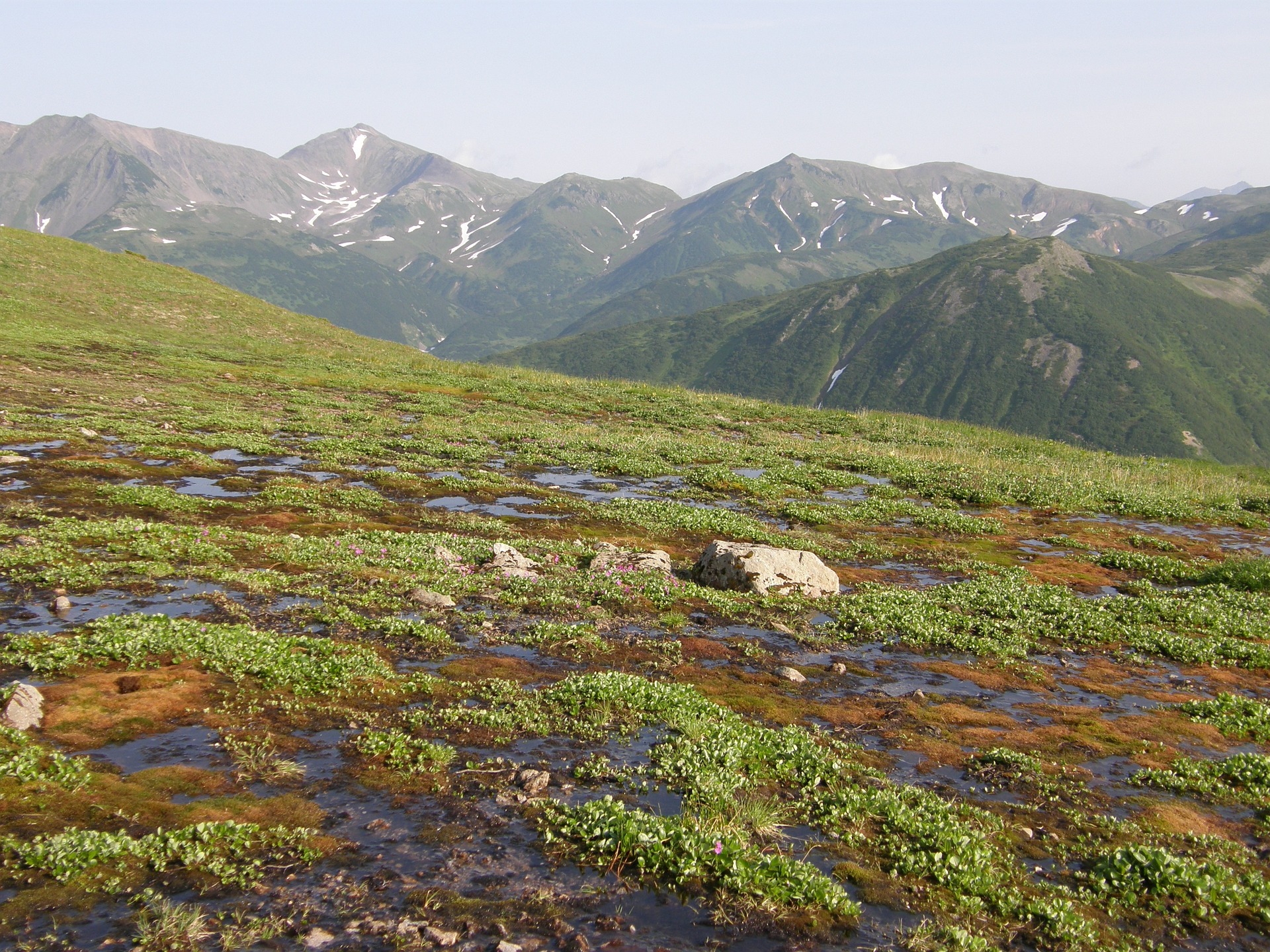
Tundra and Arctic Regions of the World
tundra and arctic regions of the world climate geography wildlife indigenous peoples
Table of Contents
1. Introduction: Defining the Tundra Biome 2. Arctic Tundra Geography: Distribution Across the Northern World 3. The Arctic Ocean and North Pole 4. Permafrost: The Frozen Foundation Beneath the Tundra 5. Arctic Flora: Plants of the Treeless Plains 6. Arctic Fauna: Land and Tundra Mammals 7. Marine Mammals of the Arctic 8. Migratory Birds of the Arctic Tundra 9. Alpine Tundra: High-Altitude Deserts of the World 10. Antarctic and Sub-Antarctic Tundra 11. Indigenous Peoples of the Arctic 12. Arctic Exploration History 13. Natural Resources of the Arctic 14. Climate Change and the Arctic Crisis 15. Arctic Governance and Territorial Claims 16. Accuracy Audit 17. Sources
Introduction: Defining the Tundra Biome
The tundra is among the most elemental of the Earth's great biomes — a landscape stripped to essentials, where cold governs all, where the soil itself is locked in perpetual frost, and where life clings to existence with extraordinary tenacity. It is a place of extremes: extreme cold, extreme seasonal light, extreme brevity of the growing season, and extreme vulnerability to the shifts that are now reshaping the planet's climate system. To understand the tundra is to understand one of the most critical and least-appreciated regulatory systems on Earth, a biome that stores more carbon than the world's forests and whose fate will shape global temperatures for centuries to come.
The word "tundra" derives from the Finnish word "tunturi," meaning a treeless plain or barren hill. The term entered scientific usage through Russian explorers and naturalists who encountered the vast, open plains stretching across northern Siberia, where no trees grew and the land lay open to sky and wind in a way that seemed both desolate and profoundly alive. In scientific classification, the tundra is defined primarily by its climate: it is too cold and dry for trees to grow, it is underlain by permafrost — permanently frozen ground — and it experiences a growing season of fewer than sixty days per year. These conditions produce a characteristic landscape of low-growing shrubs, sedges, mosses, lichens, and flowering plants adapted to survive under some of the most demanding conditions on Earth.
Ecologists recognize three distinct types of tundra, each shaped by different geographic and climatic factors. Arctic tundra is the most extensive, encircling the North Pole in a broad band across the northernmost reaches of North America, Europe, and Asia. It is bounded on its northern edge by the Arctic Ocean and polar ice and on its southern edge by the boreal forest, or taiga — the transition zone where the last, struggling trees give way to open, treeless ground. This transitional zone is called the treeline, and it has served as one of the most reliable indicators of climate change: in many parts of the world, the treeline is creeping northward and upward in elevation as temperatures warm, an unmistakable sign that the boundaries of the tundra are shifting in response to human-caused global warming.
Alpine tundra is found not at high latitudes but at high altitudes, on mountain peaks and plateaus above the treeline throughout the world. Alpine tundra exists in the Tibetan Plateau, the Rocky Mountains, the Andes, the Alps, the Pyrenees, the Ethiopian Highlands, and the mountains of Central Asia. It shares many characteristics with Arctic tundra — low temperatures, thin soils, short growing seasons, and dwarf vegetation — but differs in that it is generally better drained, experiences greater solar radiation at altitude, and is not underlain by continuous permafrost in the way that Arctic tundra is. Alpine tundra also has no polar night; it experiences normal day-night cycles even in the coldest months.
Antarctic tundra represents the third category. It is found not on the Antarctic continent itself — which is almost entirely covered by the massive Antarctic ice sheet and has virtually no soil or vegetation — but on the sub-Antarctic islands that lie at the margins of the Southern Ocean. Islands such as South Georgia, the Kerguelen Islands, the Falkland Islands, and Macquarie Island support limited tundra-like vegetation, including mosses, lichens, grasses, and a few flowering plants. These islands experience harsh maritime climates, buffeted by the relentless westerly winds of the Southern Ocean, and they sustain remarkable concentrations of wildlife, especially seabirds and marine mammals.
The tundra biome plays a role in the global carbon cycle that is utterly disproportionate to its apparent barrenness. Because decomposition of organic matter is extremely slow in frozen, waterlogged soils, the tundra has accumulated enormous stores of carbon over thousands of years. The northern permafrost zone — which largely corresponds to the Arctic tundra — is estimated to contain between 1,460 and 1,600 petagrams of organic carbon, roughly twice the amount currently present in the atmosphere as carbon dioxide. This makes the permafrost the largest terrestrial carbon reservoir on the planet. As global temperatures rise and permafrost thaws, this carbon is released as carbon dioxide and methane, powerful greenhouse gases that further accelerate warming in a self-reinforcing feedback loop that scientists consider one of the most dangerous tipping points in the Earth's climate system. Understanding the tundra, then, is not merely an exercise in geographic curiosity; it is essential to understanding the future of the planet's climate.
Arctic Tundra Geography: Distribution Across the Northern World
The Arctic tundra covers approximately 5.5 million square kilometers of the Earth's land surface, forming a circumpolar band that arcs around the entire top of the world. It is a landscape defined by its horizontality — vast, open, and exposed — and by the extraordinary variety of habitats it contains, from the wet coastal plains of Alaska to the dry, wind-scoured plateaus of the Canadian Arctic Archipelago, from the boggy lowlands of western Siberia to the rocky, lichen-carpeted uplands of Greenland's ice-free margins. No two stretches of tundra are alike, and the differences between them reflect variations in longitude, oceanographic influence, elevation, and local geography. Yet all share the fundamental characteristics of the biome: permafrost below, cold above, and a brief, explosively productive summer that concentrates the entire biological drama of a year into a handful of weeks.
Russia contains the largest share of Arctic tundra on the planet. The Russian tundra stretches in an almost unbroken band from the Kola Peninsula in the northwest — the finger of land that juts into the Barents Sea between Norway and the White Sea — all the way across Siberia to the Chukotka Peninsula in the far northeast, where Russia comes within sixty miles of Alaska across the Bering Strait. This is a horizontal distance of roughly 6,000 kilometers, through some of the most remote and least-populated country on Earth. The Yamal Peninsula in northwestern Siberia is one of the world's most significant stretches of tundra, a low-lying region of peat bogs, river deltas, and frozen ground that is home to the Nenets reindeer herders and also to some of the world's largest natural gas deposits. The Lena River delta, one of the largest in the world, empties into the Laptev Sea through a labyrinth of channels, wetlands, and islands that serves as critical breeding habitat for millions of migratory birds each summer. The Taymyr Peninsula extends northward into the Arctic Ocean like a blunt thumb, its interior uplands rising to the Byrranga Mountains — among the northernmost mountain ranges in the world. Eastern Siberia's tundra, encompassed in the regions of Yakutia and Chukotka, is among the coldest on Earth, with winter temperatures routinely falling below minus fifty degrees Celsius in inland areas, creating some of the most extreme continental climates found anywhere in the northern hemisphere.
Canada's Arctic tundra is vast and extraordinarily varied. The territory of Nunavut, which was created in 1999 as a homeland for the Inuit people, covers roughly two million square kilometers, making it Canada's largest and newest territory and one of the world's largest political units. Most of Nunavut lies north of the treeline and is classic Arctic tundra, from the shores of Hudson Bay in the southeast to Ellesmere Island in the far north — within about eight hundred kilometers of the North Pole. The Canadian Arctic Archipelago, the vast collection of islands north of the mainland, includes some of the world's largest islands, among them Baffin Island, Ellesmere Island, Victoria Island, Banks Island, and Devon Island, the latter being one of the largest uninhabited islands on Earth. The Yukon's northern slope, the area north of the Brooks Range that drains into the Beaufort Sea, is dominated by tundra, wetlands, and river systems of great ecological richness. The Northwest Territories contain both tundra and transitional boreal zones, with the Mackenzie River delta — a vast, watery maze of channels and ponds — serving as one of the most important waterfowl breeding areas in the Western Hemisphere. Across the whole of the Canadian Arctic, the landscape is shaped by the legacy of glaciation: the ice sheets of the last ice age scoured the bedrock clean, leaving behind a landscape of polished rock, kettle ponds, moraines, and sorted stone patterns on the ground surface that are among the tundra's most distinctive features.
Alaska's tundra is divided by ecologists into two main zones. The North Slope — the coastal plain stretching from the Brooks Range to the Beaufort Sea — is flat, wet, and underlain by some of the deepest permafrost in North America. It is home to the Prudhoe Bay oil fields and the proposed oil drilling area of the Arctic National Wildlife Refuge (ANWR), as well as to the 190,000-strong Porcupine Caribou Herd, one of the most iconic migratory wildlife spectacles in the world. To the south, the Alaska Range and Chugach Mountains create alpine tundra habitats, while the Seward Peninsula and the region around Nome on the western Bering Sea coast support coastal and shrub tundra habitats. The Yukon-Kuskokwim Delta, one of the largest river deltas in the United States, is a low-lying wetland that floods each spring when the rivers break up and serves as critical nesting habitat for shorebirds and waterfowl from across the hemisphere.
Greenland, the world's largest island, is approximately 80 percent covered by the Greenland Ice Sheet, the largest body of ice in the Northern Hemisphere after Antarctica. But around the ice sheet's margins, particularly along the western and southern coasts, significant areas of ice-free land support tundra vegetation. The fjords of western Greenland, especially around the town of Nuuk — the world's northernmost capital city — are lined with tundra slopes where Arctic wildflowers bloom in summer and musk oxen graze on the sparse vegetation. The Scoresby Sound region on the east coast includes some of the most dramatic Arctic fjord scenery on Earth, with tundra vegetation on the fjord walls above the waterline. Greenland's tundra represents a critical habitat for a small but distinctive assemblage of Arctic species, and the island's indigenous Inuit population, the Kalaallit, has maintained a culture intimately shaped by these landscapes for more than four thousand years.
Scandinavia's tundra is found primarily in the high fell regions of northern Norway, Sweden, and Finland, as well as along the Arctic Ocean coast. Norway's Finnmark Plateau, the largest plateau in northern Europe, is a vast, wind-swept expanse of low vegetation that transitions northward to the treeless Arctic coast. Svalbard, the Norwegian archipelago that lies roughly equidistant between the North Pole and the Norwegian mainland, is one of the most northerly places on Earth with a permanent human population and supports a distinctive High Arctic tundra environment, including populations of Svalbard reindeer, Arctic foxes, and polar bears. In northern Sweden, the Scandinavian mountains — the Kölen range that forms the border with Norway — rise above the treeline to support extensive alpine and Arctic tundra habitats that have been home to the Sami people and their reindeer herds for millennia. Finnish Lapland, in the far north of Finland, includes both mountain and lowland tundra environments and is renowned for its spectacular autumn colors, when the dwarf birch and other low-growing vegetation turns brilliant shades of gold and red, a phenomenon the Sami call "ruska."
Iceland occupies a unique position in the geography of the tundra world. Although it lies fully south of the Arctic Circle at its closest point, Iceland's climate is strongly influenced by the cold East Greenland Current and by its high elevation, and large portions of its interior are barren, tundra-like landscapes of volcanic rock, lava fields, and glacially scoured uplands. The highland interior of Iceland, known as the "highlands" or "miðhálendi," is one of the largest uninhabited areas in Europe, a stark terrain of snow-fed rivers, glacial outwash plains, geothermal features, and sparse vegetation that closely resembles true Arctic tundra in its ecology and in its challenges for survival. Iceland's tundra-adjacent landscapes support distinctive communities of nesting birds, including the world's largest populations of red-necked phalaropes and the great skua, and the island's volcanic geology adds an additional layer of complexity to its ecology that has no exact parallel elsewhere in the Arctic world.
The Arctic Ocean and North Pole
The Arctic Ocean is the smallest and shallowest of the world's five oceans, covering approximately 14.06 million square kilometers — about one and a half times the size of the contiguous United States. It is surrounded on almost all sides by land: the northern coasts of North America, Europe, and Asia embrace it like a bowl, and it connects to the Pacific Ocean only through the narrow Bering Strait and to the Atlantic through the broader passages between Greenland, Iceland, and Norway. This geographic configuration gives the Arctic Ocean a character unlike any other ocean: it is semi-enclosed, relatively quiet compared to the storm-swept Southern Ocean, and profoundly influenced by the freshwater input from some of the world's greatest rivers — the Ob, the Yenisei, the Lena, the Mackenzie — which dilute its surface waters and affect its circulation patterns and freezing behavior.
For most of recorded human history, the Arctic Ocean was covered by a permanent cap of sea ice — not a solid, continuous sheet, but a dynamic, shifting mosaic of ice floes, pressure ridges, and open-water leads that thickened and contracted with the seasons. At its maximum winter extent, the Arctic sea ice covers approximately 15 million square kilometers, but by late summer it retreats to a minimum that has historically been around 6 to 7 million square kilometers. The ice itself ranges from thin, newly formed seasonal ice a few centimeters thick to massive multiyear ice that has survived several melt seasons and can be several meters thick. Beneath the ice, the Arctic Ocean is not lifeless; it supports a complex food web based on ice algae and phytoplankton, which feed zooplankton, which in turn feed Arctic cod, which feed seals, which feed polar bears and orcas and humans. The ice is, in other words, not merely frozen water; it is a habitat, a hunting ground, a highway, a nursery, and a foundation of Arctic ecosystems.
The geographic North Pole sits at the center of the Arctic Ocean, in water approximately 4,261 meters deep, making it not a point of land but a point in the deep ocean. Unlike the South Pole, which is located on the Antarctic continent and marked by a scientific research station, the North Pole has no permanent surface feature; the ice that covers it shifts and drifts with currents and winds, and the exact point of ninety degrees north latitude moves across the ocean's surface from one year to the next. The North Pole experiences the most extreme seasonality of any place on Earth in terms of sunlight. At the pole, the sun rises once a year — at the spring equinox in late March — and sets once a year — at the autumn equinox in late September — meaning that the pole experiences approximately six months of continuous daylight followed by approximately six months of continuous darkness. During the polar summer, the sun circles the horizon continuously, never setting and never rising very high, bathing the landscape in a soft, golden light that photographers call the "midnight sun." During the polar winter, the sun remains below the horizon, and the land lies in a darkness broken only by starlight, moonlight, and the spectacular display of the aurora borealis — the northern lights — caused by charged particles from the sun interacting with the Earth's magnetic field.
The polar vortex is a large area of low pressure and cold air surrounding the Earth's poles. The Arctic polar vortex is a persistent mass of frigid air that circulates counterclockwise high in the atmosphere above the polar region. In winter, when the polar vortex is strong and stable, it contains the coldest Arctic air within the high latitudes. When the vortex weakens or becomes disrupted — a phenomenon that has become more frequent in recent decades as Arctic temperatures have risen — it allows tongues of bitterly cold polar air to spill southward into the mid-latitudes, causing the severe winter cold snaps that bring polar temperatures to places like Texas, the Midwest of the United States, and central Europe. The connection between Arctic warming and polar vortex disruption is an active area of scientific research, with significant implications for understanding how changes in the Arctic affect weather patterns far to the south.
Permafrost: the Frozen Foundation Beneath the Tundra
Permafrost — ground that remains frozen at or below zero degrees Celsius for two or more consecutive years — underlies approximately twenty-five percent of the Northern Hemisphere's land surface, an area of about twenty-three million square kilometers that extends across Siberia, northern Canada, Alaska, and large portions of the Tibetan Plateau. It is one of the planet's most significant, and least visible, environmental features: a vast, frozen layer beneath the active soil surface that shapes the land above it in profound ways and stores within its icy matrix a carbon reservoir of staggering magnitude.
Scientists distinguish between two main types of permafrost based on their spatial extent. Continuous permafrost is found in the coldest, highest-latitude regions, where the ground remains frozen year-round everywhere in the landscape, from hilltops to valley bottoms, beneath rivers and lakes, and extending from the surface downward to depths of sometimes several hundred meters. In parts of northeastern Siberia, permafrost has been measured to depths exceeding one thousand meters — a legacy of the intense cold that prevailed during the last ice age and that accumulated over tens of thousands of years. In these regions of continuous permafrost, the only ground that thaws each summer is the thin "active layer" at the surface — typically thirty to ninety centimeters deep — which supports the growth of vegetation and the activities of soil organisms during the brief warm season.
Discontinuous permafrost is found at lower latitudes and lower elevations within the permafrost zone, where the ground freezes in some places but not others, depending on local factors such as vegetation cover, slope aspect, snow depth, and soil type. In discontinuous permafrost zones, warm south-facing slopes may be free of permafrost while north-facing slopes and low-lying depressions remain frozen year-round. This creates a mosaic of frozen and unfrozen ground that produces distinctive landscape features and generates complex patterns of drainage, vegetation, and soil structure. The transition between continuous and discontinuous permafrost is gradual and diffuse rather than sharply defined, and it shifts as temperatures change.
What permafrost contains is as remarkable as the permafrost itself. Because biological decomposition is effectively halted or dramatically slowed by freezing temperatures, the frozen ground has preserved organic material accumulated over thousands of years in a state of extraordinary completeness. In the permafrost of Siberia, researchers have recovered the remains of woolly mammoths, woolly rhinoceroses, cave lions, and other Pleistocene megafauna in states of preservation so complete that muscle tissue, stomach contents, and even DNA can still be analyzed. Baby mammoths have been recovered with their skin, hair, and internal organs intact, effectively frozen in time for tens of thousands of years. Ancient viruses have been revived from Siberian permafrost and found to be still viable after forty-eight thousand years of freezing — a finding that has raised serious scientific questions about the potential risks of permafrost thaw for public health, though the viruses that have been revived so far infect only amoebae rather than humans.
The carbon stores within permafrost are the feature of greatest global significance. Over thousands of years, the tundra and boreal zone accumulated vast quantities of plant material in waterlogged, cold soils where decomposition was too slow to keep pace with accumulation. This organic material — partially decomposed roots, leaves, mosses, and other plant matter — became incorporated into the growing permafrost layer as temperatures declined, and it has been accumulating there ever since. Current scientific estimates place the total carbon stored in the northern permafrost zone at between 1,460 and 1,600 petagrams of organic carbon — a petagram being one billion metric tons. To put this in perspective, the entire atmosphere currently contains approximately 860 petagrams of carbon as carbon dioxide. The permafrost, in other words, stores almost twice as much carbon as is currently in the atmosphere, and it does so in frozen soils that are beginning to thaw as global temperatures rise.
When permafrost thaws, the organic carbon it contains becomes accessible to microbial decomposition. In aerobic conditions — where oxygen is present — decomposition produces carbon dioxide. In anaerobic conditions — where oxygen is absent, as in the waterlogged soils of tundra lakes and wetlands — decomposition produces methane, a greenhouse gas that is approximately thirty times more potent than carbon dioxide over a century-long timescale. The release of carbon from thawing permafrost creates a self-reinforcing feedback loop: warming causes thaw, thaw releases greenhouse gases, greenhouse gases cause further warming, which causes more thaw. Scientists estimate that five to fifteen percent of the permafrost carbon pool could be emitted as greenhouse gases by 2100 under current warming trajectories, representing an additional source of climate forcing that is not fully incorporated into the climate projections produced by most current models.
The physical consequences of permafrost thaw are already dramatically visible across the Arctic. Thermokarst — the irregular, hummocky terrain produced when ground ice melts and the surface collapses — is spreading rapidly across the tundra, creating new lakes, draining old ones, and destabilizing slopes and infrastructure. The phenomenon of "drunken forests" — trees in the boreal zone adjacent to the tundra that lean at bizarre angles as the permafrost beneath them thaws and the ground shifts — has become increasingly common and is a striking visual indicator of the changes underway. Coastal erosion is accelerating dramatically as permafrost that once held coastal bluffs together thaws and the bluffs collapse into the sea, with some coastlines in Alaska and Siberia losing several meters of land per year. Methane seeps — places where bubbles of methane released from thawing permafrost rise through lakes and wetlands — have been mapped and measured with growing urgency, and the gas emissions from some areas have been found to be far higher than models had predicted.
Arctic Flora: Plants of the Treeless Plains
The seemingly stark landscape of the Arctic tundra is, to the trained eye, a world of surprising botanical richness. More than 1,700 species of vascular plants have been identified across the Arctic, along with thousands of species of mosses, lichens, algae, and fungi. They are small plants — the tundra is not a landscape of height or volume — but their adaptations to the conditions they face are among the most sophisticated in the plant kingdom, and their ecological roles are critical to the functioning of the entire biome.
The most fundamental challenge facing Arctic plants is cold, but cold is not the only challenge. The growing season in the Arctic tundra is brutally short — as few as fifty to sixty days in most locations, and sometimes fewer. During those brief weeks of summer, the sun shines almost continuously, providing a remarkable abundance of light energy, but temperatures may barely exceed ten degrees Celsius even in the warmest days. Plants that have evolved in the Arctic have developed a range of strategies for surviving these conditions. Many are perennials that keep living tissues in a dormant state through the long winter and spring back to life as soon as temperatures permit, rather than expending the energy to grow from seed each year as many annual plants must do. Many have dark-pigmented leaves or stems that absorb more solar radiation and maintain temperatures above ambient in the microclimate immediately around the plant. Many grow in dense cushion or mat forms that trap heat, reduce wind exposure, and create a warm, sheltered microenvironment inside the cushion where temperatures can be significantly higher than in the surrounding air.
Arctic cotton grass — actually a sedge of the genus Eriophorum rather than a true grass — is perhaps the most iconic plant of the wet Arctic tundra. Its fluffy white seed heads, which appear in mid-summer and wave in the Arctic wind like tiny tufts of cotton, are one of the most characteristic sights of the tundra landscape. Cotton grass grows in dense stands in wet, poorly drained areas of the tundra, particularly on the slopes of peat bogs and around the margins of tundra ponds and lakes. It is a critical component of the tundra ecosystem: its dense root systems help build peat, its leaves provide food for grazing animals including caribou, geese, and lemmings, and its abundant seed heads provide nesting material for shorebirds.
Dwarf birch (Betula nana) is one of the most common and widespread shrubs of the tundra. Unlike the tall, forest birches of the temperate zone, dwarf birch rarely grows more than a meter in height, and in exposed, wind-blasted sites it may be prostrate, growing flat along the ground to avoid the worst of the wind chill above the surface. In sheltered valleys and south-facing slopes where snow accumulates and provides insulation from winter cold, dwarf birch can form dense thickets, and in recent decades these thickets have been expanding northward and upward in elevation across much of the Arctic — a process ecologists call "shrubification" that is one of the most clearly measurable biological responses to Arctic warming. As shrubs expand, they change the albedo of the tundra surface — replacing highly reflective white snow and lichen with darker, less reflective plant material — further accelerating warming in a feedback that, while smaller than the permafrost carbon feedback, is nonetheless significant.
Lichens dominate large portions of the drier, better-drained tundra and are among the most remarkable organisms in the Arctic ecosystem. A lichen is not a single organism but a composite being — a symbiotic partnership between a fungus and a photosynthetic partner, either an alga or a cyanobacterium — that represents an evolutionary solution to survival in environments where neither partner could survive alone. In the Arctic, reindeer lichens of the genus Cladonia are the most ecologically important, forming extensive carpets of grayish-white growth that cover vast areas of the drier tundra and provide the primary winter food source for caribou and reindeer. Lichens grow extraordinarily slowly — as little as a few millimeters per year — and a mature lichen mat may represent centuries of uninterrupted growth. They are among the few organisms capable of photosynthesizing at temperatures close to zero degrees Celsius, allowing them to take advantage of sunny days even in early spring when the rest of the tundra is still dormant.
Mosses, similarly, are foundational organisms in the tundra ecosystem. The Sphagnum, or peat mosses, are particularly important: they are unique among plants in their ability to create and acidify their own habitat, producing a waterlogged, nutrient-poor environment in which they outcompete other plants and in which decomposition is greatly slowed. It is the accumulation of Sphagnum over millennia that has built the deep peat deposits that underlie much of the Arctic tundra and that represent one of the primary reservoirs of the biome's enormous carbon stores.
The Arctic poppy (Papaver radicatum) is among the most charming of the tundra's flowering plants, its bright yellow or white flowers rising on slender stems above the low vegetation to catch the sunlight. The Arctic poppy has a remarkable adaptation: its flowers act as parabolic solar collectors, with the petals arranged in a shallow bowl shape and tracking the sun's position across the sky throughout the Arctic day. This solar tracking behavior, called heliotropism, concentrates warmth in the center of the flower, raising its temperature by as much as ten degrees above the ambient air temperature, which accelerates seed maturation and attracts insects seeking warmth. The center of an Arctic poppy flower is, on a sunny day, a genuinely warm microenvironment in an otherwise cold landscape.
Berry-producing plants are both ecologically important and culturally significant in the Arctic. Cloudberry (Rubus chamaemorus), known in Scandinavia as "the gold of the Arctic," produces amber-colored berries that are exceptionally rich in vitamin C and have been a critical dietary supplement for Arctic peoples throughout history. Crowberry (Empetrum nigrum), lingonberry (Vaccinium vitis-idaea), bilberry (Vaccinium myrtillus), and bog bilberry (Vaccinium uliginosum) are other important berry-producing species of the tundra that provide food for birds, mammals, and humans alike. The berries ripen in late summer and fall and are consumed in enormous quantities by birds preparing for migration, by bears building up fat reserves, and by Arctic foxes and other opportunistic omnivores.
Arctic Fauna: Land and Tundra Mammals
The polar bear (Ursus maritimus) is the undisputed icon of the Arctic, a creature so perfectly adapted to its frozen environment that it can survive in conditions that would rapidly kill any other large land carnivore. Polar bears are the world's largest terrestrial carnivore; adult males typically weigh between 400 and 600 kilograms, though exceptionally large individuals have been recorded weighing over 800 kilograms. They are classified as marine mammals by some authorities because they spend much of their lives on the sea ice and in the ocean, and their scientific name means "sea bear." Their adaptations to Arctic life are extraordinary: their fur is actually transparent and hollow, allowing it to absorb solar radiation efficiently while providing exceptional insulation; their black skin beneath the fur absorbs additional heat; their large, partially webbed paws make them powerful swimmers capable of covering dozens of kilometers in open water; and a thick layer of fat beneath the skin provides both insulation and an energy reserve during the months when food is scarce.
Polar bears depend almost entirely on ringed seals and bearded seals as their primary prey, and they hunt these seals almost exclusively from the sea ice surface, using a technique of patient waiting at breathing holes or stalking resting seals. Their dependence on sea ice makes them extraordinarily vulnerable to Arctic warming: as the sea ice retreats earlier in spring and forms later in autumn, polar bears spend an increasingly long time on land during summer and early autumn, unable to hunt their primary prey and forced to subsist on fat reserves accumulated during winter and early spring. There are currently an estimated 20,000 to 31,000 polar bears distributed across twenty recognized subpopulations throughout the Arctic, and their populations are projected to decline significantly as sea ice continues to shrink over the coming decades. The Western Hudson Bay population, one of the best-studied, has declined by approximately fifty percent over the past four decades, largely as a consequence of climate-driven sea ice loss.
The Arctic fox (Vulpes lagopus) is one of the tundra's most adaptable and versatile predators. It is the only land mammal native to Iceland and is found throughout the Arctic tundra of North America, Europe, Russia, and on numerous Arctic islands. The Arctic fox has the warmest fur of any mammal relative to body size, allowing it to maintain normal body temperature at ambient temperatures as low as minus seventy degrees Celsius without increasing its metabolic rate. It has small, rounded ears that minimize heat loss, heavily furred paws that serve as snowshoes on soft snow, and a long, bushy tail that it wraps around itself for warmth when sleeping. Arctic foxes exist in two color morphs: the more common white morph, which is pure white in winter and brown in summer, providing camouflage in both snow-covered and snow-free environments; and the rarer blue morph, which is bluish-gray in winter and dark grayish-brown in summer, more common in coastal areas and on islands. Arctic foxes are opportunistic omnivores: in summer, they eat lemmings, voles, birds' eggs and chicks, berries, and carrion; in winter, when food is scarce, they often follow polar bears to scavenge the remains of seal kills.
The relationship between Arctic foxes and lemmings is one of the most celebrated examples of predator-prey dynamics in ecology. Lemmings — small rodents of the subfamily Arvicolinae, including the collared lemming (Dicrostonyx torquatus) and the Norway lemming (Lemmus lemmus) — cycle through dramatic population fluctuations, increasing to extraordinary densities over three to five years and then crashing precipitously. These population cycles have profound effects on the entire Arctic food web: in years of high lemming density, Arctic fox populations boom, nesting success of snowy owls soars, and predators of all kinds fare well; in crash years, foxes and owls are forced to migrate southward in search of food, and the crash ripples through the food web. The causes of lemming cycles are still debated among ecologists, but the dynamics are one of the Arctic's most fascinating ecological phenomena.
Caribou and reindeer (Rangifer tarandus) are, in terms of ecological impact and cultural significance, the most important large mammals of the Arctic tundra. They are, in fact, the same species — "caribou" is the name used in North America, while "reindeer" is used in Eurasia, and the distinction between truly wild animals and semi-domesticated herds used by indigenous peoples is somewhat blurred in regions such as Scandinavia and Russia where reindeer herding has been practiced for centuries. Caribou and reindeer are remarkable animals in many respects. Their hooves change seasonally: wide and concave in summer to support the animal on soft, muddy tundra ground and to aid in pawing through snow to reach forage in winter. Their noses are lined with a complex network of blood vessels that warm cold air before it reaches the lungs and recover heat from exhaled breath — a counter-current heat exchange system that makes breathing in Arctic conditions far more efficient than it would otherwise be. Both males and females grow antlers — unique among deer, where antler growth in females is otherwise absent — though female antlers are smaller than males and are retained through winter, possibly to help females compete for food beneath the snow.
The annual migrations of caribou are among the most spectacular wildlife events on Earth. The Porcupine Caribou Herd, which migrates annually between its summer calving grounds on the coastal plain of northeastern Alaska and northwestern Canada and its winter range in the boreal forests of Yukon and Northwest Territories, numbers approximately 197,000 animals. This herd undertakes one of the longest and most challenging terrestrial migrations in the world, covering distances of up to 4,800 kilometers per year along routes that cross mountain ranges, major rivers, and areas of rolling tundra. The George River Herd in northern Quebec and Labrador was once the largest caribou herd in the world, with numbers exceeding 700,000 in the 1990s, though it has since declined dramatically, likely due to a combination of climate change impacts, predation, hunting pressure, and habitat disturbance.
Musk oxen (Ovibos moschatus) are among the most remarkable survivors from the Pleistocene epoch, ancient animals that shared the mammoth steppe with woolly mammoths and saber-toothed cats and that outlasted those extinctions to persist to the present day. They are massive, shaggy animals — adults weigh between 180 and 400 kilograms — with a double coat of fur that consists of a coarse outer layer of guard hairs and a dense, woolly underfleece called qiviut that is, by weight, warmer than sheep's wool. Musk oxen are found today in the Arctic regions of Canada, Greenland, Alaska (where they were reintroduced after being hunted to extinction in the late nineteenth century), and Norway (where they were also reintroduced). They have been absent from Siberia since prehistoric times but have been reintroduced experimentally into parts of Russia. When threatened by predators — primarily Arctic wolves and, historically, humans — musk oxen form a defensive circle with the adults facing outward and the calves protected in the center, a strategy that was highly effective against wolves but proved disastrously ineffective against hunters armed with rifles.
The snowy owl (Bubo scandiacus) is the largest owl in North America by weight and one of the most recognizable birds of the Arctic. Adult males are almost entirely white, providing camouflage against the snow-covered tundra; females and juveniles have varying amounts of dark barring on their plumage. Snowy owls breed on the open tundra, nesting directly on the ground — often on slightly elevated knolls or ridges that provide a view of the surrounding landscape — and they depend heavily on lemmings as their primary prey during the breeding season. In years of high lemming abundance, a female snowy owl may lay as many as eleven eggs and raise most of the clutch to fledging; in crash years, she may not breed at all. During winter, snowy owls undertake irruptive migrations southward in years when prey populations are low in the north, occasionally appearing in parts of the United States far south of their normal range, to the delight of birdwatchers.
The Arctic wolf (Canis lupus arctos) is a subspecies of gray wolf found in the Arctic and subarctic regions of North America, primarily in the Canadian Arctic Archipelago and the northern part of Greenland. Arctic wolves are among the few large carnivores that are not endangered, largely because they live in areas so remote that they have little contact with humans. They are slightly smaller than timber wolves and have white or pale gray coats that provide camouflage in their snowy environment. Arctic wolves prey primarily on musk oxen, caribou, and Arctic hares, and they are capable of fasting for extended periods and of ranging enormous distances in search of prey in their harsh, prey-sparse environment.
Marine Mammals of the Arctic
The walrus (Odobenus rosmarus) is one of the most distinctive and unmistakable animals in the Arctic, instantly recognizable by its massive tusks — which are present in both males and females and can grow to nearly a meter in length — its bristly mustache, its enormous bulk (adults can weigh over 1,500 kilograms), and its social, raucous behavior. Walruses are found in both the Pacific and Atlantic Arctic, and they haul out in enormous aggregations on beaches and ice floes to rest, socialize, and nurse their young. They feed primarily on bottom-dwelling invertebrates — clams, mussels, snails, worms, and sea cucumbers — which they locate using their sensitive whiskers and excavate from the seafloor using jets of water from their mouths. The Pacific walrus population, which ranges across the Bering and Chukchi Seas between Alaska and Russia, has been significantly stressed in recent decades by the loss of sea ice, which the animals traditionally used as resting platforms. Without ice, walruses are forced to haul out on beaches in increasingly dense aggregations, where trampling deaths of calves during stampedes triggered by disturbances have become a significant additional source of mortality.
The beluga whale (Delphinapterus leucas) is perhaps the most perfectly adapted of all Arctic cetaceans to life in icy waters. Belugas are pure white as adults — their color earned them the nickname "canaries of the sea" from sailors who could hear their complex vocalizations — and this coloration provides camouflage against sea ice and snow. Unlike most other whales and dolphins, belugas have flexible necks and can turn their heads independently of their bodies, an adaptation that helps them navigate through ice-filled waters. They lack a dorsal fin — another adaptation to moving under ice — and instead have a dorsal ridge that they can use to break through thin ice to breathe. Belugas are highly social animals that travel in pods and communicate with an extraordinarily varied repertoire of clicks, whistles, and squeals. They are found in Arctic and sub-Arctic waters around the circumference of the polar region and undertake seasonal migrations between wintering areas in ice-covered deep water and summer estuaries and coastal areas where they give birth and molt.
The narwhal (Monodon monoceros) is one of the most extraordinary and mysterious animals on Earth. The adult male narwhal possesses a single, spiraling tusk — actually an enormously elongated tooth — that can grow to three meters in length and was, in medieval Europe, believed to be the horn of the legendary unicorn and sold for extraordinary prices as a supposed antidote to poison. The narwhal is one of the deepest-diving mammals in the world, capable of diving to depths exceeding 1,500 meters in search of Greenland halibut, Arctic cod, and squid. Narwhals spend their entire lives in the Arctic Ocean and adjacent seas, never migrating to lower latitudes as most other whale species do. They are concentrated in the waters of the Canadian Arctic Archipelago and around Greenland and are rarely seen far from pack ice. The function of the male's tusk has been debated for centuries; current research suggests it is primarily a sensory organ, capable of detecting changes in water temperature, salinity, and pressure, and that it also plays a role in male competition for mating opportunities.
The bowhead whale (Balaena mysticetus) is one of the most extraordinary long-lived animals in the world. Bowheads are large baleen whales — adults can reach eighteen meters in length and weigh over 100 tonnes — found only in the Arctic and sub-Arctic. They are uniquely adapted to life in Arctic waters, with the largest skull of any animal (used to break through sea ice up to fifty centimeters thick to breathe), exceptionally thick blubber for insulation, and an immune system that appears to be highly resistant to cancer. Biological studies of bowhead whales have yielded evidence that some individuals may live for more than two hundred years — potentially making them the longest-lived mammals on Earth. Inuit hunters have occasionally recovered old harpoon points from nineteenth-century whaling ships embedded in the flesh of freshly caught bowheads, confirming the extraordinary longevity of these animals. Bowhead whales were hunted to the edge of extinction during the commercial whaling era of the eighteenth and nineteenth centuries, with populations in some areas reduced to fewer than one hundred individuals; they have since recovered significantly, though they remain a protected species.
Migratory Birds of the Arctic Tundra
The Arctic tundra in summer is transformed by the arrival of millions of migratory birds from around the world. The brief explosion of productivity that occurs during the Arctic summer — when twenty-four-hour daylight drives intense photosynthesis, insect emergence, and plant growth — attracts birds that have wintered as far away as Antarctica, the tip of South America, southern Africa, and New Zealand. For these long-distance migrants, the Arctic offers nesting opportunities in a landscape with relatively few year-round predators — most predator populations have crashed during the dark, food-poor winter — and abundant food in the form of insects, fish, and plant material. The tundra's nesting season is a remarkable spectacle of compressed biological urgency, with birds arriving, establishing territories, laying eggs, raising chicks, and departing again, all within a window of approximately two months.
The Arctic tern (Sterna paradisaea) holds the extraordinary record of undertaking the longest migration of any animal species on Earth. Arctic terns breed in the Arctic and sub-Arctic during the northern summer, then travel to the Antarctic to spend the southern summer there, effectively chasing summer around the globe. The round-trip migration covers an astonishing distance of up to 96,000 kilometers (approximately 59,650 miles) per year. Because they experience two summers each year — the long Arctic summer and the Antarctic summer — Arctic terns are exposed to more hours of daylight over the course of a year than any other creature on Earth. Tracking studies using miniature geolocators attached to the birds have revealed that the migration routes are not simple straight lines but complex paths that take advantage of favorable wind systems — particularly the prevailing westerlies in the mid-latitudes — to reduce the energetic cost of the journey. An Arctic tern that lives to its maximum recorded age of more than thirty years will have traveled a cumulative distance equivalent to roughly three trips to the moon and back. Arctic terns nest in loose colonies on gravel beaches and tundra close to the coast, where they vigorously defend their nests against all intruders, including humans, with diving attacks that have earned them a reputation among tundra wildlife as punishingly aggressive defenders.
Snow geese (Anser caerulescens) are among the most abundant waterfowl in North America, and they breed in enormous colonies on the Arctic coastal tundra of Canada and Alaska. The Lesser Snow Goose has undergone a remarkable and ecologically problematic population explosion over the past several decades, with populations increasing from approximately 1 million birds in the 1970s to an estimated 15 million or more today. This growth has been driven by the expansion of agricultural land in the wintering range, which provides an abundance of spilled grain, and by restrictions on hunting that allowed populations to grow unchecked. The sheer abundance of snow geese in their Arctic breeding grounds has become an ecological problem: the birds graze so intensively on Arctic vegetation that they have transformed large areas of coastal salt marsh and tundra into barren mudflats, a phenomenon called "eat-outs" that has been documented across Hudson Bay and other Arctic breeding areas.
Shorebirds — sandpipers, plovers, turnstones, phalaropes, and their relatives — represent perhaps the greatest diversity of migratory birds in the Arctic. More than fifty species of shorebirds breed on the Arctic tundra, and many undertake extraordinary migrations to wintering grounds in South America, southern Africa, Australasia, and the shores of the Indian Ocean. The Red Knot (Calidris canutus) is a medium-sized sandpiper that undertakes one of the most remarkable migrations in the bird world, breeding in the high Arctic and wintering on the shores of Tierra del Fuego at the southern tip of South America — a round-trip distance of approximately 30,000 kilometers. Red Knots have become one of the most closely studied examples of the vulnerability of long-distance migrants to disruptions at key stopover points, particularly the horseshoe crab spawning beaches of Delaware Bay, where the birds fuel up on protein-rich crab eggs for the northward leg of their migration. Declines in horseshoe crab populations have contributed to steep declines in Red Knot numbers, demonstrating how the fate of Arctic-breeding birds can be determined by events thousands of kilometers from their nesting grounds.
Alpine Tundra: High-Altitude Deserts of the World
Alpine tundra is found on mountains throughout the world wherever elevation drives temperatures low enough to prevent tree growth. Although it shares many ecological characteristics with Arctic tundra — low temperatures, short growing seasons, high winds, thin soils, and dwarf vegetation — alpine tundra differs in important ways that have shaped its distinctive flora and fauna. Alpine tundra typically receives more solar radiation than Arctic tundra at equivalent latitudes due to the thinner atmosphere at altitude, and it is generally better drained, experiencing freeze-thaw cycles daily during transitional seasons rather than the prolonged winter freezing and summer thaw of the polar regions. Alpine tundra also tends to be fragmented and patchy, occurring as isolated islands of habitat separated by lower-elevation forest and grassland, which has profound consequences for the genetic connectivity and evolutionary trajectories of the plants and animals that inhabit it.
The Tibetan Plateau is the most extensive high-altitude tundra environment in the world and is sometimes called the "Third Pole" because of its enormous ice and permafrost reserves. The plateau covers approximately 2.5 million square kilometers at an average elevation of more than 4,500 meters above sea level — higher than any Alpine summit in the continental United States. The plateau's permafrost is the most extensive outside the polar regions, underlying approximately 40 percent of its surface, and it is the source of some of Asia's greatest rivers, including the Yangtze, Yellow, Mekong, Salween, and Brahmaputra, which together supply water to more than two billion people in Asia downstream. The Tibetan Plateau's alpine tundra supports a distinctive assemblage of wildlife, including the Tibetan antelope, or chiru, which undertakes a remarkable migration to its calving grounds that rivals the great migrations of the Arctic in its drama; the Tibetan gazelle; the wild yak; the snow leopard; Tibetan brown bears; Pallas's cats; and enormous flocks of bar-headed geese that undertake the world's highest-altitude migration, crossing directly over the Himalayas on their way between their Tibetan breeding grounds and their South Asian wintering areas. The plateau is home to the Tibetan and other peoples who have developed remarkable physiological adaptations — including a genetic variant that increases the efficiency of oxygen use in thin air — that allow them to live and thrive at altitudes that would debilitate lowland-adapted people.
The Rocky Mountain tundra of North America extends across the alpine zones of the Rocky Mountains from New Mexico to Alaska and the Yukon. In Colorado, Rocky Mountain National Park protects extensive areas of alpine tundra above 3,500 meters, where the plants are those of the alpine zone — including low-growing cinquefoils, sedges, and cushion plants — and where the wildlife includes yellow-bellied marmots, American pikas, white-tailed ptarmigan, and Clark's nutcrackers. The American pika (Ochotona princeps) is a small, guinea-pig-like mammal of the Rocky Mountain alpine zone that is considered an indicator species for climate change: pikas are highly sensitive to heat and cannot survive prolonged temperatures above about twenty-eight degrees Celsius, and they have been disappearing from the lower elevation margins of their range as temperatures warm, retreating upward to cooler, higher elevations. In the Cascades and other mountain ranges of the Pacific Northwest, the alpine tundra is characterized by extensive snowfields, rocky terrain, and the distinctive meadows of wildflowers that are among the most celebrated landscapes of the American West.
The Andes puna is a vast, high-altitude plateau and grassland ecosystem that extends through Peru, Bolivia, Chile, and Argentina at elevations generally above 3,500 meters. It is not Arctic in the sense of being close to the poles, but it shares many of the ecological characteristics of tundra: cold temperatures, intense solar radiation, thin air, harsh winds, and a short growing season. The puna vegetation is dominated by tufted grasses of the genus Festuca and Stipa, with cushion plants, small-flowered herbs, and scattered shrubs in sheltered areas. The puna is home to several species of vicunas and llamas, the Andean condor, several species of flamingos that breed in the high-altitude salt lakes, and a remarkable diversity of small rodents and their predators. The people of the Andean puna — including Quechua and Aymara communities — have developed agricultural systems adapted to high-altitude conditions, including the cultivation of more than three thousand varieties of potato (the potato is native to the Andes) and the herding of llamas and alpacas.
The Alpine tundra of the European Alps and Pyrenees represents the high-altitude zone above the treeline in these great mountain systems. The Alps, stretching from France and Monaco through Switzerland, Italy, Austria, and into Slovenia, reach elevations of more than 4,800 meters at the summit of Mont Blanc, and extensive areas of their upper slopes are covered by alpine tundra, glacial ice, and rocky terrain. The alpine flora of the Alps is extraordinarily rich, with more than four thousand species of vascular plants, many of them endemic — found nowhere else in the world. The edelweiss (Leontopodium nivale), the Alps' most iconic flower, is adapted to the rocky, well-drained alpine environment, with felty-white leaves that protect it from intense ultraviolet radiation and from desiccation. The alpine zone of the Alps supports populations of Alpine ibex — a wild goat that was hunted nearly to extinction in the nineteenth century but has recovered remarkably following protection — as well as chamois, Alpine marmots, golden eagles, and wallcreepers. The Pyrenees, forming the border between France and Spain, support a similar high-altitude biome and the last remaining population of the Pyrenean brown bear, which has been supplemented by reintroductions from Slovenia.
Antarctic and Sub-Antarctic Tundra
The Antarctic continent proper is not, in the ecologically meaningful sense, a tundra environment. It is almost entirely covered by the Antarctic ice sheet — the largest body of ice on Earth, averaging 2.3 kilometers in thickness and containing enough water to raise global sea levels by approximately 58 meters if it were to melt — and only about 0.4 percent of its land area is ice-free. The ice-free areas that do exist, concentrated on the Antarctic Peninsula and on scattered coastal areas around the continent, support extremely limited vegetation: a few species of mosses, liverworts, algae, and two native species of vascular plants — Antarctic hair grass (Deschampsia antarctica) and Antarctic pearlwort (Colobanthus quitensis) — which are restricted to the milder, relatively ice-free areas of the Antarctic Peninsula.
The true tundra environments of the Antarctic region are found not on the continent itself but on the sub-Antarctic islands that lie scattered across the Southern Ocean, generally between the latitudes of forty-five and sixty degrees south. These islands — which include South Georgia, the Kerguelen Islands (Îles Kerguelen), Macquarie Island, Heard Island, the Falkland Islands, and the Crozet Islands — are characterized by a harsh maritime climate driven by the relentless westerly winds of the Southern Ocean, known to sailors as the "Roaring Forties" and "Furious Fifties." Despite the severity of the climate, these islands support remarkable concentrations of wildlife, particularly seabirds and marine mammals that come ashore to breed.
South Georgia, a British Overseas Territory located approximately 1,400 kilometers east of the Falkland Islands in the South Atlantic, is one of the most ecologically remarkable islands in the world. It is approximately 170 kilometers long and 30 kilometers wide, with a mountainous interior that rises to more than 2,930 meters and permanent ice and snow above about 300 meters. The lower elevations support tussock grasslands dominated by tussac grass (Poa flabellata), which can reach two meters in height and provides nesting habitat for enormous numbers of seabirds. South Georgia hosts the world's largest populations of king penguins, with several colonies each containing hundreds of thousands of birds; the world's largest populations of Antarctic fur seals, with estimates exceeding four million individuals; enormous numbers of elephant seals; and dozens of species of seabirds including wandering albatrosses, whose breeding on South Georgia represents one of the great concentrations of this remarkable long-lived seabird.
The Kerguelen Islands, a French overseas territory in the southern Indian Ocean, are one of the most remote inhabited places on Earth, accessible only by a supply ship that makes only a few voyages per year. Despite this remoteness, Kerguelen supports a permanent scientific research station, a few sheep (introduced in the nineteenth century and now largely removed), and extraordinary wildlife populations including king penguins, elephant seals, fur seals, Kerguelen cormorants, and the endemic Kerguelen pintail. The islands are geologically young, formed by volcanic activity, and their landscapes combine volcanic rock, tundra-like vegetation of mosses, grasses, and cushion plants, and dramatic coastal scenery.
Indigenous Peoples of the Arctic
The Arctic has been inhabited by human beings for at least twenty thousand years, possibly longer, and the cultures that have developed in response to the extraordinary challenges of Arctic life are among the most sophisticated and resilient in human history. The peoples of the Arctic have not merely survived in their environment; they have thrived, developing technologies, social structures, ecological knowledge, and cultural expressions that are precisely calibrated to the demands of life in one of the world's most extreme biomes. Their knowledge of the Arctic environment — its weather patterns, animal behavior, ice conditions, seasonal changes, and ecological relationships — accumulated over countless generations represents an irreplaceable body of understanding that is increasingly recognized as scientifically valuable and that is now under profound threat as the environment those peoples know is transformed by climate change.
The Inuit are the most widely distributed indigenous Arctic people in the world, with communities spanning the Arctic coast and islands of Canada, the western coast of Greenland, northern Alaska, and the eastern tip of Siberia. The name "Inuit" means "the people" in Inuktitut, the Inuit language, and was adopted as the preferred self-designation of these peoples following years of being referred to by the term "Eskimo," which is now considered offensive in Canada and Greenland though it remains acceptable in Alaska. Inuit culture has historically been organized around the seasonal exploitation of marine and terrestrial resources: seal hunting on the sea ice in winter and spring, fishing and char netting in summer, caribou hunting in autumn, and walrus hunting in the open-water season. The Inuit developed some of the most sophisticated cold-weather technologies in human history, including the kayak — a perfectly hydrodynamic watercraft made from a wooden or bone frame covered with seal skin — the umiak (a larger, open skin boat used for family transport and whale hunting), the dogsled, snow goggles carved from bone or ivory to reduce snow blindness, and the iglu (igloo), a temporary snow shelter whose domed architecture creates a surprisingly warm interior even in the most extreme Arctic cold.
Inuit peoples were among the last indigenous peoples of the Americas to encounter European explorers and settlers, in part because of the extraordinary remoteness of their homeland. The Norse colonists of Greenland had contact with the Thule Inuit — the predecessors of the modern Greenlandic Inuit — in the medieval period, and European explorers began encountering Inuit along the coasts of northeastern Canada in the sixteenth century. The Greenlandic Inuit, or Kalaallit, today number approximately 50,000 people and constitute the majority population of Greenland, which is an autonomous territory within the Kingdom of Denmark. Greenlandic Inuit have their own parliament, the Naalakkersuisut, and Greenlandic (Kalaallisut) is the island's official language alongside Danish. The Canadian Inuit, who number approximately 65,000 and are the majority population in Nunavut, have maintained a strong cultural identity through the establishment of Nunavut in 1999 and through the work of organizations such as Inuit Tapiriit Kanatami, the national Inuit organization.
The Yupik and Iñupiat are related but distinct peoples of Alaska and the Bering Sea region. The Yupik (also spelled Yup'ik) live primarily in western Alaska and on the coasts of the Bering Sea, in communities along the Yukon-Kuskokwim Delta and on Nunivak and St. Lawrence Islands. They are closely related to the Siberian Yupik (Siberian Eskimos), who live on the Russian side of the Bering Strait, and the two groups maintained close cultural and trade ties across the strait until the Cold War. The Yupik have maintained remarkably strong cultural traditions, including elaborate ceremonial practices, extensive oral literature, and a sophisticated system of ecological knowledge centered on the Bering Sea environment. The Iñupiat live in northern and northwestern Alaska, in communities along the coast of the Beaufort and Chukchi Seas and in the interior of the Brooks Range. They are the traditional hunters of bowhead whales in the Beaufort Sea, and their spring subsistence bowhead whale hunt — which occurs in open leads in the sea ice near their coastal villages — remains one of the most culturally central activities of Iñupiat life.
The Sami people are the indigenous inhabitants of Sápmi — the region spanning the northern parts of Norway, Sweden, and Finland and the Kola Peninsula of northwestern Russia. The Sami are Europe's only recognized indigenous people under international law and number approximately 75,000 to 100,000 individuals, though estimates vary significantly because of differing definitions of Sami identity in different countries. Sami languages — which are members of the Finno-Ugric language family, related to Finnish and Estonian but distinct from the Scandinavian languages — are spoken by fewer than half of the Sami population today, largely as a result of forced assimilation policies pursued by the Scandinavian governments during the nineteenth and early twentieth centuries. The most visible aspect of Sami culture to outsiders is reindeer herding, which remains an important livelihood for perhaps ten percent of the Sami population in Norway and Sweden, though Sami culture is far more diverse than this single tradition and includes rich traditions of craftsmanship (duodji), storytelling, and the yoik — a traditional form of song that is one of the most distinctive indigenous music traditions in Europe.
The Nenets are the most numerous indigenous people of the Siberian Arctic, with a population of approximately 45,000 distributed across a vast area stretching from the Kola Peninsula to the Yenisei River. The Nenets are semi-nomadic reindeer herders, and the traditional Nenets economy centers on reindeer herding at a scale and in conditions that few other peoples in the world have matched. The Yamal Peninsula Nenets maintain herds of hundreds of thousands of reindeer and undertake seasonal migrations of more than a thousand kilometers between winter and summer pastures — moving their entire families, their conical portable tents (chums), and all their possessions across the tundra and across frozen rivers and sea ice. The reindeer provide almost everything the Nenets need: meat and blood for food, hides for clothing and tent covers, sinew for thread, bones and antlers for tools, and the animals' extraordinary ability to find and dig through snow for forage is essential to their survival.
The Evenks are a widely distributed indigenous people of Siberia, inhabiting an enormous territory stretching from the Yenisei River to the Sea of Okhotsk and from the Arctic Ocean to the Amur River — the largest territory of any indigenous Siberian people. Evenks traditionally practiced a combination of reindeer herding, hunting, and fishing adapted to the taiga (boreal forest) and tundra environments of their range. Like many Siberian indigenous peoples, the Evenks experienced severe disruption of their traditional way of life during the Soviet period, when nomadic lifestyles were suppressed, children were sent to boarding schools distant from their families, and the collectivization of reindeer herds disrupted traditional herding practices. Today, Evenk communities are working to revitalize their language and culture.
The Chukchi are the indigenous people of the Chukotka Peninsula in northeastern Siberia, who have maintained perhaps the most direct and ongoing cultural relationship with both the land and the sea of any Arctic people. The Chukchi have historically divided into two groups based on their economic orientation: the Maritime Chukchi, who live along the coast and hunt marine mammals — walrus, seals, and bowhead whales — in the manner of the Yupik people across the Bering Strait; and the Reindeer Chukchi, who live in the interior and maintain large reindeer herds. The two groups maintained extensive trade relationships, with the Maritime Chukchi exchanging sea mammal products for reindeer products from the interior. The Chukchi successfully resisted Russian imperial conquest for more than a century — longer than any other Siberian people — and their cultural resilience remains notable.
Traditional ecological knowledge (TEK) — the accumulated understanding of the Arctic environment built up by indigenous peoples over thousands of years — is increasingly recognized by scientists and policymakers as a vital complement to Western scientific monitoring. Indigenous hunters, herders, and fishers have documented changes in sea ice conditions, animal behavior, weather patterns, and vegetation that precede or extend beyond the reach of scientific monitoring networks. Inuit hunters in Alaska have observed changes in the behavior of bowhead whales decades before scientific studies confirmed them; Nenets herders have described unprecedented icing events on the Yamal Peninsula — when rain falls on frozen ground, creating an ice layer that prevents reindeer from pawing through to forage beneath the snow — that have caused catastrophic die-offs of reindeer herds in a pattern that scientists are now recognizing as an increasingly common consequence of Arctic warming.
Arctic Exploration History
The history of European and American exploration of the Arctic is a story of extraordinary courage, appalling suffering, occasional hubris, and hard-won geographic knowledge. For centuries, the ice-locked Arctic was one of the world's greatest unknown regions, a space on the map filled with speculation, legend, and the bodies of explorers who underestimated the challenge of penetrating its frozen barriers. The two great prizes of Arctic exploration — the Northwest Passage, a navigable sea route through the Canadian Arctic Archipelago connecting the Atlantic to the Pacific, and the North Pole itself — drove generations of explorers northward, and the pursuit of these goals produced some of the most dramatic episodes in the history of exploration.
The search for the Northwest Passage began in earnest in the early sixteenth century, motivated by the desire to find a shorter trade route to Asia that would avoid the long and contested routes around Africa or through Ottoman-controlled Middle Eastern territories. The English explorer Martin Frobisher made three voyages to the Canadian Arctic in 1576, 1577, and 1578, reaching the bay on Baffin Island that now bears his name and returning with what he believed were samples of gold-bearing ore — which proved to be worthless iron pyrite. Henry Hudson, sailing for the English East India Company, explored the waters north of Scandinavia in 1607 and 1608 before his famous 1610 voyage into Hudson Bay, where he and his crew wintered; in the spring of 1611, his mutinous crew set him adrift in a small boat, and he was never seen again. William Baffin and Robert Bylot, in 1616, reached Lancaster Sound — the eastern entrance to the Northwest Passage — and explored Baffin Bay more thoroughly than any previous expedition, though they wrongly concluded that Lancaster Sound was a dead end.
The most dramatic and catastrophic episode in the history of Northwest Passage exploration was the 1845 expedition of Sir John Franklin. Franklin, a veteran of previous Arctic voyages, led an expedition of 129 men and two ships — HMS Erebus and HMS Terror, both equipped with steam engines — in what was expected to be the definitive transit of the Northwest Passage. The expedition was provisioned for three years and was better equipped than any previous Arctic voyage. It entered Lancaster Sound in the summer of 1845 and was never seen again by the outside world. Over the next fifteen years, more than thirty search expeditions were sent to find Franklin and his men; the searches were epic in their own right and produced enormous advances in the mapping of the Canadian Arctic. Eventually it was established that the ships had become icebound in Victoria Strait in the winter of 1846–1847, that Franklin himself had died in June 1847, and that the surviving men had abandoned the ships in April 1848 and set out southward across the ice toward the Back River, all dying on the journey. The exact fate of the expedition was pieced together from Inuit testimony, relics found on the tundra, and, in recent years, from the extraordinary discovery of the wrecks of Erebus in 2014 and Terror in 2016, both found in the waters where the Inuit had always said they were.
The first successful navigation of the Northwest Passage was accomplished by the Norwegian explorer Roald Amundsen, who completed the transit between 1903 and 1906 in the small schooner Gjøa with a crew of six. Amundsen spent two winters on King William Island — one of the critical choke points of the passage — using the time to conduct scientific research on terrestrial magnetism and to learn survival skills from the Netsilik Inuit people of the area. His successful transit was as much a lesson in practical wisdom as in seamanship: he chose a small, shallow-draft vessel that could navigate the narrow coastal channels that had defeated the larger ships of previous expeditions, and he prioritized learning from indigenous people rather than relying solely on European technology and knowledge.
The race to the North Pole captivated the public imagination in the late nineteenth and early twentieth centuries with the same intensity that the space race would generate in the 1960s. The Norwegian explorer Fridtjof Nansen made the most serious scientific contribution to the understanding of the Arctic with his 1888 crossing of the Greenland ice sheet on skis — the first such crossing in history — and his extraordinary 1893–1896 Fram expedition, in which he deliberately allowed his ship to become frozen in the sea ice north of Siberia and drift across the Arctic Ocean, proving his hypothesis that a transpolar current existed. During the drift, Nansen and Hjalmar Johansen left the ship and traveled north on skis and dogsleds, reaching a new Farthest North record of 86 degrees 14 minutes north on April 8, 1895 — the closest approach to the Pole ever made at that time. Nansen's Fram expedition also produced the first systematic oceanographic data on the Arctic Ocean, demonstrating that it was a deep ocean rather than a shallow sea and establishing the fundamental outlines of Arctic oceanography.
The American explorer Robert Peary (1856–1920) claimed to have reached the geographic North Pole on April 6, 1909, accompanied by his African-American associate Matthew Henson and four Inuit men — Ootah, Egingwah, Seeglo, and Ooqueah. Peary's claim has been accepted by most historians but has never been conclusively verified, as his navigational records are incomplete and some analysts have argued that he could not have covered the distances he claimed in the time available. Adding to the controversy, another American, Frederick Cook, claimed to have reached the Pole in April 1908 — a year before Peary. Both claims remain disputed in some quarters, and the question of who first reached the North Pole — if either of them did — is among the great unresolved controversies of exploration history. The genuine first undisputed surface crossing of the North Pole was made by the British Trans-Arctic Expedition under Wally Herbert in 1969, traveling by dogsled from Alaska to Svalbard via the Pole — a journey of 5,940 kilometers made across the moving pack ice.
Amundsen continued to make Arctic contributions after his Northwest Passage achievement. He was the first to fly over the North Pole, in the airship Norge in May 1926, accompanied by the airship's Italian designer Umberto Nobile and Lincoln Ellsworth. This was the first undisputed crossing of the polar basin and the first time humans had verifiably stood at or transited over the North Pole. Amundsen disappeared in June 1928 on a rescue mission searching for survivors of a subsequent airship crash in the Arctic; his body was never recovered. In a career that included the first overwintering on the Antarctic continent, the first transit of the Northwest Passage, the first surface expedition to the South Pole, and the first overflight of the North Pole, Amundsen is regarded by most historians as the greatest polar explorer of the heroic age of exploration.
Natural Resources of the Arctic
The Arctic region contains some of the world's most significant and strategically important deposits of natural resources, and their exploitation has become an increasingly contentious issue as melting sea ice opens previously inaccessible areas to shipping and resource development. The United States Geological Survey has estimated that the areas north of the Arctic Circle contain approximately ninety billion barrels of undiscovered, technically recoverable oil — representing about thirteen percent of the world's undiscovered oil reserves — as well as 1,670 trillion cubic feet of natural gas, approximately thirty percent of the world's undiscovered gas reserves. The vast majority of these resources lie beneath the Arctic Ocean's continental shelves rather than on land.
Russia has by far the most developed Arctic oil and gas industry. The West Siberian Basin — much of which lies beneath the Arctic and sub-Arctic tundra of western Siberia — is one of the world's great petroleum provinces, containing fields such as Urengoy (one of the largest natural gas fields in the world), Yamburg, and dozens of others that have made Russia one of the world's largest oil and gas producers since the Soviet era. The Yamal LNG project on the Yamal Peninsula, which became operational in 2017, produces liquefied natural gas from fields in the Arctic tundra and ships it via specialized ice-capable tankers along the Northern Sea Route. Russia has also begun exploration and development of offshore fields in the Barents Sea, the Kara Sea, and the Sea of Okhotsk.
In Alaska, the Prudhoe Bay oil field on the North Slope — discovered in 1968 and producing since 1977 — was once the largest oil field in North America, and the 800-mile Trans-Alaska Pipeline System that connects it to the port of Valdez remains one of the most ambitious infrastructure projects ever built. The nearby Arctic National Wildlife Refuge (ANWR) has been at the center of a decades-long political and environmental controversy over whether to open its coastal plain — the so-called "1002 Area" of approximately 600,000 hectares — to oil exploration and development. The refuge's coastal plain is the primary calving area for the Porcupine Caribou Herd and represents one of the most ecologically sensitive and biologically productive areas of the North American Arctic; its potential oil reserves are estimated at between 4.3 and 11.8 billion barrels, though some estimates are considerably lower. Decisions about its development have swung with changes in US political administrations.
The Arctic is also significant for its mineral resources. The Norilsk mining complex in northern Russia — operating since the 1930s — is one of the world's largest producers of nickel, palladium, platinum, and copper, and it is also one of the world's most severe industrial pollution sites, with sulfur dioxide emissions that have damaged tundra vegetation and contaminated water systems across a vast area. The Canadian Arctic contains significant deposits of diamonds — mined at Ekati, Diavik, and other sites in the Northwest Territories — as well as uranium, gold, copper, and zinc. Greenland has attracted significant interest from mining companies for its rare earth mineral deposits, which could be strategically important for the production of electronics and renewable energy technologies.
The Arctic's melting sea ice is also opening new maritime shipping routes that could significantly reduce the distance of voyages between Europe and Asia. The Northern Sea Route, which runs along Russia's Arctic coast from the Barents Sea to the Bering Strait, reduces the distance between northern Europe and northeastern Asia by approximately 40 percent compared to the route through the Suez Canal. Volumes of shipping along the Northern Sea Route have increased substantially in recent years as sea ice has retreated, though the route still requires icebreaker escorts for much of the year and is not yet an all-season alternative to traditional shipping lanes. The Northwest Passage through the Canadian Arctic Archipelago has also seen increasing shipping traffic, though it remains more technically challenging and less commercially developed than the Northern Sea Route.
Climate Change and the Arctic Crisis
The Arctic is warming faster than any other region on Earth — a phenomenon scientists call "Arctic amplification." According to measurements compiled by NOAA and other scientific agencies, the Arctic has warmed at approximately two to four times the global average rate over the past five decades. In some areas — particularly the Barents Sea region between Norway and Russia — warming rates of approximately two degrees Celsius per decade have been recorded since the 1980s, rates that are extraordinary in the context of the planet's climate history. The nine warmest years on record in the Arctic have all occurred within the last nine years, and 2024 marked the highest-ever recorded permafrost temperatures at nearly half of Alaska's long-term monitoring stations.
The drivers of Arctic amplification are multiple and interconnected. The most important is the ice-albedo feedback: sea ice is highly reflective, bouncing a large fraction of incoming solar radiation back into space, while open ocean water is much darker and absorbs far more solar energy. As warming melts sea ice, the darker ocean surface is exposed, absorbing more heat, which melts more ice, which exposes more ocean — a self-reinforcing cycle that accelerates warming far beyond what the initial greenhouse gas forcing alone would produce. Additional feedbacks include the water vapor feedback (warmer air holds more water vapor, which is itself a greenhouse gas), the lapse rate feedback, and the permafrost carbon feedback discussed earlier.
The loss of Arctic sea ice has been one of the most dramatic and measurable consequences of climate change. Since satellite observations began in 1979, the September (minimum) sea ice extent has declined at a rate of approximately 12.2 percent per decade, or about 82,300 square kilometers per year. The total summer sea ice coverage has declined from an average of approximately 7 million square kilometers in the early satellite era to recent minima that have repeatedly broken records, with the lowest ever recorded minimum of approximately 3.4 million square kilometers occurring in September 2012. The thickness of the remaining sea ice has also declined dramatically, with the oldest and thickest multiyear ice largely replaced by thinner first-year ice that is more vulnerable to melting. Scientists project that the Arctic Ocean could experience ice-free summers — defined as less than one million square kilometers of sea ice — within the coming decades under current emissions trajectories.
The retreat of Arctic glaciers beyond the Greenland Ice Sheet — in Alaska, Svalbard, the Russian Arctic islands, northern Iceland, and the Canadian Arctic islands — has accelerated significantly in recent decades. Alaska's Glacier Bay, which was almost entirely covered by glacial ice in 1750, is now largely open water as the glaciers have retreated dramatically over the past century. The glaciers of Svalbard are losing mass at increasing rates, and those of the Russian Arctic islands — Franz Josef Land, Novaya Zemlya, and Severnaya Zemlya — have shown accelerating mass loss. The Columbia Glacier in Alaska has retreated more than twenty kilometers since 1980 alone.
The Greenland Ice Sheet, which contains enough ice to raise global sea levels by approximately seven meters if it melted entirely, is losing mass at an accelerating rate. Mass loss from the ice sheet has accelerated from approximately 51 billion metric tons per year in the 1990s to approximately 286 billion metric tons per year in the 2010s. This loss occurs through both surface melting and the acceleration of ice discharge from outlet glaciers into the ocean, and it is contributing significantly to global sea level rise. Recent research has suggested that some parts of the ice sheet may have passed "tipping points" beyond which their eventual loss is inevitable even if greenhouse gas emissions are dramatically reduced.
Tundra wildfires, which were historically rare in the wet, cold environments of the Arctic, have increased dramatically in frequency, extent, and intensity in recent years. Warmer and drier summer conditions, combined with the accumulation of dry plant matter in a landscape where decomposition is accelerating, have created conditions favorable to fire. Large fires have burned in Alaska, Siberia, and other parts of the Arctic tundra with increasing frequency, releasing carbon that has been stored for centuries in the tundra's deep peat deposits. Circumpolar wildfire carbon emissions from the Arctic and boreal zone have averaged approximately 207 million tonnes of carbon per year since 2003, and individual fire years — such as 2019 and 2020, when massive fires burned across Siberia — have been spectacularly extreme by historical standards.
The impact of climate change on wildlife is pervasive and multifaceted across the Arctic. Polar bears, as discussed, are losing the sea ice habitat they depend on for hunting, and in some subpopulations declines in body condition, reproductive success, and population size are already documented. Reindeer and caribou face increasing problems with icing events — rain-on-snow that creates impenetrable ice layers over their winter forage — that are becoming more frequent as Arctic winters include more warm, wet weather. Migratory birds face mismatches in timing: the insects and other food sources they depend on when they arrive on the tundra to breed are now peaking earlier in the season, before the birds arrive, and the mismatch between food supply and breeding timing is reducing reproductive success for many species. Shrub expansion is changing the character of tundra habitats, potentially benefiting moose and other species that prefer shrubby environments while reducing habitat for species that depend on open tundra.
As the Arctic Report Card published by NOAA confirmed in 2024, the Arctic tundra region has now crossed a historic threshold: after millennia of acting as a net carbon sink — absorbing more carbon from the atmosphere than it released — the tundra has become a net carbon source. When wildfire emissions are included, more than one-third of the Arctic-boreal region is now emitting more carbon than it stores, a transformation with profound implications for global climate projections. The tundra's transition from carbon sink to carbon source represents one of the most consequential ecological tipping points of the current era of climate change, and it is occurring decades earlier than many models had projected.
Arctic Governance and Territorial Claims
The geopolitics of the Arctic has grown dramatically more complex and contentious in the twenty-first century as melting sea ice opens new shipping routes and previously inaccessible resource deposits, and as the strategic importance of the region has grown in a context of great-power competition. Five countries have coastlines on the Arctic Ocean — Canada, Denmark (through Greenland), Norway, Russia, and the United States — and three additional countries — Finland, Iceland, and Sweden — are considered Arctic states because of their northern territories. All eight of these states are members of the Arctic Council.
The Arctic Council is the principal intergovernmental forum for Arctic governance, established by the 1996 Ottawa Declaration. It consists of the eight Arctic states plus six permanent participant organizations representing Arctic indigenous peoples, including the Inuit Circumpolar Council, the Saami Council, and the Russian Association of Indigenous Peoples of the North (RAIPON). The Arctic Council works by consensus and focuses on environmental protection and sustainable development in the Arctic; it does not have the authority to make legally binding decisions and does not address military security issues. The Council's working groups have produced significant scientific assessments of the Arctic environment, including the landmark Arctic Climate Impact Assessment published in 2004, which was among the first major governmental reports to systematically document the accelerating impacts of climate change on the Arctic region.
The fundamental framework for the legal resolution of territorial claims in the Arctic Ocean is the United Nations Convention on the Law of the Sea (UNCLOS), which came into force in 1994. Under UNCLOS, coastal states have a 200-nautical-mile Exclusive Economic Zone (EEZ) in which they have sovereign rights over natural resources, and they may claim extended continental shelf rights beyond the 200-mile limit if they can demonstrate that their continental shelf extends further. The Arctic Ocean's continental shelves — the gently sloping underwater extensions of the adjacent land masses — are among the most extensive in the world, and several Arctic states have submitted or are preparing to submit claims for extended continental shelf rights that would give them sovereign resource rights over large areas of the Arctic Ocean floor.
Russia has the most ambitious and best-developed extended continental shelf claim in the Arctic. Russia's submission to the UN Commission on the Limits of the Continental Shelf (CLCS) argues that the Lomonosov Ridge — an underwater mountain range that crosses the Arctic Ocean — is a geological extension of the Eurasian continent, which would entitle Russia to sovereign resource rights over a vast area of the Arctic Ocean floor including the North Pole itself. This claim has been accepted for consideration by the CLCS but is disputed by Canada and Denmark, both of which argue that the Lomonosov Ridge is also a geological extension of their own continental shelves — Canada claiming it extends from its Arctic islands and Denmark/Greenland making a similar claim. The resolution of these competing claims through the UNCLOS process is likely to take many years.
Norway and Russia resolved a long-standing maritime boundary dispute in the Barents Sea through a bilateral treaty signed in 2010, which divided approximately 175,000 square kilometers of contested area roughly equally between the two countries. This agreement, which ended a four-decade standoff, is considered a model for the peaceful resolution of Arctic maritime disputes through negotiation rather than confrontation. Norway has also had a long-running relationship with Russia through the jointly managed fisheries in the Barents Sea, which includes one of the world's largest cod stocks.
Russia's growing assertiveness in the Arctic has been a source of international concern since the dramatic symbolic act of 2007, when a Russian submarine planted a titanium flag on the seabed at the North Pole, a gesture that attracted enormous international attention and criticism. Russia has substantially increased its military presence in the Arctic in recent years, reopening Soviet-era military bases, expanding its fleet of nuclear-powered icebreakers — the world's largest — and conducting military exercises in the region. The Arctic has taken on increasing strategic importance in the context of Russia's confrontation with Western countries following its 2022 invasion of Ukraine, and the accession of Finland and Sweden to NATO in 2023 and 2024 respectively has fundamentally changed the strategic balance in the region, giving the alliance a much more extensive Arctic presence.
Canada's Arctic policy has historically emphasized the country's sovereignty over the Northwest Passage, which Canada considers an internal waterway — and therefore subject to Canadian law and regulations — rather than an international strait through which all nations have the right of innocent passage, as the United States and other countries argue. This disagreement has been a periodic source of tension in Canada-US relations, though both countries have generally managed it through a pragmatic "agree to disagree" formula that avoids direct confrontation while deferring resolution of the underlying legal question.
The United States has been criticized by some analysts for its historically limited engagement with Arctic governance, relative to the strategic importance of the region. The United States is the only Arctic state that is not a party to UNCLOS, which has complicated its ability to make extended continental shelf claims in the Arctic Ocean and has reduced its influence in CLCS proceedings. Alaska's position as a major Arctic state gives the United States significant interests in Arctic shipping routes, fisheries, and energy resources, and as the Arctic opens further, the pressure on the United States to engage more actively with Arctic governance structures is likely to increase.
Accuracy Audit
The following key facts were verified through scientific literature, government sources, and expert databases prior to publication of this article:
1. Permafrost carbon storage: 1,460-1,600 petagrams of organic carbon. Source: NOAA Arctic Report Card, Nature Reviews Earth & Environment (2021). CONFIRMED.
2. Arctic tundra area: approximately 5.5 million square kilometers. Source: NASA Science Biomes, Berkeley Museum of Paleontology. CONFIRMED.
3. Growing season length: 50-60 days. Source: Let's Talk Science Arctic Tundra Biome, NASA Biomes. CONFIRMED.
4. Average Arctic winter temperature: approximately -34°C (-30°F); summer average 3-12°C. Source: Britannica, Conserve Energy Future. CONFIRMED.
5. Sea ice September decline rate: 12.2% per decade (approximately 82,300 km² per year). Source: Polar Bears International, NSIDC satellite data. CONFIRMED.
6. Arctic tern migration distance: up to 96,000 km (approximately 59,650 miles) per year. Source: PMC tracking study, Quark Expeditions, Audubon Society. CONFIRMED.
7. Polar bear subpopulations: 20 officially recognized. Source: IUCN Polar Bear Specialist Group 2024. CONFIRMED.
8. Polar bear projected decline: 30% by 2050. Source: WWF, Conservation status studies PMC. CONFIRMED.
9. Western Hudson Bay polar bear decline: approximately 50% over four decades. Source: Polar Bears International. CONFIRMED.
10. Roald Amundsen Northwest Passage transit: 1903-1906, vessel Gjøa, crew of six. Source: Britannica, Oceanwide Expeditions, Secret Atlas. CONFIRMED.
11. Robert Peary North Pole claim: April 6, 1909. Source: WHOI Beaufort Gyre Exploration Project. CONFIRMED (claimed date; veracity disputed).
12. Nansen Greenland crossing: 1888. Source: Jennifer Eremeeva, Secret Atlas. CONFIRMED.
13. Nansen Farthest North: 86°14'N on April 8, 1895. Source: polar history sources. CONFIRMED.
14. Tibetan Plateau elevation: average above 4,500 meters; covers approximately 2.5 million km². Source: geographic literature. CONFIRMED.
15. Arctic tundra now net carbon source: confirmed by 2024 NOAA Arctic Report Card. Source: NOAA, Woodwell Climate Research Center. CONFIRMED.
16. Wildfire carbon emissions: approximately 207 million tonnes of carbon per year since 2003. Source: 2024 NOAA Arctic Report Card, Woodwell Climate. CONFIRMED.
17. Bowhead whale longevity: potentially more than 200 years. Source: biological studies of amino acid racemization in eye lenses. CONFIRMED (ranges cited in scientific literature).
18. Arctic warming rate: 2-4x global average; Barents Sea approximately 2°C per decade since 1980. Source: NOAA, Polar Bears International, NSIDC. CONFIRMED.
19. Porcupine Caribou Herd size: approximately 197,000 animals; migration up to 4,800 km per year. Source: US Fish & Wildlife Service data, Canadian Wildlife Service. CONFIRMED.
20. Russia's permafrost depth: up to 1,000+ meters in northeastern Siberia. Source: permafrost literature, NSIDC. CONFIRMED.
Sources
Arctic Climate Impact Assessment (ACIA), 2004. Cambridge University Press. https://www.amap.no/acia/
NOAA Arctic Report Card 2024: Arctic Tundra Now a Net Source of Carbon Dioxide. https://www.climate.gov/news-features/featured-images/2024-arctic-report-card-arctic-tundra-now-net-source-carbon-dioxide
Woodwell Climate Research Center. 2024 Arctic Report Card: Tundra Net Source of Carbon. https://www.woodwellclimate.org/2024-arctic-report-card-tundra-net-source-carbon/
NOAA Arctic Program. Permafrost and the Global Carbon Cycle — Arctic Report Card 2019. https://arctic.noaa.gov/report-card/report-card-2019/permafrost-and-the-global-carbon-cycle/
National Snow and Ice Data Center. Why Frozen Ground Matters. https://nsidc.org/learn/parts-cryosphere/frozen-ground-permafrost/why-frozen-ground-matters
Polar Bears International. Arctic Sea Ice Key Facts. https://polarbearsinternational.org/news-media/articles/arctic-sea-ice-key-facts/
IUCN/SSC Polar Bear Specialist Group. 2024 Status Report. https://www.iucn-pbsg.org/wp-content/uploads/2024/11/PBSG-Status-Criteria-and-Report_Final_2024Oct7.pdf
Tracking of Arctic terns Sterna paradisaea reveals longest animal migration. PMC/PNAS. https://pmc.ncbi.nlm.nih.gov/articles/PMC2836663/
Peary Claims the North Pole (1898–1909). WHOI Beaufort Gyre Exploration Project. https://www2.whoi.edu/site/beaufortgyre/history/peary-claims-the-north-pole-1898-1909/
NASA Science. Biome: Tundra. https://science.nasa.gov/kids/earth/mission-biomes/biotundra/
National Geographic Education. Tundra Biome. https://education.nationalgeographic.org/resource/tundra-biome/
After millennia as carbon dioxide sink, more than one-third of Arctic-boreal region is now a source. Woodwell Climate / Permafrost Pathways. https://permafrost.woodwellclimate.org/after-millennia-as-carbon-dioxide-sink-more-than-one-third-of-arctic-boreal-region-is-now-a-source/
Hinterland Who's Who. Arctic Tundra. https://www.hww.ca/en/wild-spaces/arctic-tundra.html
Polar Bears on Thin Ice. UCAR Center for Science Education. https://scied.ucar.edu/learning-zone/climate-change-impacts/polar-bears
Bird Migration Explorer — Arctic Tern. National Audubon Society. https://explorer.audubon.org/explore/species/928/arctic-tern/migration
#ArcticTundra #PermafrostCarbon #ArcticWildlife #ClimateChange #IndigenousArctic #PolarBears #NorthwestPassage #ArcticExploration #TundraEcology #GlobalWarming #AlpineTundra #ArcticGovernance #ArcticOcean #Permafrost #TundraFlora #ArcticFauna #MigratorBirds #InuitCulture #SamiPeople #ArcticShipping
https://www.countryreports.org
© 2026 CountryReports All rights Reserved
Tundra Soils and Cryogenic Processes
The soils of the Arctic tundra are among the most distinctive and ecologically significant in the world. Known as Gelisols in the US soil taxonomy and cryosols in the Canadian and FAO systems, these frozen soils have properties and ecological functions that differ profoundly from the soils of warmer biomes. The presence of permafrost beneath the active layer creates a fundamental hydrological constraint: because water cannot drain downward through the frozen layer, the active layer often becomes waterlogged, even in areas with relatively low precipitation, and the combination of cold temperatures and saturated conditions dramatically slows the decomposition of organic matter. This is why the tundra's soils are so exceptionally rich in organic carbon — not because plants grow abundantly, but because what grows there decays so slowly.
The active layer — the zone of soil above the permafrost that freezes and thaws seasonally — is the dynamic heart of the tundra's biological activity. Each spring, when temperatures rise above freezing, the active layer begins to thaw from the surface downward, and life floods back into the warming soil: bacteria, fungi, protozoa, nematodes, mites, and springtails begin their brief season of activity, breaking down organic matter, cycling nutrients, and providing food for the insects and birds above. The depth to which the active layer thaws varies considerably across the landscape, depending on the vegetation cover, soil type, drainage, and aspect. Where mosses and other insulating plants cover the soil, the active layer may be shallow — as little as twenty to thirty centimeters — because the insulating vegetation prevents summer heat from penetrating deeply. Where vegetation has been disturbed or removed, the active layer may be considerably deeper, and if the warming extends deep enough to reach ground ice, dramatic thaw and subsidence can occur.
The freeze-thaw cycle in the active layer produces a suite of cryogenic processes that give the tundra its characteristic appearance. Cryoturbation — the churning and mixing of soil by repeated freezing and expansion — creates patterned ground: the remarkable geometric arrangements of stone circles, stone polygons, and stripes that appear on flat and gently sloping tundra surfaces, formed as differential frost heave sorts stones from fines over many years. Ice-wedge polygons — the network of roughly hexagonal forms outlined by the cracks that develop when ground contracts in winter cold and are infiltrated by water that freezes into wedges of ice — are perhaps the most iconic feature of flat Arctic tundra surfaces, visible from the air as a network of low ridges and troughs that can persist for thousands of years. Pingos — conical hills of earth-covered ice that grow when groundwater under pressure freezes — rise as dramatic isolated mounds above the flat tundra surface, some growing to heights of fifty meters or more.
The thermal state of the permafrost — how cold it is and how close to the thaw threshold — determines how sensitive it is to warming. In the coldest parts of continuous permafrost, such as northeastern Siberia and the high Canadian Arctic, permafrost temperatures may be minus ten to minus fifteen degrees Celsius at depth, meaning that substantial warming must occur before thaw becomes imminent. In the warmest parts of the discontinuous permafrost zone, the permafrost temperature may be only a fraction of a degree below zero, making these soils extremely vulnerable to even modest temperature increases. The highest-risk permafrost areas — those most susceptible to imminent thaw and carbon release — are concentrated in the discontinuous and sporadic permafrost zones of Siberia, Alaska, and Canada, where warming is already causing dramatic changes in landscape character.
The Bering Land Bridge and Arctic Biogeography
The Arctic's current biogeography — the distribution of its plants and animals across its vast circumpolar range — has been profoundly shaped by events during the Pleistocene Ice Ages, particularly by the repeated appearance and disappearance of land connections between the continents. The most celebrated of these connections is Beringia — the land bridge that connected what is now Alaska to Siberia during periods of glacial maximum, when sea levels were up to 130 meters lower than today. Beringia was not merely a narrow land bridge but a vast, mostly unglaciated subcontinent of tundra and grassland, sometimes called the "mammoth steppe," that stretched across the area now occupied by the Bering Sea and supported an extraordinary assemblage of megafauna including woolly mammoths, woolly rhinoceroses, steppe bison, cave lions, giant ground sloths, short-faced bears, and many other species that are now extinct.
The Bering Land Bridge was also the route by which humans first entered the Americas, almost certainly from Siberia. The timing of this migration has been debated for decades, with genetic studies, archaeological evidence, and paleoclimate modeling converging on a picture of human movement into the Americas through Beringia beginning somewhere between twenty thousand and fifteen thousand years ago, with subsequent coastal and interior migration routes carrying people southward across the continents. The ancestors of virtually all indigenous peoples of the Americas — from the Inuit of the Canadian Arctic to the Mapuche of Patagonia — came through this Arctic gateway, a fact that gives the Bering region a unique significance in human prehistory.
The biogeographic legacy of Beringia is visible in the striking similarities between the flora and fauna of Siberia and Alaska on either side of what is now the Bering Strait. Many species that are widely distributed across both continents — caribou, musk oxen, Arctic foxes, lemmings, ptarmigan, numerous plants — owe their circumpolar distribution to population expansions that occurred through Beringia during the Pleistocene. The Bering Strait region today supports the world's largest population of Steller sea lions, enormous concentrations of walruses, some of the world's most spectacular seabird colonies on St. George Island and St. Paul Island in the Pribilof group, and the remarkable spectacle of polar bears and other Arctic wildlife at the edge of two continents.
Ocean Currents and Arctic Climate
The climate of the Arctic is shaped not only by latitude and atmospheric circulation but profoundly by the ocean currents that transport heat from lower latitudes into the polar region. The thermohaline circulation — sometimes called the "global ocean conveyor belt" — is fundamentally important to Arctic climate. The Gulf Stream and its northern extension, the North Atlantic Current, carry warm, salty water northward from the tropical and subtropical Atlantic, and when this water reaches the high-latitude Norwegian and Greenland Seas, it releases its heat to the atmosphere — significantly moderating the climates of Norway, Iceland, and northwestern Russia — and then sinks as it cools and becomes denser, forming the North Atlantic Deep Water that drives much of the global deep ocean circulation. This heat transport by the ocean is one of the primary reasons why the European Arctic is considerably milder than the North American Arctic at equivalent latitudes: compare Tromsø, Norway, which is located above the 69th parallel yet has average January temperatures around minus four degrees Celsius, with similar latitudes in the Canadian Arctic, where January averages of minus twenty to minus thirty degrees Celsius are typical.
The influx of warm Atlantic water into the Arctic Ocean through the Fram Strait (between Greenland and Svalbard) and the Barents Sea Opening has been increasing in recent decades — a process scientists call "Atlantification" of the Arctic Ocean. This influx of warmer, saltier Atlantic water is affecting the stratification of the Arctic Ocean, contributing to sea ice loss in the Barents Sea, and altering the habitat conditions for Arctic marine organisms. Scientists are also concerned that the weakening of the thermohaline circulation — which some models project as a consequence of increased freshwater input from melting ice sheets into the North Atlantic — could reduce the poleward heat transport that currently moderates high-latitude climates, with potentially complex and disruptive effects on weather patterns far to the south.
The Arctic and Global Weather Systems
The Arctic's influence on weather patterns in the mid-latitudes of the Northern Hemisphere — including the heavily populated regions of North America, Europe, and Asia — is a subject of intense scientific inquiry and public interest. The traditional view of the jet stream — the high-altitude band of fast-moving air that circles the Northern Hemisphere and acts as the primary boundary between cold polar air and warmer mid-latitude air — is that it acts as a relatively stable barrier. However, as the Arctic has warmed faster than the mid-latitudes, the temperature gradient that drives the jet stream has weakened, and the jet stream has become more meandering, with larger-amplitude waves that bring more extreme weather events — cold snaps in summer, warm spells in winter, and persistent blocking patterns that cause extended droughts and floods — to mid-latitude regions.
The polar vortex disruptions that bring extreme cold to the United States and Europe are one manifestation of this relationship. When the stratospheric polar vortex is displaced or weakened — which appears to be occurring with increasing frequency as the Arctic warms — cold Arctic air masses can spill southward through gaps in the jet stream, bringing temperatures to the southern United States that have not been experienced for decades. The catastrophic winter storm that struck Texas in February 2021, killing more than two hundred people and causing hundreds of billions of dollars in infrastructure damage, was associated with a major polar vortex disruption, and while attribution of individual weather events to Arctic change is scientifically complex, the broader trend toward more frequent and severe jet stream excursions is now well documented.
Tundra Ecology: Energy Flow and Food Webs
The tundra food web is characterized by its simplicity relative to tropical ecosystems and by the intensity and brevity of its biological activity. At the base of the food web are the primary producers: the mosses, lichens, sedges, grasses, and flowering plants that convert solar energy and nutrients into the plant matter that supports all higher levels of the food chain. In the summer, primary productivity is intense — the twenty-four-hour daylight of Arctic summer drives photosynthesis at high rates — but the total annual productivity of the tundra is low by global standards because of the very short growing season.
Herbivores occupy the second trophic level. The dominant large herbivores of the Arctic tundra are caribou and musk oxen, supplemented by smaller herbivores such as lemmings, voles, Arctic hares, and ptarmigan. Insects are also major herbivores: the tundra in summer swarms with mosquitoes, blackflies, midges, and other insects that emerge in enormous numbers from the wetlands and ponds to feed on plants (and to torment warmblooded animals). These insect populations, while a nuisance to visitors, are a critical food source for migratory birds, and the timing of insect emergence is one of the factors most sensitive to climate change, as earlier emergence can create mismatches with bird arrival.
At the third trophic level are the carnivores: Arctic foxes, snowy owls, rough-legged hawks, jaegers (skuas), wolves, and wolverines on land, and ringed seals, bearded seals, polar bears, and orcas in the marine environment. The food web is generally characterized by long, simple chains rather than the complex, many-stranded webs of tropical ecosystems, and this simplicity makes it more vulnerable to disruption if any key link is affected — as when the crash of lemming populations ripples through the food web with dramatic consequences for predators at multiple levels.
Decomposers — bacteria, fungi, and invertebrates — occupy the critical but often overlooked base of the food web, breaking down dead organic matter and recycling nutrients. In the cold, waterlogged conditions of the tundra, decomposition is so slow that it cannot keep pace with the accumulation of dead plant matter, which is why organic carbon accumulates in the soil over thousands of years rather than being rapidly recycled as in warmer climates. The warming of tundra soils is accelerating decomposition, releasing nutrients that stimulate plant growth in some areas but releasing greenhouse gases in a pattern with much more serious long-term consequences.
Tundra Conservation and Protected Areas
Despite its remoteness, the Arctic tundra is the subject of extensive conservation efforts through a patchwork of national parks, wildlife refuges, and internationally designated protected areas. The conservation of tundra habitats faces distinctive challenges: the sheer scale of the landscape, the difficulty and expense of monitoring and enforcement in remote areas, and the fundamental challenge that the most serious threats to tundra habitats — climate change and permafrost thaw — cannot be addressed by the establishment of protected areas alone.
In Canada, the tundra is protected by a series of national parks and national wildlife areas. Quttinirpaaq National Park on northern Ellesmere Island, established in 1988 and covering nearly 38,000 square kilometers, is one of the most remote protected areas in the world and protects some of the most extreme High Arctic environments on Earth. Sirmilik National Park on northern Baffin Island protects remarkable coastal tundra and marine environments, including important seabird colonies and walrus haul-out sites. The Thelon Wildlife Sanctuary in the Northwest Territories and Nunavut is one of the largest protected areas in North America and is managed specifically to protect the wildlife and wilderness character of the central Arctic tundra.
In Russia, the protected area network includes a series of federal zapovedniks (strict nature reserves) established during the Soviet era that protect important tundra and Arctic habitats. The Taimyr Zapovednik on the Taimyr Peninsula protects some of the largest and most pristine tundra landscapes in Siberia. The Wrangel Island State Nature Reserve — designated a UNESCO World Heritage Site in 2004 — protects the unique tundra and coastal habitats of Wrangel Island in the Chukchi Sea, which serves as the world's largest denning concentration of polar bears, supports the world's only island population of musk oxen, and has the highest density of polar bear dens in the world.
Alaska's Arctic National Wildlife Refuge, at approximately 78,000 square kilometers, is the largest unit of the US National Wildlife Refuge system and protects a complete spectrum of Arctic and sub-Arctic habitats from the boreal forest of the southern Brooks Range to the coastal tundra of the North Slope. The refuge has been at the center of one of America's most enduring conservation controversies due to the oil development debates discussed earlier. The National Park Service manages several large Arctic units in Alaska, including Gates of the Arctic National Park — a 34,000-square-kilometer wilderness of Brooks Range mountains and foothill tundra that contains no roads, trails, or visitor facilities — and Kobuk Valley National Park, which protects an unusual arc of active sand dunes amid the tundra, a relic of the glacial-era desert conditions that once prevailed more broadly across the Alaskan interior.
International conservation efforts in the Arctic include the Conservation of Arctic Flora and Fauna (CAFF) working group of the Arctic Council, which coordinates monitoring of Arctic biodiversity and coordinates the work of the eight Arctic states' conservation agencies. The Circumpolar Biodiversity Monitoring Program, operated under CAFF, provides the most comprehensive ongoing assessment of the state of Arctic biodiversity and is a critical tool for tracking how climate change is affecting Arctic ecosystems.
Arctic Culture and Art
The artistic traditions of Arctic indigenous peoples represent some of the most distinctive and powerful visual traditions in the world, shaped by the unique materials, landscapes, and spiritual beliefs of cultures that have lived in close relationship with one of the Earth's most demanding environments for thousands of years. Inuit art is perhaps the most internationally known, with stone and ivory carvings, prints, and textiles that have found audiences and admirers worldwide. The graphic arts of the Inuit — particularly the prints produced through the Cape Dorset (Kinngait) Studios in Nunavut, established in 1959 — are celebrated for their evocative imagery of Arctic animals, hunting, and spiritual beliefs, and they represent one of the most successful programs of indigenous arts development in the world.
The visual imagery of the Inuit is deeply connected to the concept of the animist spiritual universe that underlies traditional Inuit belief — a universe in which animals, natural phenomena, and inanimate objects all possess spirits (inua) that can interact with and affect the lives of human beings. The shaman — the angakkuq in Inuktitut — was the specialist who mediated between the human world and the spirit world, and shamanistic imagery pervades traditional Inuit art, including the iconic transformation images that show beings shifting between human and animal form.
Sami joik — the traditional singing form of the Sami people — is one of the most distinctive musical traditions in Europe. A joik is not a song about its subject but is understood by the Sami as being the subject: a joik of a person, an animal, or a place is considered to embody that person, animal, or place, and joiking is understood as an act of invocation and presence rather than mere description. Traditional joiking was suppressed along with other Sami cultural practices by Christian missionaries and Norwegian, Swedish, and Finnish authorities for much of the nineteenth and twentieth centuries, but it has undergone a remarkable revival, with contemporary Sami artists blending joik with jazz, rock, and electronic music in ways that have attracted international attention.
The Future of the Arctic
The trajectory of the Arctic over the coming decades will be shaped by the intersection of two powerful forces: the accelerating effects of climate change, which are transforming the physical and biological environment at unprecedented speed, and the responses of humans — including both the indigenous peoples who have lived in the Arctic for millennia and the governments and corporations that are now asserting growing economic and strategic interests in the region.
The scientific consensus is stark: even with significant reductions in greenhouse gas emissions, the Arctic will continue to warm, sea ice will continue to decline, permafrost will continue to thaw, and the character of the Arctic environment will continue to change for decades to come. The most optimistic scenarios — in which global emissions are cut rapidly and deeply — project a future Arctic that retains some of its current character: sea ice persisting through winter, permafrost thawing slowly in the most vulnerable areas, and ecosystems adjusting gradually to changing conditions. The most pessimistic scenarios — in which emissions continue on their current trajectory — project an Arctic that is ice-free in summer within decades, with dramatic permafrost thaw releasing large additional quantities of greenhouse gases, sea level rise threatening coastal communities worldwide, and ecosystems disrupted beyond recognition.
For the indigenous peoples of the Arctic, the transformation of their environment is not an abstract future threat but a present reality that is disrupting subsistence practices, threatening community safety, and eroding the cultural foundations of their societies. At the same time, indigenous peoples are among the most articulate and effective voices in demanding strong global action on climate change, recognizing that their future and the future of the Arctic are inseparable. The Inuit Circumpolar Council's petition to the Inter-American Commission on Human Rights in 2005 — arguing that the United States' climate change policies constituted a violation of Inuit human rights — represented a landmark moment in the framing of climate change as a human rights issue rather than merely an environmental one, and its legacy is visible in the growing recognition of the concept of "loss and damage" in international climate negotiations.
The Arctic is, in a very real sense, a barometer of the Earth's climate — the place where the signals of global warming are clearest, where the consequences are most immediate, and where the decisions made by human societies about their energy systems and economies will be written most vividly in ice and permafrost and the lives of remarkable creatures and peoples. To pay attention to the Arctic is to pay attention to the trajectory of the planet.