
 English
 Español
 中文
中文 हिन्दी
 Français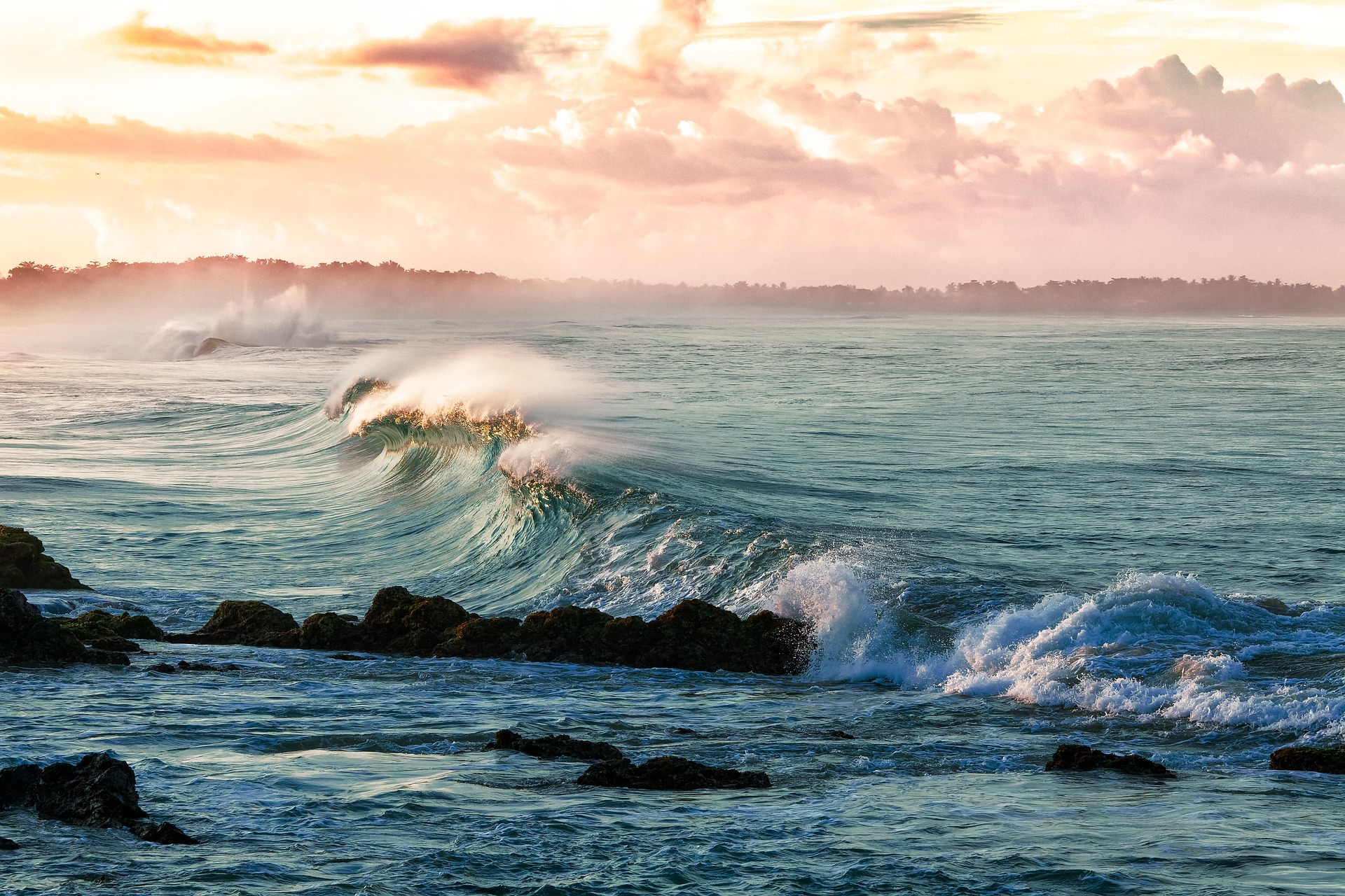
World Oceans and Seas
The interconnected body of salt water that covers seventy-one percent of Earth's surface.
The ocean is a single continuous body of salt water that wraps the planet, connecting every coast and every island. Cartographic convention divides this global ocean into five named basins and many smaller seas, yet the water, the currents, and the species that inhabit them flow freely between them. Taken together, the world ocean is the largest habitat on Earth, the primary regulator of climate, and the foundation of the global economy.
Overview
Earth's oceans cover approximately 70.8 percent of the planet's surface, an area of roughly 361 million square kilometers. The ocean contains about 97 percent of all water on Earth, with a total volume estimated at approximately 1.335 billion cubic kilometers. Because water has a high heat capacity and circulates across the entire globe, it moderates temperatures, distributes moisture, and shapes weather patterns on every continent.
Geographers, oceanographers, and international bodies generally describe the ocean as a single body of salt water known as the World Ocean. For practical reference, this continuous expanse is subdivided into five major basins: the Pacific, the Atlantic, the Indian, the Southern, and the Arctic oceans. These boundaries are conventions rather than physical barriers. Currents, nutrients, heat, and marine species move between the basins continuously, and the behavior of one ocean is inseparable from the behavior of the others.
The ocean has an average depth of approximately 3,688 meters. Its deepest known point is the Challenger Deep, located in the Mariana Trench in the western Pacific, where the seafloor descends to approximately 10,935 meters below the surface. Beyond this single trench, the global seafloor includes abyssal plains that stretch for thousands of kilometers, mid-ocean ridges that form the longest mountain chain on the planet, volcanic seamounts, deep canyons carved by sediment flows, and hydrothermal vent systems that host entirely chemosynthetic ecosystems.
Despite centuries of exploration, the ocean remains the least understood environment on the planet. Satellite gravimetry has produced a low-resolution map of the entire seafloor, yet only a minority of that seafloor has been charted at the high resolution available for most of the land surface. The ocean's vast volume, extreme pressures, cold temperatures, and perpetual darkness below the photic zone make it both a technological frontier and a scientific one.
The Five Oceans
The world ocean is conventionally divided into five named basins. Each card below links to a full profile of that ocean, covering geography, climate, ecosystems, and human use.
Pacific Ocean
Approximately 165 million km²
The largest ocean basin, holding more than half of the volume of ocean water on Earth and stretching from the Arctic to the Southern Ocean.
View profileAtlantic Ocean
Approximately 85 million km²
The second-largest basin, central to the Age of Exploration and to the shipping routes that connect the Americas, Europe, and Africa.
View profileIndian Ocean
Approximately 70 million km²
The third-largest ocean, shaped by seasonal monsoon winds and crucial to global trade between Africa, the Middle East, and Asia.
View profileSouthern Ocean
Approximately 20 million km²
Also known as the Antarctic Ocean; officially recognized by the International Hydrographic Organization in 2000 and by the National Geographic Society in 2021.
View profileArctic Ocean
Approximately 14 million km²
The smallest and shallowest of the five oceans; historically covered by sea ice year-round and now changing rapidly under a warming climate.
View profileMajor Seas
A sea is a smaller body of salt water that is either partly enclosed by land, connected to an ocean through a narrow passage, or set apart by distinct physical and biological characteristics. Seas are where the ocean meets the continents, and many of them carry outsized historical, economic, and ecological importance. The following is a representative selection of the world's major seas, organized roughly by region rather than by size.
Each of these seas sits within one of the five ocean basins, yet each has its own temperature regime, salinity, circulation, and ecology. Coastal populations around these seas have developed rich maritime cultures, commercial fleets, naval traditions, and culinary identities tied to the waters at their shores.
Mediterranean Sea
Almost enclosed sea between Europe, Africa, and Asia; the cradle of several ancient civilizations.
Caribbean Sea
Tropical sea bordered by Central America, South America, and the Caribbean archipelago; hurricane region.
South China Sea
Resource-rich sea in Southeast Asia; one of the busiest maritime corridors in the world.
Bering Sea
Subarctic sea between Alaska and the Russian Far East; supports one of the most productive fisheries on Earth.
Sea of Okhotsk
Cold marginal sea of the northwest Pacific, bounded by the Kamchatka Peninsula and the Kuril Islands.
Gulf of Mexico
Large basin bordered by the United States, Mexico, and Cuba; a major oil and gas province and fishery.
Norwegian Sea
Deep North Atlantic sea off the coast of Norway; a crucial region for deepwater formation in the global conveyor.
Sea of Japan
Semi-enclosed sea between Japan, the Korean Peninsula, and the Russian Far East; also referred to as the East Sea.
Hudson Bay
Large inland sea in northern Canada; partially frozen for much of the year and classified as part of the Arctic system.
Baltic Sea
Brackish inland sea of northern Europe; low salinity due to heavy river inflow and limited exchange with the Atlantic.
Black Sea
Inland sea between Europe and Asia connected to the Mediterranean through the Bosporus; largely anoxic below 150 meters.
Red Sea
Narrow sea between Africa and the Arabian Peninsula; a major shipping route linked to the Mediterranean through the Suez Canal.
Arabian Sea
Northwestern arm of the Indian Ocean bordered by the Arabian Peninsula, Iran, Pakistan, and India; strongly influenced by the monsoon.
Bay of Bengal
Large northeastern arm of the Indian Ocean bordered by India, Bangladesh, and Myanmar; prone to powerful tropical cyclones.
Tasman Sea
South Pacific sea between Australia and New Zealand; known for strong westerly winds and large waves.
Sea of Cortez
Also known as the Gulf of California; a narrow arm of the Pacific between mainland Mexico and the Baja California Peninsula, noted for exceptional marine biodiversity.
Ocean Currents and Circulation
The ocean is in constant motion. Surface currents, driven primarily by prevailing winds and steered by the Coriolis effect and the shape of continents, organize into great rotating systems called gyres. These currents transport enormous quantities of heat from the tropics toward the poles and exert a powerful influence on regional climate. The Gulf Stream and its continuation as the North Atlantic Drift carry warm water from the Caribbean along the eastern seaboard of North America and across the Atlantic toward northern Europe, where they help keep countries such as Ireland and the United Kingdom several degrees warmer than other land at similar latitudes. The cold Humboldt Current, flowing northward along the western coast of South America, has the opposite effect, cooling the coasts of Chile and Peru and supporting one of the richest fisheries in the world.
Beneath the surface, a slower and deeper circulation operates on a planetary scale. This circulation, known as thermohaline circulation or the global conveyor belt, is driven by differences in temperature and salinity rather than by wind. Cold, dense, salty water sinks in the high latitudes of the North Atlantic and around Antarctica, flows along the deep seafloor across ocean basins, and rises gradually elsewhere. A parcel of water that sinks in the North Atlantic may not return to the surface for approximately one thousand years. The conveyor redistributes heat, carbon, oxygen, and nutrients across the globe, and changes in its strength have been linked to dramatic shifts in climate throughout Earth's history.
Tides and Waves
Tides are the regular rise and fall of sea level produced by the gravitational attraction of the Moon and, to a lesser degree, the Sun, combined with the rotation of the Earth. Most coastlines experience approximately two high tides and two low tides each day, a pattern known as a semidiurnal tide. When the Sun, Earth, and Moon align near the new moon and the full moon, their gravitational pulls combine to produce higher high tides and lower low tides known as spring tides. When the Sun and Moon are at right angles to one another during the first and third quarters of the lunar cycle, the tidal range is smaller and is described as a neap tide. Local geography, however, produces enormous variation. The Bay of Fundy between New Brunswick and Nova Scotia in Canada holds the record for the largest tidal range on Earth, with differences between high and low tide exceeding sixteen meters.
Waves are generated primarily by wind blowing across the sea surface. The height of a wave depends on wind speed, the duration for which the wind blows, and the fetch, or the distance of open water across which the wind travels. Long-period swells from distant storms can travel thousands of kilometers across ocean basins before breaking on a distant shore. Other waves are produced by very different forces. Tsunamis are generated by sudden displacement of the water column by undersea earthquakes, submarine landslides, or volcanic eruptions, and can travel across an ocean basin at the speed of a commercial jet before rising into destructive waves when they approach shallow coasts. Rogue waves, once dismissed as seafarers' tales, are now documented in satellite and buoy records and can reach heights greater than twice the surrounding sea state.
Marine Life and Ecosystems
The ocean is the largest habitat on Earth and hosts an extraordinary variety of life. Scientists have formally described approximately 230,000 marine species, yet most estimates suggest that the true number is several times higher and that many millions of species remain undocumented, particularly in the deep sea and the microbial realm. Marine organisms range in scale from picoplankton measured in millionths of a meter to blue whales that reach lengths of more than thirty meters, making them the largest animals known to have existed on the planet.
The ocean organizes itself into a series of overlapping ecosystems shaped by depth, light, temperature, and the availability of nutrients. Coral reefs flourish in warm shallow tropical waters and support a disproportionate share of marine biodiversity. Kelp forests in cool coastal seas create three-dimensional underwater habitats that shelter fish, invertebrates, and marine mammals. Mangrove forests and seagrass meadows line protected coasts and act as nurseries for juvenile fish while also sequestering large amounts of carbon in their sediments. The open pelagic ocean, far from any shore, is dominated by drifting plankton, fast-swimming fish, squid, seabirds, and whales. Below the photic zone lies the dark bathyal and abyssal ocean, where life depends largely on marine snow descending from above. At hydrothermal vents along mid-ocean ridges, entire communities of tube worms, shrimp, and microbes thrive on chemosynthesis, deriving energy from sulfide compounds rather than from sunlight.
Marine phytoplankton, a collective name for the microscopic photosynthetic organisms that drift in the sunlit surface ocean, produce an estimated half of the oxygen in Earth's atmosphere. At the same time, these tiny organisms sit at the base of nearly every marine food web, supporting the zooplankton, fish, and ultimately the predators that sustain human fisheries. Certain regions of the ocean concentrate this biological richness to a remarkable degree. The Coral Triangle in Southeast Asia, bounded roughly by Indonesia, the Philippines, Malaysia, Papua New Guinea, Timor-Leste, and the Solomon Islands, is widely described as the center of global marine biodiversity, containing more than seventy-five percent of the world's known coral species.
The Ocean and Climate
The ocean is the most powerful regulator of Earth's climate. Because seawater has a very high capacity to absorb and release heat, the ocean stores vast amounts of thermal energy and redistributes it through currents and evaporation. Scientific assessments indicate that the ocean has absorbed roughly ninety percent of the excess heat trapped by increased greenhouse gas concentrations since the industrial era and roughly one quarter of the carbon dioxide that human activity has added to the atmosphere. Without this buffering role, atmospheric warming would have been far more severe. At the same time, evaporation from the sea supplies the moisture for rain, snow, and the great river systems that water the continents. Sea surface temperatures in the equatorial Pacific drive the El Niño and La Niña cycles, which shift weather patterns as far away as the Indian subcontinent, southern Africa, and the Americas.
These same processes mean that changes in the ocean translate directly into changes in the global climate system. Thermal expansion of warming seawater, combined with melting ice sheets and mountain glaciers, has driven a rise in global mean sea level of approximately 3.7 millimeters per year in recent decades, with substantial regional variation. Absorption of carbon dioxide has caused ocean acidification, with the average pH of the surface ocean falling by approximately 0.1 units since pre-industrial times. This apparently modest shift represents roughly a thirty percent increase in hydrogen ion concentration and is already affecting the ability of corals, shellfish, and planktonic organisms to build calcium carbonate structures. Warmer waters also hold less dissolved oxygen, expanding low-oxygen zones that are hostile to most marine animals.
Fisheries, Shipping, and Economies
The ocean is central to the world economy. Global capture fisheries yield approximately ninety million tonnes of fish and shellfish each year, and aquaculture, which is farmed production of finfish, mollusks, crustaceans, and seaweed, now exceeds capture fisheries in total output. Several hundred million people derive their livelihoods in part or in whole from fishing, fish processing, aquaculture, and related services, with the greatest share of employment in Asia. For many coastal and island nations, seafood is also the single most important source of animal protein.
The ocean is equally important as a highway for commerce. Approximately ninety percent of world trade by volume moves by sea, carried in container ships, bulk carriers, tankers, and specialized vessels that link every major economy. This traffic concentrates at a handful of critical chokepoints: the Strait of Malacca between the Malay Peninsula and the Indonesian island of Sumatra, the Suez Canal connecting the Mediterranean and the Red Sea, the Panama Canal between the Atlantic and Pacific, and the Strait of Hormuz at the mouth of the Persian Gulf. Beyond fisheries and shipping, the ocean supports offshore oil and gas extraction, emerging offshore wind and marine energy industries, submarine telecommunications cables that carry the majority of international internet traffic, and coastal tourism that is a major contributor to the gross domestic product of many nations.
Threats to the Oceans
The ocean faces a set of interlocking pressures that have intensified over the past century. Overfishing is among the most direct. According to the United Nations Food and Agriculture Organization, roughly thirty-four percent of assessed marine fish stocks were being harvested at biologically unsustainable levels in recent assessments, with the share of overexploited stocks having risen steadily over several decades. Industrial fishing fleets operating far from their home ports, illegal and unreported catches, destructive bottom trawling, and the bycatch of non-target species including sharks, sea turtles, and seabirds compound the strain on marine populations.
Pollution is a second pervasive threat. Estimates of the quantity of plastic entering the ocean each year range from approximately eight to twelve million tonnes, and plastics now appear in samples from every ocean basin, including the Arctic and the deepest trenches. Oil spills from tankers, pipelines, and offshore wells have caused acute damage to coastlines and marine species in many regions. Nutrient runoff from agriculture, fed largely by nitrogen and phosphorus fertilizers, stimulates blooms of algae that consume oxygen as they decompose and create hypoxic dead zones in which fish and invertebrates cannot survive. Persistent organic pollutants and heavy metals such as mercury accumulate through the marine food web and ultimately reach humans who consume seafood.
Climate change acts as an amplifier of these other pressures. Rising ocean temperatures have caused repeated mass coral bleaching events, including several that have affected the Great Barrier Reef of Australia within the last decade. Ocean acidification disrupts the formation of calcium carbonate shells and skeletons. Warming waters hold less oxygen and drive many species toward higher latitudes or deeper depths, altering historic fishery patterns and the ecosystems they depended on. Habitat destruction of coastal mangroves, seagrass meadows, and reef systems, through coastal development, aquaculture expansion, and sedimentation, removes the very nurseries and shelters on which marine biodiversity depends.
International Governance
Because the ocean crosses every national boundary, it is governed through an evolving system of international agreements. The United Nations Convention on the Law of the Sea, opened for signature in 1982 and often referred to as UNCLOS, is the foundational treaty. It establishes a framework of maritime zones, including territorial seas that extend twelve nautical miles from a coastal state, contiguous zones, and exclusive economic zones that extend two hundred nautical miles from baselines. Within an exclusive economic zone, a coastal state has sovereign rights over natural resources and jurisdiction over environmental protection and scientific research. Beyond the exclusive economic zones lie the high seas and the international seabed area, which are treated as a common heritage of humankind for certain purposes.
Additional instruments regulate specific activities. The Agreement on the Conservation and Sustainable Use of Marine Biological Diversity of Areas beyond National Jurisdiction, known informally as the High Seas Treaty or BBNJ Agreement and adopted in 2023, extends environmental protection and the creation of marine protected areas into the high seas. The International Maritime Organization, a specialized agency of the United Nations, regulates the safety, security, and environmental performance of international shipping. Regional fisheries management organizations coordinate catch limits and conservation measures for specific species and regions, while the International Hydrographic Organization sets standards for the charting of the world ocean. Enforcement remains uneven, and questions of compliance, equity, and new technologies such as deep seabed mining continue to dominate international negotiations.
Exploration and Science
The systematic scientific study of the ocean is relatively recent. The voyage of HMS Challenger, which circumnavigated the globe between 1872 and 1876 under the scientific direction of Charles Wyville Thomson and later Sir John Murray, is widely regarded as the founding expedition of modern oceanography. The Challenger expedition catalogued more than four thousand new species, measured ocean depths with weighted lines, and collected samples that established the scientific framework for marine biology, chemistry, and geology. During the twentieth century, Jacques Cousteau and Emile Gagnan developed the Aqua-Lung, the first reliable open-circuit scuba system, which transformed both scientific diving and public engagement with the undersea world. Cousteau's films and television programs introduced generations of viewers to marine ecosystems and conservation.
Technological advances have steadily extended the reach of exploration. In 1960, the bathyscaphe Trieste, piloted by Jacques Piccard and Don Walsh, descended to the bottom of the Challenger Deep, the first crewed dive to the deepest known point in the ocean. The deep submergence vehicle Alvin, operated by the Woods Hole Oceanographic Institution, has carried scientists on thousands of research dives and played a central role in the discovery of hydrothermal vent communities in 1977. In 2012, filmmaker James Cameron piloted the Deepsea Challenger to the Challenger Deep in the first solo dive to the deepest seabed. Satellite oceanography, autonomous underwater vehicles, and the global Argo float network now provide near-continuous monitoring of the sea surface and the upper two thousand meters of the ocean. Even so, fewer than one quarter of the seafloor has been mapped at high resolution as of 2025, a gap that the international Seabed 2030 initiative, coordinated through the Nippon Foundation and the General Bathymetric Chart of the Oceans project, aims to close by the end of the decade.
Sources
Detailed citations, data references, and institutional sources for all CountryReports content are listed on the Sources page. The following government agencies, United Nations bodies, and academic institutions are the primary authorities we rely on for ocean and marine content. Each link points to the institution's homepage.
Government Agencies and Scientific Programs
- National Oceanic and Atmospheric Administration (NOAA) — United States scientific agency for oceans and atmosphere, including the National Ocean Service, National Marine Fisheries Service, and National Centers for Environmental Information.
- NASA Earth Observatory — Satellite-derived imagery and data on sea surface temperature, ocean color, sea level, and sea ice.
United Nations and Intergovernmental Bodies
- United Nations — Official texts of the United Nations Convention on the Law of the Sea, the BBNJ Agreement, and records of United Nations Ocean Conferences.
- Food and Agriculture Organization of the United Nations (FAO) — Global fisheries and aquaculture statistics, including the State of World Fisheries and Aquaculture report.
- International Maritime Organization (IMO) — Global regulatory body for the safety, security, and environmental performance of international shipping.
- International Hydrographic Organization (IHO) — Intergovernmental authority on nautical charting and the delimitation of ocean basins.
- Intergovernmental Oceanographic Commission of UNESCO (IOC-UNESCO) — Coordinates international ocean science, tsunami warning systems, and the United Nations Decade of Ocean Science for Sustainable Development.
Academic and Research Institutions
- Woods Hole Oceanographic Institution — Leading independent research institution in ocean science and engineering, operator of the submersible Alvin.
- Scripps Institution of Oceanography — Research institute of the University of California San Diego; one of the oldest and largest centers for ocean, earth, and atmospheric science.
- Monterey Bay Aquarium Research Institute (MBARI) — Advanced research in deep-sea exploration, underwater robotics, and marine biology.
Museums and Conservation Organizations
- National Geographic Society — Expedition reports, cartographic resources, and educational material on oceans, including the society's recognition of the Southern Ocean.
- Smithsonian National Museum of Natural History — Sant Ocean Hall exhibitions and collections on ocean science and biodiversity.
- International Union for Conservation of Nature (IUCN) — Red List assessments of marine species and global guidance on marine protected areas.
If you notice an error or would like to suggest a correction, please use our contact page to get in touch.