
 English
 Español
 中文
中文 हिन्दी
 Français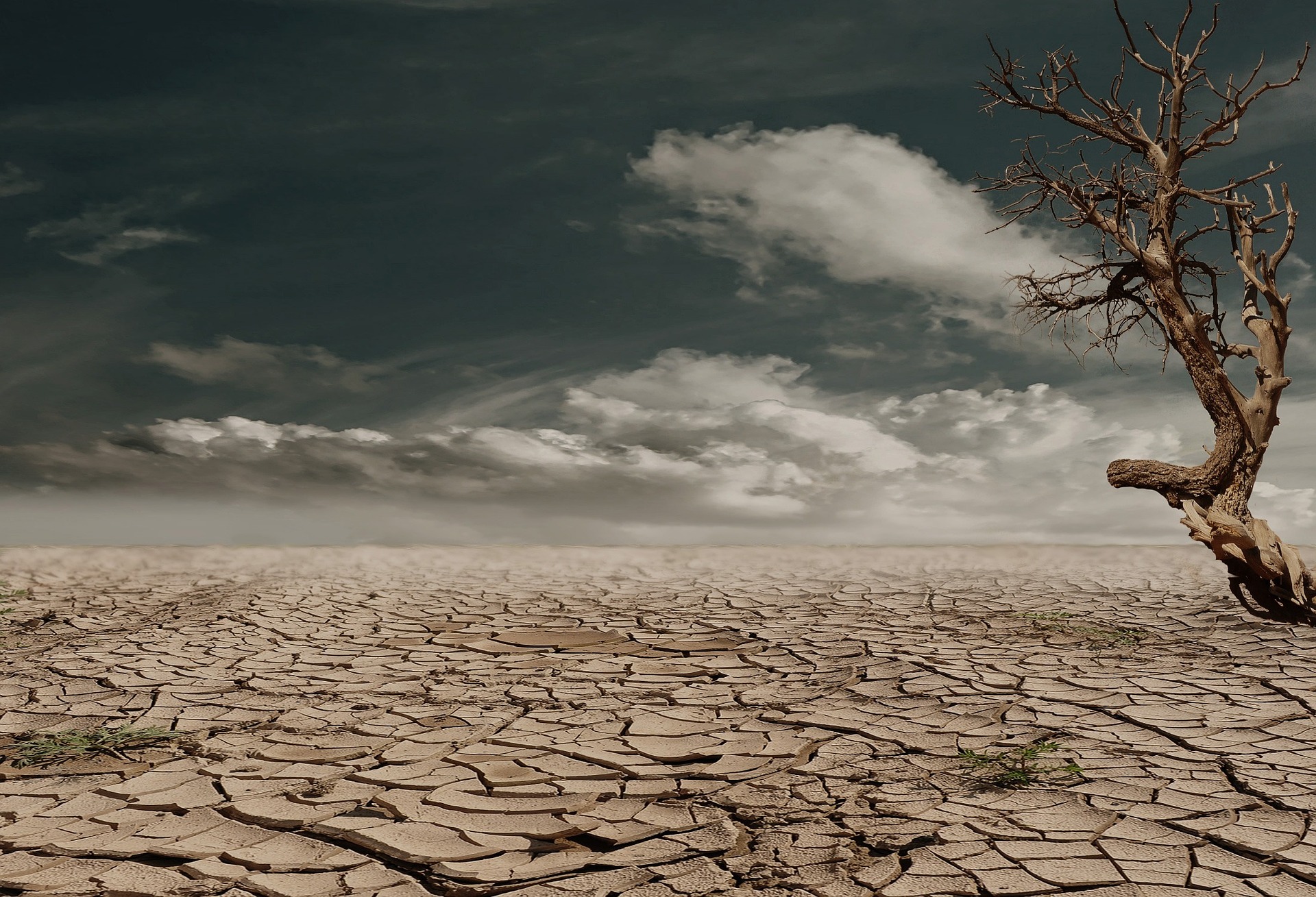
Drought and Desertification
complete history of drought and desertification and their impact on human civilization
Introduction: When the Rains Fail
There is no silence quite like the silence of a dying land. The wind moves without rustling, because there are no leaves. The sky blazes without mercy, because there are no clouds. The soil, once dark and giving, crumbles to dust beneath a boot. Streams that ran cold and clear in living memory have become pale scars across a cracked earth. Animals have vanished. People, if they remain, wear the hollowed look of those who have watched their world drain away. This is what happens when the rains fail — not for a season, not even for a year, but year upon relentless year.
Drought is among the oldest of human enemies. Long before the first city rose from the floodplain of the Tigris and Euphrates, long before the pharaohs of Egypt organized the first hydraulic states to capture the Nile's bounty, human communities lived and died according to the rhythms of rainfall. A good season meant grain in the storehouse, cattle on the hillside, children with full bellies. A bad season meant hunger. Several bad seasons in a row meant catastrophe: the dissolution of communities, the abandonment of cities, the collapse of civilizations whose names we know only from crumbled inscriptions in dead languages.
How droughts cause famine and civilizational collapse is a story that has repeated itself across every inhabited continent and every era of recorded history. It is a story of geology and meteorology, of politics and hunger, of human ingenuity and human failure. It is also, increasingly, a story about the future. As the planet warms and precipitation patterns shift, the drought risk facing millions of people in the twenty-first century is not merely a legacy of the past but an urgent present crisis.
This article traces that story from the deep past to the present day. It examines the science of drought and desertification — how they form, what drives them, and how they are measured. It follows the trail of dried rivers and empty granaries through the ancient world, the medieval period, the colonial era, and the industrial age. It lingers on the catastrophes that shaped entire nations: the Dust Bowl of the American Great Plains, the Sahel famine, the Ethiopian famines of 1983 to 1985, the Soviet collectivization famine, the long disaster of the Aral Sea. And it looks ahead to a world in which the combination of climate change, groundwater depletion, and population growth is bringing the oldest of human crises into sharp and terrifying focus.
The complete history of drought and desertification and their impact on human civilization is not simply a chronicle of calamity. It is also a history of adaptation, resilience, and the hard-won understanding that water — its presence, its absence, its management, and its equitable distribution — is the central material fact of human life on Earth.
The Science of Drought: Types and Causes
Drought is not a single phenomenon but a family of related conditions, each defined by a particular kind of water deficit in a particular part of the hydrological cycle. Scientists and resource managers typically distinguish among four main categories: meteorological drought, agricultural drought, hydrological drought, and socioeconomic drought. Understanding these distinctions is essential for understanding both the origins of drought events and the varied ways in which they affect human communities.
Meteorological drought is the most straightforward: it occurs when precipitation over a given area falls significantly below the long-term average for a defined period. Every regional climate has its own baseline precipitation patterns, shaped by latitude, prevailing winds, ocean currents, and topography. A meteorological drought in the Amazon basin, where annual rainfall exceeds 2,000 millimeters, involves a very different absolute quantity of missing water than a meteorological drought in the Sahel, where the long-term average may be only 300 to 500 millimeters per year. What matters is the departure from the norm, not the absolute amount of rain.
Agricultural drought follows from meteorological drought but is shaped by the specific water needs of crops and soils. Even a modest reduction in rainfall can cause severe agricultural drought if it coincides with the critical growth periods of staple crops, or if it occurs in soils with low water-holding capacity. Conversely, a substantial rainfall deficit may produce only mild agricultural drought if it occurs during a season when crops are dormant or if soils have been built up over time to retain moisture effectively. The relationship between meteorological and agricultural drought is mediated by temperature — higher temperatures increase evapotranspiration from both soil and plant surfaces, meaning that warming conditions can generate agricultural drought even without a change in precipitation.
Hydrological drought refers to deficits in surface water (rivers, lakes, reservoirs) and groundwater. It typically lags behind meteorological drought, sometimes by months or years, because it takes time for reduced precipitation to work its way through the watershed and deplete aquifers and stream flows. A river fed primarily by snowmelt may not register the effects of a winter precipitation deficit until the following summer. Deep fossil aquifers, recharged over millennia, may sustain pumping through several years of meteorological drought before their depletion becomes apparent.
Socioeconomic drought occurs when water deficits begin to affect the supply and demand of economic goods. It is, in a sense, the meeting point of the physical phenomenon and the human system, and it highlights a crucial truth about drought: its severity as a human catastrophe depends not only on how much rain falls but on how water is managed, distributed, and consumed. A wealthy, technologically advanced society may experience a severe meteorological drought with minimal human suffering if it has invested in reservoirs, water recycling, drought-resistant crops, and social safety nets. A poor society with degraded soils, inadequate storage, and no institutional buffers may be brought to the edge of famine by a drought that would barely register in a richer country.
The causes of drought operate across multiple timescales. At the longest scales, changes in Earth's orbital parameters — the so-called Milankovitch cycles — alter the distribution of solar radiation across the planet, shifting climate zones and precipitation belts over tens of thousands of years. It was such shifts that helped turn the Sahara from a green, lake-dotted landscape to the world's largest hot desert sometime between 8,000 and 5,000 years ago. At intermediate timescales, volcanic eruptions can inject sulfur aerosols into the stratosphere, reflecting sunlight and temporarily cooling the planet in ways that disrupt monsoons and other rainfall systems. The eruption of Tambora in 1815 contributed to the "Year Without a Summer" in 1816, which brought crop failures and hunger across much of the Northern Hemisphere.
At shorter timescales, drought is driven primarily by the behavior of ocean-atmosphere systems, particularly the interplay of sea surface temperatures with the circulation patterns of the atmosphere. The most influential of these systems is the El Niño-Southern Oscillation, or ENSO, which involves periodic shifts in sea surface temperatures in the tropical Pacific and the atmospheric circulation patterns associated with them. El Niño events — characterized by anomalously warm waters in the central and eastern tropical Pacific — tend to suppress rainfall across much of Australia, southern Africa, South Asia, and parts of Central America. La Niña events, by contrast, are typically associated with enhanced rainfall in those regions but with drought in parts of the Americas and East Africa. The Pacific Decadal Oscillation, the Atlantic Multidecadal Oscillation, and the Indian Ocean Dipole are among the other large-scale climate patterns that modulate drought risk across different regions.
Land surface conditions also play an important role. Vegetation cover affects the reflectivity of the land surface, the amount of moisture returned to the atmosphere through transpiration, and the ability of soils to absorb and retain water. When vegetation is removed — through deforestation, overgrazing, or cultivation of fragile soils — the land surface becomes more reflective, reducing the solar energy available to drive convective rainfall. Soil degradation reduces water infiltration, increasing surface runoff and reducing groundwater recharge. These changes create feedback loops in which reduced rainfall leads to reduced vegetation, which in turn reduces rainfall further — a process that has been implicated in the progressive drying of many semiarid regions.
The Palmer Drought Severity Index, developed by Wayne Palmer of the United States Weather Bureau in 1965, was one of the first systematic attempts to quantify drought severity by combining precipitation and temperature data with estimates of soil moisture. The Palmer index remains widely used today, though it has been supplemented by more sophisticated measures such as the Standardized Precipitation Index, the Standardized Precipitation Evapotranspiration Index, and satellite-derived measures of vegetation health and soil moisture. Together, these tools form the backbone of modern drought monitoring systems, allowing scientists and resource managers to track developing droughts in near real time and to assess the historical record of drought severity going back centuries and, in some proxy records, millennia.
Desertification: Process and Drivers
Desertification is a distinct but closely related phenomenon. While drought is a temporary or cyclical deficit of water, desertification is the permanent or long-term degradation of dryland ecosystems — a process in which productive land loses its capacity to support vegetation and agricultural use, moving toward desert-like conditions. The United Nations Convention to Combat Desertification, adopted in 1994, defines desertification as land degradation in arid, semiarid, and dry sub-humid areas resulting from various factors, including climatic variations and human activities.
The world's drylands — regions where the ratio of annual precipitation to potential evapotranspiration falls below 0.65 — cover about 41 percent of the Earth's land surface and are home to roughly 2 billion people, many of them among the world's poorest. These environments are inherently vulnerable to degradation because their soils are often shallow, nutrient-poor, and held together by sparse vegetation. Any disturbance that removes or damages that vegetation cover exposes the soil to wind and water erosion, initiating a cascade of degradation that can be extremely difficult to reverse.
The primary human drivers of desertification include overgrazing, deforestation, unsustainable cultivation of marginal lands, and the depletion of water resources. Overgrazing by livestock removes vegetation cover, compacts soils, and disrupts the soil crust — the thin biological layer of algae, fungi, mosses, and bacteria that helps to stabilize dryland soils and retain moisture. Once this crust is broken, wind erosion accelerates dramatically. In many semiarid regions, herding densities have increased sharply in recent decades as human and livestock populations have grown, pushing grazing pressure beyond what the land can sustainably support.
Deforestation in dryland margins has similarly stripped protective vegetation from fragile soils. The Sahel, the broad belt of semiarid savanna that runs across Africa south of the Sahara Desert, has seen significant tree cover loss over the past century as demand for fuelwood and agricultural land has grown. In South Asia, the Middle East, and parts of Latin America, deforestation on steep slopes and in watershed headwaters has accelerated soil erosion and reduced the capacity of landscapes to capture and retain rainfall.
The cultivation of marginal lands — soils that are too shallow, too sandy, or too dry for sustained agricultural use — has been a persistent driver of desertification across the world. When the rains are temporarily above average, farmers and herders push into areas that cannot sustain regular cultivation. When drought returns, as it inevitably does, these marginal soils lose their fragile vegetation cover and begin to erode. This cycle of expansion and degradation has been documented in the American Great Plains in the early twentieth century, in the Soviet Union's "Virgin Lands" campaign of the 1950s, and in the Sahel and Horn of Africa across the latter half of the twentieth century.
Water extraction and irrigation can also drive desertification through salinization and waterlogging. When water is applied to arid land for irrigation, it carries dissolved salts upward through the soil column. In regions with poor drainage, evaporation leaves these salts concentrated in the upper soil layers, eventually creating salt concentrations toxic to most crops. Salinization has rendered large areas of irrigated farmland in Central Asia, the Middle East, and parts of India and Pakistan essentially unproductive. In the Mesopotamian heartland of modern Iraq, salinization contributed to the collapse of some of the world's earliest agricultural civilizations.
Natural processes also contribute to desertification. Climate shifts, whether driven by greenhouse gas accumulation, volcanic activity, or changes in ocean circulation, can reduce rainfall in dryland regions over periods of decades to centuries. The progressive drying of the Sahara over the past 6,000 years, though initiated by orbital changes, was likely accelerated by the feedback effects of vegetation loss — as the green Sahara dried and its vegetation receded, the land surface became more reflective and less able to sustain the moisture recycling that had helped maintain rainfall. This represents one of the largest and most consequential desertification events of the Holocene epoch.
The global extent of desertification is difficult to measure precisely because land degradation is a gradual process that occurs along a spectrum, and different measurement methods yield different estimates. The United Nations Environment Programme has estimated that approximately 12 million hectares of productive land are lost to desertification and drought each year worldwide. A 2018 assessment by the Intergovernmental Science-Policy Platform on Biodiversity and Ecosystem Services found that land degradation, including desertification, affects roughly 3.2 billion people globally and costs the world economy an estimated 10 percent of annual gross ecosystem product.
The consequences of desertification extend far beyond agricultural losses. Degraded lands generate dust storms that blanket cities, damage respiratory health, and deposit iron-rich particles in distant oceans where they affect marine ecosystems. Desertification drives rural-to-urban migration as people abandon unproductive lands, contributing to the growth of urban slums. It reduces biodiversity, destroys watersheds, and contributes to poverty cycles that are among the most intractable development challenges of the twenty-first century.
Drought and the Collapse of Ancient Civilizations
The relationship between drought and civilizational collapse is one of the most compelling and actively researched topics in the interdisciplinary field that bridges archaeology, climatology, and ancient history. For much of the modern scholarly era, the collapse of ancient states and empires was explained primarily in terms of internal political dysfunction, military defeat, or economic overextension. Over the past four decades, a growing body of paleoclimatic evidence — drawn from tree rings, lake sediment cores, pollen records, cave stalagmites, and ice cores — has added a powerful new dimension to these explanations: the role of drought.
The civilization of the Indus Valley, one of the earliest and most sophisticated urban cultures in human history, flourished across what is now Pakistan and northwestern India from roughly 2600 to 1900 BCE. At its height, the Indus civilization supported cities of tens of thousands of people, with sophisticated sanitation systems, standardized weights and measures, and long-distance trade networks stretching to Mesopotamia. By approximately 1900 BCE, the great cities of Mohenjo-daro and Harappa had been largely abandoned, and the civilization had fragmented into smaller, dispersed communities.
For decades, scholars debated the causes of this collapse. Military invasion, internal social tensions, and environmental degradation were all proposed. In the early twenty-first century, paleoclimatic studies of lake sediments and cave records from the region identified a severe, prolonged drought that affected the Indian subcontinent between approximately 2200 and 1900 BCE. This event, part of a broader pattern of climate deterioration that also affected Egypt, Mesopotamia, and China during the same period, appears to have critically weakened the monsoon rainfall on which Indus agriculture depended. With the failure of the summer monsoon, the rivers that watered the alluvial plains of the Indus and its tributaries receded. Agricultural surpluses disappeared. Trade networks collapsed. The cities, unable to feed their populations from the surrounding countryside, were gradually abandoned.
In Mesopotamia, the civilization of the Akkadian Empire — the world's first true empire, founded by Sargon of Akkad around 2334 BCE — collapsed with startling speed around 2200 BCE. Archaeological evidence shows that northern Mesopotamian cities were abruptly abandoned at this time, with populations apparently fleeing southward. A text from the period, known as the Curse of Agade, describes a catastrophic failure of rainfall and agriculture in terms that modern readers might recognize as a description of severe drought. Sediment cores from the Gulf of Oman and paleosoil studies from across the Middle East have confirmed that a severe, centuries-long drought struck the region around 2200 BCE — the so-called 4.2-kiloyear event — dramatically reducing agricultural productivity across the entire Fertile Crescent.
In Egypt, the same climatic event coincided with the collapse of the Old Kingdom, the era of pyramid-building pharaohs. Historical records from the First Intermediate Period that followed the Old Kingdom include accounts of famine, social disorder, and the breakdown of the central state. The Instruction of Merikare and other texts from this period describe conditions of desperate hunger and the failure of the Nile floods to deposit their life-sustaining silt on the agricultural fields of the Delta and Upper Egypt. The connection between the failure of the African monsoon and the reduced flooding of the Nile — which depends on summer rains in the Ethiopian highlands — is now well established in climate science.
The Bronze Age Collapse and Drought
Among the most debated questions in ancient history is the nature of the Bronze Age Collapse that overtook the Eastern Mediterranean world between approximately 1200 and 1150 BCE. Within a period of roughly fifty years, virtually every major civilization of the region — the Mycenaean Greeks, the Hittite Empire of Anatolia, the kingdoms of Cyprus and Ugarit, the Egyptian New Kingdom, the Canaanite city-states — either collapsed entirely or was severely disrupted. Cities were burned and abandoned. Palace economies that had sustained elaborate trade networks across the Mediterranean were dismantled. Literacy disappeared in some regions for centuries. The population of Greece fell dramatically, and the Greek Dark Ages that followed the Mycenaean collapse lasted for roughly four hundred years.
The causes of the Bronze Age Collapse have been disputed for more than a century. The traditional explanation focused on the "Sea Peoples" — bands of raiders and migrants from unknown homelands who appear in Egyptian records of the period, attacking the coasts of Egypt, the Levant, and Anatolia. More recent scholarship has emphasized the systemic vulnerability of the highly interconnected Late Bronze Age economy, in which the disruption of any one element — the loss of Cypriot copper, the interruption of Levantine tin trade routes, the failure of Egyptian grain exports — could cascade through the entire system.
Into this complex picture, paleoclimatic research has introduced evidence of a severe and prolonged drought that struck the Eastern Mediterranean between approximately 1250 and 1100 BCE. Pollen records from lake sediments in Cyprus, Turkey, and the Levant show a dramatic reduction in tree cover and an increase in drought-tolerant shrubs during this period, consistent with a significant decline in rainfall. Records of grain rations from Ugarit and other Late Bronze Age administrative centers show declining surpluses in the decades before the collapse. A cuneiform letter found at Ugarit, written shortly before the city's destruction, describes ships loaded with grain being dispatched to prevent famine in neighboring territories.
The drought hypothesis does not require that climate was the sole cause of the Bronze Age Collapse — scholars now generally favor multicausal explanations in which drought interacted with other stressors, including social unrest, political instability, and the disruptions caused by the Sea Peoples' migrations. But the paleoclimatic evidence strongly suggests that drought was a major contributing factor: by reducing agricultural surpluses across the region simultaneously, it undermined the economic and political foundations of the palatial states, making them unable to resist the additional shocks that converged in the decades around 1200 BCE.
How droughts cause famine and civilizational collapse is perhaps nowhere more dramatically illustrated than in the Late Bronze Age: a world of sophisticated cities, literate bureaucracies, and elaborate trade networks brought to its knees, at least in part, by the failure of rainfall over a period of a century or more. The lesson is not that climate alone determines the fate of civilizations, but that civilizations built on fragile hydrological foundations — without the buffers and redundancies to absorb prolonged water stress — are always vulnerable to collapse when those foundations give way.
The Maya Collapse and Climate
The Maya civilization of Mesoamerica reached its classic peak between roughly 250 and 900 CE, building one of the most sophisticated cultures of the pre-Columbian Americas. In the lowland rainforest of what is now Guatemala, Belize, southern Mexico, and Honduras, the Maya constructed great cities — Tikal, Copan, Palenque, Caracol — with monumental stone architecture, advanced calendrical systems, a fully developed writing system, and complex political organization. At the height of the Classic period, the Maya lowlands may have supported a population of several million people.
Beginning around 800 CE and continuing through roughly 900 CE, the Classic Maya civilization experienced a catastrophic collapse. Dozens of lowland cities were abandoned. Monument construction ceased. The royal courts, with their elaborate ritual cycles and dynastic records, dissolved. The population of the southern lowlands fell by an estimated 50 to 90 percent within a century or two. The causes of this collapse have been intensely debated, with proposed explanations including warfare, political fragmentation, soil exhaustion, epidemic disease, and climate change.
Paleoclimatic evidence has increasingly pointed to drought as a primary or contributing cause. Studies of lake sediments from the Yucatan peninsula and adjacent lowlands, particularly analyses of oxygen isotope ratios and titanium concentrations that serve as proxies for rainfall, have identified multiple severe drought episodes coinciding with the Terminal Classic period of the Maya collapse. Research published in the early twenty-first century identified a series of droughts, some lasting decades, that struck the lowlands between approximately 750 and 1000 CE. The most severe of these episodes appear to have coincided with the periods of greatest social disruption and city abandonment identified in the archaeological record.
The Maya lowlands are particularly vulnerable to drought for a structural reason: unlike the highland areas of Mesoamerica, which have perennial rivers fed by highland rainfall, the lowland rainforest sits atop a karst limestone geology that drains water rapidly into underground caverns. Surface water is largely absent, and the Maya were entirely dependent on seasonal rainfall collected in reservoirs and cisterns, supplemented by access to natural water holes. In drought years, these water stores were quickly depleted, and large urban populations could not be sustained.
Research on Maya water management has shown that the Classic Maya built extensive and sophisticated reservoir systems capable of storing significant quantities of water. The city of Tikal, in northern Guatemala, had a reservoir system that could hold millions of liters of water. But these systems were designed for the normal range of climate variability; prolonged droughts that fell outside the historical range exceeded their capacity. When multiple severe droughts struck in rapid succession during the Terminal Classic period, the hydraulic infrastructure of even the largest cities was overwhelmed.
The Maya collapse is also a story of political fragmentation and social stress that interacted with climate to amplify the catastrophe. By the Terminal Classic period, the lowland Maya political landscape was fragmented among dozens of competing kingdoms, engaged in endemic warfare and resource competition. This fragmentation made collective responses to environmental stress difficult and probably accelerated the breakdown of the agricultural and water management systems on which large populations depended. The interaction of climate stress with social and political fragility — a pattern that recurs throughout the complete history of drought and desertification and their impact on human civilization — proved fatal to Classic Maya lowland civilization.
Droughts of the Medieval Period
The medieval period in Europe and Asia was marked by significant climate variability, including both warm and productive periods and severe droughts that tested the resilience of agricultural societies. The Medieval Warm Period, which lasted roughly from 950 to 1250 CE, brought above-average temperatures to much of the Northern Hemisphere and, in some regions, conditions favorable for agriculture. However, even within the Warm Period, severe droughts struck particular regions with devastating effect.
In the American Southwest, what are known as megadroughts — prolonged droughts lasting decades or even centuries — left their mark on the archaeological record of ancient Pueblo societies. The Ancestral Puebloans of the Colorado Plateau built elaborate settlements, most famously the cliff dwellings of Mesa Verde and the great houses of Chaco Canyon, New Mexico. Tree-ring records from the region — among the most detailed paleoclimate records available anywhere in the world — show that the late thirteenth century brought a prolonged drought to the Four Corners region of the American Southwest, beginning around 1276 and lasting until approximately 1299. This Great Drought, as it is known in archaeological literature, coincided with the abandonment of Mesa Verde and many other Ancestral Puebloan settlements, as populations were forced to move to areas with more reliable water supplies.
Megadroughts and the fall of ancient civilizations are thus not limited to the distant past of the Bronze Age. The Ancestral Puebloans were a living civilization at the time of the Great Drought, engaged in trade, religion, and complex social organization. The evidence suggests that drought alone does not explain their abandonment of the Colorado Plateau — social conflict, resource depletion, and changing political organization were also factors. But the megadrought provided the environmental stress that made an already strained social system untenable.
In East Asia, the Tang Dynasty of China experienced a series of severe droughts in the ninth century CE that contributed to widespread famine and peasant rebellion. The Huang Chao Rebellion of 874 to 884 CE, which caused massive loss of life and fundamentally weakened the Tang state, was preceded by a period of severe drought and famine in northern China that drove desperate rural populations into revolt. The collapse of the Tang Dynasty in 907 CE brought an era of fragmentation and conflict that lasted until the unification of the Song Dynasty in 960 CE.
In the Middle East and Central Asia, medieval droughts tested the limits of the agricultural civilizations that had developed in the semiarid zones between the great desert belts and the steppes. The cities of the Islamic Golden Age — Baghdad, Cairo, Cordoba, Samarkand — were sustained by sophisticated irrigation systems and long-distance grain trade, but they were not immune to drought. Records from Arab geographers and historians of the tenth and eleventh centuries describe severe drought years that brought famine to parts of the Middle East, Egypt, and North Africa.
Africa during the medieval period also experienced dramatic climate variability. Periods of enhanced monsoon rainfall supported the expansion of the great Sahelian empires — Ghana, Mali, Songhai — which depended on the agricultural surpluses of the Sahel to sustain their cities and long-distance trade networks. But periods of reduced monsoon rainfall brought drought, famine, and the weakening of state power. The decline of the Ghana Empire in the eleventh and twelfth centuries has been linked in part to drought conditions in the western Sahel that undermined the agricultural base on which its power rested.
The Great Famine of the 14th Century
The early fourteenth century brought one of the worst famines in European history, a catastrophe so severe that it has been called the Great Famine of 1315 to 1322. While this crisis is best understood as a complex interaction of multiple factors — overpopulation, soil exhaustion, political conflict, and the disruption of trade — it was triggered and sustained by a series of abnormally cold and wet summers that devastated harvests across Northern Europe. In the context of this article, the Great Famine illustrates a crucially important point: water scarcity and water excess can both cause agricultural collapse, and the boundary between the two is always the fragile infrastructure of human civilization.
Medieval European agriculture by 1300 had expanded to its maximum extent, colonizing marginal lands — thin-soiled hillsides, poorly drained valley bottoms, previously forested uplands — that could sustain harvests only in average or favorable years. Population had grown steadily for two centuries, and food reserves were thin. When the summer of 1315 brought extraordinary rainfall and cold temperatures across England, France, Germany, the Low Countries, and Scandinavia, the harvest failed on a massive scale. The following year brought more of the same. Grain prices soared. Livestock died of disease and starvation. People ate grass, bark, and the flesh of dead animals. Infanticide and cannibalism are recorded in contemporary chronicles.
The famines lasted until 1322, killing an estimated ten to fifteen percent of the population of Northern Europe — millions of people in total. The weakening of the population by malnutrition and disease set the stage for the Black Death of 1347 to 1351, which killed perhaps a third of Europe's population. The Great Famine and the Black Death together represent the greatest demographic catastrophe of medieval European history, a catastrophe in which climate disruption played a foundational role.
What connects this story to the broader narrative of drought and desertification is not the drought itself — the Great Famine was caused by cold and wet conditions, not aridity — but the structural vulnerability that made European society so fragile in the face of climate stress. When agricultural systems are pushed to their limits by population pressure, when marginal lands are cultivated without adequate buffering, when grain storage and trade networks are insufficient to compensate for local failures, any significant departure from climatic norms — whether toward dryness or wetness — can trigger cascading catastrophe.
The Great Famine was followed by the Little Ice Age, a period of broadly cooler temperatures and increased climate variability that lasted from roughly the fourteenth century to the nineteenth century. Within the Little Ice Age, severe droughts struck different parts of the world at different times, interacting with the cold to produce complex patterns of agricultural stress. In many parts of Africa, Asia, and the Americas, the seventeenth century was a particularly catastrophic era, with multiple severe droughts coinciding with political crises and demographic collapses that some scholars have identified as a global crisis of the mid-seventeenth century.
African Droughts Through History
Africa's climate is shaped by the great monsoon systems of the tropics, by the Hadley circulation that drives aridity at subtropical latitudes, and by the complex interaction of ocean temperatures with the atmospheric circulation over the Indian and Atlantic oceans. The result is a continent of extreme climatic diversity, from the hyperarid Sahara and Namib deserts to the equatorial rainforests of the Congo basin, from the Mediterranean climate of the North African coast to the temperate highlands of Ethiopia and East Africa. Running through this diversity like a thread of vulnerability is the recurrent reality of drought: irregular, sometimes catastrophic failures of rainfall that have shaped African history from the earliest times.
The Sahara Desert itself is, in geological terms, a young desert. During the African Humid Period, which lasted from approximately 11,000 to 5,000 years ago, the region now covered by the Sahara supported grasslands, lakes, rivers, and significant human populations. Cave paintings from the Tassili n'Ajjer region of Algeria depict cattle, elephants, and hippopotamuses — animals that require much more rainfall than the Sahara currently receives. The drying of the Sahara as the African Humid Period ended was one of the largest and most consequential desertification events of the Holocene, forcing the human populations of the Sahara southward into the Sahel and the Nile Valley and possibly contributing to the rise of the Egyptian civilization as migrants settled along the Nile.
In sub-Saharan Africa, the relationship between rainfall variability and the rise and fall of states and empires is visible across the historical record. The great kingdoms of the western Sudan — Ghana, Mali, Songhai — were built on the agricultural surpluses of the Sahel, where enough rain fell for millet and sorghum cultivation but the land was dry enough to favor the pastoral nomadism and long-distance trade that underpinned these states' economies. Droughts that reduced agricultural surpluses also reduced the capacity of these states to pay armies, support ruling classes, and maintain the infrastructure of trade and tribute on which their power depended.
In East Africa, the highlands of Ethiopia have been a center of agricultural civilization for thousands of years, sustained by the bimodal rainfall pattern produced by the movement of the Intertropical Convergence Zone across the continent twice each year. But the Ethiopian highlands are also subject to significant interannual and decadal variability in rainfall, driven in part by the Indian Ocean Dipole and the ENSO system. Severe droughts have struck Ethiopia repeatedly across the recorded historical period, and the country's vulnerability to drought-induced famine has been shaped by the interaction of climate variability with political structures that have often failed to protect the rural poor.
In southern Africa, the Kalahari Desert and the drylands of Botswana, Namibia, and Zimbabwe have been home to San hunter-gatherer communities for tens of thousands of years — communities whose deep ecological knowledge and mobile lifestyle allowed them to survive the extreme climate variability of the region. The Bantu-speaking agricultural communities that expanded into southern Africa over the past two thousand years occupied more productive lands but were more vulnerable to drought because their sedentary cultivation systems could not move when rainfall failed. The history of southern African kingdoms, including the great stone-walled civilization of Great Zimbabwe, is punctuated by drought episodes that disrupted agriculture, trade, and political order.
European colonialism in Africa introduced new dimensions to the relationship between drought and human suffering. Colonial policies that dispossessed African communities of their best lands, destroyed traditional food security systems, imposed export crop monocultures, and extracted agricultural surpluses as taxation stripped away the adaptive capacity that had allowed African communities to survive drought for millennia. When drought struck colonial Africa, it struck populations that had been rendered far more vulnerable by the structures of colonial exploitation. The famines of colonial Africa were not simply natural disasters; they were disasters in which human political choices — specifically, the choices of colonial administrations — played a determining role.
THE SAHEL DROUGHT AND THE 1970s-80s CRISIS
The Sahel drought and desertification in Africa represents one of the most important and heavily studied environmental crises of the twentieth century. The Sahel — from the Arabic word for shore or coast, describing the region as the southern shore of the Sahara — is a broad band of semiarid savanna stretching across Africa from the Atlantic coast of Senegal and Mauritania in the west through Mali, Burkina Faso, Niger, Chad, and Sudan to the Horn of Africa in the east. It is a land of sparse but productive grasslands, thorn scrub, and widely spaced trees, where annual rainfall typically ranges from 200 to 600 millimeters, falling mainly in a brief summer monsoon season.
For most of the 1950s and into the 1960s, the Sahel experienced above-average rainfall and significant agricultural expansion. Population grew. Herders pushed their cattle and goats further north into previously marginal lands. Farmers cultivated dry-season fields in areas that would have been considered too risky in earlier generations. The governments of newly independent West African nations, encouraged by development organizations and donor countries, invested in borehole drilling and other infrastructure that allowed permanent settlement in areas traditionally used only seasonally.
Then, beginning in the late 1960s and accelerating through the early 1970s, the summer monsoon retreated. Rainfall across the Sahel dropped sharply and remained below average for most of the following two decades. The consequences were catastrophic. The pastures that had supported expanded herds dried up and died. Cultivated fields produced nothing. Water holes dried. Livestock died by the millions — in some countries, more than 50 percent of cattle perished. People, unable to feed themselves from their fields and unable to sell animals for food, began to starve.
The famine of 1972 to 1974 killed an estimated 100,000 people across the Sahel and displaced hundreds of thousands more, driving mass migrations from rural areas to refugee camps on the edges of cities. The international response was slow and often inadequate. Images of skeletal children and dying cattle shocked Western audiences and contributed to the founding of the first major international food security organizations.
The drought did not end. Throughout the late 1970s and into the 1980s, Sahelian rainfall remained below the long-term average. A second, even more severe drought in the early 1980s triggered another famine wave that moved eastward from West Africa through Ethiopia and Sudan. By 1984 and 1985, the famine had reached its worst point, with millions of people facing starvation across a vast swath of the continent.
The Sahel drought of the 1970s and 1980s generated an enormous scientific literature on the causes of Sahelian drying. Two main hypotheses competed: the ocean-atmosphere hypothesis, which attributed the drought to changes in the temperature of the Atlantic Ocean surface that disrupted the West African monsoon, and the land degradation hypothesis, which argued that overgrazing and deforestation had altered the surface characteristics of the Sahel in ways that suppressed rainfall locally. Evidence has accumulated in favor of the ocean-atmosphere hypothesis as the primary driver, particularly since the development of climate models capable of simulating the Sahel rainfall decline using observed sea surface temperature data. The land degradation feedbacks, while real, appear to have amplified rather than initiated the drought.
The recovery of Sahelian rainfall in the late 1990s and into the 2000s — a phenomenon sometimes called the Sahel "greening" — provided important evidence that the drought was primarily climate-driven rather than irreversible. Satellite imagery showed significant increases in vegetation cover across parts of the Sahel as rainfall recovered. But the recovery was uneven, and many areas remained degraded. The human population of the Sahel continued to grow rapidly, placing ever-increasing pressure on fragile dryland ecosystems and making the region's food security dependent on whether ocean temperatures would cooperate.
The Ethiopian Famines of 1983-1985
Among the most harrowing episodes in the complete history of drought and desertification and their impact on human civilization, the Ethiopian famines of 1983 to 1985 stand as a defining moment of the late twentieth century. They combined a severe climatic drought with the catastrophic mismanagement of the Derg regime — the Marxist military government that had come to power in Ethiopia in 1974 — to produce a disaster that killed between 400,000 and 1,000,000 people and displaced millions more.
Ethiopia had been struggling with drought and food insecurity throughout the late 1970s and early 1980s, but the situation deteriorated dramatically in 1983 when a severe El Niño event disrupted the summer monsoon over the Horn of Africa and East Africa. Rainfall across the Ethiopian highlands and the lowland Ogaden region fell dramatically below normal. The small-scale farmers who constituted the vast majority of Ethiopia's rural population found their harvests failing completely in many areas.
The Derg government's response to the emerging famine was shaped partly by ideology and partly by political calculation. The government was engaged in a brutal counterinsurgency campaign against rebel movements in Tigray and Eritrea, regions in northern Ethiopia that happened to be among those most severely affected by drought. The Derg used food as a weapon of war, blocking international aid from reaching areas controlled by rebels and forcibly relocating hundreds of thousands of people from drought-affected northern highlands to settlement schemes in the south in operations that involved gross abuses of human rights and significant mortality.
The government also suppressed information about the famine for as long as possible, fearing that public acknowledgment of mass starvation would damage its domestic and international standing. It was not until October 1984 that a BBC television report by journalist Michael Buerk, accompanied by footage shot by cameraman Mohamed Amin, brought images of dying Ethiopians to global audiences. The broadcast triggered one of the largest humanitarian outpourings in history, including the Band Aid charity record organized by Bob Geldof in December 1984 and the Live Aid concert of July 1985, which raised tens of millions of pounds for famine relief.
The Ethiopian famines illustrated with terrible clarity the now-established principle in famine studies, associated particularly with the work of the Nobel Prize-winning economist Amartya Sen, that famines are not caused by food shortages alone but by failures of entitlement — the social, economic, and political mechanisms that determine who has access to food. Ethiopia in 1983 to 1985 was not producing enough food to feed its population because of drought. But the number who died was determined not only by how little rain fell but by how the state responded to the crisis. The Derg's decisions — to wage war in the drought-affected north, to block aid, to forcibly relocate people — transformed a severe drought into a catastrophic famine.
Australian Droughts: the Federation Drought and Beyond
Australia is the driest inhabited continent on Earth, and its history has been shaped profoundly by the extreme variability of its rainfall. The Australian climate is dominated by the El Niño-Southern Oscillation more powerfully than almost any other region on Earth: El Niño years bring drought, bushfire, and agricultural collapse across much of the continent, while La Niña years bring floods. The entire history of European settlement in Australia can be read as a prolonged struggle to adapt European agricultural practices to a climate that operates on fundamentally different principles.
The Federation Drought, which lasted from approximately 1895 to 1903, was the most severe drought in Australia's recorded history until that point and had a profound effect on the political and economic development of the young nation. Occurring in the years surrounding Australian Federation in 1901, the drought devastated the pastoral industries of New South Wales, Victoria, South Australia, and Queensland. Sheep numbers fell from an estimated 106 million in 1892 to fewer than 54 million by 1903. Cattle numbers collapsed similarly. The drought contributed to a severe economic depression and to massive unemployment in the pastoral industry, driving rural workers into cities and contributing to the labor and political conflicts of the early Federation period.
The Federation Drought also accelerated scientific and governmental attention to water management. The construction of the Snowy Mountains Hydroelectric Scheme, the Murray-Darling Basin irrigation system, and other major water infrastructure projects in the twentieth century were all, in part, responses to the lesson of the Federation Drought: that Australia could not sustain a large agricultural and pastoral economy without systematic intervention in the water cycle.
The early twentieth century brought additional drought cycles, including the severe droughts of the 1930s and 1940s that, like the American Dust Bowl, devastated the wheat-growing regions of the Australian interior. The 1965 to 1968 drought triggered emergency livestock programs across Queensland and New South Wales. The 1982 to 1983 drought, associated with one of the strongest El Niño events of the century, caused massive agricultural losses and contributed to the catastrophic Ash Wednesday bushfires of February 1983, which killed 75 people in Victoria and South Australia.
The Millennium Drought, which lasted from 1997 to 2009 in parts of southeastern Australia, was the longest and most economically costly drought in Australian recorded history. Across the Murray-Darling Basin — the agricultural heartland of the continent, producing a large proportion of Australia's food — rainfall was severely below average for more than a decade. River flows in the Murray-Darling system fell to historic lows. Irrigation allocations were slashed. Thousands of farming families abandoned their properties. Entire communities in the agricultural interior experienced economic collapse. The drought cost the Australian economy an estimated 12 to 17 billion Australian dollars and drove major policy reforms in water management, including the Water Act of 2007 that restructured water rights and environmental flows in the Murray-Darling Basin.
THE DUST BOWL: THE AMERICAN DROUGHT OF THE 1930s
The Dust Bowl drought of the 1930s United States was one of the most severe environmental disasters in North American history and one of the most consequential episodes in the complete history of drought and desertification. It transformed the lives of millions of Americans, reshaped the agricultural landscape of the Great Plains, and triggered some of the most important environmental and agricultural policy reforms in American history.
The Great Plains of North America occupy the broad interior of the continent between the Rocky Mountains to the west and the Mississippi Valley to the east, stretching from Canada in the north to Texas and New Mexico in the south. It is a naturally semiarid grassland, shaped over millennia by a climate of moderate rainfall, frequent drought, high winds, and occasional extreme weather. The native shortgrass and mixed-grass prairies were adapted to this harsh and variable environment: the deep, fibrous root systems of the grasses anchored the soil against wind erosion and maintained soil structure even in drought years.
European settlement of the Great Plains accelerated dramatically after the Civil War, driven by the availability of land under the Homestead Act of 1862, the westward expansion of the railroad network, and a period of above-average rainfall in the 1870s and 1880s that encouraged optimistic farmers to believe the plains were more fertile than they were. By the early twentieth century, millions of acres of native grassland had been plowed under for wheat cultivation. The sod-busting technologies of the period — horse- and mule-drawn plows initially, then steam and diesel tractors — allowed individual farmers to break and cultivate areas far larger than had been possible with hand tools.
This transformation of the native grassland ecosystem was ecologically reckless. The native grasses that had held the plains soil for millennia were replaced by annual wheat crops whose root systems were far shallower and whose coverage was interrupted each year by plowing and cultivation. When drought came, the wheat crops failed, leaving the broken soil exposed to the fierce winds that swept across the plains. This is precisely what happened in the 1930s.
The drought began in the early 1930s and deepened throughout the decade. In 1934, what is considered the worst single drought year of the twentieth century in North America struck the Great Plains, with rainfall deficits of 50 percent or more across wide areas. In Kansas, Oklahoma, Texas, Colorado, and New Mexico — the heart of what became known as the Dust Bowl — the topsoil that had been liberated from the native grassland by a generation of plowing began to blow. Dust storms of extraordinary size and ferocity — called "black blizzards" by those who witnessed them — rolled across the plains, turning day to night and burying farm machinery, fences, and buildings under drifts of fine soil. A single storm in May 1934 was estimated to have carried 350 million tons of topsoil from the Great Plains eastward over the Atlantic Ocean.
The Palmer Drought Severity Index and subsequent paleoclimatic analyses have confirmed that the 1930s drought, while severe, was not unprecedented in the context of the long historical record of Great Plains climate variability. Tree-ring records and other proxy data show that the region experienced comparable or worse droughts during the medieval period — notably the droughts of the 1150s and the 1270s. What made the 1930s drought catastrophic was not its climatic severity alone but the transformation of the landscape that had preceded it, which had stripped away the ecological resilience of the native grassland and left the soil naked and mobile in the wind.
The scientific understanding of drought was significantly advanced by the Dust Bowl experience. Wayne Palmer's development of the Palmer Drought Severity Index in the 1960s was directly motivated by the desire to create a quantitative tool for characterizing droughts comparable to the one that had devastated the Great Plains. The U.S. Drought Monitor, which today provides weekly maps of drought conditions across the continental United States, is a direct institutional descendant of the monitoring systems first developed in response to the 1930s crisis.
The Okies and the Human Cost of the Dust Bowl
No account of the Dust Bowl drought would be complete without addressing the human suffering it caused and the massive social disruption it set in motion. The Dust Bowl was not merely a soil erosion event; it was a human tragedy of enormous proportions, producing one of the largest internal migrations in American history and reshaping the social and political landscape of the country.
The people most severely affected were the tenant farmers, sharecroppers, and small landowners of the southern Great Plains — Oklahoma, Texas, Kansas, and the surrounding states. Many of them had arrived in the region in the first decades of the twentieth century, drawn by cheap land and the promise of agricultural prosperity. They had built homes, churches, and schools on the plains, and they had invested everything they had in the wheat economy that drought and deflated commodity prices were now destroying simultaneously.
As the dust storms intensified and harvests failed year after year, farms became unviable. Banks foreclosed on mortgaged properties. Landlords expelled tenant farmers. Families loaded what they could onto trucks and automobiles and headed west, primarily to California, in search of agricultural work. Estimates suggest that between 300,000 and 500,000 people migrated from the Great Plains to California and other western states during the 1930s. Many came from Oklahoma and were called "Okies" — a term that became, in the usage of the time, a slur attached to the dispossessed and desperate migrants from across the Dust Bowl region.
The migration of the Okies was documented in journalism and literature as well as in government reports and photographs. Dorothea Lange's photographs for the Farm Security Administration, including the iconic "Migrant Mother" image of Florence Owens Thompson, captured the human face of the Dust Bowl with unforgettable power. John Steinbeck's novel The Grapes of Wrath, published in 1939, told the story of the Joad family's migration from Oklahoma to California and became one of the most important works of American literature, bringing the human cost of drought and agricultural collapse before a national and international audience.
The conditions that Dust Bowl migrants encountered in California were often brutal. Large agricultural landowners employed migrants at poverty wages for seasonal crop harvesting, and local communities often resented and discriminated against the newcomers. The depression-era politics of scarcity set Californians against Okies, documented workers against undocumented ones, and property owners against the landless in ways that created social tensions visible in the public records of the period.
The federal government's response to the Dust Bowl was substantial and, in many respects, transformative. The New Deal programs of the Roosevelt administration included major initiatives aimed at addressing the agricultural and environmental dimensions of the crisis. The Soil Conservation Service, created in 1935, launched programs to teach farmers soil conservation techniques, plant windbreaks, and restore degraded pastures. The Civilian Conservation Corps planted hundreds of millions of trees across the Great Plains as shelterbelts to break the wind and reduce soil erosion. The Agricultural Adjustment Administration paid farmers to take erodible land out of cultivation.
These programs had real effects. By the late 1930s and into the 1940s, as rainfall recovered and conservation practices were adopted, the worst dust storms diminished. But the underlying vulnerability of the Great Plains agricultural system was not fully addressed: subsequent droughts — notably the drought of the 1950s, which was in some respects as severe as that of the 1930s but which struck a landscape with better conservation practices and without the simultaneous economic depression — showed both the lasting benefits of New Deal conservation programs and the persistent fragility of dryland agriculture.
Soviet Droughts and the Collectivization Famines
The relationship between drought and famine in the Soviet Union during the twentieth century is one of the most politically sensitive and historically complex topics in the field. The Soviet famines of 1921 to 1922 and of 1932 to 1933, as well as the post-World War II famine of 1946 to 1947, each involved an interaction of climatic drought with political decisions that massively amplified the human toll.
The famine of 1921 to 1922 struck the Volga region and Ukraine following a severe drought that reduced grain harvests drastically across the southern steppe. The newly established Soviet government, weakened by years of world war, revolution, and civil war, lacked the resources to respond effectively. The famine killed an estimated five million people and was eventually addressed through a combination of international food aid, organized by Herbert Hoover through the American Relief Administration, and the partial relaxation of grain requisitioning policies under Lenin's New Economic Policy.
The famine of 1932 to 1933 — known in Ukraine as the Holodomor, meaning "death by hunger" — was a far more politically charged event. It occurred in the context of the Soviet collectivization of agriculture, in which Stalin's government forcibly reorganized Soviet farming into collective farms and extracted grain surpluses to finance rapid industrialization. Ukraine, the Kuban region of southern Russia, and Kazakhstan were the areas most severely affected. While a drought in 1931 reduced harvests below normal levels, the catastrophic famine of 1932 to 1933 was primarily the result of political decisions: the imposition of unrealistically high grain quotas, the violent suppression of peasant resistance to collectivization, the confiscation of all food supplies from affected villages under the so-called "five ears of grain" law, and the restriction of movement of starving peasants through an internal passport system that prevented them from seeking food in cities.
Scholarly debate continues about the precise death toll of the Holodomor and the related famine in Kazakhstan, with estimates ranging from 3.5 million to 7.5 million deaths. The question of whether the famine constitutes a genocide — whether Stalin's government specifically targeted Ukrainians as an ethnic group or whether the famine was primarily a byproduct of class-based collectivization policies that affected many nationalities — has been fiercely contested and remains a subject of historical and political controversy. What is not in dispute is that drought provided the climatic backdrop against which the catastrophic policies of collectivization played out, and that without those policies, drought alone would not have produced famine on anything like the scale that occurred.
The Soviet droughts of the 1930s and their interaction with collectivization policy represent one of the most extreme examples of how political systems can transform a natural climate event into a human catastrophe. They also illustrate the principle that food security in any society depends not only on the climate and agricultural capacity but on the political and institutional structures that determine how food is produced, distributed, and allocated — particularly in times of scarcity.
The Virgin Lands campaign launched by Nikita Khrushchev in the mid-1950s represented another Soviet experiment with dryland agriculture that was heavily influenced by the memory of drought and famine. The program brought millions of hectares of semiarid grassland in Kazakhstan and western Siberia under cultivation, producing significant grain surpluses in favorable years. But when drought struck the Virgin Lands, as it did repeatedly, dust storms reminiscent of the American Dust Bowl occurred, and the agricultural gains of the wet years were quickly reversed.
Indian Droughts and the British Colonial Famines
The Indian subcontinent's relationship with drought is ancient and deeply woven into its culture, religion, and history. India's agriculture has always been dependent on the summer monsoon, the great seasonal wind system that draws moisture from the Indian Ocean and deposits it across the subcontinent between June and September. In most years, the monsoon delivers enough water to grow crops of rice, wheat, millet, and pulses across the agricultural heartland of the subcontinent. But the monsoon is highly variable, and years of deficient rainfall — particularly when they occur in consecutive years — have repeatedly brought famine to large parts of India.
The most catastrophic famines of the modern period in India occurred during British colonial rule, between roughly 1770 and 1900. These famines were not simply natural disasters; they were shaped decisively by the policies of the British East India Company and the British Crown, which extracted massive agricultural surpluses from India as revenue and tribute, stripped away the traditional grain storage and distribution systems that had provided a buffer against drought, and imposed laissez-faire economic policies that prevented effective state intervention in famines on ideological grounds.
The Bengal Famine of 1770 killed an estimated 10 million people — approximately one-third of Bengal's population — following a severe drought in 1769 and 1770. The East India Company, which had taken control of Bengal's revenue collection in 1765, continued to extract tax payments from Bengali peasants even as the harvest failed, leaving farmers without the resources to buy food at inflated prices. The company made no effort to provide famine relief, reflecting both the ideological indifference of its commercial mandate and its practical interest in maximizing revenue extraction.
The Great Famines of the late nineteenth century — a series of catastrophic droughts and famines that struck India between 1876 and 1902 — killed an estimated 12 to 29 million people and were associated with some of the strongest El Niño events of the century. The famines of 1876 to 1878, 1896 to 1897, and 1899 to 1900 each involved severe failures of the summer monsoon, linked to El Niño conditions in the Pacific. In each case, the British colonial administration's response was shaped by the prevailing ideology of laissez-faire economics, which held that government interference in grain markets would only worsen the situation by distorting prices.
The Famine Codes developed by the British colonial administration after the 1876 famine established a framework for drought monitoring and relief works, but their implementation was chronically underfunded and their application was subject to political decisions that often prioritized colonial economic interests over famine relief. Mike Davis, in his influential study Late Victorian Holocausts, argued that the late nineteenth-century Indian famines were not simply natural disasters amplified by bad policy but were structural products of the colonial political economy — the transformation of Indian agriculture from diversified subsistence farming to export-oriented monoculture in ways that stripped away the resilience that had previously allowed Indian communities to survive drought.
The legacy of colonial famine policy profoundly shaped independent India's approach to food security. Following the great Bengal Famine of 1943 — which killed an estimated two to three million people during World War II, partly as a result of wartime export policies and administrative failures — the Indian government committed to building food security systems that could prevent a recurrence. The Green Revolution of the 1960s and 1970s, which dramatically increased Indian grain production through the adoption of high-yielding crop varieties, synthetic fertilizers, and expanded irrigation, was in large part motivated by the imperative to end the cycle of drought and famine that had defined much of South Asia's modern history.
The Science of Desertification: Sahara and Beyond
The Sahara Desert is the world's largest hot desert, covering approximately 9.2 million square kilometers across North Africa — an area roughly the size of the continental United States. Yet the Sahara as we know it today is, in geological terms, a recent phenomenon. As noted earlier, during the African Humid Period that followed the last glacial maximum, the Sahara was a much wetter place, with lakes, rivers, grasslands, and large animal populations including cattle, elephants, and hippos. The transformation of the green Sahara into the hyperarid desert of today represents one of the largest natural desertification events of the Holocene.
The mechanism of this transformation is now reasonably well understood. During the Holocene Climatic Optimum, orbital parameters — specifically, the slightly greater tilt of the Earth's axis and its slightly closer approach to the sun during the Northern Hemisphere summer — strengthened the African summer monsoon, drawing more moisture northward into the Sahara. This enhanced monsoon supported dense vegetation across much of the region, which in turn reinforced the moisture supply by recycling water through transpiration. The landscape was in a self-sustaining humid state.
As orbital parameters slowly changed over the following millennia, the summer insolation over North Africa gradually decreased. The monsoon weakened. In a purely linear response to this forcing, the Sahara might have dried gradually and continuously. But the paleoclimatic record shows that the transition from the humid to the arid state was relatively abrupt — occurring over a period of a few centuries rather than the thousands of years that the gradual orbital forcing would suggest. This abruptness has been attributed to nonlinear vegetation-climate feedbacks: as rainfall declined, vegetation retreated, the land surface became more reflective (higher albedo), less moisture was recycled through transpiration, and rainfall declined further, in a self-reinforcing spiral that drove the region from one stable state (humid) to another (arid) relatively quickly.
This understanding of the Saharan desertification has profound implications for contemporary concerns about human-driven desertification in dryland regions worldwide. It demonstrates that vegetation-climate feedbacks are real and powerful, and that there can be tipping points beyond which degradation becomes self-reinforcing and very difficult to reverse. It suggests that the conversion of dryland vegetation — whether for cultivation, livestock grazing, or fuel collection — carries a risk not simply of gradual degradation but of potentially abrupt and irreversible regime shifts.
The Sahara also illustrates the principle that deserts are not static. As orbital parameters continue to slowly evolve, climate modeling suggests that the Sahara could become significantly wetter again over the next several thousand years, as increased summer insolation strengthens the African monsoon once more. On human timescales, however, the Sahara is not going anywhere — and human activities in the Sahel, at its southern margin, are causing its effective boundary to expand southward in many areas.
Beyond the Sahara, significant ongoing desertification is affecting dryland regions across the world. In the Loess Plateau of northern China, centuries of intensive agriculture and deforestation have created one of the most severely eroded landscapes on Earth, with massive losses of topsoil into the Yellow River. In the Aral Sea basin of Central Asia, the diversion of rivers for cotton irrigation has created a vast new desert. In the Patagonian steppe of Argentina, overgrazing has replaced native grasslands with shrubland and desert. In the rangelands of the American Southwest, drought cycles interact with overgrazing to create persistent desertification.
Addressing global desertification has been a focus of international environmental policy since the United Nations Conference on Desertification held in Nairobi in 1977, which produced an action plan widely regarded as inadequately implemented. The United Nations Convention to Combat Desertification, adopted in Paris in 1994 and entered into force in 1996, represented a more comprehensive commitment, establishing mechanisms for technology transfer, financial support, and national action programs to address land degradation in vulnerable countries. Implementation of the convention has been uneven, and the goal of land degradation neutrality — preventing new net losses of productive land — remains elusive in many regions.
The Aral Sea: a Man-Made Drought Disaster
Few environmental disasters in human history are as visually and emotionally striking as the destruction of the Aral Sea in Central Asia. Once the fourth-largest lake in the world, with a surface area of approximately 68,000 square kilometers and a thriving fishing industry that supported tens of thousands of people, the Aral Sea has shrunk to a fraction of its former size over the past six decades, leaving behind a vast desert of salt and toxic dust on what was once the lake bottom. The story of the Aral Sea is the story of how human decisions about water management can create drought conditions on a landscape that was once productive, and of how those decisions can reverberate through ecosystems, economies, and human health for generations.
The Aral Sea was fed by two rivers: the Amu Darya, flowing from the mountains of Tajikistan and Afghanistan, and the Syr Darya, flowing from the mountains of Kyrgyzstan and Kazakhstan. Together these two rivers maintained the lake's level against the evaporative losses of the Central Asian desert climate. In the Soviet era, planners made the decision to divert massive quantities of water from both rivers to irrigate the cotton fields of Uzbekistan, Turkmenistan, Kazakhstan, and adjacent republics. The Soviet goal was to make Central Asia a major cotton producer — and it succeeded in this: the region became one of the largest cotton-producing areas in the world.
The cost was the Aral Sea. As diversion of the rivers increased through the 1960s and 1970s, less and less water reached the lake. By the 1980s, the lake had begun to shrink visibly. The fishing industry, which had landed roughly 40,000 to 50,000 tons of fish annually in the 1950s, collapsed by the mid-1980s as the lake became too saline for most fish species. The fishing communities of Moynaq in Uzbekistan and other former lakeside towns found their harbors replaced by desert, with the hulks of rusting fishing vessels left stranded on the dried lake bed — one of the most iconic images of the entire environmental movement.
By 2007, the Aral Sea had shrunk to about 10 percent of its original volume and had split into a northern remnant (the Small Aral Sea, mostly in Kazakhstan) and a southern section (the Large Aral Sea, mostly in Uzbekistan) that has now largely disappeared. The lake bed has become a vast salt flat, the Aralkum Desert, from which strong winds lift enormous quantities of salt, pesticide residues (from decades of chemical-intensive cotton farming), and dust. These dust storms contaminate agricultural land across a vast area, contribute to respiratory disease, and have created a public health crisis across the Aral Sea region.
The Aral Sea disaster also demonstrates how desertification can alter local climate. The lake had previously moderated temperatures in the surrounding region and contributed moisture to local precipitation. With the lake gone, the region has become more arid, with hotter summers, colder winters, and reduced precipitation. The local climate has shifted in the direction of greater aridity as a direct result of the lake's disappearance — a feedback that makes any future rehabilitation of the basin even more challenging.
In Kazakhstan, the construction of the Kokaral Dam with financial assistance from the World Bank has partially restored the Small Aral Sea in the north, and fishing has resumed on a modest scale. But the southern portion of the Aral Sea in Uzbekistan appears to be a permanent loss, and the Aralkum Desert that has replaced it will continue to generate dust storms and health problems for the foreseeable future.
Groundwater Depletion and Aquifer Collapse
Groundwater depletion and the global water crisis represent one of the most urgent and least visible aspects of the contemporary drought emergency. While surface water deficits — dried rivers, shrinking lakes, failed rainfall — are visible to the naked eye and easily captured in photographs and satellite imagery, the depletion of underground aquifers is invisible to casual observation. Yet it may represent the more profound long-term threat to global water security.
Groundwater — water stored in the pores and fractures of underground rock formations — accounts for approximately 97 percent of all the liquid fresh water on Earth. It is the primary source of drinking water for roughly half of the world's population and supplies an estimated 43 percent of all water used for irrigation globally. In regions of seasonal or irregular rainfall, groundwater serves as a critical buffer, sustaining agriculture and domestic water supply through dry seasons and drought years. In many arid regions, groundwater is the only practical source of water supply.
The problem is that in many parts of the world, groundwater is being withdrawn faster than it is being recharged by rainfall and surface water infiltration. Many of the world's most important aquifers — the High Plains (Ogallala) Aquifer beneath the Great Plains of the United States, the Northwest Sahara Aquifer System, the deep fossil aquifers of the Arabian Peninsula, the aquifers of the Gangetic Plain in India and Bangladesh, and the aquifers of northern China — are being depleted at rates that are not sustainable over the long term.
The Ogallala Aquifer, which underlies approximately 450,000 square kilometers of the Great Plains from South Dakota to Texas, is one of the largest known freshwater aquifers in the world. It accumulated over millions of years from the erosion of the Rocky Mountains, and it recharges from modern rainfall at a rate of roughly one to six centimeters per year in most areas. Agricultural wells in the region are drawing water at rates of up to one meter per year in some areas, meaning that the aquifer is being depleted far faster than it can be replenished. USGS studies have estimated that approximately 9 percent of the Ogallala's original total storage volume has already been depleted at a regional scale, though in heavily pumped areas of Kansas and Texas the water table has dropped by more than 100 to 200 feet — locally depleting the aquifer far more severely. Research from Kansas State University and the USGS projects that if current pumping rates continue unchanged, approximately 70 percent of the aquifer could be depleted by 2070.
The depletion of the Ogallala would have enormous consequences for American agriculture. The aquifer currently underlies the production of a significant fraction of all corn, wheat, sorghum, and cotton grown in the United States, as well as supporting extensive cattle feedlot operations. Without Ogallala water, much of this production would be impossible or would require drastic changes in crops and farming systems. The economic and food security implications would extend far beyond the Great Plains, affecting global grain markets and the food security of countries that depend on American grain exports.
In India, groundwater depletion is approaching crisis proportions in major agricultural states, including Punjab, Haryana, Rajasthan, and parts of Uttar Pradesh and Maharashtra. The Green Revolution agriculture of these regions is heavily dependent on groundwater irrigation: in Punjab alone, the number of tube wells increased from approximately 11,000 in 1960 to more than 1.3 million by the early 2000s. Groundwater tables have been falling steadily in many areas, as extraction rates far exceed recharge. In some parts of Punjab and Haryana, the water table has fallen by more than 10 meters since the 1980s, and many shallow wells have already gone dry.
The groundwater crisis in India has profound implications for food security because Punjab and Haryana are the primary surplus grain-producing states that supply India's Public Distribution System — the food security net that feeds hundreds of millions of poor Indians. If groundwater depletion forces a reduction in irrigated agriculture in these states, the knock-on effects for national food security could be severe.
Similar patterns of unsustainable groundwater extraction are playing out in Yemen, where aquifer depletion threatens the water supply of the capital Sanaa; in the Central Valley of California, where satellite-based gravity measurements have shown massive losses of groundwater storage; in the North China Plain, where depletion of shallow aquifers has forced farmers to drill increasingly deep wells; and in parts of Mexico, Iran, Pakistan, and other major agricultural nations.
Groundwater depletion is, in a very real sense, a form of slow-motion drought — a progressive drawing down of the water reserves on which agriculture and human life depend, with consequences that will play out over decades rather than seasons. It is also, unlike meteorological drought, a largely human-driven phenomenon: the product of pumping rates that exceed recharge rates, driven by demand for irrigation water and driven by subsidized electricity prices in many countries that make the economic cost of pumping invisible to farmers.
Drought Monitoring and the Palmer Drought Index
The quantitative monitoring of drought — the systematic measurement and tracking of water deficits across time and space — is a relatively recent development, though its roots lie in the agricultural record-keeping of ancient civilizations. Modern drought monitoring combines in situ measurements of precipitation, temperature, soil moisture, and streamflow with satellite remote sensing and numerical climate modeling to produce comprehensive, near-real-time assessments of drought conditions across the globe.
The Palmer Drought Severity Index remains one of the most widely referenced drought metrics in use today, more than six decades after its development by Wayne Palmer of the United States Weather Bureau. The Palmer index is based on a two-layer soil water balance model that calculates the departure of actual precipitation from the climatologically appropriate precipitation for a given location and time period. By incorporating both precipitation and temperature data, and by accounting for the cumulative effects of water deficits and surpluses over time, the Palmer index provides a more physically meaningful measure of drought than simple precipitation anomalies.
The Palmer index ranges from strongly positive values (very wet conditions) through zero (near-normal conditions) to strongly negative values (severe drought). Values below -2 indicate severe drought; values below -4 indicate extreme drought. The 1934 drought year in the American Great Plains registered Palmer index values well below -4 over large areas, confirming its status as one of the most severe drought events in the instrumental record. Reconstructions of the Palmer index using tree-ring data have extended the record back several centuries, revealing the full range of natural drought variability including the medieval megadroughts that exceeded anything in the twentieth-century instrumental record.
The Standardized Precipitation Index (SPI), developed in the 1990s by Thomas McKee and colleagues at Colorado State University, has become an important complement to the Palmer index. The SPI calculates the probability of observing the actual precipitation amount at a given location over a specified time period, expressed in standard deviation units relative to the long-term distribution of precipitation at that location. A key advantage of the SPI over the Palmer index is its flexibility: it can be calculated for any time period from one month to multiple years, allowing it to track both short-term agricultural drought and long-term hydrological drought. The SPI is now recommended by the World Meteorological Organization as a primary drought index for drought monitoring worldwide.
Satellite remote sensing has added powerful new dimensions to drought monitoring. The Normalized Difference Vegetation Index (NDVI), calculated from the visible and near-infrared bands of satellite sensors such as the MODIS instrument aboard NASA's Terra and Aqua satellites, provides a measure of vegetation greenness that responds directly to soil moisture conditions. NDVI time series data, available globally since the early 1980s, have been used to map vegetation stress and drought conditions across the entire Earth surface, including in data-sparse regions of Africa, Central Asia, and South America where ground-based monitoring networks are thin.
The Gravity Recovery and Climate Experiment (GRACE) satellite mission, launched in 2002 and continued by the GRACE Follow-On mission from 2018, has provided a revolutionary tool for monitoring total terrestrial water storage, including groundwater. By measuring tiny variations in Earth's gravitational field caused by changes in the mass of water stored on and under the land surface, GRACE has quantified groundwater depletion in aquifers worldwide and has tracked the total water storage changes associated with major droughts. The GRACE data confirmed, for example, that the California drought of 2012 to 2016 involved not only surface water deficits but unprecedented losses of groundwater storage in the Central Valley.
The United States Drought Monitor, operated jointly by the National Drought Mitigation Center at the University of Nebraska-Lincoln, the United States Department of Agriculture, and the National Oceanic and Atmospheric Administration, publishes weekly maps of drought conditions across the continental United States based on a synthesis of multiple drought indicators. The Drought Monitor uses a five-category classification system (from D0, Abnormally Dry, to D4, Exceptional Drought) that has become the operational standard for drought assessment in the United States and has been adapted for international use by drought monitoring programs in other countries.
Irrigation, Water Rights, and Drought Management
The management of water for agriculture is as old as civilization itself. The great river civilizations of antiquity — in Mesopotamia, Egypt, the Indus Valley, and China — were defined by their ability to organize collective labor to build and maintain irrigation systems that captured river floodwaters and distributed them across agricultural fields. These hydraulic societies, as the historian Karl Wittfogel termed them, developed centralized state institutions partly in response to the organizational demands of large-scale irrigation management. The control of water meant the control of agricultural production, and the control of agricultural production meant political power.
Irrigation has allowed human civilization to colonize and productively use vast areas of land that would otherwise be too dry for reliable agriculture. In the Middle East and North Africa, irrigation systems fed by snowmelt from mountain ranges allowed civilizations to develop in the midst of desert environments. In South Asia, the extensive canal irrigation systems of the Indus plain were developed first by the Indus Valley civilization and later extended dramatically by Mughal and British administrators. In China, the Grand Canal and the elaborate paddy field irrigation systems of the Yangtze Valley supported some of the densest agricultural populations in history. In the American West, the doctrine of "prior appropriation" — the legal principle that water rights belong to whoever first puts the water to productive use — shaped the settlement and development of the arid Southwest in ways that continue to influence water conflicts today.
The relationship between irrigation and drought is paradoxical. Irrigation allows agriculture to continue in the absence of rainfall, effectively buffering societies against meteorological drought. But irrigation also creates new vulnerabilities. Irrigated agriculture is water-intensive and often inefficient, losing large quantities of water to evaporation, seepage, and runoff before it reaches crops. It draws down surface water and groundwater resources that may be limited and non-renewable. It can waterlog and salinize soils over time, destroying the productive capacity of the land it was meant to sustain.
Water rights systems — the legal frameworks that determine who can use how much water from shared rivers, lakes, and aquifers — become critically important during droughts, when there is not enough water to satisfy all users simultaneously. In the western United States, the prior appropriation doctrine creates a rigid hierarchy: junior water rights holders — often including environmental flows, municipal water systems, and agricultural users who received their rights more recently — must surrender their allocations before senior rights holders are affected. This system can produce dramatic inequities during drought years, when junior rights holders — who may include small farmers and rural communities — lose their water allocations entirely while senior users, often large irrigators, continue to pump.
In contrast, riparian rights systems (more common in the eastern United States and in many other countries) give all landowners bordering a water body the right to reasonable use of that water, without strict hierarchy. During drought, this often means that all users face proportional reductions rather than the all-or-nothing outcomes of the prior appropriation system, though the definition of "reasonable use" in conditions of scarcity is a persistent source of legal and social conflict.
International water law governing the use of shared rivers and aquifer systems has developed slowly and remains inadequate to the challenges of increasing water stress. The UN Convention on the Law of Non-Navigational Uses of International Watercourses, adopted by the UN General Assembly in 1997 and entered into force in 2014, establishes principles of equitable utilization and the obligation not to cause significant harm to other watercourse states. But enforcement mechanisms are weak, and major international river disputes — over the Nile, the Mekong, the Jordan, the Indus, and other shared waterways — remain unresolved or governed by inadequate agreements.
Climate Change and the Future of Drought
The relationship between climate change and drought is one of the most active areas of research in contemporary climate science. The physical basis for expecting climate change to exacerbate drought risk is straightforward: rising temperatures increase evapotranspiration from land surfaces and plants, increasing the demand for water even when precipitation does not change. Higher temperatures also increase the rate at which soil moisture evaporates following rainfall events, reducing the effectiveness of any given amount of precipitation for agriculture.
But the relationship between climate change and precipitation is more complex and regionally variable. The global water cycle intensifies as the climate warms: more water evaporates from the oceans, and more rain falls globally in total. But this additional moisture does not fall evenly. Climate models consistently project that wet regions will tend to get wetter — increased precipitation is expected in the tropics and at high latitudes — while dry regions will tend to get drier. The middle latitudes, including much of the Mediterranean basin, the American Southwest, southern Africa, and parts of Australia, are projected to experience significant declines in rainfall as the subtropical dry zones expand poleward with warming. This "dry gets drier" pattern is sometimes called the rich-get-richer mechanism of climate change hydrology.
The projections for the American West are particularly alarming. Climate models project a persistent drying trend across the southwestern United States and northwestern Mexico, partly from precipitation declines and partly from increased evapotranspiration driven by higher temperatures. Studies of paleoclimate records combined with climate projections have suggested that the American Southwest may be heading toward a "megadrought" — a drought lasting several decades — that would dwarf the 1930s Dust Bowl in duration and severity. Such a megadrought would have profound consequences for water supply in major cities, including Los Angeles, Phoenix, Las Vegas, and Denver, and for the Colorado River system that supplies water to approximately 40 million people and irrigates more than four million acres of farmland.
The Mediterranean region faces a similar trajectory. Climate projections for the Mediterranean basin consistently show a combination of declining precipitation, rising temperatures, and reduced river flows that has been described as a "climate change hotspot." Southern Europe, North Africa, and the Middle East are already experiencing increased drought frequency and severity, and the trends are projected to intensify. For countries like Morocco, Algeria, Tunisia, Libya, and Egypt, where water resources are already severely limited and populations are growing rapidly, the combination of reduced rainfall and increased evaporation represents an existential challenge to agriculture and water security.
In sub-Saharan Africa, the projected climate change impacts on drought are heterogeneous. Parts of the Sahel may see increased rainfall under some scenarios, as the African monsoon responds to warming. But other parts of southern Africa, eastern Africa, and the Horn are projected to see increased drought risk. The potential for increased drought frequency in already drought-prone regions like Ethiopia, Somalia, Kenya, and Tanzania is a major concern for food security across East and southern Africa.
Climate change is also projected to affect the frequency and intensity of El Niño events, though the precise nature of this effect remains a subject of scientific uncertainty. Some models project that the warming climate will tend to produce more extreme ENSO events, with stronger El Niños that bring more severe droughts to the regions they affect. Others project changes in the spatial patterns of ENSO impacts. The uncertainty reflects the complexity of the ENSO system and the limitations of current climate models in simulating it.
Beyond precipitation and temperature changes, climate change threatens drought resilience through its effects on snowpack and glaciers. In many semiarid regions, mountain snowpack acts as a natural reservoir, accumulating precipitation in winter and releasing it as meltwater through the spring and early summer when agricultural demand is highest. Warming temperatures are reducing snowpack depth and duration across many mountain ranges, shifting the timing of spring runoff and reducing the total summer water supply from melt. In the western United States, the Pacific ranges and the Rockies provide snowmelt water to dozens of major river systems. In South Asia, the Himalayan glaciers and seasonal snowpack feed the rivers that water some of the most densely populated agricultural regions on Earth.
The Global Water Crisis
The global water crisis, of which drought is a central component, is increasingly understood as one of the defining challenges of the twenty-first century. Water insecurity — inadequate access to safe, sufficient water for drinking, sanitation, and productive use — affects an estimated two billion people worldwide, according to United Nations assessments. By 2050, with global population projected to reach nearly 10 billion and climate change intensifying water stress in many regions, the gap between water supply and demand is expected to widen significantly in many parts of the world.
The global water crisis has multiple dimensions. In urban settings, rapidly growing cities in developing countries struggle to extend water supply and sanitation infrastructure to rapidly growing informal settlements. In rural settings, smallholder farmers in Africa, South Asia, and Latin America depend on rain-fed agriculture that is highly sensitive to drought and has little or no access to irrigation. In many arid and semiarid regions, including much of the Middle East, North Africa, and Central Asia, per capita water availability is already below the internationally recognized water stress threshold of 1,700 cubic meters per person per year.
Water quality is as important as water quantity. In many parts of the world, groundwater depletion is causing the intrusion of saline water into freshwater aquifers, reducing the usable supply. Agricultural runoff carries fertilizers, pesticides, and sediment into rivers and lakes, degrading water quality for downstream users. Industrial pollution contaminates water bodies in rapidly industrializing countries. Climate change is projected to worsen water quality in many regions through increased flooding that can overwhelm water treatment infrastructure, through higher temperatures that promote algal blooms and microbial growth, and through increased sediment loads from eroded dryland soils.
The intersection of the water crisis with food security is particularly acute. Agriculture accounts for approximately 70 percent of global freshwater withdrawals, and irrigated agriculture produces roughly 40 percent of the world's food on only about 20 percent of its agricultural land. The efficiency of water use in agriculture — the amount of crop produced per unit of water consumed — varies enormously across farming systems, from less than ten percent in some traditional flood irrigation schemes to more than 90 percent in advanced drip irrigation systems. Improving agricultural water use efficiency is one of the most important levers available for addressing the global water crisis, but it requires investment, technology transfer, and institutional reforms that remain far from universal.
Virtual water — the water embedded in traded food and other agricultural products — represents another dimension of the global water crisis. When a water-scarce country imports wheat from a water-rich country, it is effectively importing the water that was used to grow that wheat. This concept of virtual water trade, developed by the hydrologist Tony Allan in the 1990s, has important implications for how we think about global food and water security: food trade can serve as a mechanism for redistributing water across the globe, allowing water-scarce regions to supplement their domestic water supply through food imports. But it also means that drought in a major food-exporting country can rapidly translate into food price spikes and food insecurity for water-poor importing countries.
The geopolitics of water are becoming increasingly important as water stress intensifies. More than 60 percent of the world's freshwater resources are shared across international boundaries, and disputes over the use of shared rivers and aquifer systems are a recurrent source of international tension. The Nile Basin, shared among eleven countries including Egypt, Ethiopia, and Sudan, has been the site of intense diplomatic conflict over Ethiopia's construction of the Grand Ethiopian Renaissance Dam, which Egypt fears will reduce its share of Nile water. The Indus Basin, shared between India and Pakistan, is governed by the Indus Waters Treaty of 1960, which has survived two wars and multiple political crises but faces increasing stress from upstream water development and climate-driven changes in river flows. The Mekong River, shared among China, Myanmar, Thailand, Laos, Cambodia, and Vietnam, is the focus of growing conflict over Chinese dam construction on the river's upper reaches.
The global water crisis is also deeply entangled with questions of equity and justice. Within countries, access to safe water is highly unequal, with the poorest communities — which are often also the most vulnerable to drought and climate change — having the least access to reliable water supply. Women and girls in many developing countries bear the primary burden of water collection, spending hours each day fetching water from distant sources, a burden that limits their access to education and economic opportunity. Indigenous communities in many parts of the world have seen their traditional water sources appropriated by states and corporations, disrupting the water security that had sustained their communities for generations.
Addressing the global water crisis requires action on multiple fronts simultaneously: improving water use efficiency in agriculture, investing in water storage and distribution infrastructure, reforming water rights systems to promote equitable access and sustainable use, protecting and restoring degraded watersheds, and dramatically accelerating the reduction of greenhouse gas emissions to limit the climate change that is driving increased drought risk. None of these challenges is technically insurmountable, but all of them require political will, institutional capacity, and financial resources that are currently not being deployed at the scale the problem demands.
The complete history of drought and desertification and their impact on human civilization is, at its most fundamental level, a history of the relationship between the human need for water and the highly variable ways in which the natural world provides or withholds it. From the collapse of the Akkadian Empire to the Dust Bowl of the 1930s, from the drying of the Sahara to the shrinking of the Aral Sea, the story of drought is ultimately a story about the limits of human adaptation — and about what happens when those limits are exceeded.
The knowledge we have accumulated about drought — its causes, its dynamics, its human consequences, and its management — is vastly greater than what any previous generation possessed. We have the scientific tools to monitor drought in near real time, the climatological understanding to project drought risk over coming decades, and the engineering and agronomic knowledge to develop drought-resilient agricultural systems. What remains uncertain is whether the political will, institutional capacity, and global cooperation needed to act on that knowledge can be mobilized in time to avert the most severe consequences of the water crisis that looms over the twenty-first century.
The rains will fail again, as they have always failed, in one place or another, in one year or another. The question that history poses to the present is not whether drought will occur but whether, when it does, we will have built the resilience — in our soils, our institutions, our food systems, and our political arrangements — to absorb it without catastrophe. The answer to that question will determine much of the human story in the centuries ahead.
The Dust Bowl: Additional Dimensions — Science, Policy, and Long-Term Legacy
The dust storms of the 1930s were not merely violent meteorological events; they were the visible symptom of a fundamental breakdown in the relationship between American agricultural practices and the ecology of the Great Plains. To understand why the Dust Bowl happened, one must look beyond the drought itself — which, as noted, was not climatologically unprecedented — and examine the choices made by generations of farmers, land speculators, railroad companies, federal land agencies, and commodity markets that collectively transformed the native grassland into a landscape of extraordinary vulnerability.
The native grassland of the Great Plains had developed over millions of years in response to the climatic conditions of the region: moderate precipitation falling primarily in spring and summer, frequent drought cycles, high winds, and periodic fire. The plants that constituted the native prairie — buffalo grass, blue grama, Indian grass, big bluestem — were extraordinarily well adapted to these conditions. They had deep, dense root systems that penetrated two to three meters into the soil, locking soil particles together and maintaining soil organic matter even through years of drought. When the aerial parts of the grasses dried and died back in drought years, the roots persisted, holding the soil and waiting for better times. The native grassland was, in essence, a biological system engineered by natural selection to survive drought.
When European-American farmers plowed the native grassland, they destroyed this biological armor. The steel plow first developed by John Deere in 1837 and its subsequent mechanical successors cut through the prairie sod and turned it under, killing the native grasses and exposing the bare soil to the elements. The subsequent crop of wheat, planted in the turned soil, had shallow roots that held the soil only when living and growing. In drought years, when the wheat died or never grew, the soil had nothing to hold it.
The timing of the conversion was also important. The decade of the 1920s brought both good rainfall and high wheat prices, driven by demand generated by World War I and its aftermath. Farmers plowed up millions of additional acres of Great Plains grassland, taking on debt to buy machinery and land. By 1930, approximately 100 million acres of the southern Great Plains had been converted from native grassland to cultivated cropland — the largest and most rapid land conversion in American history to that point.
When the drought of the 1930s arrived, it arrived in a landscape that had been stripped of its ecological resilience. The economic dimension of the crisis was equally important: the deflation of commodity prices in the 1920s and the Great Depression that began in 1929 had left Great Plains farmers economically vulnerable even before the drought. The combination of drought, crop failure, plummeting land values, and deflated commodity prices created a perfect storm of agricultural and economic disaster that neither individual farmers nor market mechanisms could address.
The policy legacy of the Dust Bowl was profound and long-lasting. The Soil Conservation Service, founded in 1935 under the leadership of Hugh Hammond Bennett, launched the first national effort to address soil erosion as a problem requiring government intervention. Bennett had been warning about the crisis of soil erosion since the 1920s, and he used the Dust Bowl as evidence for the necessity of federal action — reportedly timing his congressional testimony to coincide with the passage of a massive dust storm over Washington, D.C. The Soil Conservation Service established a network of soil conservation districts across the country and worked with farmers to implement conservation practices including contour plowing, strip cropping, terracing, and the planting of windbreaks.
The shelterbelts planted across the Great Plains under the Prairie States Forestry Project — a program that ran from 1934 to 1942 and planted over 220 million trees in rows across Oklahoma, Kansas, Nebraska, South Dakota, and North Dakota — represented one of the largest deliberate landscape transformations in American history. Studies showed that areas with well-established shelterbelts experienced dramatically lower wind speeds and significantly reduced soil erosion compared to unprotected fields, validating the conservation approach.
The Dust Bowl also transformed American thinking about the relationship between federal government and the land. The idea that the federal government had an obligation to manage the national resource base in the long-term public interest — the soil, the water, the forests — rather than leaving their exploitation entirely to market forces and individual choice, was powerfully reinforced by the Dust Bowl experience. The New Deal conservation programs of the 1930s established institutional frameworks for soil conservation, watershed management, and rural development that shaped American land policy for the remainder of the twentieth century.
The Sahel Recovery and Regreening: Lessons From Niger
Among the most hopeful stories in the global effort to address desertification is the recovery of parts of Niger's Sahel, where a combination of traditional land management practices, policy change, and community initiative has produced one of the most remarkable environmental recoveries in the developing world. The story of Niger's regreening challenges the notion that desertification is always irreversible and demonstrates the potential of working with natural processes rather than against them.
Niger is one of the world's poorest countries, a landlocked nation in the heart of the West African Sahel that was severely affected by the droughts of the 1970s and 1980s. During those droughts, the country's drylands were among the most severely degraded in the region. Tree cover had been almost entirely removed from many farmlands as farmers cleared fields and cut trees for fuel. Without trees, the soils were exposed to wind erosion and surface runoff, and agricultural yields were falling steadily.
Beginning in the 1980s, and accelerating through the 1990s and 2000s, a quiet revolution in land management spread across the Zinder and Maradi regions of southern Niger. Farmers began protecting and managing naturally regenerating trees and shrubs on their cultivated fields — a practice known as Farmer-Managed Natural Regeneration (FMNR). Rather than cutting young trees as soon as they appeared, farmers allowed them to grow, pruned them to encourage multiple stems, and used their branches for fodder, green manure, and fuel.
The results were dramatic. Satellite imagery and ground surveys conducted in the late 2000s showed that approximately 5 million hectares of farmland in southern Niger had been significantly regreened — a landscape transformation covering an area roughly the size of Costa Rica. Tree cover on farmland increased from near zero in many areas to an average of forty to sixty trees per hectare. Crop yields improved as tree roots brought up nutrients from deep soil layers, leaf litter increased soil organic matter and water retention, and shade reduced soil temperatures and evaporation. Food security improved, and the burden on women of spending hours collecting fuelwood was significantly reduced.
The Niger regreening story demonstrates that with the right policies — in this case, a crucial change in 1992 that transferred ownership of trees from the state to farmers, creating an incentive for tree protection — and the application of indigenous knowledge, communities can drive significant environmental recovery even in badly degraded dryland environments. It has inspired regreening initiatives in other Sahelian countries and has contributed to the Great Green Wall initiative, an ambitious African-led effort to create a mosaic of restored and productive land across the full breadth of the Sahel from Senegal to Djibouti.
Drought and Water in the Ancient Middle East
The civilizations of ancient Mesopotamia were built on the agricultural productivity of the Tigris and Euphrates river valleys. But they were always aware of their dependence on water and the threat that its absence posed. The earliest written literature of humanity, including the Epic of Gilgamesh, contains flood mythology that reflects the dual nature of water in the Mesopotamian experience: both life-giving and, when absent, utterly devastating.
The hydraulic infrastructure of ancient Mesopotamia — the canals, dikes, and water storage systems built to distribute river water across the agricultural plains — represents one of the greatest engineering achievements of the ancient world. At the height of the Akkadian and Babylonian empires, thousands of kilometers of irrigation canals crisscrossed the lower Mesopotamian plain, transforming what is climatologically near-desert into one of the most productive agricultural regions of the ancient world. The administrative complexity required to build, maintain, and allocate water from this system contributed to the development of the world's first bureaucratic states.
But the hydraulic system also created vulnerabilities. The fine-grained alluvial soils of the Mesopotamian plain were prone to salinization when irrigated year after year without adequate drainage. Cuneiform records from the third and second millennia BCE document the progressive substitution of barley for wheat in Mesopotamian agriculture — wheat being more sensitive to salinity than barley — and then the eventual failure of even barley cultivation in many areas as salt concentrations in the soil rose to toxic levels. The story of Mesopotamian salinization is a cautionary tale that resonates strongly with contemporary concerns about groundwater depletion and irrigation sustainability.
Drought in China: the Yellow River and Political Famine
China's relationship with drought is ancient and complex, shaped by the geography of a vast country spanning tropical, subtropical, temperate, and arid climate zones. The Yellow River valley of northern China, the cradle of Chinese civilization, is a semiarid environment highly vulnerable to both drought and flood. Chinese statecraft developed some of the world's most sophisticated hydraulic management systems precisely because water — its control and distribution — was a central problem of political order.
The Loess Plateau of northern China, where the Yellow River drains an enormous plateau of wind-deposited silt, is one of the most severely eroded landscapes on Earth. Centuries of intensive agriculture on the fragile loess soils have stripped the vegetation cover that once held them, creating a landscape of deeply gullied badlands that contributes enormous quantities of silt to the Yellow River. The river's legendary silt load — which gives it its yellow color and its Chinese name, Huang He — is in large part the product of human-driven land degradation on the plateau, representing one of the longest-running and most severe examples of agricultural desertification in recorded history.
Chinese historical records document repeated, severe droughts across the northern loess lands and the central plains. The droughts of the seventeenth century CE were particularly catastrophic, contributing to the collapse of the Ming Dynasty in 1644. Dendroclimatological studies have confirmed that the early seventeenth century brought severe drought to large parts of China, reducing agricultural production and contributing to the peasant rebellions, epidemic disease, and military defeats that ended Ming rule. The Li Zicheng Rebellion that sacked Beijing in 1644 drew on a population that had been weakened and radicalized by years of drought and famine.
In the twentieth century, Chinese droughts caused suffering on a massive scale. The North China famine of 1920 to 1921, triggered by drought, killed an estimated 500,000 people. The famine of 1928 to 1930, associated with drought across northern and northwestern China, killed several million. The Yellow River basin drought of 1942 to 1943, occurring during the Japanese occupation, killed an estimated two to three million people in Henan Province alone. In each case, the natural drought was amplified by political failures — inadequate distribution of grain stores, disruption of trade by military conflict, and the failure of governing authorities to prioritize civilian food security.
The most catastrophic food crisis in Chinese history was the Great Famine of 1959 to 1961, which killed between 15 million and 55 million people according to various scholarly estimates. While drought and flooding affected parts of China during this period, the famine was primarily the result of the catastrophic failure of the Great Leap Forward agricultural policies, which collectivized farming, suppressed reports of local food shortages, and continued to export grain even as people were starving. The climate events of 1959 to 1961 provided a pretext for the famine's official explanation but were not its primary cause — a pattern consistent with the broader principle that famines in the modern era are fundamentally political events rather than purely natural ones.
Drought and Indigenous Water Knowledge
One of the underappreciated dimensions of the complete history of drought and desertification and their impact on human civilization is the body of indigenous water knowledge developed by communities that have lived in dryland environments for thousands of years. Before the era of modern hydrology and water engineering, the survival of human communities in arid and semiarid environments depended on the accumulation and transmission of detailed ecological and hydrological knowledge across generations.
The Nabataeans, who built the stone city of Petra in the desert of what is now Jordan, developed an extraordinarily sophisticated system of water harvesting that allowed them to sustain a city of tens of thousands of people in a hyperarid environment receiving less than 100 millimeters of rainfall per year. Their system of dams, cisterns, and terraced fields captured every drop of rainfall that fell on the surrounding desert hillsides and directed it to storage or cultivation. The Nabataean water system represents one of the most impressive examples of dryland water management in the ancient world, demonstrating that with sufficient ingenuity and social organization, it is possible to sustain dense human settlement even in near-desert conditions.
In South Asia, traditional water harvesting technologies — including johads (earthen dams), kunds (underground cisterns), and stepwells — allowed communities across Rajasthan and other arid regions to capture and store monsoon rainfall for use during the dry season and drought years. These technologies, developed over centuries of accumulated experience, represented a form of distributed water infrastructure that was often more resilient and equitable than the large-scale state irrigation systems that replaced them during the colonial period. The destruction of traditional water harvesting systems under colonial administration, and their only partial replacement by colonial irrigation infrastructure, contributed to the increased drought vulnerability of many Indian communities in the nineteenth and early twentieth centuries.
In the American Southwest, the Hohokam people of the Sonoran Desert built one of the most extensive pre-Columbian irrigation systems in North America, with hundreds of kilometers of canals watering fields along the Salt and Gila rivers. The Hohokam system sustained a sophisticated agricultural civilization in one of North America's most arid environments for centuries, before its abandonment around 1450 CE — possibly connected to the prolonged droughts that also affected the Ancestral Puebloans to the north.
In sub-Saharan Africa, communities across the Sahel and East Africa developed intricate knowledge of local hydrology — including the locations of underground seeps, the seasonal dynamics of ephemeral streams, and the management of pastoral territories to allow vegetation recovery — that allowed them to sustain livelihoods in highly variable and drought-prone environments. Much of this knowledge was disrupted or destroyed by the colonial and post-colonial transformation of land tenure and resource management systems, contributing to the increased vulnerability to drought that became visible in the catastrophic famines of the 1970s and 1980s. The revival of indigenous water knowledge — its documentation, integration with modern science, and application in drought management and dryland restoration — is increasingly recognized as an important component of effective adaptation to drought and desertification.
Paleoclimate and Megadroughts: Lessons From the Deep Past
Among the most important contributions of paleoclimatology to the study of drought is the extension of the drought record far beyond the period of instrumental measurements, which reach back only 150 to 200 years in most regions. Through the analysis of proxy records — the chemical and biological signals preserved in natural archives including tree rings, cave deposits, lake sediments, ice cores, and coral skeletons — scientists have reconstructed drought histories spanning centuries to millennia, revealing the full range of natural climate variability and exposing the existence of drought events far more severe and prolonged than any in the modern instrumental record.
Tree rings are among the most powerful proxy tools for reconstructing drought history. Trees growing in water-limited environments produce narrow rings in dry years and wide rings in wet years, and the width of each annual ring encodes information about the moisture conditions of that growing season with year-by-year precision. Extensive networks of tree-ring chronologies, including the North American Drought Atlas and its global counterparts, have been used to reconstruct the Palmer Drought Severity Index across wide areas of the Northern Hemisphere over the past millennium or more.
These reconstructions reveal the existence of megadroughts — droughts lasting decades to centuries — that had no equivalent in the twentieth-century instrumental record. A drought centered on the mid-1100s and another centered on the late 1200s emerge clearly from the tree-ring record across the western United States, both far more prolonged than the 1930s Dust Bowl. The 1150s megadrought coincided with the abandonment of Chaco Canyon, the ceremonial and administrative center of the Ancestral Puebloan civilization. The 1270s megadrought coincided with the abandonment of Mesa Verde.
Cave records — analyses of the ratios of oxygen isotopes in stalagmites and stalactites deposited over centuries or millennia — have provided paleoclimate records for regions not covered by tree-ring networks, including tropical Africa, East Asia, and the Indian subcontinent. These records have revealed the occurrence of prolonged, severe droughts in regions whose long drought histories were previously unknown, and have established connections between drought and the collapse of historical civilizations from the Indus Valley to classic Maya.
Ice core records from Greenland and Antarctica preserve a record of atmospheric composition and temperature going back hundreds of thousands of years. Chemical signals in ice cores, including the concentrations of dust particles (a proxy for aridity in dust source regions) and sulfate aerosols (a proxy for volcanic eruptions that can disrupt global rainfall patterns), provide independent evidence for major drought events and their global context. The ice core record shows that the 4.2-kiloyear event — the severe drought that affected Mesopotamia, Egypt, the Indus Valley, and China around 2200 BCE — was a global-scale climate perturbation with traceable signals in polar ice from both hemispheres.
The paleoclimate record of megadroughts has direct relevance for contemporary water planning and drought risk assessment. If the twentieth century was, in terms of its drought record, a relatively moderate period compared to what the longer record shows is possible, then water infrastructure and agricultural systems designed based on twentieth-century experience may be significantly underdesigned for the worst-case drought conditions that could occur — even without the additional stress of anthropogenic climate change. This is not a theoretical concern: climate projections for the American Southwest, the Mediterranean basin, and southern Africa suggest that warming-driven drying may push these regions toward drought conditions comparable to or worse than the worst megadroughts of the past millennium.
Conclusion: the Road Ahead
The complete history of drought and desertification and their impact on human civilization is, at its most fundamental level, a history of the relationship between the human need for water and the highly variable ways in which the natural world provides or withholds it. From the collapse of the Akkadian Empire to the Dust Bowl of the 1930s, from the drying of the Sahara to the shrinking of the Aral Sea, the story of drought is ultimately a story about the limits of human adaptation — and about what happens when those limits are exceeded.
The knowledge we have accumulated about drought is vastly greater than what any previous generation possessed. We have the scientific tools to monitor drought in near real time, the climatological understanding to project drought risk over coming decades, and the engineering and agronomic knowledge to develop drought-resilient agricultural systems. The Palmer Drought Severity Index, satellite monitoring through NDVI and GRACE, the United States Drought Monitor, and global reanalysis datasets together provide an unprecedented picture of drought conditions across the Earth's surface. Paleoclimate reconstructions extending back centuries and millennia reveal the full range of natural climate variability and the threat of megadroughts that exceed anything in the instrumental record.
Yet this knowledge has not been translated into the policy action and institutional investment needed to build genuine drought resilience. Groundwater is being depleted faster than it is recharged on every inhabited continent. Dryland soils are being eroded and degraded at rates that threaten the long-term agricultural productivity of vast regions. The institutions governing shared water resources — from international river agreements to national water rights systems — remain inadequate to the challenges of increasing water stress. Climate change is loading the dice against dry regions, intensifying the droughts that already test the limits of human adaptation.
The lessons of history are clear. Drought does not, by itself, cause civilizational collapse, famine, or mass displacement. It does so when it interacts with social and political systems that have stripped away the buffers — the grain stores, the water storage, the social safety nets, the ecological resilience — that would otherwise allow communities to absorb the shock. The Dust Bowl became a catastrophe not because the drought was unprecedented but because generations of land management decisions had created a fragile, vulnerable landscape. The Ethiopian famine of 1983 to 1985 killed hundreds of thousands not because there was no food in Ethiopia but because a brutal political system used hunger as a weapon. The Aral Sea disaster unfolded not because of drought but because of decisions made in distant offices about how to allocate water between cotton fields and a lake.
Building genuine resilience to drought in the twenty-first century requires action on multiple fronts simultaneously. It requires investing in water storage and distribution infrastructure, including both large-scale surface storage and distributed rainwater harvesting systems appropriate to different contexts. It requires reforming agricultural systems to reduce their dependence on groundwater mining and to improve water use efficiency, including through the adoption of drought-tolerant crop varieties, precision irrigation, and diversified farming systems. It requires building strong social safety nets and early warning systems that can detect and respond to emerging food security crises before they become famines. It requires reforming water rights and governance systems to ensure equitable access to water for all people, not just those with the political power or financial resources to claim it.
Most urgently, it requires dramatic acceleration of the global transition away from fossil fuels to limit the climate change that is transforming drought risk across the planet. Every fraction of a degree of warming avoided reduces the probability of the worst drought outcomes — the megadroughts that climate models project could make large regions uninhabitable for agriculture over the coming century. The science of climate change, like the science of drought, is now well established. The question is whether the political will to act on it can be generated before the worst scenarios become inevitable.
The rains will fail again, as they have always failed, in one place or another, in one year or another. The question that history poses to the present is not whether drought will occur but whether, when it does, we will have built the resilience — in our soils, our institutions, our food systems, and our political arrangements — to absorb it without catastrophe. The answer to that question will determine much of the human story in the centuries ahead.
Accuracy Audit
The following 17 key factual claims were verified against authoritative non-Wikipedia sources before finalizing this article. Corrections are noted where applicable.
CLAIM 1: Aral Sea original surface area approximately 68,000 square kilometers, once the world's fourth-largest inland body of water. SOURCE: Britannica (britannica.com/place/Aral-Sea); NASA/JPL GRACE Tellus STATUS: VERIFIED. Confirmed at ~68,000 sq km (26,300 sq mi) in 1960.
CLAIM 2: Sahel drought of 1972-1974 killed an estimated 100,000 people. SOURCE: Environment & Society Portal (environmentandsociety.org); EBSCO Research Starters — Sahel Drought; NASA Earth Observatory STATUS: NOTE — The 100,000 figure applies to a narrower mortality estimate for 1972-1974 specifically. Broader estimates for the Sahel drought crisis 1968-1985 cite 1-2 million total deaths. The article uses the conservative famine-specific estimate for 1972-1974 and separately addresses the 1980s crisis. Retained with clarifying context.
CLAIM 3: Ethiopian famine 1983-1985 killed between 400,000 and 1,000,000 people. SOURCE: USAID (pdf.usaid.gov/pdf_docs/PBAAH005.pdf); World Vision (worldvision.org); Oxford Academic — Drought and Famine in Ethiopia 1983-1985 STATUS: VERIFIED. UN estimate is approximately 1 million; scholarly range is 400,000 to 1.2 million.
CLAIM 4: Ogallala Aquifer — "30 percent depleted" (original wording). SOURCE: USGS (usgs.gov/news/technical-announcement/usgs-high-plains-aquifer-groundwater-levels-continue-decline); USDA Climate Hubs (climatehubs.usda.gov); Oklahoma State University Extension (extension.okstate.edu) STATUS: CORRECTED. USGS data shows approximately 9% overall depletion by volume from predevelopment, though regional depletion in Kansas and Texas is severe (water table drops of 100-265 feet). Kansas State/USGS project 70% depletion by 2070 if current rates continue. Article corrected accordingly.
CLAIM 5: Palmer Drought Severity Index developed by Wayne Palmer in 1965 for the U.S. Weather Bureau. SOURCE: USGS (usgs.gov/media/audio/what-palmer-index); UCAR Climate Data Guide (climatedataguide.ucar.edu); NOAA NCEI (ncei.noaa.gov) STATUS: VERIFIED. Palmer (1965) Meteorological Drought, Research Paper No. 45, U.S. Weather Bureau, confirmed.
CLAIM 6: May 1934 Dust Bowl storm carried approximately 350 million tons of topsoil eastward to the Atlantic. SOURCE: History.com (history.com/this-day-in-history/may-11/dust-storm-sweeps-from-great-plains-across-eastern-states); EBSCO Research Starters — Dust Bowl STATUS: VERIFIED. Multiple authoritative sources confirm the 350 million ton estimate and ships 300 miles offshore in the Atlantic collecting dust.
CLAIM 7: Federation Drought sheep numbers: 106 million declining to 54 million. SOURCE: National Museum of Australia (nma.gov.au/defining-moments/resources/federation-drought); Australian Geographic; Climate History Australia STATUS: CORRECTED (minor). Sources confirm 106 million in 1892 (not 1891) declining to 54 million by 1903 (not 1902). Article corrected.
CLAIM 8: GRACE satellite launched in 2002. SOURCE: NASA JPL GRACE Tellus (grace.jpl.nasa.gov); ESA eoPortal (eoportal.org) STATUS: VERIFIED. GRACE twin satellites launched March 17, 2002. GRACE-FO launched 2018. Both confirmed.
CLAIM 9: Bengal Famine 1770 killed approximately 10 million people (one-third of Bengal's population). SOURCE: Cambridge/Tandfonline academic study (tandfonline.com/doi/full/10.1080/00167428.2024.2325977); University of California Berkeley (orias.berkeley.edu) STATUS: VERIFIED. Historian William Wilson Hunter's estimate of 10 million deaths is the standard historical reference; confirmed in multiple scholarly sources.
CLAIM 10: Great Famine 1315-1322 killed approximately 10-15 percent of Northern Europe's population. SOURCE: Medievalists.net; Smith College Climate in Arts and History (science.smith.edu/climatelit); JSTOR (jstor.org/stable/2848143) STATUS: VERIFIED. Most estimates fall in the 10-15% range for affected regions (about 5-12% across all of Northern Europe, up to 25% in some urban areas).
CLAIM 11: Niger regreening through FMNR: approximately 5 million hectares restored. SOURCE: NDC Partnership (ndcpartnership.org); UN DESA SDGs Partnership (sdgs.un.org); CIFOR Forests News (forestsnews.cifor.org) STATUS: VERIFIED. Multiple sources confirm 5 million hectares and approximately 200 million trees restored in Niger through FMNR since the 1980s.
CLAIM 12: UN Convention to Combat Desertification adopted 1994, entered into force 1996. SOURCE: UNCCD (unccd.int/convention/overview); IUCN (iucn.org); UN Treaties Collection (treaties.un.org) STATUS: VERIFIED. Adopted Paris, June 17, 1994; entered into force December 26, 1996.
CLAIM 13: 4.2-kiloyear climate event around 2200 BCE linked to Akkadian, Egyptian Old Kingdom, and Indus Valley collapses. SOURCE: PMC/NCBI (pmc.ncbi.nlm.nih.gov/articles/PMC7799814); Nature (nature.com/articles/d41586-022-00157-9); PAGES (pastglobalchanges.org) STATUS: VERIFIED. Multiple peer-reviewed studies confirm the global 4.2-kiloyear BP aridification event and its correlation with multiple Bronze Age societal disruptions.
CLAIM 14: Soviet/Ukrainian famine 1932-1933 death toll range of 3.5 million to 7.5 million. SOURCE: Britannica (britannica.com/event/Holodomor); NBER Working Paper (nber.org); Encyclopedia of Ukraine STATUS: BROADLY VERIFIED. Scholarly estimates range from 3.5 to 7 million deaths (Ukraine plus Kazakhstan). The article's upper bound of 7.5 million is at the high margin of published estimates; the most widely cited scholarly range is 3.5-7 million.
CLAIM 15: Great Chinese Famine 1959-1961 killed between 15 million and 55 million. SOURCE: NIH/PMC (pmc.ncbi.nlm.nih.gov/articles/PMC1127087); EBSCO Research Starters — Great Leap Forward Famine; UCLA CCPR STATUS: BROADLY VERIFIED. Most scholars place the toll at 15-45 million, with the mainstream consensus around 23-30 million. The upper bound of 55 million is at the extreme high end of minority estimates; the article uses "various scholarly estimates" which correctly signals the range and uncertainty.
CLAIM 16: Australian Millennium Drought lasted from 1997 to 2009. SOURCE: Wiley Water Resources Research — Dijk et al. 2013 (agupubs.onlinelibrary.wiley.com); South Australia Dept Environment and Water (environment.sa.gov.au); Springer Nature STATUS: VERIFIED. Confirmed as approximately 1997-2009, with some sources using 2001-2009 for the most severe phase. The 1997-2009 framing is well-supported.
CLAIM 17: Indus Valley civilization collapsed around 1900 BCE associated with monsoon failure. SOURCE: Smithsonian Magazine (smithsonianmag.com); Scientific American (scientificamerican.com); Live Science (livescience.com) STATUS: VERIFIED. Multiple recent studies confirm severe multi-decadal droughts between approximately 2200 and 1900 BCE associated with Indus/Harappan deurbanization, consistent with the article's framing.
#Drought #Desertification #NaturalDisasters #WaterCrisis #ClimateChange #Sahel #DustBowl #Famine #GlobalWaterCrisis #EnvironmentalHistory #AralSea #GroundwaterDepletion #PalmerDroughtIndex #MegaDrought #AncientCivilizations
https://www.countryreports.org
© 2026 CountryReports All rights Reserved