
 English
 Español
 中文
中文 हिन्दी
 Français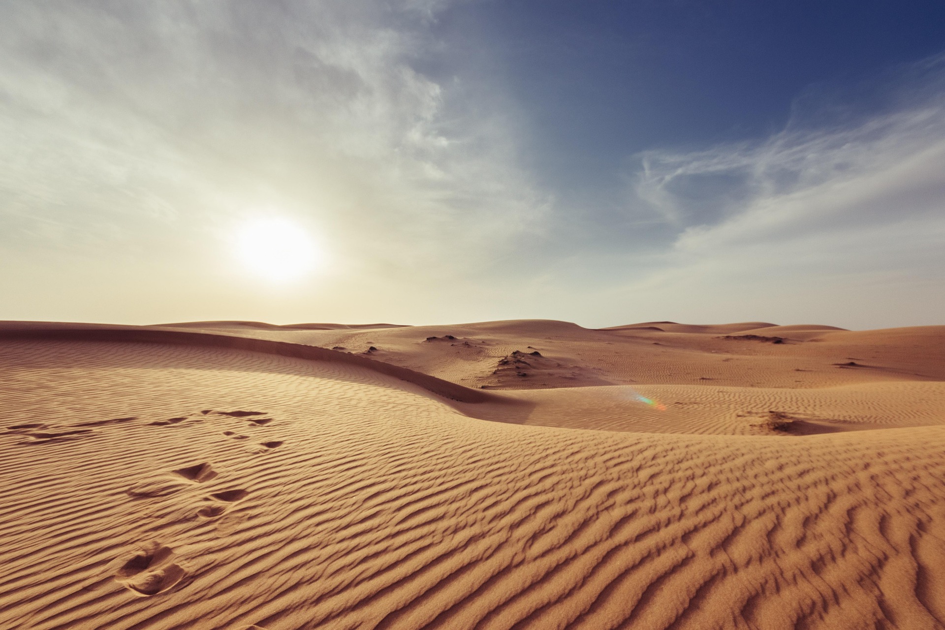
Deserts of the World
Hot and cold, polar and temperate — the drylands that cover a third of Earth's land surface.
Deserts are the planet's great drylands. They cover roughly one third of Earth's land surface, extend from the equator to the poles, and host some of the most specialized ecosystems and human cultures on the planet. Although popular imagination pictures a desert as a sea of sand beneath a punishing sun, the scientific definition is about water, not heat: any region that receives very little precipitation, whether baking under tropical sun or buried under Antarctic ice, qualifies as a desert.
Overview
A desert is most commonly defined as a region that receives less than 250 millimeters of precipitation in an average year. Some classification systems tighten the definition by also considering the potential evaporation rate, since a dryland is only truly arid when water leaves the landscape faster than it can arrive. By either measure, drylands account for approximately one third of Earth's land surface, a share that has remained remarkably stable on continental scales even as local boundaries have expanded and retreated over geologic time.
The popular image of a desert is dominated by the Sahara and the Arabian Peninsula: dune fields, camel caravans, and blazing sun. In reality, geographers recognize several distinct families of desert. Hot subtropical deserts form along the great belts of descending dry air near 30 degrees north and south of the equator. Cold winter deserts, such as the Gobi or the Great Basin, endure long snowy winters and short growing seasons. Coastal deserts sit alongside cold ocean currents and are often shrouded in fog rather than baked by sun. Rain-shadow deserts appear on the leeward side of high mountain ranges, where descending air has already lost its moisture. Polar deserts, finally, include the vast Antarctic continent and the Arctic archipelagos, where extreme cold locks water away as ice and makes liquid moisture scarce at ground level.
Classification can therefore be framed in several ways: by latitude (tropical, temperate, polar), by temperature (hot, cold), by moisture regime (arid, hyper-arid), and by geographic setting (subtropical, rain-shadow, coastal, continental, polar). These categories overlap. The Atacama, for example, is simultaneously subtropical in latitude, coastal in setting, and hyper-arid in moisture, while the Gobi is cold, continental, and shaped by both distance from the ocean and the Himalayan rain shadow.
Deserts are not lifeless. They support distinctive plant and animal communities, some of the world's oldest human societies, irreplaceable paleontological records, and significant reserves of minerals, oil, and gas. They also serve as sentinels for climate change: small shifts in temperature or rainfall can push marginal lands across the threshold into full aridity, a process the United Nations tracks under the broad heading of desertification.
Key Facts
- Share of land surface
- Approximately 33 percent of Earth's land is classified as desert or dryland
- Typical precipitation ceiling
- Less than 250 millimeters (about 10 inches) per year
- Largest desert on Earth
- Antarctica, a cold polar desert covering roughly 14 million square kilometers
- Largest hot desert
- The Sahara in North Africa, approximately 9.2 million square kilometers
- Driest non-polar desert
- The Atacama Desert in northern Chile; some stations have never recorded measurable rainfall
- Hottest regularly recorded site
- Death Valley in the Mojave Desert, which also contains the lowest point in North America at −86 meters
- Largest continuous sand sea
- The Rub’ al Khali or Empty Quarter, on the Arabian Peninsula
- Annual land degradation
- Approximately 12 million hectares lost to desertification each year (UNCCD estimate)
How Deserts Form
The distribution of the world's great deserts is not random. Every major dryland sits within one of a small number of atmospheric or geographic traps that suppress rainfall, and the same principles reappear on every continent.
The first and most influential of these traps is the subtropical high-pressure belt. Warm air rises at the equator, releases its moisture as tropical rain, and then drifts poleward in the upper atmosphere before descending near latitudes of about 30 degrees north and 30 degrees south. This descending air warms as it compresses, so its relative humidity drops, and it suppresses cloud formation. The Sahara, the Arabian Desert, the Kalahari in southern Africa, and the great Australian interior all sit under these subtropical high-pressure cells. The Royal Geographical Society and the National Geographic Society both identify this Hadley-cell subsidence as the single most important desert-forming mechanism on the planet.
A second mechanism is the rain shadow. When a prevailing wind lifts moist air over a mountain range, the air cools, the moisture condenses, and rain or snow falls on the windward side. Air descending the leeward slope is warm and dry. The Atacama sits in the rain shadow of the Andes, the Great Basin and Mojave sit east of the Sierra Nevada, and Patagonia lies east of the southern Andes. Death Valley, one of the driest places in North America, lies in the cumulative rain shadow of no fewer than four mountain ranges.
A third factor is distance from the ocean. Interior continental basins simply run out of accessible moisture. Winds arriving in Central Asia have already crossed thousands of kilometers of land, and much of what little moisture they once carried has been wrung out along the way. This is a major driver of aridity in the Gobi and in the Taklamakan of western China.
A fourth factor is cold ocean currents. Where cold upwelling water sits alongside a warm coast, the cool sea surface chills the overlying air. The chilled air cannot hold much moisture, so coastal fogs form but convective rainfall does not. The Humboldt Current west of South America helps produce the hyper-aridity of the Atacama, and the Benguela Current off southwestern Africa shapes the coastal Namib. The United States Geological Survey and the National Oceanic and Atmospheric Administration both treat this current-driven coastal aridity as a distinct class of desert-forming process.
Polar deserts work differently. Extreme cold reduces the capacity of the air to hold water, snowfall totals are low, and liquid water is locked in ice sheets. Antarctica receives less annual precipitation across its vast interior than many subtropical deserts, and the Arctic archipelagos share the same pattern.
The Sahara
The Sahara is the largest hot desert on Earth. It stretches across North Africa from the Atlantic coast to the Red Sea and extends south to the Sahel, covering approximately 9.2 million square kilometers and reaching into eleven countries: Morocco, Algeria, Tunisia, Libya, Egypt, Sudan, Chad, Niger, Mali, Mauritania, and the disputed territory of Western Sahara. If the Sahara were a country it would be the fifth largest in the world, larger than the contiguous United States.
Sand seas, known by the Arabic term erg, cover only a fraction of the Sahara. Much of the desert is gravel plain, known as reg, or bare rocky plateau, known as hamada. Mountain ranges rise abruptly from the plains, most notably the Ahaggar in southern Algeria and the Tibesti in northern Chad, whose Emi Koussi volcano is the highest point in the central Sahara. Beneath the surface lie several of the world's largest fossil aquifers, including the Nubian Sandstone Aquifer System, which stores water that fell as rain during wetter ancient climates.
The Sahara in its modern form is relatively young in geologic terms. Paleoclimate records, including cores collected by international research teams and summarized by the Smithsonian National Museum of Natural History and the Desert Research Institute, indicate that the region became persistently arid roughly seven million years ago but has cycled through repeated green phases since then. During the African Humid Period, between about 11,000 and 5,000 years ago, monsoon rains pushed far to the north, rivers and lakes spread across what is now desert, and Neolithic peoples painted hunting scenes and herds of cattle on rock faces that now stand amid bare sand.
The Sahara is home to ancient trans-Saharan trade routes, the salt mines of Taoudenni, the oasis cities of the Fezzan, and some of the richest dinosaur and early mammal fossil beds in Africa. It is also the point of origin for enormous seasonal dust plumes, which cross the Atlantic and fertilize the soils of the Amazon with mineral-rich material, a phenomenon tracked in detail by NASA Earth Observatory satellites.
The Arabian Desert
The Arabian Desert occupies most of the Arabian Peninsula, stretching across Saudi Arabia, Yemen, Oman, the United Arab Emirates, Qatar, Bahrain, Kuwait, Jordan, and southern Iraq. It is a continuation, in climatic terms, of the Sahara, but it is isolated from it by the Red Sea and has developed distinctive landscapes and cultures of its own.
The southern third of the peninsula is dominated by the Rub’ al Khali, known in English as the Empty Quarter. Covering approximately 650,000 square kilometers, it is the largest continuous sand sea in the world. Its dunes, some rising more than 250 meters, are arranged in vast, ordered chains that are visible from orbit in NASA Earth Observatory imagery. To the north lies An-Nafud, a smaller but no less striking sand sea characterized by rust-colored dunes and isolated oases. The two are connected by the Ad-Dahna, a thin arc of sand that threads across central Saudi Arabia.
Beneath the sand and surrounding sedimentary basins lie some of the largest proven oil and natural gas reserves on Earth. The discovery and development of these reserves from the 1930s onward transformed the Arabian Peninsula from one of the poorest regions of the world into a cluster of high-income economies, a transition documented by the FAO Land and Water Division in its regional profiles of water and land use.
The Arabian Desert is the homeland of Bedouin peoples, whose traditional society was organized around camel and goat pastoralism, oasis agriculture, and seasonal movement among wells. Although the great majority of Peninsula populations now live in modern cities, Bedouin cultural heritage continues to shape cuisine, poetry, music, and social custom. Wildlife of the Arabian Desert includes the Arabian oryx, driven to extinction in the wild in the 1970s and reintroduced from zoo populations into protected reserves, and the sand cat, fennec fox, and several species of jerboa and gazelle.
The Gobi
The Gobi is the largest desert in Asia and one of the world's most important cold deserts. It stretches across southern Mongolia and northern China, covering roughly 1.3 million square kilometers. Unlike the subtropical deserts of Africa and Arabia, the Gobi is continental in character. Its aridity comes from a combination of distance from the ocean and the rain shadow of the Tibetan Plateau and Himalayas to the south, which block moist air masses from the Indian Ocean.
Temperatures in the Gobi are extreme in both directions. Summer highs can exceed 40 degrees Celsius, while winter lows regularly fall well below −30 degrees Celsius, and snow is a familiar part of the desert year. Only a small fraction of the Gobi is covered in dunes. Most of the desert consists of bare rock, steppe grassland that thins to gravel, and gently rolling plains. The International Arid Lands Consortium and the University of Arizona Desert Lab both use the Gobi as a reference case for cold-winter aridity.
The Gobi is one of the richest vertebrate fossil sites in the world. The American Museum of Natural History expeditions of the 1920s, led by Roy Chapman Andrews, recovered the first scientifically documented dinosaur eggs at the Flaming Cliffs of Bayanzag, along with velociraptor and protoceratops specimens that remain foundational to paleontology. Mongolian and international teams continue to work in the Nemegt Basin and the Djadokhta Formation today.
Mongolian herding cultures have shaped the Gobi for more than three thousand years. Mobile pastoralists raise the so-called five snouts (camels, horses, cattle, sheep, and goats), moving seasonally among pasturelands. The wild Bactrian camel and the Asiatic wild ass continue to survive in remote protected reserves. In recent decades the southern margin of the Gobi has been advancing, a process that has drawn scientific attention from both the Desert Research Institute and Chinese academies of science.
The Patagonian Desert
The Patagonian Desert, also called the Patagonian Steppe, is the largest desert in the Southern Hemisphere's temperate latitudes. It occupies most of southern Argentina, extending from the eastern slopes of the Andes to the Atlantic coast, and covers roughly 620,000 square kilometers. A narrow strip of the same dry ecosystem extends into Chile east of the southern Andes.
The Patagonian Desert is a textbook rain-shadow desert. Prevailing westerly winds pick up moisture over the Pacific Ocean, rise abruptly over the Andes, and release their rain and snow on the Chilean side. The air that descends eastward into Argentina is dry and cool, and it is further stripped of moisture by the relentless Patagonian wind. Annual precipitation across much of the region is between 150 and 250 millimeters, classifying the landscape as arid to semi-arid.
Unlike hot subtropical deserts, the Patagonian Desert is a cool-temperate environment. Summers are mild, winters are cold and often snowy, and the vegetation consists of hardy tussock grasses, dwarf shrubs, and low cushion plants adapted to wind and desiccation. The landscape is known to geologists for its exposed Cretaceous and Tertiary sedimentary basins, which have yielded some of the largest dinosaur fossils ever recovered, including the titanosaur Patagotitan.
Human use of the Patagonian Desert has long centered on sheep grazing, introduced during the late nineteenth century. Large estancias still dominate land use, although the economic and ecological costs of overgrazing are a recurring concern in studies by the FAO Land and Water Division. Native wildlife includes the guanaco, the lesser rhea, the Andean condor along the mountain front, and the Patagonian mara.
The Atacama
The Atacama Desert runs for roughly 1,600 kilometers along the Pacific coast of northern Chile, pinned between the Andes to the east and the Pacific to the west. It is widely regarded as the driest non-polar place on Earth. Some weather stations in the Atacama have never recorded measurable rainfall during their operational history, and parts of the desert are estimated to have received essentially no rain for decades or centuries at a time.
Three mechanisms converge to produce this extreme aridity. The cold Humboldt Current runs along the coast, chilling the overlying air and suppressing convective rainfall. The Andes cast a massive rain shadow that blocks moisture from the Atlantic. And the subtropical high-pressure cell over the southeastern Pacific parks descending dry air almost permanently over the region. Together they create what atmospheric scientists at NASA Earth Observatory have described as a textbook case of compounded aridity.
The Atacama was historically mined for sodium nitrate, a compound used in fertilizers and explosives. From the late nineteenth century until the development of synthetic nitrogen fixation in the early twentieth century, Atacama nitrate was a major global commodity, and the revenue from it reshaped Chilean politics and financed the country's early infrastructure. Copper mining in and near the Atacama, centered on Chuquicamata and Escondida, has since become Chile's dominant export industry and the backbone of the world copper market.
Because the Atacama combines extreme dryness, minimal cloud cover, low atmospheric turbulence, and high elevation, it has become one of the most important astronomical sites in the world. The Atacama Large Millimeter Array (ALMA) on the Chajnantor Plateau and the European Southern Observatory's Very Large Telescope (VLT) on Cerro Paranal use these conditions to probe the structure of galaxies, protoplanetary disks, and the cosmic microwave background. NASA and the Desert Research Institute also use the Atacama as a terrestrial analog for Mars surface conditions.
North American Deserts
North America has four distinct desert regions, all straddling the western United States and northern Mexico. The United States Geological Survey and the Desert Research Institute recognize each as a separate biogeographic province, shaped by distinct elevation, latitude, and rainfall patterns.
Sonoran Desert
The Sonoran is the most biodiverse desert in North America. It receives two rainy seasons, a winter frontal regime and a summer monsoon, and supports a remarkable richness of plant life including the iconic saguaro cactus, which grows only here. It spans Arizona, southeastern California, and the Mexican states of Sonora and Baja California.
- • Bimodal rainfall regime
- • Saguaro, organ pipe, and cholla cacti
- • Tohono O'odham and Seri ancestral lands
Mojave Desert
The Mojave is a transitional desert between the Great Basin and the Sonoran, characterized by the Joshua tree and by Death Valley, whose Badwater Basin lies at −86 meters, the lowest point in North America. Summer temperatures in Death Valley regularly exceed 50 degrees Celsius.
- • Death Valley National Park
- • Joshua tree woodlands
- • Mojave National Preserve
Chihuahuan Desert
The Chihuahuan is the largest desert in North America, occupying high intermontane basins across northern Mexico, southern New Mexico, West Texas, and southeastern Arizona. Its elevated interior gives it cooler nights and colder winters than the Sonoran, and its flora is rich in agaves and yuccas.
- • Big Bend National Park
- • White Sands gypsum dunes
- • Agave and yucca communities
Great Basin Desert
The Great Basin is the largest cold desert in North America, occupying most of Nevada and western Utah between the Sierra Nevada and the Wasatch ranges. Its precipitation falls largely as winter snow, and its iconic plant is big sagebrush, which dominates vast sweeps of the landscape.
- • Cold-winter desert climate
- • Great Salt Lake and endorheic basins
- • Sagebrush steppe ecosystems
Australian Deserts
The Australian interior, known colloquially as the Outback, is one of the largest continuous arid regions in the world. Geographers recognize several distinct deserts within it, each named for its dominant surface or geographic position: the Great Victoria, the Great Sandy, the Gibson, the Tanami, the Simpson, the Little Sandy, and the Sturt Stony Desert. Together they cover roughly 1.37 million square kilometers, close to one fifth of the continent.
Australian deserts form beneath the southern subtropical high-pressure belt and are amplified by the continent's flat, low relief, which offers little to lift moist air. Rainfall is highly variable: long droughts are punctuated by episodic heavy rain that can cause normally dry lakes, such as Kati Thanda–Lake Eyre, to fill for short periods and trigger spectacular pulses of wildlife activity.
Aboriginal Australian peoples have lived in and cared for these landscapes for tens of thousands of years, making them among the oldest continuously inhabited environments on Earth. Traditional land management included carefully managed fire regimes known in English as cool-season patch burning or fire-stick farming, which reduced fuel loads, encouraged new growth, and sustained habitat for kangaroos and other game. Contemporary land-management agencies, in partnership with Indigenous ranger programs, have reintroduced many of these practices in recognition of their ecological value.
Uluru, also known as Ayers Rock, is the most famous landmark of the Australian desert country. A massive inselberg of arkose sandstone rising abruptly from the surrounding plain in the Northern Territory, it is a sacred site of the Anangu people and a central element of Tjukurpa, their traditional law and cosmology. The surrounding Uluru-Kata Tjuta National Park is jointly managed by its traditional owners and the Australian Government.
Polar Deserts
By the most widely used definition, in which any region receiving less than 250 millimeters of annual precipitation qualifies, the largest desert on Earth is not the Sahara but Antarctica. The Antarctic continent covers approximately 14 million square kilometers, and the interior of the East Antarctic Ice Sheet receives as little as 50 millimeters of precipitation per year, almost all of it as wind-driven snow. Some ice-free valleys in the McMurdo Dry Valleys region have not seen measurable precipitation for extended periods and are among the driest landscapes known on the planet, a condition studied in detail by the Desert Research Institute, NASA, and the National Science Foundation's United States Antarctic Program.
The Arctic polar desert is the second great polar dryland, covering roughly 2.6 million square kilometers across the Canadian Arctic Archipelago, northern Greenland, Svalbard, Franz Josef Land, the New Siberian Islands, and other high-latitude archipelagos. Its ecology is shaped not only by aridity but also by long winter darkness, short cool summers, continuous permafrost, and a very short growing season for the scattered vascular plants, mosses, and lichens that occur there.
Calling these regions deserts can feel counterintuitive to a reader used to images of warm sand, but the logic is sound: precipitation is very low, liquid water is largely inaccessible at the surface, and the ecosystems that have evolved are highly specialized to cope with those conditions. Both NOAA and NASA Earth Observatory classify the polar ice sheets as cold deserts in their mapping of global climate zones.
Desert Life and Adaptations
Desert organisms have evolved a remarkable toolkit of strategies for surviving extreme temperature swings, scarce water, and intense solar radiation. Plants, animals, and the people who have long lived in dryland environments share a common set of principles: store water, reduce losses, and time activity to the hours or seasons when conditions allow.
CAM Photosynthesis
Cacti, agaves, and many succulents use crassulacean acid metabolism to open their stomata at night, when the air is cool and humid, minimizing water loss relative to daytime photosynthesis.
Deep and Wide Roots
Mesquite, acacia, and other desert trees extend tap roots many meters downward to reach deep groundwater, while many shrubs and grasses spread shallow lateral roots to capture brief rainfall events.
Water Storage Tissues
Barrel and saguaro cacti expand and contract with available water, storing months or years of reserve in fleshy stems protected by spines and a waxy cuticle.
Nocturnal Activity
Many desert animals, from kangaroo rats to fennec foxes and most desert reptiles, shift their activity to night, avoiding the hottest hours and reducing evaporative water loss.
Burrows and Shade
Ground squirrels, jerboas, and desert tortoises retreat to burrows where temperatures remain stable and humidity is significantly higher than at the surface.
Metabolic Water
The kangaroo rat of the American West can live its entire life without drinking liquid water, extracting all the moisture it needs from the metabolic breakdown of dry seeds.
Heat-Tolerant Ungulates
The addax of the Sahara and the Arabian oryx can raise their body temperature during the day to reduce the gradient with the surroundings, sweating only when temperatures would otherwise become lethal.
Human Adaptations
Bedouin, Tuareg, Aboriginal Australian, Navajo, and many other peoples have developed architectures, clothing, diets, and seasonal movement patterns finely tuned to dryland conditions, accumulating ecological knowledge now recognized as essential by the UNCCD and the FAO.
Desertification and Climate Change
Desertification refers to the degradation of dryland ecosystems through a combination of climatic pressures and unsustainable land use. It is not the simple expansion of a desert into a neighboring green region; rather, it is the progressive loss of productivity, vegetation cover, and soil structure in drylands that are already climatically marginal. The phenomenon is tracked globally by the United Nations Convention to Combat Desertification (UNCCD), which was adopted in 1994 and is the only legally binding international agreement that links environment and development to sustainable land management.
Estimates of the scale of desertification vary among sources, but the UNCCD, the FAO Land and Water Division, and the UNEP World Environment Situation Room all report that roughly 12 million hectares of productive land are lost to degradation each year, an area comparable to the combined size of a medium-sized country. The Sahel, the semi-arid belt along the southern edge of the Sahara, and the southern fringe of the Gobi are two of the most watched frontlines.
Climate change interacts with desertification in several ways. Higher global temperatures increase evaporation, which effectively pushes the boundary between arid and semi-arid conditions. Changing precipitation patterns can concentrate rainfall into fewer, more intense events that run off rather than infiltrating. Meanwhile, some historically arid regions may become slightly wetter under certain climate scenarios, a reminder that the relationship between warming and aridity is not uniform globally. For a broader treatment of these issues, see the CountryReports overview at Climate Change.
Responses range from large-scale initiatives such as the African Union's Great Green Wall, which aims to restore a belt of vegetation across the Sahel, to farm-level practices such as zai pit planting, stone bunds, agroforestry, and rotational grazing. NASA Earth Observatory imagery has been used to monitor the recovery of degraded regions in Niger, Burkina Faso, and parts of China over multi-decade periods, providing some of the clearest evidence that careful land management, where supported by stable policy and secure tenure, can reverse desertification on meaningful scales.
Sources
Detailed citations, data references, and institutional sources for all CountryReports content are listed on the Sources page. The following government science agencies, international bodies, research institutes, and learned societies are the primary authorities we rely on for content about the world's deserts. Each link points to the institution's homepage.
Government Science Agencies
- United States Geological Survey (USGS) — Desert landform mapping, hydrology of arid basins, and biogeographic classification of North American deserts.
- National Oceanic and Atmospheric Administration (NOAA) — Climate records, precipitation normals, and drought monitoring in arid regions.
- NASA Earth Observatory — Satellite imagery of dune fields, dust transport, polar ice sheets, and multi-decade vegetation change in drylands.
International Bodies
- UNEP World Environment Situation Room — Aggregated data on land degradation, dryland ecosystems, and global environmental change.
- United Nations Convention to Combat Desertification (UNCCD) — Legal framework and data on land degradation, drought, and sustainable dryland management.
- FAO Land and Water Division — Agricultural water use, soil, and land-management data for arid and semi-arid regions worldwide.
Museums, Societies, and Research Institutes
- National Geographic Society — Public-facing reference material on desert regions, cultures, and wildlife.
- Smithsonian National Museum of Natural History — Paleoclimate records, desert paleontology, and natural history collections.
- Desert Research Institute (DRI) — Dedicated research environmental science institute focused on arid lands.
- Royal Geographical Society (United Kingdom) — Geographic research, mapping, and exploration archives covering deserts worldwide.
- International Arid Lands Consortium — Academic research network focused on the sustainable management of arid and semi-arid lands.
- University of Arizona Desert Laboratory — Long-running field station for the scientific study of desert ecosystems, particularly the Sonoran Desert.
If you notice an error or would like to suggest a correction, please use our contact page to get in touch.