
 English
 Español
 中文
中文 हिन्दी
 Français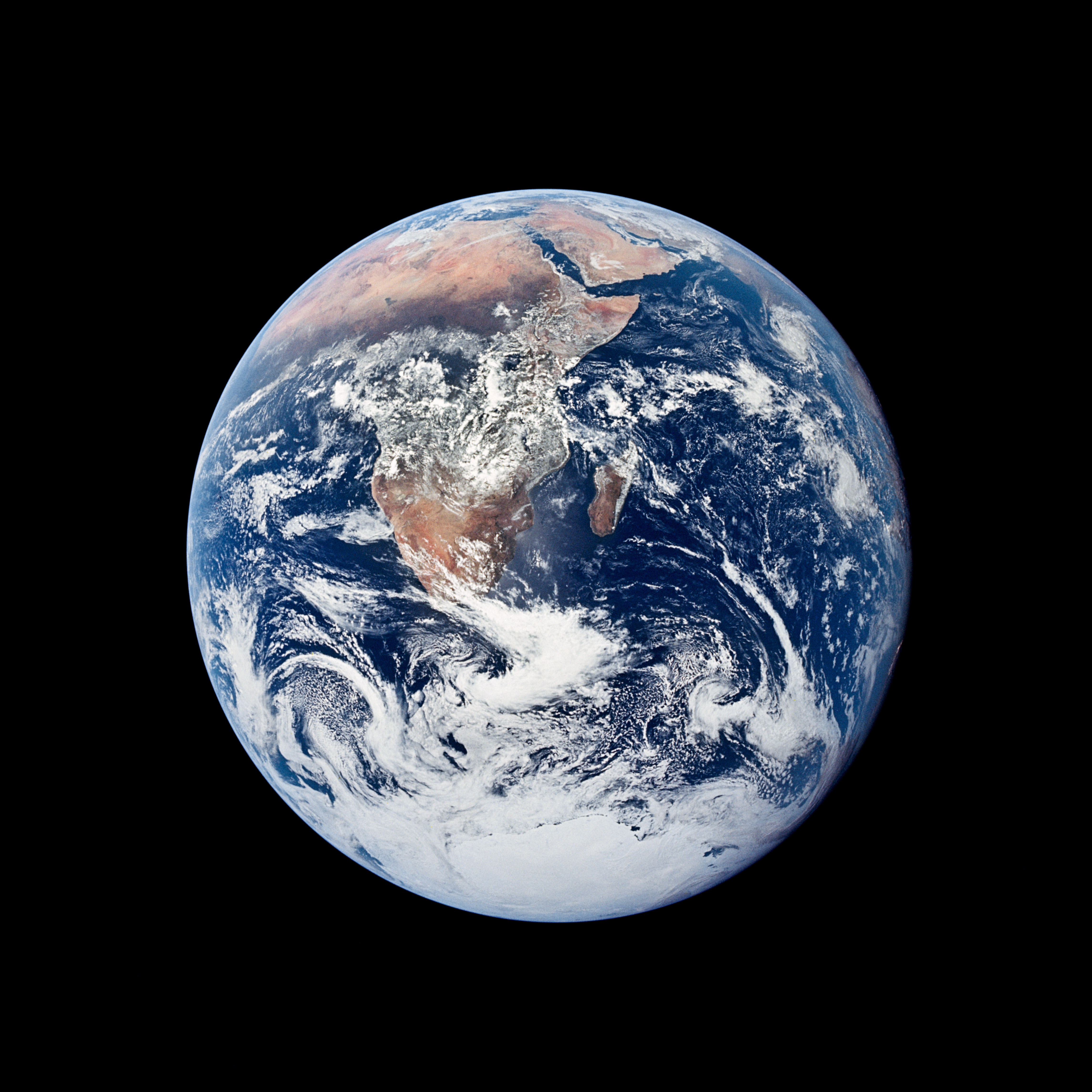
Earth from Space
How orbital photography and Earth-observing satellites reveal the geography, oceans, weather, and land cover of our planet.
For most of human history, the planet could only be pictured from the ground. In less than a single lifetime that has changed completely. Since 1946 a growing fleet of cameras, rockets, and satellites has looked back at Earth from above the atmosphere, and today thousands of instruments in orbit image the planet every hour of every day. The view from space has transformed how geographers map continents, how meteorologists forecast storms, how oceanographers measure currents, and how ecologists track vegetation and land cover across regions and across decades.
Overview
Earth observation from space refers to the systematic imaging and measurement of the planet's surface, oceans, atmosphere, and near-space environment from instruments carried on rockets, crewed spacecraft, and artificial satellites. The field began with suborbital rocket photography in the late 1940s, expanded rapidly during the Space Race of the 1960s, and matured into a permanent scientific and operational infrastructure beginning with the launch of the first weather satellite in 1960 and the first civilian land-imaging satellite in 1972. As of the mid-2020s, the United Nations Office for Outer Space Affairs counts more than one thousand operational Earth-observing satellites in orbit, operated by more than sixty nations and a growing number of private companies.
The images and measurements returned by these missions are not simply pictures. They are calibrated data products, often derived from wavelengths of light invisible to the human eye, that allow scientists and governments to map land cover, track hurricanes and typhoons as they form, monitor sea-surface temperature and ocean circulation, measure the mass of glaciers and ice sheets, detect volcanic plumes and wildfire smoke, and follow the slow reshaping of coastlines, forests, and cities. Many of the most important Earth-observing archives, such as the continuous Landsat record that began in 1972, now span more than five decades and form the longest continuous view of the planet's land surface ever assembled.
Key Facts
- First photograph from space
- October 24, 1946, from a captured V-2 rocket launched at White Sands Missile Range, New Mexico, reaching an altitude of about 105 kilometers
- First weather satellite
- TIROS-1, launched by the United States on April 1, 1960
- Earthrise photograph
- December 24, 1968, taken by Apollo 8 astronaut William Anders in lunar orbit
- Blue Marble (Apollo 17)
- December 7, 1972, photographed by the Apollo 17 crew at a distance of approximately 29,000 kilometers from Earth
- First Landsat
- Landsat 1, launched July 23, 1972; continuous land-imaging archive now spans more than five decades
- ISS orbital altitude
- Approximately 400 kilometers above Earth's surface, completing an orbit roughly every 90 minutes
- Operational Earth-observing satellites
- Approximately 1,000 or more as of the mid-2020s (Union of Concerned Scientists Satellite Database; UN Office for Outer Space Affairs)
- Landsat archive size
- More than 10 million scenes distributed freely through the United States Geological Survey; the archive grows by roughly one thousand new scenes each day
- Geostationary orbit altitude
- Approximately 35,786 kilometers above the equator, where a satellite completes one orbit every 24 hours and appears fixed in the sky
- ISS Expedition crew photographs
- More than 4 million handheld images of Earth taken by astronauts and cataloged in NASA's Gateway to Astronaut Photography of Earth
- Primary open data portals
- NASA Earthdata, USGS EarthExplorer, ESA Copernicus Open Access Hub, NASA Worldview, NOAA CLASS
History of Earth Observation
The first photograph of Earth from space was taken on October 24, 1946, from a captured German V-2 rocket launched at White Sands Missile Range in New Mexico. A 35-millimeter motion-picture camera bolted to the rocket's side clicked off a black-and-white frame every second and a half as the vehicle climbed to an altitude of about 105 kilometers, well above the internationally recognized boundary of space at 100 kilometers. The resulting photographs, though grainy and obscured by cloud, showed a visibly curved Earth and began a continuous tradition of orbital and suborbital imaging.

A second milestone arrived on April 1, 1960, when the National Aeronautics and Space Administration launched the Television Infrared Observation Satellite, known as TIROS-1. It carried two television cameras into a near-polar orbit and returned the first useful cloud imagery from space, demonstrating that weather systems could be observed synoptically from above. TIROS-1 operated for only 78 days, but its successors inaugurated an unbroken sequence of American meteorological satellites that continues today under the Geostationary Operational Environmental Satellite (GOES) and Joint Polar Satellite System (JPSS) programs.
The most culturally significant images, however, came from the crewed Apollo program. On December 24, 1968, Apollo 8 became the first crewed spacecraft to reach the Moon and enter lunar orbit. During the mission's fourth orbit, astronaut William Anders photographed Earth rising above the lunar limb, producing the image known as Earthrise. Four years later, on December 7, 1972, the crew of Apollo 17 photographed the fully illuminated Earth from a distance of approximately 29,000 kilometers as they traveled outbound toward the Moon. The photograph, catalog number AS17-148-22727 in the NASA archive, became one of the most widely reproduced images in history and is almost universally known as the Blue Marble.

The 1970s also saw the birth of modern civilian remote sensing. On July 23, 1972, the United States launched Landsat 1, originally known as the Earth Resources Technology Satellite. Landsat 1 carried a multispectral scanner that recorded the land surface in four bands of visible and near-infrared light at a spatial resolution of about 80 meters. Its images, and those of the Landsat satellites that have followed in unbroken succession to the present Landsat 9 (launched in 2021), form the longest continuous record of the Earth's land surface in existence. Later decades brought European, Japanese, Canadian, Indian, Chinese, and Brazilian missions, commercial operators, and finally the European Union's Copernicus programme, whose Sentinel satellites provide free and open data at unprecedented scale.
Major Earth-Observing Missions
Modern Earth observation relies on a network of missions in several orbits, operated by national space agencies and intergovernmental partnerships. The most important long-running programs are described below. Each feeds calibrated data into the open archives that scientists, governments, and educators use worldwide.
Landsat (1972–present)
Joint NASA and United States Geological Survey program. Landsat 1 launched in 1972; Landsat 9 is the current operational satellite. Images the global land surface every sixteen days at 30-meter resolution across visible, near-infrared, shortwave-infrared, and thermal bands.
Terra and Aqua (MODIS)
Terra launched December 1999, Aqua launched May 2002. Each carries the Moderate Resolution Imaging Spectroradiometer (MODIS), imaging the entire Earth every one to two days at resolutions of 250 meters to one kilometer across 36 spectral bands.
Sentinel (ESA Copernicus)
European Space Agency programme under the European Union's Copernicus initiative. Sentinel-1 (C-band radar), Sentinel-2 (10-meter multispectral), Sentinel-3 (ocean and land monitoring), and Sentinel-5P (atmospheric chemistry) deliver free and open data on a rolling daily basis.
GOES and Himawari
Geostationary weather satellites. GOES-16, GOES-18, and GOES-19 cover the Americas for the National Oceanic and Atmospheric Administration; Japan's Himawari-9 covers East Asia and the western Pacific for the Japan Meteorological Agency. Each returns a full-disk image of Earth every ten minutes.
VIIRS on Suomi NPP and JPSS
The Visible Infrared Imaging Radiometer Suite flies on the Suomi National Polar-orbiting Partnership satellite (launched 2011) and on the Joint Polar Satellite System series. Its Day/Night Band produces the high-sensitivity nighttime imagery used to map city lights, wildfires, and fishing fleets.
Sentinel-6 Michael Freilich
Launched November 2020. A joint mission of ESA, NASA, NOAA, and EUMETSAT, Sentinel-6 continues the precise radar altimetry record of global sea-surface height that began with TOPEX/Poseidon in 1992 and Jason-1, 2, and 3.
GRACE and GRACE-FO
The Gravity Recovery and Climate Experiment (2002–2017) and its follow-on mission (2018–present), flown by NASA and the German Research Centre for Geosciences, measure tiny changes in Earth's gravity field to track groundwater, ice-sheet mass, and ocean mass redistribution.
SMAP, ICESat-2, and SWOT
Soil Moisture Active Passive (2015) maps soil moisture globally every two to three days; ICESat-2 (2018) uses laser altimetry to measure ice-sheet elevation; the Surface Water and Ocean Topography mission (2022), a NASA and CNES partnership, maps rivers, lakes, and ocean topography in unprecedented detail.

Types of Earth Observation
Earth-observing instruments fall into several broad categories defined by the part of the electromagnetic spectrum they sample and the physical quantities they measure. Each category has distinct strengths and limitations, and modern research increasingly combines them.
Optical (visible and near-infrared) imagers record sunlight reflected from the Earth's surface in discrete wavelength bands. Examples include Landsat's Operational Land Imager, Sentinel-2's MultiSpectral Instrument, and the MODIS sensors on Terra and Aqua. Optical imagery is intuitive for human interpretation and is the basis for true-color composites, but it requires daylight and is blocked by clouds.
Thermal infrared imagers detect the heat that Earth's surface radiates outward. Thermal bands on Landsat and MODIS are used to measure land-surface temperature, detect active wildfires, map volcanic lava flows, and identify thermal plumes from industrial sources and power plants. Thermal sensors work at night as well as during the day.
Synthetic aperture radar, or SAR, transmits its own microwave pulses and records the signal scattered back from the surface. Because microwaves penetrate clouds and operate independently of sunlight, SAR instruments such as those on ESA's Sentinel-1 and on the Japanese ALOS-2 can image any location on Earth at any time. SAR is indispensable for flood mapping, monitoring land subsidence and volcanic inflation through interferometry, and tracking sea ice.
Hyperspectral imagers divide the reflected light spectrum into hundreds of narrow bands rather than the handful used by multispectral instruments. Missions such as the German EnMAP, launched in 2022, and the International Space Station's Earth Surface Mineral Dust Source Investigation (EMIT) instrument use hyperspectral data to identify specific minerals, plant species, and atmospheric gases by their spectral signatures.
Gravity and altimetry missions measure physical properties rather than reflected light. GRACE and GRACE-FO map tiny variations in Earth's gravity field that reveal groundwater depletion and ice-sheet mass change. Radar altimeters on Sentinel-6, Jason-3, and SWOT measure the height of the sea surface to within a few centimeters, supporting studies of ocean circulation, tides, and sea-level trends. Laser altimeters on ICESat-2 measure polar ice elevation to centimeter precision.
What Satellite Observation Reveals
The practical value of Earth observation can be appreciated through a handful of major applications. Each draws on decades of accumulated data and continues to expand as new missions come online.
Weather systems and severe storms. Geostationary satellites such as GOES and Himawari return a new image of half the Earth every ten minutes, allowing meteorologists to watch hurricanes, typhoons, frontal systems, and thunderstorm complexes evolve in near real time. Infrared imagery reveals cloud-top temperatures and convective intensity even at night, and lightning mappers on the newer GOES satellites detect individual flashes in developing storms.
Ocean currents and sea-surface temperature. Radar altimeters measure the small bumps and troughs in the sea surface caused by currents and eddies, while infrared and microwave radiometers on missions such as Aqua map sea-surface temperature globally each day. These measurements feed into ocean circulation models used for fisheries management, shipping routes, and El Niño forecasting. Learn more on our World Oceans and Seas page.

Vegetation and agriculture. The Normalized Difference Vegetation Index, or NDVI, is computed from red and near-infrared reflectance and serves as a proxy for plant photosynthetic activity. Derived from MODIS, Landsat, and Sentinel-2 imagery, NDVI products are used by national agriculture agencies, the World Food Programme, and commercial farmers to track crop vigor, forecast yields, monitor grazing lands, and identify early warning signs of drought.
Urban growth and land cover change. Multidecadal archives such as Landsat make it possible to trace the expansion of cities, the spread of road networks, and the conversion of forest to pasture and cropland. Projects including the NASA and USGS-funded Global Land Analysis and Discovery (GLAD) laboratory at the University of Maryland produce wall-to-wall maps of tree-cover loss updated each year.
Deforestation monitoring. The PRODES and DETER systems operated by Brazil's National Institute for Space Research (INPE) use satellite imagery to produce official statistics on Amazon deforestation, while Global Forest Watch combines Landsat, Sentinel-2, and radar data to provide near-real-time alerts of forest loss worldwide.
Volcanic eruptions and wildfires. The thermal bands of MODIS and VIIRS detect active fires and volcanic hotspots within hours of onset. Ash plumes and smoke are tracked by geostationary satellites and by atmospheric sounders such as Sentinel-5P's TROPOMI instrument. These products are used by aviation authorities such as the Volcanic Ash Advisory Centers and by national fire-management agencies.
Polar ice and glaciers. ICESat-2 laser altimetry, Sentinel-1 SAR interferometry, and the GRACE-FO gravity mission together allow scientists to measure the thickness and mass of the Greenland and Antarctic ice sheets and to monitor the flow speed of outlet glaciers. These are the same techniques used to monitor mountain glaciers worldwide.
The International Space Station as an Observatory
The International Space Station, orbiting at an average altitude of about 400 kilometers and inclined at 51.6 degrees to the equator, is the most productive human platform for Earth photography ever built. Since crewed occupation began in November 2000, successive Expedition crews have produced a continuous handheld record of the planet from low Earth orbit. NASA's Crew Earth Observations program maintains the Gateway to Astronaut Photography of Earth database, which by 2025 contained more than four million cataloged images with precise time and location metadata.

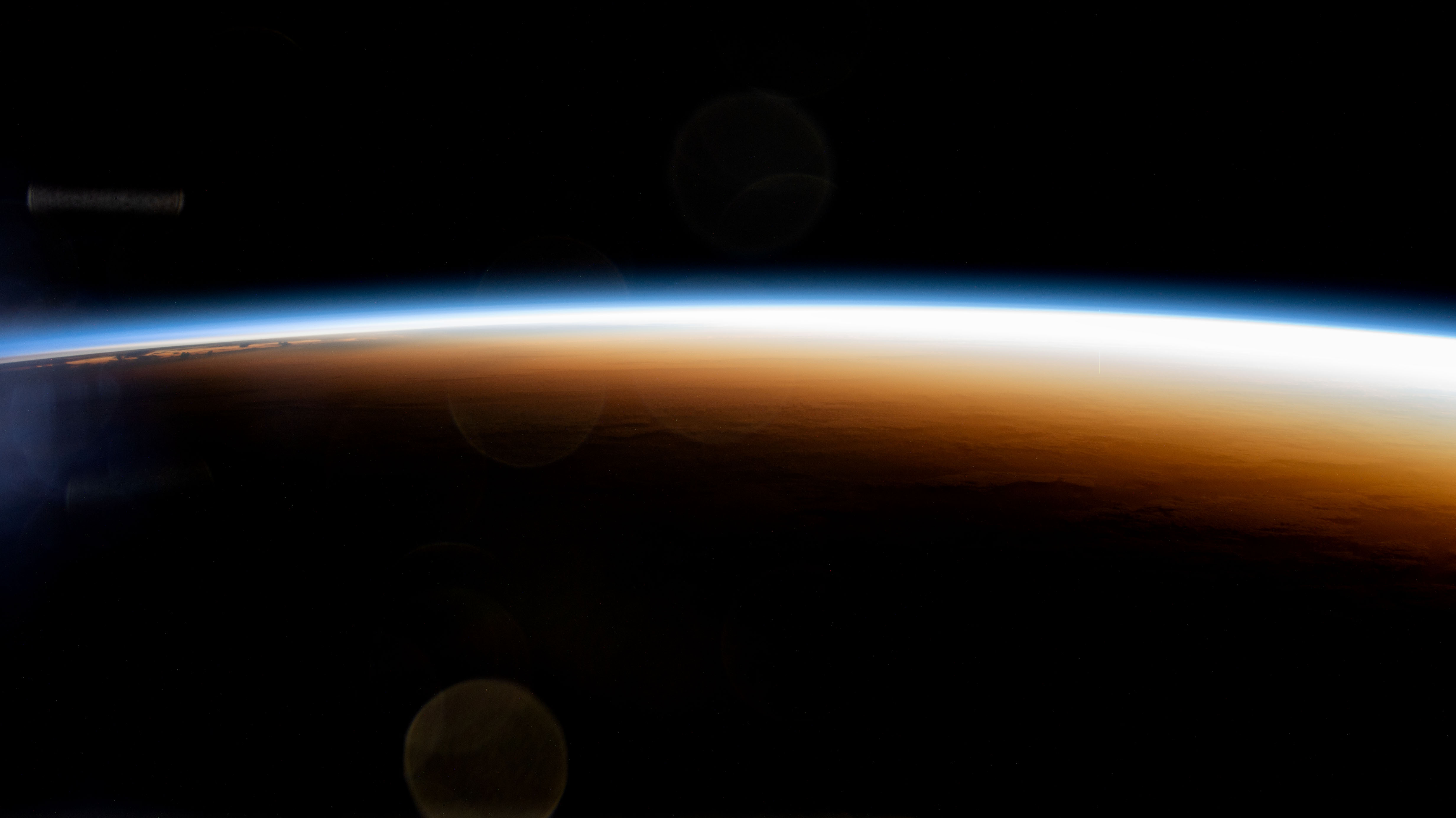
Because the station orbits every 90 minutes, crews experience a sunrise and a sunset every 45 minutes and overfly most inhabited regions of Earth every few days. Astronaut photographs from the ISS have documented rapid events such as erupting volcanoes, hurricane eyewalls, river floods, and sprawling wildfire smoke plumes. The station also carries dedicated Earth-observation payloads on its external platforms, including the ECOsystem Spaceborne Thermal Radiometer Experiment on Space Station (ECOSTRESS), the Earth Surface Mineral Dust Source Investigation (EMIT), the Global Ecosystem Dynamics Investigation (GEDI) lidar, and the Atmospheric Waves Experiment.
From the station's seven-window Cupola module, crews capture not just spectacular wide-angle views but also targeted documentation of rivers, coastlines, lakes, and cities requested by scientists on the ground. The resulting imagery is released into the public domain and is widely used in textbooks, atlases, and education programs, including CountryReports' own country profiles. To explore related missions that have photographed our planet from farther away, see The Moon and The Solar System.
Open Data Portals
A defining feature of modern Earth observation is that most of its data is free and publicly accessible. Government agencies in the United States, the European Union, Japan, and elsewhere treat Earth-observation archives as public-science infrastructure, and private citizens, students, journalists, and researchers anywhere in the world can download and use the same imagery that professional scientists rely on. The most important portals include the following.
- NASA Earthdata — the central gateway to NASA's Earth Observing System data, including MODIS, VIIRS, ICESat-2, GRACE-FO, SMAP, and hundreds of other missions.
- USGS EarthExplorer — the primary public interface to the complete Landsat archive, aerial photography, and digital elevation models.
- Copernicus Data Space Ecosystem — the European Union's open data platform for all Sentinel satellites and for Copernicus services. Successor to the earlier Copernicus Open Access Hub.
- NASA Worldview — an in-browser tool that allows any user to view hundreds of near-real-time global imagery layers on a zoomable map, usually within a few hours of acquisition.
- EONET — Earth Observatory Natural Event Tracker — a curated feed of current wildfires, storms, volcanic eruptions, and other natural events cross-referenced to satellite imagery.
- NOAA CLASS — the Comprehensive Large Array-data Stewardship System, which hosts NOAA's weather-satellite archives including GOES and JPSS data.
- JAXA Earth Observation — the Japan Aerospace Exploration Agency's portal for ALOS-2, GCOM-C, GCOM-W, and Himawari products.
- Gateway to Astronaut Photography of Earth — NASA's catalog of more than four million handheld photographs of Earth taken by astronauts on the Space Shuttle, Skylab, Mir, and the International Space Station.
For additional context on how Earth's systems connect to the view from orbit, see our page on the climate system, and for the broader history of human spaceflight that made these missions possible, see Space Exploration History.
Sources
Detailed citations, data references, and institutional sources for all CountryReports content are listed on the Sources page. The following government agencies, intergovernmental programs, and academic institutions are the primary authorities we rely on for Earth-observation content. Each link points to the institution's homepage or the directly relevant subsite.
Government Space Agencies and Earth-Observation Programs
- NASA — Earth Science Division — United States space agency Earth-observing fleet, including Landsat (jointly with USGS), Terra, Aqua, Suomi NPP, SMAP, ICESat-2, GRACE-FO, and SWOT.
- United States Geological Survey — Landsat Missions — operator of the civilian ground system and public archive for the Landsat program since 1972.
- European Space Agency — Observing the Earth — coordinator of the Copernicus Sentinel missions in partnership with the European Commission, and operator of Earth Explorer research satellites.
- Copernicus Programme — the European Union's Earth observation programme, providing free and open access to Sentinel satellite data and to six thematic services.
- NOAA National Environmental Satellite, Data, and Information Service — operator of the GOES geostationary series and the JPSS polar-orbiting series of U.S. weather satellites.
- EUMETSAT — the European Organisation for the Exploitation of Meteorological Satellites, operator of the Meteosat and MetOp weather-satellite fleets.
- Japan Aerospace Exploration Agency (JAXA) — Satellites and Spacecraft — operator of the ALOS, GCOM, GOSAT, and Himawari Earth-observing missions.
- Centre National d'Études Spatiales (CNES) — Earth Observation — French national space agency and co-operator of the SWOT and Jason altimetry series with NASA.
- Canadian Space Agency — Satellites — operator of the RADARSAT Constellation Mission and predecessor RADARSAT-1 and RADARSAT-2 SAR satellites.
- Indian Space Research Organisation — Earth Observation Satellites — operator of the Resourcesat, Cartosat, Oceansat, and INSAT series of Earth-observing satellites.
- United Nations Office for Outer Space Affairs (UNOOSA) — maintainer of the UN Register of Objects Launched into Outer Space, the authoritative international registry of operational satellites.
Scientific and Historical Archives
- NASA Gateway to Astronaut Photography of Earth (Johnson Space Center) — catalog of handheld photographs of Earth taken by astronauts from Mercury through the International Space Station.
- NASA Earth Observatory — NASA's editorial publication on Earth-observation science, with an archive of thousands of image-of-the-day features dating to 1999.
- United Kingdom Met Office — Satellite Applications — research group responsible for operational use of satellite data in UK numerical weather prediction.
- World Meteorological Organization Space Programme — the United Nations specialized agency's coordinating body for meteorological satellites and the Global Observing System.
- Smithsonian National Air and Space Museum — curator of original flight hardware and historical records relating to TIROS-1, Landsat, and the Apollo program.
Academic Research Centers
- University of Maryland — Global Land Analysis and Discovery (GLAD) Laboratory — producer of global annual tree-cover-loss maps derived from Landsat and Sentinel-2.
- Massachusetts Institute of Technology — Earth, Atmospheric and Planetary Sciences — leading academic department in the interpretation of altimetry, gravity, and Earth-system science data.
- Harvard University — Department of Earth and Planetary Sciences — research on remote sensing of the solid Earth, ice, and atmosphere.
- University of Colorado Boulder — Colorado Center for Astrodynamics Research — home to the long-running sea-level research group that interprets Jason and Sentinel-6 altimetry.
- German Research Centre for Geosciences (GFZ Potsdam) — Global Geomonitoring and Gravity Field Section — co-operator with NASA of the GRACE and GRACE-FO missions.
If you notice an error or would like to suggest a correction, please use our contact page to get in touch.