
 English
 Español
 中文
中文 हिन्दी
 Français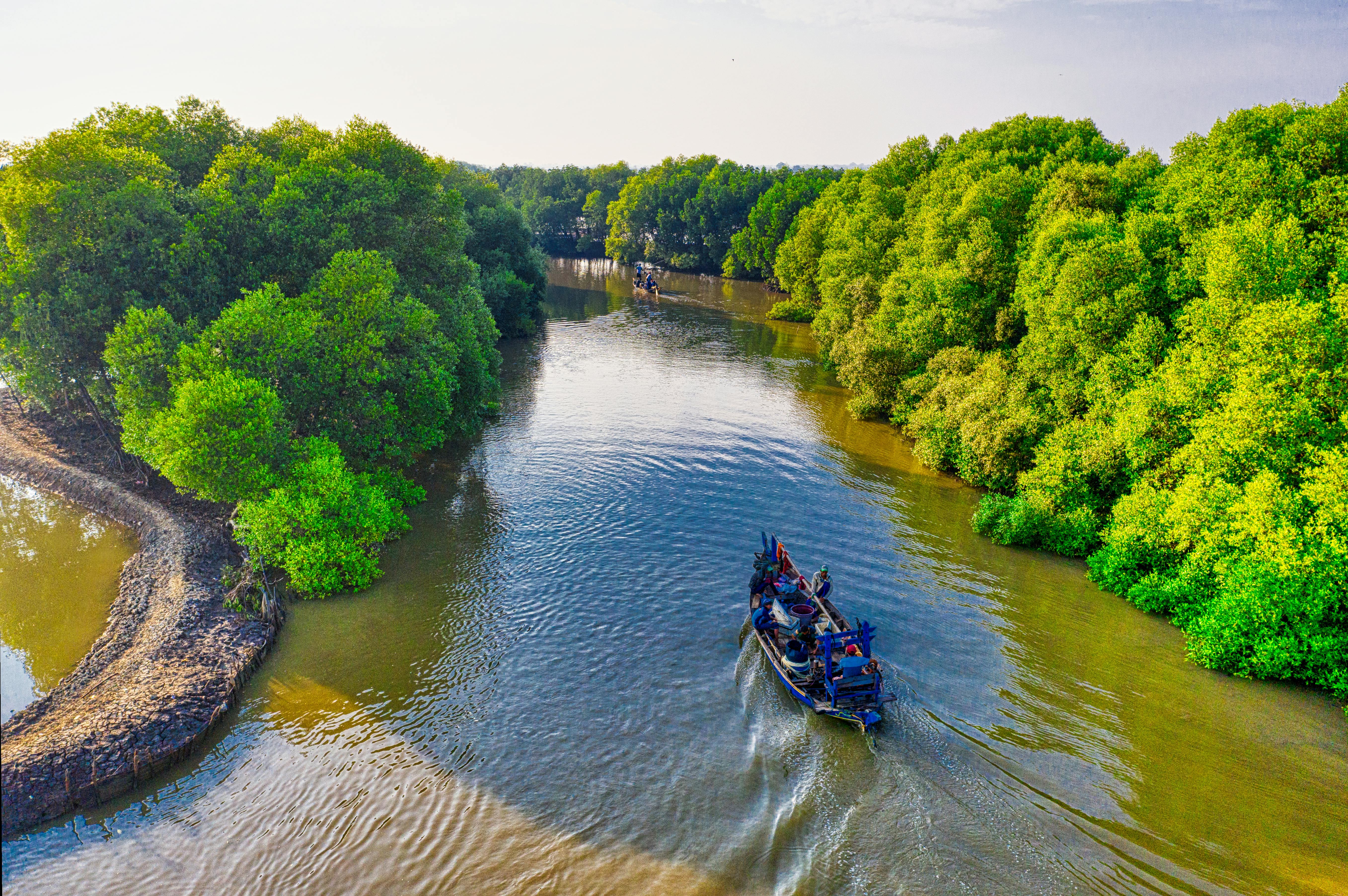
Forests and Rainforests
Tropical, temperate, and boreal biomes — the living systems that blanket roughly a third of the world's land.
Forests cover roughly 4.06 billion hectares of the Earth's land surface, or about 31 percent of the total, according to the Global Forest Resources Assessment 2020 published by the Food and Agriculture Organization of the United Nations. They range from the dense evergreen rainforests of the equatorial belt to the conifer-dominated taiga that rings the far north, and they shelter a majority of the world's terrestrial species while regulating rainfall, soil, and the global carbon cycle. This page provides a global overview of forest types, the great forest regions, the pressures they face, and the international efforts underway to monitor, protect, and restore them.
Overview
A forest, as defined by the Food and Agriculture Organization of the United Nations, is land greater than half a hectare in area with trees taller than five meters and a canopy cover of more than ten percent. Under this common reporting definition, the world held approximately 4.06 billion hectares of forest in 2020. Just over half of that total was concentrated in five countries: the Russian Federation, Brazil, Canada, the United States of America, and the People's Republic of China. Forest cover varies enormously across the globe, from the near-total tree cover of parts of the Amazon, Congo, and Southeast Asian lowlands to the scattered woodlands of the Sahel and the almost treeless expanses of the polar regions and the great deserts.
Ecologists generally group the world's forests into three broad biomes defined by latitude and climate. Tropical forests, found in the humid belt near the equator, include both the famous evergreen rainforests and the seasonally dry tropical forests that lose their leaves during the dry season. Temperate forests, located in the mid-latitudes of both hemispheres, mix deciduous and coniferous trees and pass through four seasons. Boreal forests, sometimes called taiga, form a nearly continuous band of conifer-dominated woodland across the high latitudes of the Northern Hemisphere, from Scandinavia across Russia and on through Canada and Alaska. A fourth, smaller category, the coastal mangrove forest, occupies the intertidal zone of tropical and subtropical shorelines.
Forests are more than collections of trees. They are intricate communities of plants, animals, fungi, microbes, and soils that evolved over tens of millions of years and that perform functions essential to human life. They pull water from the soil and return it to the atmosphere through transpiration, fueling rainfall hundreds or thousands of kilometers downwind. They store vast quantities of carbon in wood, leaves, and soil, making them central players in the global carbon cycle. They harbor the majority of the world's terrestrial biodiversity, and they supply timber, food, fiber, fuel, and medicine to an estimated 1.6 billion people who depend directly on them for some part of their livelihoods. The health of the world's forests is therefore a matter of both ecology and human welfare.
Key Facts
- Total forest area
- Approximately 4.06 billion hectares (about 31 percent of global land area), per FAO Global Forest Resources Assessment 2020
- Top five forest nations
- Russia, Brazil, Canada, United States, and China together hold more than half of world forest area
- Amazon rainforest
- Approximately 6.7 million square kilometers across nine countries; the largest tropical rainforest on Earth
- Congo Basin rainforest
- Approximately 2.0 million square kilometers; the second-largest tropical rainforest region
- Boreal forest belt
- Roughly 27 percent of all forest cover worldwide; stretches across Russia, Scandinavia, Alaska, and Canada
- Tallest known tree
- Hyperion, a coast redwood (Sequoia sempervirens) in Redwood National Park, California, measured at approximately 115.92 meters (380.3 feet)
- Oldest non-clonal tree
- Methuselah, a Great Basin bristlecone pine (Pinus longaeva) in the White Mountains of California, dated to approximately 4,850 years old
- Indigenous-managed forest
- Indigenous and tribal peoples manage at least 28 percent of global tropical forest area, per FAO and FILAC 2021
- Carbon in forest ecosystems
- Approximately 662 billion tonnes stored in living biomass, deadwood, litter, and forest soils combined, per FAO FRA 2020
- Annual net loss, 2010-2020
- Approximately 4.7 million hectares per year (net, after accounting for forest expansion and plantations), per FAO FRA 2020
- Species in tropical forests
- Host an estimated 50 to 75 percent of all terrestrial plant and animal species on roughly 6 percent of Earth's land
Types of Forests
Ecologists classify forests by climate, latitude, and the dominant plant communities they contain. The three principal forest biomes — tropical, temperate, and boreal — each emerge from a distinctive combination of temperature, rainfall, and seasonality, and each has characteristic tree species, soil chemistry, and wildlife. Within these broad categories, finer subtypes capture the differences between, for example, an evergreen lowland rainforest and a seasonally dry woodland, or between a coastal Pacific rainforest and a continental oak-hickory stand. Mangroves form a distinctive fourth category that straddles the boundary between land and sea.
Tropical forests occupy the warm, humid belt near the equator, where temperatures remain high throughout the year and day length changes little with the seasons. Tropical moist forests, including the classic rainforests of the Amazon, Congo, and Southeast Asia, receive at least 2,000 millimeters of rainfall annually and support dense, multi-layered canopies of evergreen trees. Tropical dry forests, found in regions with a pronounced dry season, such as the Chaco of Paraguay and the Miombo woodlands of southern Africa, contain many deciduous species that shed their leaves during the dry months.
Temperate forests occupy the mid-latitudes between roughly 25 and 50 degrees north or south. They include deciduous forests of oak, beech, and maple that turn gold and scarlet each autumn; mixed forests where broadleaf and coniferous species grow together; and evergreen temperate rainforests, such as those of the Pacific coast of North America, where mild winters and heavy winter rainfall support towering conifers. Temperate forests have been profoundly altered by centuries of human settlement, and many are today a mosaic of secondary growth and managed woodland rather than primary forest.
Boreal forests, also known as taiga, form a nearly continuous band across the high latitudes of the Northern Hemisphere, between roughly 50 and 65 degrees north. They are dominated by cold-adapted conifers such as spruce, fir, pine, and larch, punctuated by birch and aspen, and interwoven with bogs, fens, and peatlands. Boreal forests experience short, cool summers and long, cold winters, and the combination of slow decomposition and waterlogged soils makes them one of the world's largest terrestrial carbon reservoirs. Mangrove forests, finally, occupy protected tropical and subtropical coastlines, where salt-tolerant trees form a buffer between open ocean and inland forest.
Tropical Rainforests
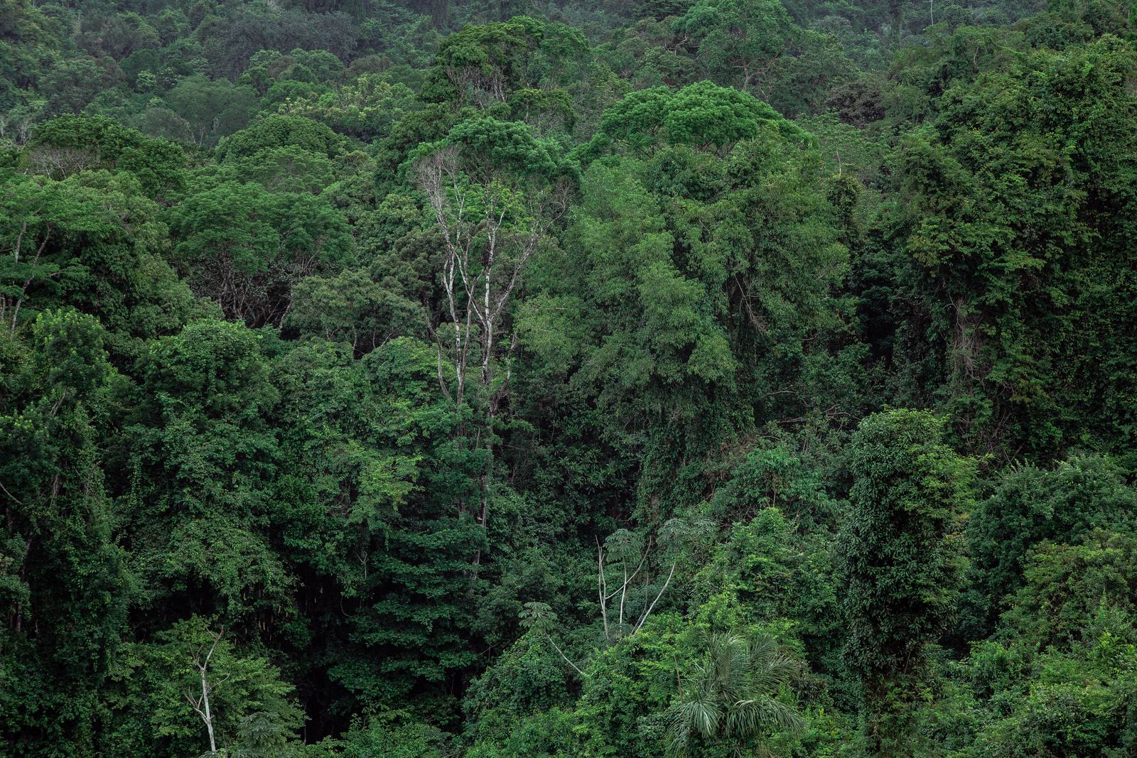
The world's tropical rainforests are concentrated in four great regions: the Amazon basin of South America, the Congo basin of central Africa, the islands and peninsulas of Southeast Asia and New Guinea, and the fragmented forests of Central America and the Caribbean. Each has a distinctive geology, climatic history, and flora and fauna, and together they represent the richest concentrations of terrestrial life on the planet.
Amazon Basin
The Amazon covers approximately 6.7 million square kilometers across Brazil, Peru, Colombia, and six other nations. It is the largest contiguous tropical rainforest on Earth and contains an estimated 390 billion individual trees of some 16,000 species, along with much of the drainage basin of the Amazon River system.
- • Roughly 60 percent lies within Brazil
- • Home to jaguars, harpy eagles, macaws, pink river dolphins
- • Generates roughly half of its own rainfall through transpiration
Congo Basin
The Congo Basin rainforest spans roughly two million square kilometers across the Democratic Republic of the Congo, the Republic of the Congo, Gabon, Cameroon, the Central African Republic, and Equatorial Guinea. It is the second-largest rainforest after the Amazon and is home to forest elephants, western lowland gorillas, chimpanzees, bonobos, and okapi.
- • Central African peatlands store roughly 30 billion tonnes of carbon
- • Drained by the Congo River, second-largest river by discharge
- • Historically lower deforestation rates than the Amazon
Southeast Asian Rainforests
Tropical rainforests cover the lowlands of Indonesia, Malaysia, Papua New Guinea, and parts of Thailand, Vietnam, and the Philippines. The forests of Borneo, Sumatra, and New Guinea are dominated by the towering dipterocarp family and shelter orangutans, tigers, rhinoceroses, and hornbills.
- • Orangutans on Borneo and Sumatra only
- • Some of the oldest rainforests on Earth (130+ million years)
- • Extensive tropical peat swamps in lowland Indonesia
Central America and the Caribbean
The forests of Mexico, Guatemala, Belize, Costa Rica, and Panama bridge the floras of North and South America. Cloud forests on volcanic highlands, such as Monteverde in Costa Rica, trap moisture from mist and harbor hummingbirds, quetzals, and an unusually rich flora of epiphytes.
- • Smithsonian Tropical Research Institute headquartered in Panama
- • Highland cloud forests with high endemism
- • Mayan biosphere reserves in Guatemala and Belize
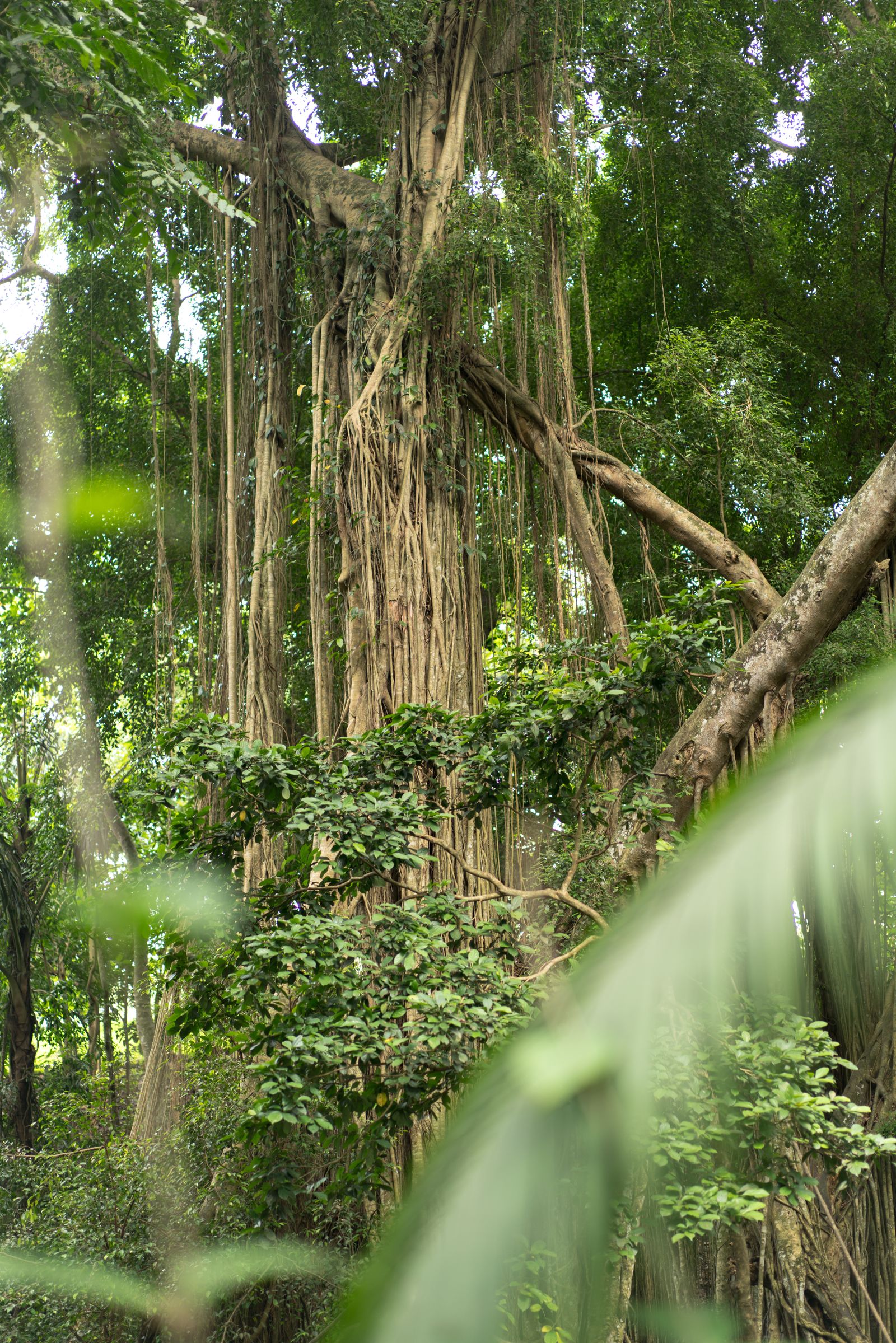
A mature tropical rainforest is organized into distinct vertical layers. The emergent layer, reaching 45 to 55 meters above the forest floor, consists of a few scattered giant trees that tower above the main canopy and catch the full sun and wind. The canopy itself, typically 25 to 45 meters tall, forms a nearly continuous green ceiling that captures most of the incoming solar radiation and harbors the majority of rainforest species, from howler monkeys and sloths in the Neotropics to gibbons and orangutans in Asia. Below the canopy lies the understory, a shadier zone of smaller trees and palms, and at ground level the forest floor, where little light reaches and decomposition proceeds rapidly in warm, humid conditions. Lianas, epiphytes, and strangler figs connect the layers, while the soil itself is often surprisingly thin, with most of the ecosystem's nutrients locked up in the living biomass above.
Temperate Forests
Temperate forests form three broad bands across the mid-latitudes of the Northern Hemisphere and smaller patches in the Southern. They encompass the moist coastal forests of the Pacific Northwest of North America, the rolling deciduous hardwoods of the eastern United States and the Appalachians, the beech-oak-pine mixtures of central and western Europe, and the rich deciduous forests of eastern China, the Korean peninsula, and Japan. In the Southern Hemisphere, smaller temperate forests survive in southern Chile and Patagonian Argentina, in southeastern Australia, Tasmania, and New Zealand.
Pacific Northwest Temperate Rainforest
A narrow belt of moist coniferous forest stretches from southeast Alaska through British Columbia, Washington, and Oregon into northern California. Sitka spruce, western hemlock, western redcedar, Douglas fir, and coast redwood form some of the tallest and most massive forests on Earth.
Appalachian and Eastern Deciduous Forest
The Appalachian hardwood forests of the eastern United States are among the most biologically diverse temperate forests in the world. Oak, hickory, tulip poplar, and maple dominate, and the region supports rich populations of salamanders and migratory songbirds.
European Mixed and Broadleaf Forests
Deciduous and mixed forests extend across France, Germany, Poland, the Carpathians, and the British Isles. The Białowieża Forest on the Polish-Belarusian border is one of the last surviving fragments of primeval European lowland forest and shelters European bison.
East Asian Deciduous Forest
The temperate forests of eastern China, the Korean peninsula, and Japan are distinguished by unusual floristic richness, with many genera that were lost from European forests during Pleistocene glaciations surviving in Asia, including magnolia, katsura, and Japanese beech.
Valdivian and Patagonian Forests
Southern Chile and Argentina hold the Valdivian temperate rainforest, home to the long-lived alerce, a relative of the redwood, and the Patagonian beech forests of Nothofagus. They are among the only large temperate rainforests in the Southern Hemisphere.
Tasmanian and New Zealand Forests
Cool temperate rainforests in Tasmania and New Zealand are dominated by Nothofagus (southern beech), podocarps, and Agathis kauri. They preserve many ancient Gondwanan lineages and are refuges for unique birds, including the kakapo and kiwi.

Boreal Forests (Taiga)
The boreal forest, or taiga, is the largest single forest biome on the planet and accounts for roughly 27 percent of all forest cover worldwide. It circles the Northern Hemisphere in a nearly continuous belt from Norway and Sweden through Finland and the Baltic states, across the breadth of the Russian Federation, and on through Alaska into Canada. Small outliers descend southward along mountain ranges into the continental interior. The biome lies roughly between 50 and 65 degrees north, south of the treeless tundra and north of the temperate deciduous forests.
Boreal forests are dominated by cold-adapted conifers. In Eurasia the principal species are Scots pine, Norway spruce, Siberian larch, Siberian pine, and silver fir; in North America the dominant trees are white and black spruce, balsam fir, jack pine, and tamarack. Deciduous birch, aspen, and poplar fill in clearings and recently burned patches. The understory is typically open, with dwarf shrubs such as blueberry and lingonberry, a thick carpet of feather mosses and reindeer lichens, and scattered sedges and grasses. Characteristic wildlife includes moose, brown bear, wolverine, lynx, pine marten, Eurasian and North American beavers, sable, and the caribou (reindeer), along with large owls and many migratory songbirds that breed in the vast summer insect bloom.
Large portions of the boreal zone rest on permafrost and are punctuated by bogs, fens, and shallow lakes. Cold, waterlogged conditions slow decomposition and lead to the accumulation of thick organic layers. Boreal peatlands are therefore among the most carbon-dense ecosystems on Earth, storing hundreds of billions of tonnes of carbon in soils and underlying peat. Natural fire is an integral part of the boreal system: stand-replacing fires sweep through on century timescales in many regions, regenerating young forests adapted to the cycle. Changes in fire frequency, insect outbreaks such as the spruce budworm and mountain pine beetle, and expanding logging and mineral extraction are the principal modern pressures on boreal forests.
Biodiversity and Ecosystem Services
Forests are the terrestrial heartland of global biodiversity. Tropical forests alone, although they cover only about 6 percent of the Earth's land surface, are thought to contain somewhere between half and three-quarters of all known plant and animal species. A single hectare of Amazonian or Bornean lowland rainforest may contain several hundred tree species, more than all the native tree species of North America combined. Insect diversity is larger still, with individual tropical canopy trees sometimes hosting dozens of beetle species found nowhere else. Temperate and boreal forests contain fewer species per hectare but host important and often endemic faunas, including salamanders of the southern Appalachians, woodpeckers of European old growth, and songbird populations that migrate tens of thousands of kilometers each year. For a broader view see our pages on Animal Species and Biodiversity and Endangered Species.
Forests provide an extensive suite of ecosystem services. The most familiar is the supply of wood, food, medicines, and fiber. At least 1.6 billion people rely on forests for part of their livelihoods, according to the Food and Agriculture Organization, including tens of millions who live inside or at the edges of forest landscapes. Forests supply timber for construction, fuelwood and charcoal for cooking and heating, fruits and nuts, resins and latex, bushmeat, and thousands of plant compounds that have been developed into medicines. An estimated 25 percent of modern pharmaceuticals are derived from tropical forest plants, including the quinine used against malaria and the vinblastine and vincristine used against leukemia.
Forests also regulate the water cycle and soil resources on which farms, cities, and fisheries depend. Forested watersheds capture rainfall, slow runoff, recharge groundwater, and filter sediments out of rivers that supply rivers and lakes downstream. Tropical forests transpire enormous quantities of water vapor that fuel rainfall hundreds or thousands of kilometers inland: the Amazon alone generates roughly half of its own precipitation through transpiration. Forested slopes stabilize soils, reduce landslides, and buffer lowlands from flooding. Coastal mangrove forests shield shorelines from storm surge and nursery young fish, linking forest and ocean ecosystems in ways that are only beginning to be fully understood. Forest flowers and trees support pollinators, including wild bees, bats, birds, and other insects, on which much of world agriculture depends.
Finally, forests are major stores of carbon. The Global Forest Resources Assessment 2020 estimates that the world's forests collectively hold approximately 662 billion tonnes of carbon in living biomass, deadwood, litter, and soil combined. They accumulate additional carbon through photosynthesis each year and release it when trees die, decompose, or burn. The balance between these flows determines whether a particular forest is a net sink or source of carbon, and it is an active area of research for institutions such as the United States Geological Survey, the United States Department of Agriculture Forest Service, and the United Nations Environment Programme. Forest biomes, along with other major biomes, are therefore central to the stability of the Earth system.

Deforestation and Monitoring
Deforestation is the long-term conversion of forest to non-forest land uses such as cropland, pasture, plantations, mines, roads, and settlements. The Food and Agriculture Organization estimates that the world lost approximately 420 million hectares of forest between 1990 and 2020, an area larger than the European Union. The annual rate of gross deforestation stood at approximately 10 million hectares per year in the 2015 to 2020 period, a rate lower than in earlier decades but still substantial. Net loss, which accounts for forest expansion and plantation planting, was approximately 4.7 million hectares per year over the same period. Losses are concentrated in the tropics, while temperate and boreal forests have on aggregate expanded modestly through natural regrowth and plantations.
The underlying drivers of tropical deforestation are, in order of global impact: the conversion of forest to commercial agriculture, especially for soy, beef, palm oil, and cocoa; the clearing of forest for smallholder subsistence farming and shifting cultivation; the expansion of roads, dams, and settlements; and selective and illegal logging that opens forests to subsequent clearance. Cattle ranching is the single largest direct driver in the Amazon, particularly in Brazil. Oil palm plantations are the leading driver in the lowlands of Indonesia and Malaysia. Smallholder agriculture, mining, and charcoal production drive forest loss in much of the Congo Basin. Road construction deep into primary forests tends to multiply future clearing because it enables access for loggers, hunters, and settlers.
Modern forest monitoring combines ground inventories with satellite remote sensing. The United States Geological Survey and NASA operate the long-running Landsat program, which has provided continuous imagery of the Earth's land surface since 1972 and is the backbone of most global forest change assessments. The European Space Agency's Copernicus Sentinel satellites provide higher-resolution complementary observations. National programs such as Brazil's PRODES and DETER, operated by the Brazilian National Institute for Space Research (INPE), monitor Amazon deforestation in near real time. At the global level, the FAO's Global Forest Resources Assessment, published every five years since 1948, is the authoritative long-term reference for forest area, ownership, management, and change. University-based projects such as the Global Forest Change dataset maintained by the University of Maryland provide additional annual forest cover change data. Together these systems allow deforestation to be tracked at finer spatial and temporal scales than ever before.
Indigenous Stewardship
Indigenous peoples have lived in, shaped, and managed the world's forests for tens of thousands of years. A joint report published in 2021 by the Food and Agriculture Organization of the United Nations and the Fund for the Development of the Indigenous Peoples of Latin America and the Caribbean (FILAC) concluded that Indigenous and tribal peoples manage at least 28 percent of tropical forest area in Latin America and the Caribbean, and by extension a comparable share of global tropical forest land. The same report and subsequent peer-reviewed studies have found that Indigenous territories, when their land rights are recognized by national governments, experience substantially lower rates of deforestation than surrounding areas, including many protected areas without resident Indigenous populations.
In the Amazon, Indigenous peoples of Brazil, Peru, Colombia, Ecuador, Bolivia, and Venezuela, along with neighboring riverine and maroon communities, manage large contiguous expanses of primary forest through a combination of small-scale agroforestry, gathering, hunting, fishing, and regulated use of timber and non-timber forest products. In the Congo Basin, Baka, Bayaka, Bagyeli, and other forest peoples maintain similar practices. In Southeast Asia and New Guinea, Dayak, Penan, and Papuan communities are custodians of some of the oldest rainforests on Earth. In North America, Indigenous nations in the boreal forest, such as the Cree, Dene, and Innu, and the many Indigenous peoples of the Pacific Northwest, continue to exercise territorial rights and stewardship over large forest landscapes.
International policy frameworks have increasingly recognized the role of Indigenous peoples in forest governance. The United Nations Declaration on the Rights of Indigenous Peoples, adopted by the General Assembly in 2007, affirms the right of Indigenous peoples to own, use, develop, and control the lands, territories, and resources they have traditionally occupied. Subsequent work by the United Nations Food and Agriculture Organization, the United Nations Environment Programme, and regional bodies has underscored that secure tenure, free prior and informed consent, and direct financing of Indigenous-led conservation are among the most effective tools available to reduce tropical deforestation.
Conservation and Reforestation
Most of the world's forests fall under some form of legal management. According to the FAO Global Forest Resources Assessment 2020, approximately 18 percent of global forest area is located within legally established protected areas such as national parks, wildlife refuges, and reserves. Another large share is managed for production of timber and non-timber forest products, and a growing share is designated explicitly for conservation or for multiple uses. National park systems cover major portions of the world's iconic forests, from the Tongass National Forest in Alaska and the Great Smoky Mountains in the eastern United States, to Tumucumaque National Park in Brazilian Amazonia, Salonga in the Democratic Republic of the Congo, Khao Yai in Thailand, and the Tai National Park in Ivory Coast. The World Heritage program of UNESCO and the Ramsar Convention on wetlands add further layers of recognition for forests of outstanding universal value.
Two major international initiatives support the conservation of standing forests. REDD+, short for Reducing Emissions from Deforestation and forest Degradation, is a mechanism developed under the United Nations Framework Convention on Climate Change. It provides a framework for developing countries to receive results-based finance in exchange for verified reductions in emissions from their forest sectors. The Bonn Challenge, launched in 2011 by the German government and the International Union for Conservation of Nature, set a global target of bringing 150 million hectares of deforested and degraded land into restoration by 2020 and 350 million hectares by 2030; it has been endorsed or built on by regional initiatives such as AFR100 in Africa and Initiative 20x20 in Latin America.
Large-scale reforestation and restoration programs have also taken shape at national level. China's Grain for Green program and its Three North Shelter Forest program have added tens of millions of hectares of new tree cover since the late 1970s. India's Green India Mission, South Korea's post-war reforestation of deforested hillsides, and Ethiopia's Green Legacy initiative all aim to restore forest and woodland on a very large scale. The Trillion Trees initiative, a partnership among BirdLife International, the Wildlife Conservation Society, and the World Wildlife Fund, sets a goal of protecting and restoring one trillion trees globally. Scientists emphasize that restoration is most successful when it uses native species, respects existing land rights, and targets degraded land rather than replacing intact natural ecosystems; monocultures of fast-growing exotic species, while useful for timber, do not substitute ecologically for primary forest. For further context on where forests fit among the Earth's major biological communities, see our overview of Biomes and Ecosystems.
Sources
Detailed citations, data references, and institutional sources for all CountryReports content are listed on the Sources page. The following international bodies, government agencies, and academic institutions are the primary authorities we rely on for forest content. Each link points to the institution's homepage or a directly relevant subsite.
International Bodies and Global Assessments
- Food and Agriculture Organization of the United Nations — Global Forest Resources Assessment — Authoritative worldwide dataset on forest area, management, ownership, carbon stocks, and change, published every five years since 1948. The FRA 2020 is the source for most global forest statistics cited on this page.
- United Nations Environment Programme — Forests — Global forest policy, the UN-REDD Programme, and assessments of forest carbon, biodiversity, and governance.
- FAO and FILAC (2021) — Forest Governance by Indigenous and Tribal Peoples in Latin America and the Caribbean — Joint report on the role of Indigenous and tribal peoples in protecting tropical forests, with data on deforestation rates inside and outside Indigenous territories.
- Convention on Biological Diversity — Forest Biodiversity — Intergovernmental framework for forest biodiversity, including the Aichi Targets and the Kunming-Montreal Global Biodiversity Framework.
- International Union for Conservation of Nature — Forests — Coordinator of the Bonn Challenge and global forest restoration monitoring through the Restoration Barometer.
Government Science and Management Agencies
- USDA Forest Service — Federal agency managing 193 million acres of United States national forests and grasslands; publishes the Forest Inventory and Analysis (FIA) dataset and the Resources Planning Act (RPA) Assessment.
- United States Geological Survey — Co-operator of the Landsat program with NASA and producer of the Land Change Monitoring, Assessment, and Projection (LCMAP) dataset on land cover change.
- NASA — Landsat Science — Continuous Earth-observation program since 1972 that underpins most global forest change monitoring.
- National Park Service — Forests — United States agency managing forest ecosystems across the national park system, including old-growth redwoods, Appalachian hardwoods, and boreal forests in Alaska.
- Brazilian National Institute for Space Research (INPE) — Operator of the PRODES and DETER satellite monitoring systems for the Amazon, the gold standard for tropical deforestation detection.
- Natural Resources Canada — Canadian Forest Service — Federal science agency for forest research and the State of Canada's Forests annual report.
Academic Research Centers
- Smithsonian Tropical Research Institute — Long-term research on tropical forest ecology, including the Barro Colorado Island forest dynamics plot in Panama, one of the longest-running tropical forest studies in the world.
- University of Maryland — Global Land Analysis and Discovery (GLAD) laboratory — Producer of the Global Forest Change dataset, which provides annual global tree-cover loss and gain maps from Landsat imagery.
- Yale School of the Environment — Forest research, the Yale Forests, and the Global Forest Atlas research program.
- CIFOR-ICRAF (Center for International Forestry Research and World Agroforestry) — International research organization on tropical forests, agroforestry, and forest-dependent livelihoods.
- University of Oxford — Tropical Forests and People research program — Interdisciplinary research on the management, use, and conservation of tropical forests.
Scientific Reports from Conservation Organizations
- World Wildlife Fund — Scientific publications and Living Forests reports — Peer-reviewed and technical reports on forest biomes, drivers of deforestation, and conservation outcomes.
- World Resources Institute — Forest research publications — Host of Global Forest Watch and publisher of extensive forest sector analysis.
If you notice an error or would like to suggest a correction, please use our contact page to get in touch.